Maryville, Illinois

Last updated

Maryville, Illinois
Motto: 
"Come Grow With Us" [1]
Madison County Illinois Incorporated and Unincorporated areas Maryville Highlighted.svg
Location in Madison County, Illinois
Usa edcp location map.svg
Red pog.svg
Maryville
Location in the United States
Coordinates: 38°43′31″N89°57′28″W / 38.72528°N 89.95778°W / 38.72528; -89.95778
CountryUnited States
StateIllinois
County Madison
Township Collinsville
Area
[2]
  Total5.76 sq mi (14.93 km2)
  Land5.68 sq mi (14.72 km2)
  Water0.08 sq mi (0.20 km2)
Elevation
[3]
568 ft (173 m)
Population
 (2020) [4]
  Total8,221
  Density1,446.09/sq mi (558.36/km2)
Time zone UTC−6 (CST)
  Summer (DST) UTC−5 (CDT)
ZIP code
62062
Area code 618
FIPS code 17-47397
GNIS feature ID2399269 [3]
Wikimedia CommonsMaryville, Illinois
Website www.vil.maryville.il.us

Maryville is a village in Madison County, Illinois, United States. The population was 8,221 at the 2020 census, [4] up from 7,487 in 2010.

Contents

History

Coal mining was historically the principal industry in Maryville. [5] Maryville was incorporated on July 21, 1902. [6]

Geography

Maryville is located in southern Madison County at 38°43′31″N89°57′28″W / 38.72528°N 89.95778°W / 38.72528; -89.95778 (38.725298, -89.957674). [7] It is 17 miles (27 km) northeast of downtown St. Louis, Missouri. It is bordered to the north by Glen Carbon, to the east by Troy, and to the south by Collinsville.

Illinois Route 159 passes through the village as Center Street, leading north 6 miles (10 km) to Edwardsville, the Madison county seat, and south 4 miles (6 km) to the center of Collinsville. Illinois Route 162 crosses the northern part of the village, leading east 4 miles (6 km) to Troy and west 6 miles (10 km) to Pontoon Beach. Interstates 55 and 70 cross the southern end of Maryville together, with access from Exit 15 (IL 159).

According to the U.S. Census Bureau, Maryville has a total area of 5.76 square miles (14.92 km2), of which 5.69 square miles (14.74 km2) are land and 0.075 square miles (0.19 km2), or 1.30%, are water. [2]

Demographics

Historical population
CensusPop.Note
1910 729
1920 83614.7%
1930 602−28.0%
1940 536−11.0%
1950 5390.6%
1960 67525.2%
1970 1,06758.1%
1980 1,94982.7%
1990 2,57632.2%
2000 4,65180.6%
2010 7,48761.0%
2020 8,2219.8%
U.S. Decennial Census [8]

As of the census [9] of 2000, there were 4,651 people, 1,743 households, and 1,267 families living in the village. The population density was 996.5 inhabitants per square mile (384.8/km2). There were 1,816 housing units at an average density of 389.1 per square mile (150.2/km2). The racial makeup of the village was 94.11% White, 3.46% African American, 0.11% Native American, 0.49% Asian, 0.04% Pacific Islander, 0.77% from other races, and 1.01% from two or more races. Hispanic or Latino of any race were 2.00% of the population.

There were 1,743 households, out of which 35.6% had children under the age of 18 living with them, 61.8% were married couples living together, 8.8% had a female householder with no husband present, and 27.3% were non-families. 21.9% of all households were made up of individuals, and 5.5% had someone living alone who was 65 years of age or older. The average household size was 2.53 and the average family size was 2.99.

In the village, the age distribution of the population showed 24.9% under the age of 18, 7.2% from 18 to 24, 33.3% from 25 to 44, 21.7% from 45 to 64, and 12.9% who were 65 years of age or older. The median age was 36 years. For every 100 females, there were 90.9 males. For every 100 females age 18 and over, there were 87.0 males.

The median income for a household in the village was $60,135, and the median income for a family was $62,110. Males had a median income of $43,226 versus $30,393 for females. The per capita income for the village was $27,634. About 2.6% of families and 4.1% of the population were below the poverty line, including 2.0% of those under age 18 and 4.9% of those age 65 or over.

Notable people

Events

On March 8, 2009, 27-year-old Terry Sedlacek shot and killed Senior Pastor Fred Winters in front of the congregation at First Baptist Church of Maryville affiliated with the Southern Baptist Convention. [12]

Related Research Articles

<span class="mw-page-title-main">Madison County, Illinois</span> County in Illinois, United States

Madison County is a county in the U.S. state of Illinois. It is a part of the Metro East in southern Illinois. According to the 2020 census, it had a population of 264,776, making it the eighth-most populous county in Illinois and the most populous in the southern portion of the state. The county seat is Edwardsville, and the largest city is Granite City.

<span class="mw-page-title-main">Pierron, Illinois</span> Village in Illinois, United States

Pierron is a village in Bond and Madison counties, Illinois, United States. The population was 459 at the 2020 census, down from 600 at the 2010 census. The village is part of the St. Louis metropolitan area.

<span class="mw-page-title-main">Pontoosuc, Illinois</span> Village in Illinois, United States

Pontoosuc is a village in Hancock County, Illinois, United States. The population was 146 at the 2010 census, down from 171 at the 2000 census.

<span class="mw-page-title-main">Alhambra, Illinois</span> Village in Illinois, United States

Alhambra is a village in Madison County, Illinois, United States. The population was 622 at the 2020 census.

<span class="mw-page-title-main">Collinsville, Illinois</span> City in Illinois, United States

Collinsville is a city located mainly in Madison County and partially in St. Clair County, Illinois, United States. As of the 2020 census, the city had a population of 24,366. Collinsville is approximately 14 miles (23 km) east of St. Louis, Missouri, and is part of that city's Metro East area.

<span class="mw-page-title-main">Fairmont City, Illinois</span> Village in Illinois, United States

Fairmont City is a village in St. Clair and Madison counties, Illinois, United States. The population was 2,265 at the 2020 census, down from 2,635 in 2010. In the 1990s Fairmont City's Hispanic population doubled, and as of 2020, over 79% of the population was of Hispanic descent.

<span class="mw-page-title-main">Glen Carbon, Illinois</span> Village in Illinois, United States

Glen Carbon is a village in Madison County, Illinois, United States, 14 miles (23 km) northeast of St. Louis. The population was 13,842 at the 2020 census.

<span class="mw-page-title-main">Godfrey, Illinois</span> Village in Illinois, United States

Godfrey is a village in Madison County, Illinois, United States. The population was 17,825 at the 2020 census. Godfrey is located within the River Bend portion of the Greater St. Louis metropolitan area.

<span class="mw-page-title-main">Grantfork, Illinois</span> Village in Illinois, United States

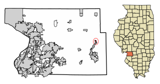
Grantfork is a village in Madison County, Illinois, United States. The population was 341 as of the 2020 census. It is part of the St. Louis Metropolitan Area.

<span class="mw-page-title-main">Hamel, Illinois</span> Village in Illinois, United States

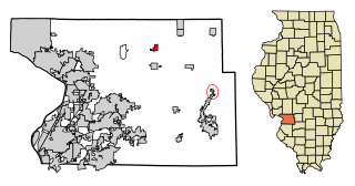
Hamel is a village in Madison County, Illinois, United States. The population was 929 at the 2020 census, up from 816 in 2010. It is a part of the Illinois Metro East portion of the Greater St. Louis metropolitan area.

<span class="mw-page-title-main">Hartford, Illinois</span> Village in Illinois, United States

Hartford is a village in Madison County, Illinois, United States, on the Mississippi River near the mouth of the Missouri River. The population was 1,185 at the 2020 census, down from 1,429 in 2010. Lewis and Clark spent the winter of 1803-04 there, near what has been designated the Lewis and Clark State Historic Site.

<span class="mw-page-title-main">Livingston, Illinois</span> Village in Illinois, United States

Livingston is a village in Madison County, Illinois, United States. The population was 763 at the 2020 census, down from 858 in 2010.

<span class="mw-page-title-main">Madison, Illinois</span> City in Illinois, United States

Madison is a city in Madison and St. Clair counties in the U.S. state of Illinois. The population was 3,171 at the 2020 census, down from 3,891 in 2010. It is home to World Wide Technology Raceway at Gateway and the first Bulgarian Orthodox church in the United States.

<span class="mw-page-title-main">Marine, Illinois</span> Village in Illinois, United States

Marine is a village in Madison County, Illinois, United States. The population was 912 at the 2020 census.

<span class="mw-page-title-main">Pontoon Beach, Illinois</span> Village in Illinois, United States

Pontoon Beach is a village in Madison County, Illinois, United States. The population was 5,876 at the 2020 census. It is part of the St. Louis metropolitan area.

<span class="mw-page-title-main">St. Jacob, Illinois</span> Village in Illinois, United States

St. Jacob or Saint Jacob is a village in Madison County, Illinois, United States. The population was 1,358 at the 2020 census, up from 1,098 in 2010.

<span class="mw-page-title-main">Troy, Illinois</span> City in Illinois, United States

Troy is a city in Madison County, Illinois, United States. The population was 10,960 at the 2020 census, up from 9,888 in 2010.

<span class="mw-page-title-main">Wood River, Illinois</span> City in Illinois, United States

Wood River is a city in Madison County, Illinois. The population was 10,464 as of the 2020 census.

<span class="mw-page-title-main">Worden, Illinois</span> Village in Illinois, United States

Worden is a village in Madison County, Illinois, United States. The population was 1,096 at the 2020 census.

<span class="mw-page-title-main">New Berlin, Illinois</span> Village in Illinois, United States

New Berlin is a village in Sangamon County, Illinois, United States. The population was 1,346 at the 2010 census, and 1,327 at a 2018 estimate. It is part of the Springfield Metropolitan Statistical Area. New Berlin is home to CUSD #16, New Berlin High School.

References

  1. "The Village of Maryville, Illinois". The Village of Maryville, Illinois. Retrieved August 31, 2012.
  2. 1 2 "2022 U.S. Gazetteer Files: Illinois". United States Census Bureau. Retrieved February 17, 2023.
  3. 1 2 U.S. Geological Survey Geographic Names Information System: Maryville, Illinois
  4. 1 2 "P1. Race – Maryville village, Illinois: 2020 DEC Redistricting Data (PL 94-171)". U.S. Census Bureau. Retrieved February 17, 2023.
  5. Norton, William T. (1912). Centennial History of Madison County, Illinois, and Its People, 1812 to 1912. The Lewis Publishing Co. pp.  618.
  6. "Maryville, Illinois". City-Data.com. Retrieved August 31, 2012.
  7. "US Gazetteer files: 2010, 2000, and 1990". United States Census Bureau. February 12, 2011. Retrieved April 23, 2011.
  8. "Census of Population and Housing". Census.gov. Retrieved June 4, 2015.
  9. "U.S. Census website". United States Census Bureau . Retrieved January 31, 2008.
  10. "2020 Olympic Profile". 2021. Archived from the original on July 18, 2021. Retrieved August 6, 2021.
  11. "Bob Boken Stats". Baseball Almanac. Retrieved August 31, 2012.
  12. http://www.foxnews.com/story/0,2933,506820,00.html Pastor Killed, 2 Hurt in Illinois Church Shooting