
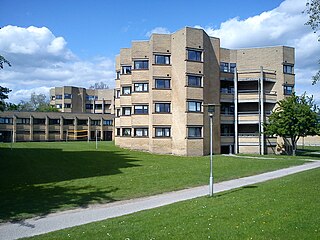
Viby J is a former town and now a district, in the southwestern part of Aarhus in Denmark. The district has almost 30,000 inhabitants. The "J" stands for Jutland, as there is another town called Viby on the island of Zealand, officially referred to as Viby Sj and also a village on Funen.

Brabrand is a postal district of Aarhus Municipality, Denmark. South of Brabrand, in the Aarhus river-valley, is the largest recreational area of Aarhus Municipality, comprising the Brabrand Lake and the meadow-lake of Årslev, with surrounding natural sites.

Aarhus Municipality, previously known as Århus Municipality until 2011, is a municipality in Central Denmark Region, on the east coast of the Jutland peninsula in central Denmark.

Aarhus C is a postal district in the city of Aarhus, Denmark, consisting of the Inner city, Vesterbro, University of Aarhus, Frederiksbjerg, Langenæs and Aarhus Ø, with postal code 8000. The district is commonly defined as the area enclosed by the ring road of Ring 1, and in the west by the Aarhus Harbour and shoreline.

Tilst is a suburban area of Aarhus, Denmark, situated some 10 km to the west of Aarhus.

Aaby, or Åby, is a suburban area of Aarhus in Denmark. Located 4 km from the city centre of Aarhus, Åby was originally an old village, but is now an integrated a part of Åbyhøj, that sprawled around it. To distinguish Åby from Åbyhøj, the village area is often referred to as Gammel Åby. Åby is situated at a bend of the Aarhus River and there is access to the river and the pathway of Brabrandstien from here.

Skåde is a neighbourhood of Højbjerg, a southern district of Aarhus in Denmark. It is located 6 km south from the city centre.
Vejlby is a north-eastern neighbourhood of Aarhus in Denmark. It is located 5km from the city centre and is administratively part of the district of Risskov.

Aarhus N is a postal district in the city of Aarhus, consisting of Trøjborg, Risskov, Vejlby, Skejby, Vorrevangen and Christiansbjerg, all with postal code 8200. Aarhus N is an abbreviation for Aarhus Nord and is located north of the city centre. It is the highest lying area of Aarhus.
Aarhus Vest or Aarhus V, is a postal district in the city of Aarhus, consisting of Hasle, Herredsvang, Møllevangen and Frydenlund.

Vesterbro is a neighbourhood of Aarhus, Denmark. It is located in the Aarhus C district, west of the city centre of Indre By. Vesterbro used to be farmland outside the city walls, and the neighbourhood's development progressed, when the city walls of Aarhus were demolished in 1851.

Hasle Hills is a landscape and recreational area of 15.5 hectares in Aarhus, Denmark. It is located in the borderland between Hasle and the neighbourhood of Gellerup in the district of Aarhus V in the western parts of the city. Hasle Hills is part of the nature protection area of Naturen på Holmstrup Mark, which also contains parts of the larger recreational area of Skjoldhøjkilen, stretching west from Hasle Hills.

Skjoldhøjkilen is a recreational and natural site, in the district of Brabrand in the western part of Aarhus in Denmark. It stretches westwards from Hasle Hills, like a wavy green strip of meadows, small lakes and woodlands. It is 3.5 km long and just as Hasle Hills, it is administered by the self-governing institution 'Hasle Bakker'.

Ring 2, or Ringvejen, is the outermost ring road surrounding the city of Aarhus in Denmark.

Skejby Church is a church in Skejby Parish in Aarhus, Denmark. The parish lies in Aarhus N three kilometers north-west of Aarhus city centre on the outskirts of the urban area. The parish has 816 inhabitants of which 655 are members of the Church of Denmark.

Hasle Church is a church located in Hasle Parish in Aarhus, Denmark. The church is located 3 km. west of Aarhus city centre and north of Åbyhøj. It is a parish church within the Church of Denmark servicing a parish population of 7.515 (2015).

Marienlyst Park is a public park in Hasle in the Aarhus V district, north-west Aarhus, Denmark. The park is situated west of the Herredsvang neighborhood along the street Fjældevænget Busvej to the south and Brendstrup Forest to the west. Marienlyst Park is one of the largest parks in Aarhus and features both landscaped lawns and artificial forested hills. Facilities include an amphitheatre, soccer fields, playgrounds and a 6-hole golf course. Marienlyst Park was established in connection with the development of western Hasle in the 1970s and today forms part of a green corridor extending from Vestereng to Brabrand Lake. The park is owned by Aarhus Municipality and is managed by the municipal department Natur og Miljø. Marienlyst Park can be rented for public events.

Bellevue Beach is a public Blue Flag beach park in Aarhus, Denmark. It is located in the northern district of Aarhus N, 4 kilometres from the city centre, on the Bay of Aarhus.
Business Park Skejby is a large business park in the northern district of Aarhus N, in the city of Aarhus, Denmark.


