
Warrimoo is a medium-sized village in the lower Blue Mountains of New South Wales, Australia, 273 metres above sea level. The state government's electorate is Blue Mountains and the state member is Labor's Trisha Lee Doyle.

Winmalee is a town in New South Wales, Australia. Winmalee is located 77 kilometres west of the Sydney CBD, in the local government area of the City of Blue Mountains. At the 2011 census, Winmalee had a population of 6,593.
St Thomas Aquinas Church is a Roman Catholic church building located in Springwood, New South Wales, Australia. The church shares its grounds with the St Thomas Aquinas Primary School.

Springwood is a town in the Blue Mountains, New South Wales, Australia. Springwood is located 72 kilometres west of the Sydney CBD in the local government area of the City of Blue Mountains. At the 2021 census, Springwood had a population 8,423 people.
Valley Heights is a small township of the City of Blue Mountains in New South Wales, Australia. It is about 70 km (43 mi) from the Sydney central business district and is located east of the township of Springwood. At the 2006 census, Valley Heights had a population of 1,337 people.

The City of Blue Mountains is a local government area of New South Wales, Australia, governed by the Blue Mountains City Council. The city is located in the Blue Mountains, on the Great Dividing Range at the far western fringe of the Greater Sydney area.

Wentworth Falls is a town in the Blue Mountains region of New South Wales, situated approximately 100 kilometres (62 mi) west of the Sydney central business district, and about 8 kilometres (5.0 mi) east of Katoomba, Australia on the Great Western Highway, with a Wentworth Falls railway station on the Main Western line. The town is at an elevation of 867 metres (2,844 ft) AHD . At the 2016 census, Wentworth Falls had a population of 6,076.
Yarramundi is a suburb of Sydney, in the state of New South Wales, Australia. Yarramundi is located 69 kilometres west of the Sydney central business district, in the local government area of the City of Hawkesbury.
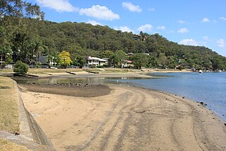
Woronora is a suburb in southern Sydney, in the state of New South Wales, Australia. Woronora is located 27 kilometres south of the Sydney central business district, in the local government area of the Sutherland Shire. Woronora Heights is a separate suburb, to the south-west.
Berowra Heights is an outer suburb of Northern Sydney, in the state of New South Wales, Australia 39 kilometres north of the Sydney central business district, in the local government area of Hornsby Shire. Berowra Heights is north-west of the suburb of Berowra and east of Berowra Waters.

Cowan is a small outer suburb of Sydney, in the state of New South Wales, Australia, approximately 40 kilometres (25 mi) north of the Sydney central business district, in the local government area of Hornsby Shire. Cowan shares the postcode of 2081 with Berowra. Brooklyn, which lies 6 kilometres (3.7 mi) to the north-east of Cowan, is considered the northernmost suburb of the Greater Sydney Metropolitan Area.

Mount Riverview is a town off the Great Western Highway about 2 km NE of Blaxland in the Lower Blue Mountains, New South Wales, 70 kilometres west of the Sydney CBD, Australia. At the 2006 census, Mount Riverview had a population of 2,993 people.

The Illawarra escarpment, or officially the Illawarra Range, is the fold-created cliffs and plateau-eroded outcrop mountain range west of the Illawarra coastal plain south of Sydney, in the state of New South Wales, Australia. The range encloses the Illawarra region which stretches from Stanwell Park in the north to Kiama, Gerringong and the Shoalhaven River in the south.

Kurrajong is a small town in New South Wales, Australia. Kurrajong is located 75 kilometres (47 mi) north-west of Sydney, in the local government area of the City of Hawkesbury.
Yellow Rock is a small village or locality in the Blue Mountains region of New South Wales, Australia. At the 2011 census, Yellow Rock had a population of 1029.

Kurrajong Heights is a small town in the state of New South Wales, Australia. Kurrajong Heights is 79 kilometres (49 mi) north-west of Sydney, in the local government area of the City of Hawkesbury. It is stretched across the Bells Line of Road in the Blue Mountains, west of Kurrajong and east of Bilpin. At the 2016 census, Kurrajong Heights had a population of 1,342 people.

Grose Vale is a suburb of Sydney, in the state of New South Wales, Australia. It is located in the City of Hawkesbury. It was previously known as South Kurrajong. Many historic properties are located in Grose Vale including "Lemon Forest" originally owned by the Lamrock family as well as a number of homes owned by the Dunston and Ezzy families.

Bilpin is a small town on the historic Bells Line of Road in the City of Hawkesbury local government area in the Blue Mountains, west of Sydney, New South Wales.

The 2013 New South Wales bushfires were a series of bushfires in Australia across the state of New South Wales primarily starting, or becoming notable, on 13 October 2013; followed by the worst of the fires beginning in the Greater Blue Mountains Area on 16 and 17 October 2013.

