The Blue Mountains are a mountainous region and a mountain range located in New South Wales, Australia. The region is considered to be part of the western outskirts of the Greater Sydney area. The region borders on Sydney's main metropolitan area, its foothills starting about 50 kilometres (31 mi) west of centre of the state capital, close to Penrith. The public's understanding of the extent of the Blue Mountains is varied, as it forms only part of an extensive mountainous area associated with the Great Dividing Range. As defined in 1970, the Blue Mountains region is bounded by the Nepean and Hawkesbury rivers in the east, the Coxs River and Lake Burragorang to the west and south, and the Wolgan and Colo rivers to the north. Geologically, it is situated in the central parts of the Sydney Basin.

The Blue Mountains National Park is a protected national park that is located in the Blue Mountains region of New South Wales, in eastern Australia. The 267,954-hectare (662,130-acre) national park is situated approximately 80 kilometres (50 mi) west of the Sydney CBD, and the park boundary is quite irregular as it is broken up by roads, urban areas and areas of private property. Despite the name mountains, the area is an uplifted plateau, dissected by a number of larger rivers. The highest point in the park is Mount Werong at 1,215 metres (3,986 ft) above sea level; while the low point is on the Nepean River at 20 metres (66 ft) above sea level as it leaves the park.

The Hawkesbury River, or Hawkesbury-Nepean River, is a river located northwest of Sydney, New South Wales, Australia. The Hawkesbury River and its associated main tributary, the Nepean River, almost encircle the metropolitan region of Sydney. Between Wisemans Ferry and the Pacific Ocean marks the boundary of Greater Metropolitan Sydney in the south and the Central Coast region to the north.

Nepean River, is a major perennial river, located in the south-west and west of Sydney, New South Wales, Australia. The Nepean River and its associated mouth, the Hawkesbury River, almost encircles the metropolitan region of Sydney.

Warrimoo is a medium-sized village in the lower Blue Mountains of New South Wales, Australia, 273 metres above sea level. The state government's electorate is Blue Mountains and the state member is Labor's Trisha Lee Doyle.

Winmalee is a town in New South Wales, Australia. Winmalee is located 77 kilometres west of the Sydney CBD, in the local government area of the City of Blue Mountains. At the 2011 census, Winmalee had a population of 6,593.

Springwood is a town in the Blue Mountains, New South Wales, Australia. Springwood is located 72 kilometres west of the Sydney CBD in the local government area of the City of Blue Mountains. At the 2021 census, Springwood had a population 8,423 people.
Valley Heights is a small township of the City of Blue Mountains in New South Wales, Australia. It is about 70 km (43 mi) from the Sydney central business district and is located east of the township of Springwood. At the 2006 census, Valley Heights had a population of 1,337 people.

The City of Blue Mountains is a local government area of New South Wales, Australia, governed by the Blue Mountains City Council. The city is located in the Blue Mountains, on the Great Dividing Range at the far western fringe of the Greater Sydney area.
Canoelands is a suburb of northern Sydney, in the state of New South Wales, Australia. Canoelands is 60 kilometres north of the Sydney central business district, in the local government area of Hornsby Shire and The Hills Shire.
Yarramundi is a suburb of Sydney, in the state of New South Wales, Australia. Yarramundi is located 69 kilometres west of the Sydney central business district, in the local government area of the City of Hawkesbury.

Mount Riverview is a town off the Great Western Highway about 2 km NE of Blaxland in the Lower Blue Mountains, New South Wales, 70 kilometres west of the Sydney CBD, Australia. At the 2006 census, Mount Riverview had a population of 2,993 people.

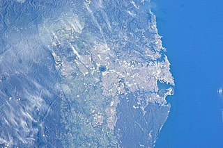
The geography of Sydney is characterised by its coastal location on a basin bordered by the Pacific Ocean to the east, the Blue Mountains to the west, the Hawkesbury River to the north and the Woronora Plateau to the south. Sydney lies on a submergent coastline on the east coast of New South Wales, where the ocean level has risen to flood deep river valleys (rias) carved in the Sydney sandstone. Port Jackson, better known as Sydney Harbour, is one such ria.

The Cumberland Plain, also known as Cumberland Basin, is a relatively flat region lying to the west of Sydney CBD in New South Wales, Australia. An IBRA biogeographic region, Cumberland Basin is the preferred physiographic and geological term for the low-lying plain of the Permian-Triassic Sydney Basin found between Sydney and the Blue Mountains, and it is a structural sub-basin of the Sydney Basin.
Hawkesbury Heights is a small town in the state of New South Wales, Australia in the City of Blue Mountains. It is located between the townships of Yarramundi and Winmalee. To the south is Yellow Rock. The only road link to the suburb is Hawkesbury Road, which becomes Springwood Road to the east.

The Grose River, a perennial river that is part of the Hawkesbury-Nepean catchment, is located in the Blue Mountains region of New South Wales, Australia.

The Cordeaux River, a perennial river of the Hawkesbury-Nepean catchment, is located in the Southern Highlands and Macarthur regions of New South Wales, Australia.

The Wollangambe River, an Australian perennial river that is part of the Hawkesbury–Nepean catchment within the Sydney Basin, is located in the Greater Blue Mountains Area of New South Wales.

The 2013 New South Wales bushfires were a series of bushfires in Australia across the state of New South Wales primarily starting, or becoming notable, on 13 October 2013; followed by the worst of the fires beginning in the Greater Blue Mountains Area on 16 and 17 October 2013.


