Hawkins Creek, Queensland

Last updated

Hawkins Creek
Queensland
StateLibQld 1 89200 Farm shed at Hawkins Creek, near Ingham, Queensland, ca.1912.jpg
Farm shed at Hawkins Creek, circa 1912
Australia Queensland location map.svg
Red pog.svg
Hawkins Creek
Coordinates 18°34′43″S146°07′01″E / 18.5787°S 146.1169°E / -18.5787; 146.1169 (Hawkins Creek (centre of locality))
Population236 (2021 census) [1]
 • Density2.118/km2 (5.487/sq mi)
Postcode(s) 4850
Area111.4 km2 (43.0 sq mi)
Time zone AEST (UTC+10:00)
Location
LGA(s) Shire of Hinchinbrook
State electorate(s) Hinchinbrook
Federal division(s) Kennedy
Suburbs around Hawkins Creek:
Dalrymple Creek Dalrymple Creek Rungoo
Lannercost Hawkins Creek Bemerside
Trebonne Ingham Gairloch

Hawkins Creek is a rural locality in the Shire of Hinchinbrook, Queensland, Australia. [2] In the 2021 census, Hawkins Creek had a population of 236 people. [1]

Contents

Geography

The locality is bounded to the south-east, south, south-west, and west by the Herbert River, and to the north-west loosely by the Mount Leach Range. [3]

The northern half of the locality is within the Girrigun National Park, which extends into neighbouring Damrymple Creek and Rungoo. [3] The terrain within the national park is mountainous, ranging from 30 to 850 metres (98 to 2,789 ft) above sea level, with three named peaks: [3]

The southern half of the locality is lower-lying land being 10 to 20 metres (33 to 66 ft) above sea level. It is predominantly used for growing sugarcane. A cane tramway passes through this area enabling the harvested sugarcane to be transferred to the Macknade Sugar Mill in Macknade for crushing. [3]

History

Warrgamay (also known as Waragamai, Wargamay, Wargamaygan, Biyay, and Warakamai) is an Australian Aboriginal language in North Queensland. The language region includes the Herbert River area, Ingham, Hawkins Creek, Long Pocket, Herbert Vale, Niagara Vale, Yamanic Creek, Herbert Gorge, Cardwell, Hinchinbrook Island and the adjacent mainland. [8]

Hawkins Creek State School (sometimes written Hawkin's Creek State School) opened on 9 October 1912 and closed on 31 December 2003. [9] [10] It was at 18 Gortons Road ( 18°36′44″S146°05′40″E / 18.6122°S 146.0945°E / -18.6122; 146.0945 (Hawkins Creek State School (former)) ). [11] [3]

The Catholic Church of the Holy Family opened in 1953. It was in Hawkins Creek Road. [12] [13]

Demographics

In the 2016 census, Hawkins Creek had a population of 216 people. [14]

In the 2021 census, Hawkins Creek had a population of 236 people. [1]

Education

There are no schools in Hawkins Creek. The nearest government primary and secondary schools are Ingham State School and Ingham State High School, both in neighbouring Ingham to the south. [3]

Related Research Articles

<span class="mw-page-title-main">Cardwell, Queensland</span> Town in Queensland, Australia

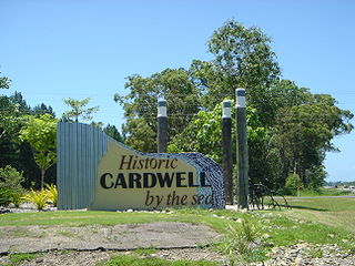
Cardwell is a coastal town and rural locality in the Cassowary Coast Region, Queensland, Australia. In the 2016 census, the locality of Cardwell had a population of 1,309 people.

<span class="mw-page-title-main">Ingham, Queensland</span> Town in Queensland, Australia

Ingham is a rural town and locality in the Shire of Hinchinbrook, Queensland, Australia. It is named after William Bairstow Ingham and is the administrative centre for the Shire of Hinchinbrook.

<span class="mw-page-title-main">Herbert River</span> River in Far North Queensland

The Herbert River is a river in Far North Queensland, Australia. The southernmost of Queensland's wet tropics river systems, it was named in 1864 by George Elphinstone Dalrymple explorer, after Robert George Wyndham Herbert, the first Premier of Queensland.

<span class="mw-page-title-main">North Queensland</span> Region in Queensland, Australia

North Queensland or the Northern Region is the northern part of the Australian state of Queensland that lies just south of Far North Queensland. Queensland is a massive state, larger than many countries, and its tropical northern part has been historically remote and undeveloped, resulting in a distinctive regional character and identity.

<span class="mw-page-title-main">Lucinda, Queensland</span> Town in Queensland, Australia

Lucinda is a coastal town and locality in the Shire of Hinchinbrook, Queensland, Australia. In the 2021 census, the locality of Lucinda had a population of 435 people.

<span class="mw-page-title-main">Halifax, Queensland</span> Town in Queensland, Australia

Halifax is a town and a coastal locality in the Shire of Hinchinbrook, Queensland, Australia. In the 2021 census, the locality of Halifax had a population of 477 people.

<span class="mw-page-title-main">Abergowrie, Queensland</span> Suburb of Shire of Hinchinbrook, Queensland, Australia

Abergowrie is a rural town and locality in the Shire of Hinchinbrook, Queensland, Australia. In the 2021 census, the locality of Abergowrie had a population of 305 people.

Taylors Beach is a coastal town and locality in the Shire of Hinchinbrook, Queensland, Australia. It takes its name from its beach. In the 2016 census, the locality of Taylors Beach had a population of 318 people.

<span class="mw-page-title-main">Macknade, Queensland</span> Town in Queensland, Australia

Macknade is a rural town and coastal locality in the Shire of Hinchinbrook, Queensland, Australia. In the 2016 census, the locality of Macknade had a population of 229 people.

Majors Creek is a locality split between the City of Townsville and the Shire of Burdekin, Queensland, Australia. In the 2016 census, Majors Creek had a population of 329 people.

Bambaroo is a rural locality in the Shire of Hinchinbrook, Queensland, Australia. In the 2021 census, Bambaroo had a population of 146 people.

Helens Hill is a rural locality in the Shire of Hinchinbrook, Queensland, Australia. In the 2021 census, Helens Hill had a population of 118 people.

<span class="mw-page-title-main">Mount Fox, Queensland</span> Suburb of Shire of Hinchinbrook, Queensland, Australia

Mount Fox is a rural locality in the Shire of Hinchinbrook, Queensland, Australia. In the 2016 census Mount Fox had a population of 87 people.

Cordelia is a rural locality in the Shire of Hinchinbrook, Queensland, Australia. In the 2021 census, Cordelia had a population of 176 people.

<span class="mw-page-title-main">Bemerside, Queensland</span> Suburb of Shire of Hinchinbrook, Queensland, Australia

Bemerside is a rural locality in the Shire of Hinchinbrook, Queensland, Australia. In the 2021 census, Bemerside had a population of 259 people.

Mount Gardiner is a rural locality in the Livingstone Shire, Queensland, Australia. In the 2016 census Mount Gardiner had a population of 34 people.

Dalrymple Creek is a locality in the Shire of Hinchinbrook, Queensland, Australia. In the 2021 census, Dalrymple Creek had a population of 51 people.

Rungoo is a coastal locality in the Cassowary Coast Region, Queensland, Australia. In the 2021 census, Rungoo had a population of 11 people.

Lake Mary is a rural locality in the Livingstone Shire, Queensland, Australia. In the 2021 census, Lake Mary had a population of 96 people.

Garrawalt is a rural locality in the Shire of Hinchinbrook, Queensland, Australia.

References

  1. 1 2 3 Australian Bureau of Statistics (28 June 2022). "Hawkins Creek (SAL)". 2021 Census QuickStats. Retrieved 28 February 2023. OOjs UI icon edit-ltr-progressive.svg
  2. "Hawkins Creek – locality in Shire of Hinchinbrook (entry 15528)". Queensland Place Names. Queensland Government . Retrieved 28 October 2019.
  3. 1 2 3 4 5 6 "Queensland Globe". State of Queensland . Retrieved 23 April 2022.
  4. 1 2 3 "Mountain peaks and capes - Queensland". Queensland Open Data. Queensland Government. 12 November 2020. Archived from the original on 25 November 2020. Retrieved 25 November 2020.
  5. "Gardiner Mountain – mountain in Hinchinbrook Shire (entry 13442)". Queensland Place Names. Queensland Government . Retrieved 25 November 2020.
  6. "Mount Hawkins – mountain in Hinchinbrook Shire (entry 15530)". Queensland Place Names. Queensland Government . Retrieved 25 November 2020.
  7. "South Gardiner Mountain – mountain in Hinchinbrook Shire (entry 31455)". Queensland Place Names. Queensland Government . Retrieved 25 November 2020.
  8. CC BY icon-80x15.png This Wikipedia article incorporates CC-BY-4.0 licensed text from: "Warrgamay". Queensland Aboriginal and Torres Strait Islander languages map. State Library of Queensland . Retrieved 5 February 2020.
  9. Queensland Family History Society (2010), Queensland schools past and present (Version 1.01 ed.), Queensland Family History Society, ISBN   978-1-921171-26-0
  10. "Queensland state school - centre closures" (PDF). Queensland Government . 20 August 2013. Archived (PDF) from the original on 20 March 2022. Retrieved 7 April 2022.
  11. "Parish of Marathon County of Cardwell" (Map). Queensland Government. 1976. Retrieved 23 April 2022.
  12. Blake, Thom. "Church of the Holy Family". Queensland religious places database. Retrieved 23 April 2022.
  13. "Parish History". Ingham Region Catholic Parishes. 28 December 2013. Retrieved 23 April 2022.
  14. Australian Bureau of Statistics (27 June 2017). "Hawkins Creek (SSC)". 2016 Census QuickStats. Retrieved 20 October 2018. OOjs UI icon edit-ltr-progressive.svg

Further reading