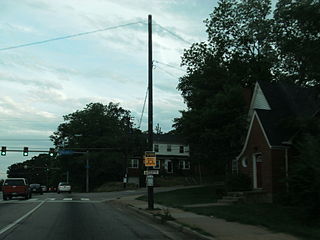
Burke is an unincorporated section of Fairfax County, Virginia, United States traditionally defined as the area served by the Burke post office. Burke includes two census-designated places: The Burke CDP, population 41,055 in 2010 and the Burke Centre CDP, population 17,326.

Chantilly is a census-designated place (CDP) in western Fairfax County, Virginia, United States. The population was 23,039 at the 2010 census. Chantilly is named after an early-19th-century mansion and farm, which in turn took the name of an 18th-century plantation that was located in Westmoreland County, Virginia. The name "Chantilly" originated in France with the Château de Chantilly, about 25 miles north of Paris.

Great Falls is a census-designated place (CDP) in Fairfax County, Virginia, United States. The population as of the 2010 census was 15,427, an increase of 80.5% from the 2000 census.

Groveton is a census-designated place (CDP) in Fairfax County, Virginia, United States. The population was 14,598 at the 2010 census, down from 21,296 in 2000 due to a reduction in area. Located south of the city of Alexandria, it encompasses numerous neighborhoods including Groveton, Bucknell Manor and Stoneybrooke. Huntley Meadows Park, Fairfax County's largest park, is located in the southwest part of the CDP.

Lincolnia is a census-designated place (CDP) in Fairfax County, Virginia, United States. The population was 22,828 at the 2010 census, an increase of over 44% from 2000.

Lorton is a census-designated place (CDP) in Fairfax County, Virginia, United States. The population was 18,610 as of the 2010 census.

Mantua is a census-designated place (CDP) in Fairfax County, Virginia, United States. Mantua is a bedroom community serving as a suburb to the Washington, D.C. metropolitan area. Most of the homes in Mantua were built between the 1950s and the 1980s. The population was 7,135 at the 2010 census.

Merrifield is a census-designated place (CDP) in Fairfax County, Virginia, United States. The population was 15,212 at the 2010 census.

Oakton is a census-designated place (CDP) in Fairfax County, Virginia, United States. The population was 34,166 at the 2010 census. Located in Northern Virginia, its center is 16 miles (26 km) west of Washington, D.C.

Rose Hill is a census-designated place (CDP) in Fairfax County, Virginia, United States. The population was 20,226 at the 2010 census. Built in the mid-1950s, Rose Hill is the largest of the subdivisions that make up the CDP, which is just southwest of Alexandria; others include Wilton Woods, Burgundy Village, and Winslow Heights. Street addresses are in Alexandria ZIP codes 22310, 22303 and 22315.

Springfield is a census-designated place (CDP) in Fairfax County, Virginia, United States. The Springfield CDP is recognized by the U.S. Census Bureau with a population of 30,484 as of the 2010 census. Homes and businesses in bordering CDPs including North Springfield, West Springfield, and Newington are usually given a Springfield mailing address. The population of the collective areas with Springfield addresses is estimated to exceed 100,000. The CDP is a part of Northern Virginia, the most populous region of the Washington Metropolitan Area.

Wolf Trap is an affluent census-designated place (CDP) in Fairfax County, Virginia, United States. The population was 16,131 at the 2010 census. Wolf Trap National Park for the Performing Arts is located in the CDP.

Fairfax Station is a census-designated place (CDP) in Fairfax County, Virginia, United States. The population was 12,030 at the 2010 census. Located in Northern Virginia, its center is located 22 miles (35 km) southwest of Washington, D.C.

Kingstowne is a census-designated place (CDP) in Fairfax County, Virginia, United States. It is a planned community amid the Washington, D.C. suburbs of Springfield, Alexandria, and Franconia, Virginia, and is centered on the intersection of South Van Dorn Street and Kingstowne Boulevard. The population as of the 2010 census was 15,556.

Floris is a census-designated place (CDP) located within the Oak Hill area of Fairfax County, Virginia, United States. The population as of the 2010 census was 8,375.

Kings Park West is a census-designated place in the eastern United States, in Fairfax County, Virginia, southwest of Washington, D.C. The population as of the 2010 census was 13,390.

Long Branch is a census-designated place in Fairfax County, Virginia, bordering the city of Fairfax. The population as of the 2010 census was 7,593.

George Mason is a census-designated place (CDP) in Fairfax County, Virginia, United States. The population as of the 2010 census was 9,496. It consists of George Mason University and some adjacent neighborhoods to the south and southwest of the city of Fairfax.

Newington Forest is a census-designated place in Fairfax County, Virginia, United States. The population as of the 2010 census was 12,442. It is part of the Washington metropolitan area. It includes the Newington Forest subdivision and several nearby neighborhoods of southern Springfield and northern Lorton.

South Run is a census-designated place in Fairfax County, Virginia, United States. The population as of the 2010 census was 6,389.


