George Mason, Virginia

Last updated

George Mason, Virginia
House, George Mason CDP, Fairfax County, VA.jpg
A house in the CDP, August, 2017
Nickname: 
GMU
USA Virginia Northern location map.svg
Red pog.svg
George Mason
Location within Fairfax county
USA Virginia location map.svg
Red pog.svg
George Mason
George Mason (Virginia)
Usa edcp location map.svg
Red pog.svg
George Mason
George Mason (the United States)
Coordinates: 38°49′56″N77°18′51″W / 38.83222°N 77.31417°W / 38.83222; -77.31417
CountryUnited States
State Virginia
County Fairfax
IncorporatedJuly 26, 2013
Named for George Mason University
Government
  TypeBoard of Directors
  BodyBoard of Directors
  President of the Board of DirectorsHeather Villavicencio (Nonpartisan)
  Vice President of the Board of DirectorsJulie Stewart
Area
  Total2.5 sq mi (6.55 km2)
  Land2.5 sq mi (6.52 km2)
  Water0.02 sq mi (0.04 km2)  0.53%
Elevation
450 ft (140 m)
Population
 (2020)
  Total11,162
  Rank40
  Density4,464.8/sq mi (1,712.0/km2)
Demonym Masonian
Time zone UTC−5 (Eastern (EST))
  Summer (DST) UTC−4 (EDT)
ZIP codes
22030, 22032
Area code(s) 571, 703
FIPS code 51-30618
GNIS feature ID2584851
Website http://gmfhoa.org/

George Mason is a census-designated place (CDP) in Fairfax County, Virginia, United States. The population at the 2020 census was 11,162. [1] It consists of George Mason University and some adjacent neighborhoods to the south and southwest of the city of Fairfax, and is named for American Founding Father George Mason.

Contents

History

The land that is now George Mason was located on the farm of John and Harriet Burtis, originally of New York State; the Burtises were abolitionists who grew vegetables and raised sheep. On May 25, 1861, Corporal John Barnes of the C.S.A. 17th Virginia Infantry Regiment's Company D, also known as the Fairfax Rifle Rangers, riding with his companion, ordered Burtis to give him provisions. Burtis procured several of his sheep for the Corporal, but refused to use his team of horses to move them to the Confederate camp in Fairfax Station. Barnes eventually convinced a local free black man to move the sheep for him, but loudly declared in the presence of the man that he would arrest Burtis and seize his team. Burtis, having learned of the danger he was in, left with his wife and his team, taking a "...circuitous route through the woods", eventually reaching Washington. [2]

In 1962, planning began for the 150 acres of land donated by the City of Fairfax to be the new campus of George Mason College of the University of Virginia, with the campus opening in 1964. In 1972, Governor of Virginia Linwood Holton signed legislation to separate George Mason College from the University of Virginia, renaming it George Mason University.

A. G. Van Metre Associates began developing George Mason Forest in the early 1980s, and completed the community in 2003, having built approximately 200 single-family homes. On July 3, 2013, the George Mason Forest Homeowners Association filed for incorporation, successfully being granted corporation status on July 26.

Recreational and cultural activities

Parks and recreation

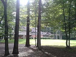
George Mason is home to several green spaces, with around 3.5 miles of trails, most of which are on the university campus.

Two parks are located in George Mason: Fairfax Villa Park near Shirley Gate Road, and University Park on Braddock Road; a portion of Providence Park, which is mostly in Fairfax, is also in the CDP.

George Mason is also near the Country Club of Fairfax in Fairfax Station.

The CDP is about 2 miles from the Daniels Run Trail, the Wilcoxon Trail, and the Gerry Connolly Cross County Trail, all in Fairfax, and about 2.5 miles from the Accotink Trail in Mantua. George Mason is also home to Mason Pond, a small pond on the university campus; as well as an unnamed pond near Braddock Road, which is the source of Popes Head Creek, which flows into the Occoquan River in unincorporated Fairfax County. Both forks of the Rabbit Branch, which joins up with the Sideburn Branch to from Pohick Creek in Burke, also have their sources in George Mason.

The Villa Aquatic Club, a private pool, is located on Andes Drive in George Mason. George Mason University has four athletic fields for the George Mason Patriots: the George Mason Softball Complex, Sphuler Field, George Mason Stadium, and the George Mason University Tennis Courts.

Transportation

Two major state highways directly serve George Mason: Virginia State Route 123 (Ox Road), which bisects the CDP and the campus, and also connects them to Fairfax, Virginia State Route 236 (Main Street), and U.S. Route 50 / U.S. Route 29 (Lee Highway) in the north, and Fairfax Station, Virginia State Route 654 (Popes Head Road / Zion Drive), and Virginia State Route 643 (Burke Centre Parkway) in the south; and Virginia State Route 620, which forms the CDP's southern border, and connects it to Centreville, Virginia State Route 655 (Shirley Gate Road), and Virginia State Route 286 (Fairfax County Parkway) in the west, and Burke, Virginia State Route 652 (Twinbrook Road), and Virginia State Route 651 (Guinea Road) in the east.

George Mason is approximately 2 miles from the Burke Centre station on the Virginia Railway Express' Manassas Line and Amtrak's Northeast Regional, and approximately 2.5 miles from the Vienna/Fairfax-GMU Washington Metro station.

George Mason is also served by five Fairfax County Connector bus routes: 306 and 17G, which go from George Mason University to The Pentagon, Green and Gold, which go to the Vienna/Fairfax-GMU station and come back in two different loops, and 29K, which goes to the King Street-Old Town Metro Station in Alexandria.

Geography

The CDP is bordered to the north by the Fairfax city line, to the west by Shirley Gate Road, to the south by Braddock Road, and to the east by Burke Station Road. [3] The university campus is largely to the east of Ox Road (Virginia State Route 123), which runs north to south across the center of the CDP. Many of the university's athletic facilities are west of Ox Road, however. According to the U.S. Census Bureau, the CDP has a total area of 2.5 square miles (6.6 km2), of which 0.02 square miles (0.04 km2), or 0.53%, is water. [4]

Climate

The climate in this area is characterized by hot, humid summers and generally mild to cool winters. According to the Köppen Climate Classification system, George Mason has a humid subtropical climate, abbreviated "Cfa" on climate maps. [5]

Climate data for George Mason, Virginia, 1984–present
MonthJanFebMarAprMayJunJulAugSepOctNovDecYear
Record high °F (°C)74 (23)76 (24)88 (31)96 (35)97 (36)100 (37)104 (40)105 (40)100 (37)92 (33)85 (29)77 (25)105 (40)
Average high °F (°C)42 (5)45 (7)55 (12)66 (18)75 (23)83 (28)87 (30)85 (29)79 (26)68 (20)58 (14)46 (7)66 (18)
Average low °F (°C)24 (-4)27 (-2)34 (1)43 (6)52 (11)61 (16)67 (19)65 (18)58 (14)45 (7)37 (2)28 (-2)45 (7)
Record low °F (°C)-10 (-23)-2 (-18)-2 (-18)19 (-7)29 (-1)38 (3)45 (7)44 (6)35 (1)24 (-4)15 (-9)-4 (-20)-10 (-23)
Average precipitation inches (mm)2.9 (70)2.9 (70)3.8 (90)3.2 (80)3.8 (90)3.5 (80)3.9 (90)4.2 (100)3.8 (90)3.3 (80)3.3 (80)3.4 (80)42.2 (1070)
Average snowfall inches (cm)5.8 (14)6.7 (17)3.6 (9)0.1 (0)0 (0)0 (0)0 (0)0 (0)0 (0)0.1 (0)0.9 (2)3.4 (8)20.9 (53)
Average precipitation days1311121111101010881012126

Government

George Mason is a census-designated place within Fairfax County; therefore, schools, roads, and law enforcement are provided by the county.

Board of directors

The board is the legislative branch of the community government, led by the president, currently Heather Villavicencio, and the vice-president, currently Julie Stewart.

According to the Association By-Laws, the Board has the power to manage the common property, suspend the rights of defaulting members, exercise the powers and duties not otherwise delegated, declare members of the board who have not attended three or more consecutive meetings to have resigned and fill the resigned's seat, establish policies for the execution of duties, and employ a manager as is deemed necessary.

The duties of the board include keeping record of decisions and presenting it to all Association members present at the annual meeting, oversee all Association employees, assess the value of each lot and inform their owners through written notice, demand the payment to the Association of the assessment, take out liability insurance on Association property, have employees with fiscal responsibility be bonded, maintain the common area, and take action when assessments have not been paid within thirty days of the owner receiving notice.

The board also appoints the members of the Architectural Control Committee and the Nominating Committee, as well as special committees.

Representation

George Mason is within the Braddock District of Fairfax County. The CDP is also in Virginia's 11th congressional district, currently represented in Congress by Representative Gerry Connolly (D-Mantua). George Mason is represented by David Bulova (D-Fairfax) in the state House of Delegates, and by Chap Petersen (D-Fairfax) in the state Senate.

Local media

George Mason lies within the distribution zone for two national newspapers, the Washington Post, and the Washington Times, as well as for the local Fairfax Times. George Mason is also covered by AOL's Patch service's Fairfax City division. [6]

Education

Primary and secondary schools

As a part of Fairfax County, George Mason is served by the Fairfax County Public Schools and private schools. George Mason is served by one high school, Woodson High School, and one middle school, Frost Middle School, both in adjacent Long Branch.

Public elementary schools

  • Olde Creek Elementary School
  • Fairfax Villa Elementary School
  • Providence Elementary School
  • Daniels Run Elementary School

Colleges and universities

George Mason is home to the main campus of George Mason University, a public liberal arts and research university. The CDP is also near a few other higher education centers, including Missouri State University's Department of Defense and Strategic Studies, and Fairfax University of America.

Public libraries

George Mason is served by the City of Fairfax Regional Library, a branch of the Fairfax County Public Library.

Demographics

Historical population
CensusPop.Note
2010 9,496
2020 11,16217.5%

2020 census

At the 2020 census (some information from the 2022 American Community Survey) there were 11,162 people, 1,766 housing units and 1,755 households residing in the CDP. The population density was 4,464.8 inhabitants per square mile (1,712.0/km2). The average housing unit density was 706.4 per square mile (270.9/km2). The racial makeup of the CDP was 42.27% White, 19.67% African American, 0.84% Native American, 17.19% Asian, 0.04% Pacific Islander, 11.77% from other races, and 8.22% from two or more races. Hispanic or Latino of any race was 16.64% of the population. [7]

Of the households, 4.4% were non-family households, 68.2% were married couple families, 8.1% were a male family householder with no spouse, and 19.3% were a female family householder with no spouse. The average family household had 3.37 people. [7]

The median age was 20.9, 13.3% of people were under the age of 18, and 6.8% were 65 years of age or older. The largest ancestry is the 7.1% who had Irish ancestry, 23.3% spoke a language other than English at home, and 19.1% were born outside the United States, 65.5% of whom were naturalized citizens. [7]

The median income for a household in the CDP was $146,985, and the median income for a family was $146,985. 4.1% of the population were military veterans, and 67.4% had a batchelor's degree or higher. In the CDP 5.2% of the population was below the poverty line, including 6.1% of those under the age of 18 and 3.2% of those aged 65 or over, with 7.0% of the population without health insurance. [7]

2010 census

The population at the 2010 census was 9,496. [8]

Related Research Articles

<span class="mw-page-title-main">Fairfax County, Virginia</span> County in Virginia, United States

Fairfax County, officially the County of Fairfax, is a county in the Commonwealth of Virginia. It is part of Northern Virginia and borders both the city of Alexandria and Arlington County and forms part of the suburban ring of Washington, D.C., the nation's capital. The county is predominantly suburban in character with some urban and rural pockets.

<span class="mw-page-title-main">Fairfax, Virginia</span> Independent city in Virginia, United States

Fairfax, Virginia, formally the City of Fairfax, and colloquially known as Fairfax City, Downtown Fairfax, Old Town Fairfax, Fairfax Courthouse, FFX, or simply Fairfax, is an independent city in the Commonwealth of Virginia in the United States. As of the 2020 census, the population was 24,146. It is the county seat of Fairfax County, Virginia.

<span class="mw-page-title-main">Annandale, Virginia</span> Census-designated place in Virginia, US

Annandale is a census-designated place (CDP) in Fairfax County, Virginia. The population of the CDP was 43,363 as of the 2020 United States Census. It is home to the oldest and largest branch of the Northern Virginia Community College system, and to one of the D.C. area's Koreatowns.

<span class="mw-page-title-main">Burke, Virginia</span> Unincorporated section of Fairfax County, Virginia

Burke is an unincorporated section of Fairfax County, Virginia, United States, traditionally defined as the area served by the Burke post office. Burke includes two census-designated places: the Burke CDP, population 42,312 in 2020 and the Burke Centre CDP, population 17,518 in 2020.

<span class="mw-page-title-main">Chantilly, Virginia</span> CDP in Virginia, United States

Chantilly is a census-designated place (CDP) in western Fairfax County, Virginia. The population was 24,301 as of the 2020 census. Chantilly is named after an early-19th-century mansion and farm, which in turn took the name of an 18th-century plantation that was located in Westmoreland County, Virginia. The name "Chantilly" originated in France with the Château de Chantilly, about 28 miles north of Paris.

<span class="mw-page-title-main">Lincolnia, Virginia</span> Census-designated place in Virginia, United States

Lincolnia is a census-designated place (CDP) in Fairfax County, Virginia, United States. The population was 22,828 at the 2010 census, an increase of over 44% from 2000.

<span class="mw-page-title-main">Lorton, Virginia</span> Census-designated place in Virginia, United States

Lorton is a census-designated place (CDP) in Fairfax County, Virginia, United States. The population was 20,072 as of the 2020 census.

<span class="mw-page-title-main">McLean, Virginia</span> Census-designated place and unincorporated community in Virginia, United States

McLean is an unincorporated community and census-designated place in Fairfax County, Virginia, United States. The population of the community was 50,773 at the 2020 census. It is located between the Potomac River and Vienna within the Washington metropolitan area.

<span class="mw-page-title-main">Mount Vernon, Virginia</span> Census-designated place in Virginia, United States

Mount Vernon is a census-designated place (CDP) and unincorporated community in Fairfax County, Virginia, United States. The population was 12,416 at the 2010 census. Primarily due to its historical significance and natural recreation and beauty, the Mount Vernon area receives over one million tourists each year.

<span class="mw-page-title-main">Springfield, Virginia</span> Census-designated place in Virginia, United States

Springfield is a census-designated place (CDP) in Fairfax County, Virginia, United States. The Springfield CDP is recognized by the U.S. Census Bureau with a population of 31,339 as of the 2020 census. Previously, per the 2010 census, the population was 30,484. Homes and businesses in bordering CDPs including North Springfield, West Springfield, and Newington are usually given a Springfield mailing address. The population of the collective areas with Springfield addresses is estimated to exceed 100,000. The CDP is a part of Northern Virginia, the most populous region of the Washington Metropolitan Area.

<span class="mw-page-title-main">Tysons, Virginia</span> Census-designated place in Virginia, United States

Tysons, also known as Tysons Corner, is a census-designated place (CDP) in Fairfax County, Virginia, United States, spanning from the corner of SR 123 and SR 7. It is part of the Washington metropolitan area and located in Northern Virginia between McLean and Vienna along the I-495.

<span class="mw-page-title-main">Woodbridge, Virginia</span> Census-designated place in Virginia, United States

Woodbridge is a census-designated place (CDP) in Prince William County, Virginia, United States, located 20 miles (32 km) south of Washington, D.C. Bounded by the Occoquan and Potomac rivers, Woodbridge had 44,668 residents at the 2020 census.

<span class="mw-page-title-main">Fairfax Station, Virginia</span> Census-designated place in Virginia, United States

Fairfax Station is a census-designated place (CDP) in Fairfax County, Virginia, United States. The population was 12,420 at the 2020 census. Located in Northern Virginia, its center is located 22 miles (35 km) southwest of Washington, D.C.

<span class="mw-page-title-main">Virginia State Route 123</span> State highway in northern Virginia, US

State Route 123 or Virginia State Route 123 is a primary state highway in the U.S. state of Virginia. The state highway runs 29.27 miles (47.11 km) from U.S. Route 1 in Woodbridge north to the Chain Bridge across the Potomac River into Washington from Arlington. It goes by four local names. From its southern terminus to the Occoquan River Bridge, it is known as Gordon Boulevard. From the Occoquan River Bridge to the city of Fairfax it is known as Ox Road. From Fairfax until it enters the Town of Vienna, it is known as Chain Bridge Road. Then, as it passes through the Town of Vienna, it is known as Maple Avenue. After leaving the Town of Vienna, the name reverts to Chain Bridge Road, and continues this way until the intersection with I-495 in Tysons. Between Tysons and the George Washington Memorial Parkway, it is known as Dolley Madison Boulevard. After crossing over the George Washington Memorial Parkway, the name once again reverts to Chain Bridge Road and continues this way until the end of the road, at Chain Bridge. SR 123 is a partial circumferential highway in Northern Virginia that connects Woodbridge in eastern Prince William County with the independent city of Fairfax and the Fairfax County communities of Vienna, Tysons, and McLean, the last being the home of the National Counterterrorism Center and the Central Intelligence Agency. The state highway also connects all of the major highways that radiate from Washington, including Interstate 95 (I-95), I-66, US 29, US 50, SR 267, and the George Washington Memorial Parkway. Furthermore, SR 123 crosses another pair of circumferential highways, I-495 and the Fairfax County Parkway, and SR 7, a major northwest–southeast highway through Northern Virginia. The state highway is a part of the National Highway System for its entire length.

<span class="mw-page-title-main">Kings Park, Virginia</span> Census-designated place in Virginia, United States

Kings Park is a census-designated place (CDP) in the eastern United States in Fairfax County, Virginia, southwest of Washington D.C. The population as of the 2010 census was 4,333.

<span class="mw-page-title-main">Floris, Virginia</span> Census-designated place in Virginia, United States

Floris is a census-designated place (CDP) located within the Oak Hill area of Fairfax County, Virginia, United States. The population at the 2020 census was 8,341.

<span class="mw-page-title-main">Crosspointe, Virginia</span> Census-designated place in Virginia, United States

Crosspointe is a census-designated place in Fairfax County, Virginia, United States. The population as of the 2020 census was 5,722.

<span class="mw-page-title-main">Kings Park West, Virginia</span> Census-designated place in Virginia, United States

Kings Park West is a census-designated place in the eastern United States, in Fairfax County, Virginia, southwest of Washington, D.C. At the 2020 census the population was 13,465 people

Long Branch is a census-designated place in Fairfax County, Virginia, bordering the city of Fairfax. The population as of the 2010 census was 7,593.

<span class="mw-page-title-main">Wakefield, Fairfax County, Virginia</span> Census-designated place in Virginia, United States

Wakefield is a census-designated place in Fairfax County, Virginia, United States. The population as of the 2010 census was 11,275. The current Wakefield area was built in the 1950-60's.

References

  1. "QuickFacts George Mason CDP, Virginia". Census.gov. Retrieved January 27, 2024.
  2. "About – GMFHOA" . Retrieved July 2, 2021.
  3. "Places and County Subdivisions". TIGERweb. U.S. Census Bureau, Geography Division. Retrieved October 5, 2016.
  4. "Geographic Identifiers: 2010 Demographic Profile Data (G001): George Mason CDP, Virginia". U.S. Census Bureau, American Factfinder. Retrieved October 5, 2016.[ dead link ]
  5. "Newington, Virginia Travel Weather Averages (Weatherbase)". Weatherbase. Retrieved July 7, 2021.
  6. "Fairfax City, VA Patch - Breaking News, Local News, Events, Schools, Weather, Sports and Shopping". Fairfax City, VA Patch. Retrieved July 8, 2021.
  7. 1 2 3 4 "George Mason CDP, Virginia". data.census.gov. Retrieved January 27, 2024.
  8. Virginia Trend Report 2: State and Complete Places (Sub-state 2010 Census Data). Missouri Census Data Center. Accessed 2011-06-08.