Hayton, Allerdale

Last updated

Hayton
Village
St James' Church, Hayton - geograph.org.uk - 51829.jpg
St James' Church, Hayton
Location map United Kingdom Allerdale.svg
Red pog.svg
Hayton
Location in the former Allerdale district
Cumbria UK location map.svg
Red pog.svg
Hayton
Location within Cumbria
Population237 (2011) [1]
OS grid reference NY 1041
Civil parish
Unitary authority
Ceremonial county
Region
Country England
Sovereign state United Kingdom
Post town WIGTON
Postcode district CA7
Dialling code 016973
Police Cumbria
Fire Cumbria
Ambulance North West
UK Parliament
List of places
UK
England
Cumbria
54°45′36″N3°23′28″W / 54.760°N 3.391°W / 54.760; -3.391 Coordinates: 54°45′36″N3°23′28″W / 54.760°N 3.391°W / 54.760; -3.391

Hayton is a village in the Cumberland unitary authority area of Cumbria, England. It is the only settlement in the civil parish of Hayton and Mealo. [2] Historically located in Cumberland, and on a minor road between the B5300 and the A596, it is approximately 2 miles from the coast. Nearby settlements include the town of Aspatria and the villages of Oughterside and Prospect. A small tributary called Patten Beck runs across the village, through the grounds of the castle. [3]

Contents

Demographics

In the 2011 census the Office for National Statistics (ONS) identified a "Hayton (Allerdale) Built-up area", corresponding to the village, with a population of 237 in 94 households. [4] This figure was also the population recorded for the whole parish of Hayton and Mealo, [5] confirming that the village is the only settlement in the parish. The built-up area was calculated to be 0.081 square miles (0.21 km2), [4] while the area of the parish is 2.919 square miles (7.559 km2). [5] The ONS identifies built-up areas algorithmically. [6]

In the 2001 UK Census the village consisted of 89 households with a total population of 229 . [7] The largest population was recorded in the 1921 Census when there were 346 residents within the Hayton and Mealo area. From 1921 to 1961 population gradually decreased to 214 which is likely to be due to the change in agricultural processes and the increased use of machinery which reduced the size of labourforce needed. [8]

Population change in Hayton Haytonpop.png
Population change in Hayton

Amenities

The village does have a church and a local small village shop selling essentials. The nearest supermarket is located in the nearby town of Aspatria. [9] The village has one small family shop, a bench and a postbox.

There are no schools in Hayton, however there are 10 infant schools, 7 junior schools, 46 primary schools and 9 secondary schools in the Allerdale area in the surrounding towns of Maryport, Cockermouth, Keswick and Wigton which are within a 9 – 20-mile radius of Hayton. A number of the secondary schools take students through to the age of 18 which covers A-Level studies. [10]

Transport

There is no local bus service and the nearest train station is 2.2 miles away at Aspatria. [11] The M6 is 25 miles from the village, just beyond the city of Carisle.

Climate

Due to its location on the North West coast and the mountainous geography of the area, the Lake District is the wettest region in the UK. It receives on average over 2,000mm of rainfall every year however there local variation across the region. Typically in the area surrounding Hayton, the most rainfall occurs in the months February and October; with an average of 109mm in each month. [12] The driest month is July with an annual average of 58mm however throughout the year there is average of 18 rainy/ drizzle days per month. Annual daytime temperatures range from 7 °C in February to highs of 17 °C in June and then 9 °C in November [13]

History

To the north-east of the village lies Hayton Castle, which on 11 April 1967 was officially listed as a Grade I building. [14]

The UK Census of 1881 gives clear indication of the main occupation of residents in Hayton and Mealo as the majority of the population was employed in agriculture. [15] A number of farms remain, the main ones being; Hazel Mount at the bottom, south-west entrance to the village, and Grange Farm, Hayton Farm, Midtown Farm and Town Head Farm in the centre of the village.

There is also a PW – Place of Worship marked on some older maps however this building is not official named as an active place of worship but land use is clear with the gravestone visible from aerial photography.

On 22 June 1836 the Wigton Poor Law Union was established to represent 30 constituent townships and parishes of which Hayton & Mealo was included. To begin with, the new union operated in existing workhouses at Caldbeck, Oulton, Glasson and Wigton itself however in 1838 – 42, a new workhouse was constructed at Cross Lane – an 11-acre site – costing a total £323.16s.8d. [16]

In 1870–72, John Marius Wilson's Imperial Gazetteer of England and Wales described Hayton as:

"A township and a chapelry in Aspatria parish, Cumberland; on the coast, 2½ miles W of Aspatria r. station. They have a post-office under Maryport. The township includes Mealo, and comprises 1,971 acres. Pop., 390. The chapelry was constituted in 1867. Pop., 1,095. The living is a rectory. Value, £300." [17]

Toponymy

The origins of the name lie in Saxon times; Hay meaning 'animal feeding stalls' and Ton translating to 'house or farm'. [18] This reflects the original function and main focus of employment in the area in years past, agriculture.

Additional Information

FacilityPresent (Yes/No)
Public Phone BoxNo
Public HouseNo
Village Greenyes
Village ShopYes
Village HallYes Mealo
Recreational areaNo
Post BoxYes
Areas of outstanding natural beautyYes

See also

Related Research Articles

<span class="mw-page-title-main">Cumberland</span> Historic county of England

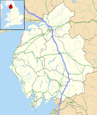
Cumberland is a historic county in North West England. It covers part of the Lake District as well as the north Pennines and Solway Firth coast. Cumberland had an administrative function from the 12th century until 1974, when it was subsumed into Cumbria, a larger administrative area which also covered Westmorland and parts of Yorkshire and Lancashire. In April 2023, Cumberland was revived as an administrative entity when Cumbria County Council was abolished and replaced by two unitary authorities; one of which is named Cumberland and includes most of the historic county, with the exception of Penrith and the surrounding area.

<span class="mw-page-title-main">Aspatria</span> Human settlement in England

Aspatria is a town and civil parish in Cumberland, Cumbria, England. The town rests on the north side of the Ellen Valley, overlooking a panoramic view of the countryside, with Skiddaw to the South and the Solway Firth to the North. Its developments are aligned approximately east–west along the A596 Carlisle to Workington road and these extend to approximately 2 miles (3.2 km) in length. It lies about 8 miles (13 km) northeast of Maryport, a similar distance to the Southwest of Wigton, about 9 miles (14 km) north of Cockermouth and 5 miles (8.0 km) from the coast and Allonby. It comprises the townships of Aspatria and Brayton, Hayton and Mealo, and Oughterside and Allerby, the united area being 8,345 acres (3,377 ha); while the town takes up an area of 1,600 acres (647 ha). In earlier days a Roman road leading from "Old Carlisle" to Ellenborough passed through the hamlet.

<span class="mw-page-title-main">Allerdale</span> Former non-metropolitan district in England

Allerdale was a non-metropolitan district of Cumbria, England, with borough status. Its council was based in Workington and the borough has a population of 93,492 according to the 2001 census, increasing to 96,422 at the 2011 Census.

<span class="mw-page-title-main">Bothel and Threapland</span> Human settlement in England

Bothel and Threapland is a civil parish in Cumbria, England, just outside the Lake District National Park. According to the 2001 census, it had a population of 438. The parish includes the villages of Bothel and Threapland. The village of Bothel is south-east of the parish of Aspatria and Threapland is south of Aspatria and Carlisle is eighteen miles (29 km) North-east of the parish. It had a population of 483 in the 2011 census figures.

<span class="mw-page-title-main">Bromfield, Cumbria</span> Village and civil parish in England

Bromfield is a village and civil parish in Cumbria, in the north of England.

<span class="mw-page-title-main">Broughton Moor</span> Village in Cumbria, England

Broughton Moor is a village and civil parish in Cumbria, England. It is situated on an extensive moor about 2 miles (3.2 km) north of Broughton, 5 miles (8.0 km) north west of Cockermouth, 2.5 miles (4.0 km) south of Maryport and 4.5 miles (7.2 km) north of Workington.

<span class="mw-page-title-main">Bridekirk</span> Human settlement in England

Bridekirk is a village and civil parish in the Cumberland district in the county of Cumbria, England. It is around 3.2 kilometres (2 mi) north of the Derwent river and about the same distance from the nearest large town of Cockermouth just south of the river. Bridekirk is just outside the Lake District National Park and is not far from the Maryport and Carlisle Railway.

<span class="mw-page-title-main">Waverton, Cumbria</span> Human settlement in England

Waverton is a linear village and civil parish in the Allerdale borough of Cumbria, England. Waverton lies on the main A596 road east of a bridge over the River Waver, 2.2 miles south west from Wigton and 14.2 miles from the nearest city, Carlisle. The river is the reason for Waverton's name as well as it coming from the old English word tuǹ, this meaning "An enclosure; a farmstead; a village; an estate".

<span class="mw-page-title-main">Mealsgate</span> Human settlement in Cumbria, United Kingdom

Mealsgate is a village in Cumbria, England, historically within Cumberland.

<span class="mw-page-title-main">Dearham</span> Village in Cumbria, England

Dearham is a village and civil parish in Cumbria, historically part of Cumberland, near the Lake District National Park in England. It lies about 2 miles (3.2 km) east of Maryport and 5 miles (8.0 km) west of Cockermouth.

<span class="mw-page-title-main">Gilcrux</span> Human settlement in England

Gilcrux is a small village and civil parish in the ceremonial county of Cumbria, England, and historically part of Cumberland. It is situated just outside the Lake District National Park.

<span class="mw-page-title-main">B5300 road</span> A road on the Cumbrian coast in England.

The B5300 is a B road which runs for approximately twelve miles between the towns of Silloth and Maryport in the Allerdale borough of Cumbria, United Kingdom. From north to south, it passes through the villages of Blitterlees, Beckfoot, Mawbray, Dubmill, and Allonby. It runs through the Solway Coast Area of Outstanding Natural Beauty, passes close to the Salta Moss Site of Special Scientific Interest, Milefortlet 21, a Roman archaeological site, the salt pans, a remnant of the Solway plain's medieval saltmaking industry, and the village of Crosscanonby. It is an important route for carrying goods to and from Silloth docks and Maryport harbour. It is also the major road connecting smaller coastal settlements with Maryport and Silloth, from where other roads lead to Workington, Whitehaven, Wigton, and Carlisle. A short section of the road between Dubmill and Mawbray was closed in February 2019 due to coastal erosion, and reopened in June 2019.

<span class="mw-page-title-main">Holme St Cuthbert</span> A civil parish in Cumbria, England

Holme St Cuthbert is a small village and civil parish in the county of Cumbria, United Kingdom. The village is located approximately 23 miles to the south-west of Carlisle, Cumbria's county town, and was historically in the county of Cumberland.

<span class="mw-page-title-main">Westnewton, Cumbria</span> Village and parish in England

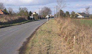
Westnewton is a small village and civil parish in Cumberland, Cumbria, England. The 2011 census had a population of 265. The village of Westnewton is situated to the north-west of the Lake District, on the relatively flat plain halfway between the Lake District hills and the Solway Firth. It is a small village located two miles north of Aspatria, on the B5301 Aspatria and Silloth road. The small hamlet of New Cowper is located one-and-a-half miles to the north-west. The landscape generally in this area is one of gently undulating fields, relatively devoid of features other than the thorn field-hedges, with shallow valleys carrying small streams, such as the Black Dub beck. Westnewton has a school called St Matthew's Church of England School, a church called St Matthew's Church, and a cemetery. There used to be a public house called the Swan Inn but this has closed.

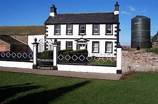
St James Church, Hayton, Cumbria is an active Anglican parish church in the deanery of Solway, the archdeaconry of West Cumberland and the diocese of Carlisle. The church dates from the 19th century.

<span class="mw-page-title-main">Holme East Waver</span> A civil parish in Cumbria, England

Holme East Waver is a civil parish in Cumbria, United Kingdom. It is bordered to the north by the civil parish of Bowness-on-Solway, to the east by the civil parishes of Kirkbride, Woodside, and Waverton, and to the south by the civil parishes of Dundraw and Holme Abbey, lands common to Holme St. Cuthbert, Holme Low, and Holme Abbey, and the town of Silloth-on-Solway. At the 2001 census, it had a population of 306 in 121 households, increasing slightly at the 2011 Census to a population of 318 in 130 households. It is named for the River Waver, and the rivers Waver and Wampool enter the Solway Firth at the western end of the parish. Part of the Solway Coast Area of Outstanding Natural Beauty is within the parish of Holme East Waver. The largest village is Newton Arlosh.

<span class="mw-page-title-main">Hayton and Mealo</span>

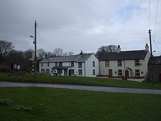
Hayton and Mealo is a civil parish in Allerdale district, Cumbria. The only settlement is Hayton, a village in the centre of the parish, which had a population of 237 in the 2011 census. In 1848, its population was 378.

<span class="mw-page-title-main">Oughterside and Allerby</span>

Oughterside and Allerby is a civil parish in Allerdale district, Cumbria, England. In the 2011 census it had a population of 619. The north western boundary of the parish is a short stretch of coast, then, working clockwise, the parish is bordered by Hayton and Mealo to the north, Aspatria to the north east, Plumbland to the south east, Gilcrux to the south and Crosscanonby to the south west. The A596 road from Aspatria to Maryport passes through the parish, and the B5300 road follows its coastline in the north west. The main settlements in the parish are Allerby in the west and Oughterside and Prospect, in the east.

<span class="mw-page-title-main">Woodside, Cumbria</span> Civil parish in Allerdale, Cumbria, England

Woodside is a civil parish in Allerdale district, Cumbria, England. At the 2011 census it had a population of 516. The parish has an area of 27.14 square kilometres (10.48 sq mi)

References

  1. "Parish population 2011" . Retrieved 18 June 2015.
  2. "Vision of Britain". Archived from the original on 17 September 2012. Retrieved 23 March 2012.
  3. "Old Maps – Hayton, Allerdale". Archived from the original on 30 April 2012. Retrieved 23 March 2012.
  4. 1 2 UK Census (2011). "Local Area Report – Hayton (Allerdale) Built-up area (E34003607)". Nomis. Office for National Statistics . Retrieved 6 September 2021.
  5. 1 2 UK Census (2011). "Local Area Report – Hayton and Mealo Parish (E04002410)". Nomis. Office for National Statistics . Retrieved 6 September 2021.
  6. "2011 Built-up Areas - Methodology and Guidance" (PDF). Office for National Statistics. 2013.
  7. "Neighbourhood Statistics" . Retrieved 14 March 2012.
  8. "Vision of Britain" . Retrieved 23 March 2012.
  9. "Google Maps" . Retrieved 14 March 2012.
  10. "Allerdale Borough Council" . Retrieved 23 March 2012.
  11. "Transport Direct". Archived from the original on 18 February 2013. Retrieved 23 March 2012.
  12. "Lake District weather & climate" . Retrieved 23 March 2012.
  13. "Yearly weather trends in the Prospect area" . Retrieved 23 March 2012.
  14. "British Listed Buildings" . Retrieved 10 March 2012.
  15. "Vision of Britain" . Retrieved 9 March 2012.
  16. "Past People of Allerdale" (PDF). Retrieved 9 March 2012.
  17. "Vision of Britain" . Retrieved 23 March 2012.
  18. "The Domesday Book Online" . Retrieved 9 March 2012.