Related Research Articles

Fog is a visible aerosol consisting of tiny water droplets or ice crystals suspended in the air at or near the Earth's surface. Fog can be considered a type of low-lying cloud usually resembling stratus, and is heavily influenced by nearby bodies of water, topography, and wind conditions. In turn, fog affects many human activities, such as shipping, travel, and warfare.

An ice storm, also known as a glaze event or a silver storm, is a type of winter storm characterized by freezing rain. The U.S. National Weather Service defines an ice storm as a storm which results in the accumulation of at least 0.25-inch (6.4 mm) of ice on exposed surfaces. They are generally not violent storms but instead are commonly perceived as gentle rains occurring at temperatures just below freezing.
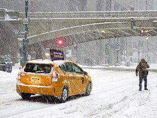
A winter storm is an event in which wind coincides with varieties of precipitation that only occur at freezing temperatures, such as snow, mixed snow and rain, or freezing rain. In temperate continental climates, these storms are not necessarily restricted to the winter season, but may occur in the late autumn and early spring as well. A snowstorm with strong winds and other conditions meeting certain criteria is called a blizzard.

Black ice, sometimes called clear ice, is a thin coating of glaze ice on a surface, especially on streets. The ice itself is not black, but visually transparent, allowing the often black road below to be seen through it. The typically low levels of noticeable ice pellets, snow, or sleet surrounding black ice means that areas of the ice are often practically invisible to drivers or people stepping on it. There is, thus, a risk of slippage and subsequent accident due to the unexpected loss of traction.

The Weather Prediction Center (WPC), located in College Park, Maryland, is one of nine service centers under the umbrella of the National Centers for Environmental Prediction (NCEP), a part of the National Weather Service (NWS), which in turn is part of the National Oceanic and Atmospheric Administration (NOAA) of the U.S. Government. Until March 5, 2013 the Weather Prediction Center was known as the Hydrometeorological Prediction Center (HPC). The Weather Prediction Center serves as a center for quantitative precipitation forecasting, medium range forecasting, and the interpretation of numerical weather prediction computer models.
A winter storm warning is a hazardous weather statement issued by Weather Forecast Offices (WFO) of the National Weather Service (NWS) in the United States to alert the public that a winter storm is occurring or is about to occur in the area, usually within 36 hours of the storm's onset.
A winter weather advisory is a hazardous weather statement issued by Weather Forecast Offices (WFO) of the National Weather Service in the United States when one or more types of winter precipitation—snow, rain and snow mixed, freezing rain, sleet, graupel, etc.—presenting a hazard, but not expected to produce accumulations meeting storm warning criteria, are forecast within 36 hours of the expected onset of precipitation or are occurring in the advisory's coverage area.
A winter storm watch is issued by the National Weather Service of the United States when there is a possibility of heavy snow or potential of significant ice accumulations, without meeting a specific other winter criteria. The watch is typically issued 12 to 48 hours before the storm's expected arrival in the given area. The criteria for this watch can vary from place to place, which is true with other winter weather warning and advisories.

This article describes severe weather terminology used by the National Weather Service (NWS) in the United States. The NWS, a government agency operating as an arm of the National Oceanic and Atmospheric Administration (NOAA) branch of the United States Department of Commerce (DoC), defines precise meanings for nearly all of its weather terms.

A snow squall, or snowsquall, is a sudden moderately heavy snowfall with blowing snow and strong, gusty surface winds. It is often referred to as a whiteout and is similar to a blizzard but is localized in time or in location and snow accumulations may or may not be significant.
Ice pellets or sleet is a form of precipitation consisting of small, hard, translucent balls of ice. Ice pellets are different from graupel, which is made of frosty white opaque rime, and from a mixture of rain and snow, which is a slushy liquid or semisolid. Ice pellets often bounce when they hit the ground or other solid objects, and make a higher-pitched "tap" when striking objects like jackets, windshields, and dried leaves, compared to the dull splat of liquid raindrops. Pellets generally do not freeze into other solid masses unless mixed with freezing rain. The METAR code for ice pellets is PL.
A snow squall warning is a bulletin issued by Environment Canada's Meteorological Service of Canada and the National Weather Service in the United States to warn population of two types of snow events reducing visibility in blowing snow: lake effectsnow squalls and frontal snow squalls.
This article describes severe weather terminology used by the Meteorological Service of Canada, a branch within Environment and Climate Change Canada. The article primarily describes various weather warnings, and their criteria. Related weather scales and general weather terms are also addressed in this article. Some terms are specific to certain regions.
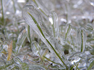
Glaze or glaze ice, also called glazed frost, is a smooth, transparent and homogeneous ice coating occurring when freezing rain or drizzle hits a surface. It is similar in appearance to clear ice, which forms from supercooled water droplets. It is a relatively common occurrence in temperate climates in the winter when precipitation forms in warm air aloft and falls into below-freezing temperature at the surface.
A freezing rain advisory was an advisory issued by the National Weather Service in the United States when freezing rain or freezing drizzle was expected to cause significant inconveniences, but did not meet warning criteria.
A Heavy Freezing Spray Warning is issued by the National Weather Service of the United States to warn vessels that rapid accumulation and icing of freezing water droplets due to a combination of cold water, wind, cold air, and vessel or vehicle movement is likely. Accumulation rates of 2 cm per hour or greater must be possible for a warning to be issued, or else a freezing spray advisory would be issued.
A Freezing Spray Advisory is issued by the National Weather Service of the United States to warn sea vessels and sometimes road vehicles near the shoreline that accumulation of freezing water droplets and icing due to a combination of cold suspended droplets, wind, and cold air, so vessel movement is possible, however, accumulations are not expected to reach rates of 2 cm per hour, or else a heavy freezing spray watch, warning or a specific notice would be issued.

The January 2014 Gulf Coast winter storm was a somewhat rare winter storm that impacted the eastern and southeastern United States, as well as Mexico, most notably the Gulf Coast region, which rarely receives frozen precipitation, in late January 2014. The storm came during a period of very cold temperatures across much of the United States, bringing frigid temperatures as far south as the Gulf Coast. The Weather Channel Unofficially named it Winter Storm Leon.

At the start of spring 2016, a major winter storm moved through the High Plains and Midwest, bringing blizzard conditions with snowfall of up to 12–18 inches (30–46 cm) and strong winds as well. Snowstorms like this are typical in these areas at this time of year. The system also brought with it a severe weather threat as well. As it moved to the east, a crippling ice storm scenario was developing as well.

The February 15–20, 2021 North American winter storm, also unofficially referred to as Winter Storm Viola, was a significant and widespread snow and ice storm across much of the United States, Northern Mexico, and Southern Canada. The system started out as a winter storm on the West Coast of the United States on February 15, later moving southeast into the Southern Plains and Deep South from February 16–17. It then moved into the Appalachian Mountains and Northeastern United States, before finally moving out to sea on February 20. The storm subsequently became a powerful low pressure system over the North Atlantic, before eventually dissipating on February 26.
References
- ↑ National Weather Service. "Heavy Freezing Spray Watch". Glossary - National Weather Service. Retrieved 1 June 2011.