Related Research Articles

Wind chill is the sensation of cold produced by the wind for a given ambient air temperature on exposed skin as the air motion accelerates the rate of heat transfer from the body to the surrounding atmosphere. Its values are always lower than the air temperature in the range where the formula is valid. When the apparent temperature is higher than the air temperature, the heat index is used instead.
A winter storm warning is a hazardous weather statement issued by Weather Forecast Offices (WFO) of the National Weather Service (NWS) in the United States to alert the public that a winter storm is occurring or is about to occur in the area, usually within 36 hours of the storm's onset.
A winter storm watch is issued by the National Weather Service of the United States when there is a possibility of heavy snow or potential of significant ice accumulations, without meeting a specific other winter criteria. The watch is typically issued 12 to 48 hours before the storm's expected arrival in the given area. The criteria for this watch can vary from place to place, which is true with other winter weather warning and advisories.

At sea, a storm warning is a warning issued by the National Weather Service of the United States when winds between 48 knots and 63 knots are occurring or predicted to occur soon. The winds must not be associated with a tropical cyclone. If the winds are associated with a tropical cyclone, a tropical storm warning will be substituted for the storm warning and less severe gale warning.
This article describes severe weather terminology used by the National Weather Service (NWS) in the United States, a government agency operating within the Department of Commerce as an arm of the National Oceanic and Atmospheric Administration (NOAA).
A cold wave is a weather phenomenon that is distinguished by a cooling of the air. Specifically, as used by the U.S. National Weather Service, a cold wave is a rapid fall in temperature within a 24-hour period requiring substantially increased protection to agriculture, industry, commerce, and social activities. The precise criteria for a cold wave are the rate at which the temperature falls, and the minimum to which it falls. This minimum temperature is dependent on the geographical region and time of year.
This article describes severe weather terminology used by the Meteorological Service of Canada, a branch within Environment and Climate Change Canada. The article primarily describes various weather warnings, and their criteria. Related weather scales and general weather terms are also addressed in this article. Some terms are specific to certain regions.

In weather forecasting in the United States, "particularly dangerous situation" (PDS) is the wording used by the National Weather Service to convey special urgency in watch or warning messages for unusually extreme and life-threatening severe weather. It is used in the format "This is a particularly dangerous situation..." at the discretion of the issuing forecaster. A watch or warning bearing the phrase is referred to as a PDS watch or PDS warning.

A blizzard warning is a hazardous weather statement issued by Weather Forecast Offices (WFO) of the National Weather Service (NWS) in the United States, which indicates heavy snowfall accompanied by sustained winds or frequent gusts of 35 mph (56 km/h) or greater are forecast to occur for a minimum of three hours. A blizzard tends to reduce visibilities to 1⁄4 mile (400 m) or less.
A cold weather advisory is a hazardous weather statement issued by Weather Forecast Offices (WFO) of the National Weather Service (NWS) in the United States to alert the public that temperatures or wind chills are forecast to reach values low enough that it poses a threat to human health and life if adequate protection is not taken against hypothermia and frostbite. The exact criteria meriting the issuance of an advisory vary from state to state, and areas prone to colder temperatures will often require colder temperatures/wind chills before issuing an advisory.
A wind chill watch was a weather watch formerly issued by the National Weather Service of the United States when the wind chill could reach dangerous levels within the next 12 to 48 hours; as of October 2024 it has been re-named "extreme cold watch." The exact definition required to issue a watch varies from state to state or from National Weather Service county warning areas to another, but if forecasters believe conditions are favorable for life-threatening wind chills meeting local criteria, a watch will be issued. People going outside should plan to protect themselves against hypothermia and frostbite. In October 2024, the "wind chill watch" and "wind chill warning" were, among other changes, re-named in-favor of a "simplified" naming scheme.
A wind chill warning was a hazardous weather statement previously issued by both local forecast offices of the National Weather Service (NWS) in the United States and by the Meteorological Service of Environment and Climate Change Canada (ECCC) when wind chills were forecast to reach values low enough for residents and travelers to be susceptible to life-threatening medical conditions or death associated with accelerated body heat loss. In both Canada and the United States, the "wind chill warning" has been replaced with the "extreme cold warning."

The January–March 2014 North American cold wave was an extreme weather event that extended through the late winter months of the 2013–2014 winter season, and was also part of an unusually cold winter affecting parts of Canada and parts of the north-central and northeastern United States. The event occurred in early 2014 and was caused by a southward shift of the North Polar Vortex. Record-low temperatures also extended well into March.

In late January 2019, a severe cold wave caused by a weakened jet stream around the Arctic polar vortex hit the Midwestern United States and Eastern Canada, killing at least 22 people. It came after a winter storm brought up to 13 inches (33 cm) of snow in some regions from January 27–29, and brought the coldest temperatures in over 20 years to most locations in the affected region, including some all-time record lows. In early February, a concentration of Arctic air colloquially referred to as the "polar vortex" moved west, and became locked over Western Canada and the Western United States. As a result, February 2019 was among the coldest and snowiest on record in these regions. In early March, the cold once again shifted east, breaking records in many areas. In mid-March, the cold wave finally retreated, but combined with above-average temperatures, precipitation, and a deep snowpack, widespread flooding ensued in the Central US.

The 2019–20 North American winter was unusually warm for many parts of the United States; in many areas, neutral ENSO conditions controlled the weather patterns, resulting in strong El Niño like conditions and the sixth-warmest winter on record, and many areas in the Northeastern United States saw one of the least snowy winters in years. In fact, Baltimore and Islip saw no snow in February for the first time. Some notable events still occurred, such as a powerful blizzard that impacted the Western United States in late November, a series of cold shots in January and February, a snowstorm within the Texas Panhandle and a late-season blizzard in the High Plains.

The 2020–21 North American winter was the most significant winter season to affect North America in several years, and the costliest on record, with a damage total of at least $33.35 billion. The season featured six storms ranking on the Regional Snowfall Index scale (RSI), with four storms ranking as at least a Category 3. Most of the winter's damage and fatalities occurred due to a historic and major cold wave in mid-February. Several other significant events occurred, including a crippling early-season ice storm in the Southern Plains, a powerful nor'easter in mid-December, another major nor'easter in early February, two major and widespread winter storms in mid-February, and a major blizzard in the Rocky Mountains in mid-March. The winter-related events were responsible for at least 358 fatalities, making it the deadliest season since 1992–93. A La Niña pattern influenced much of the winter in North America.

The February 13–17, 2021 North American winter storm was a crippling winter and ice storm that had widespread impacts across the United States, Northern Mexico, and parts of Canada from February 13 to 17, 2021. The storm, unofficially referred to as Winter Storm Uri by the Weather Channel, started out in the Pacific Northwest and quickly moved into the Southern United States, before moving on to the Midwestern and Northeastern United States a couple of days later.
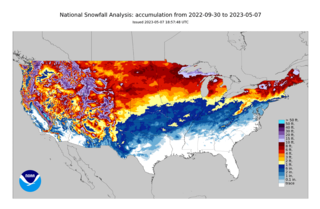
The 2022–23 North American winter was quite warm for the eastern half of North America, with much of the Eastern United States experiencing one of their warmest and least snowy winters on record. Despite this, numerous significant events still occurred, including a severe lake-effect winter storm across the Great Lakes region in mid-November, a cold wave bringing extremely cold temperatures to the Northeast in early-February, and several tornado outbreaks throughout the winter. However, most of the winter's damage and fatalities were due to a crippling and historic winter storm that wreaked havoc across the majority of the United States and parts of Canada in late-December. Additionally, the Western United States was colder than usual in contrast to the east, with a series of atmospheric rivers through December to March bringing widespread flooding in California and record amounts of snow across the region. During the winter, five storms have been ranked on the Regional Snowfall Index (RSI), two of which have attained the “Major” category. Similar to the previous two winters, a La Niña was expected to influence weather patterns across the continent.
From December 21 to 26, 2022, an extratropical cyclone created crippling winter storm conditions, including blizzards, high winds, snowfall, and record cold temperatures across the majority of the United States and parts of Canada. Impacted areas include parts of Minnesota, Iowa, Wisconsin, Michigan, Ohio, Pennsylvania, New York, and Ontario, with Buffalo, New York and the Fort Erie and Kingston areas of Ontario experiencing two full days of hazardous conditions and zero visibility. The cold wave affected all U.S. states from Colorado to the Eastern Seaboard, with effects felt as far south as Miami, Florida. On December 24, 110 million people across 36 states were subject to wind chill alerts.
An extreme cold watch is a weather watch issued by the United States' National Weather Service (NWS) to inform the public that "dangerously cold air, with or without wind, is possible." The extreme cold watch is a 'step' below the "extreme cold warning."
References
- ↑ Environment Canada. "Wind Chill Hazzards". Archived from the original on December 17, 2005.
- 1 2 Extreme Cold Warning
- ↑ Michael Musher, National Weather Service Public Affairs. "National Weather Service Revises Watch, Warning and Advisory Products". News Around NOAA. Archived from the original on 2024-10-07. Retrieved 2024-10-10.
- ↑ Blaise Keller. "Beyond the Barometer: Changes coming to wind chill alerts". Wisconsin State Journal. Archived from the original on 2024-10-08. Retrieved 2024-10-10.
- ↑ "National Weather Service Plans to Issue 'Extreme Cold Warnings'". Archived from the original on 2013-06-16.
- ↑ "NWS To Experiment With 'Extreme Cold' Warnings". 10 January 2011.
- ↑ "Experimental Cold Warning Feedback Needed".
- ↑ "NWS Tests Extreme Cold Warning". Archived from the original on 2013-06-09.
- ↑ "National Weather Service ditching 'extreme cold' warnings".
- ↑ "National Weather Service Public Information Statement PNS18-11" (PDF). Retrieved February 1, 2019.
- ↑ "Update on Winter Weather Initiatives Partner Webinar" (PDF). Retrieved February 1, 2019.
- ↑ Michael Musher, National Weather Service Public Affairs. "National Weather Service Revises Watch, Warning and Advisory Products". News Around NOAA. Archived from the original on 2024-10-07. Retrieved 2024-10-10.
- ↑ Blaise Keller. "Beyond the Barometer: Changes coming to wind chill alerts". Wisconsin State Journal. Archived from the original on 2024-10-08. Retrieved 2024-10-10.