Hickory Flat, Georgia

Last updated

Hickory Flat, Georgia
Hickory Flat Library, Cherokee County, Georgia.jpg
Hickory Flat Library
USA Georgia location map.svg
Red pog.svg
Hickory Flat
Usa edcp location map.svg
Red pog.svg
Hickory Flat
Metro atlanta.jpg
Red pog.svg
Hickory Flat
Coordinates: 34°10′12″N84°25′22″W / 34.17000°N 84.42278°W / 34.17000; -84.42278
Country United States
State Georgia
County Cherokee
Time zone UTC-5 (EST)
  Summer (DST) UTC-4 (EDT)
ZIP codes
30115-30188
Area code(s) 770/678/470
Website www.hickoryflat.com

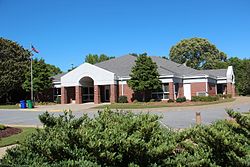
Hickory Flat is an unincorporated community in southeastern Cherokee County, Georgia, United States. It geographic center is now a triangle formed by GA 140 on the north and east, Hickory Rd on the south, and East Cherokee Drive on the west. This triangle is now the business hub of the community with two shopping centers anchored by grocery stores. It also contains the Hickory Flat Public Library and the Sequoyah High School educational complex which includes feeder schools; Hickory Flat Elementary and Dean Rusk Middle School.

Contents

History

The community of Hickory Flat has a long history, dating to the period of frontier settlement of former Cherokee lands, associated with westward expansion and gold exploration in Georgia. [1] The community is located along an old Native American trading route and is one of the county's earliest white settlements. To its north along the old Indian trail is a geographic feature known to locals as "Indian Knoll". This feature in the middle of rolling farm land is a small but prominent mound where it is believed that tribes would meet, during the time of the Cherokee[ citation needed ] A map of Georgia, from 1839, clearly indicates the community situated along what would eventually become Georgia State Route 140, between the city of Canton and the community of Social Hill. [2] Begun in 1838, Hickory Flat Academy (now Hickory Flat Elementary) was the second school to be established in Cherokee County. Another nearby school can date its history to the later half of the 19th century. [3] Nonetheless, the community remained small and rural well into the 21st century, when urban sprawl from the Atlanta MSA stimulated economic growth and the movement of large numbers of new residents to the area. The center of the community was for many years, and is still regarded today, as the four-way stoplight at the intersection of Georgia State Route 140 and East Cherokee Drive. A store and gas station, built there in the 1950s was, for generations of local residents, the focal point and meeting place for the community. The second floor of the store was originally used as a Masonic hall. The structure took on other functions in the late 20th century, and fell into disrepair by the early 21st century. [4] When plans were announced to demolish the structure, and build a modern fast food outlet, The Cherokee County Historical Society sought to rally support for preservation and restoration of the dilapidated structure. However, the effort failed to gain sufficient traction, and the building was demolished to make way for a Chick-fil-A. [4] Seeking to acknowledge the history and importance of the store's location, as a local gathering spot, the new Chick-fil-A included a "vintage-inspired" interior design, which features a large "gathering table" made from reclaimed wood. [5]

Suburban sprawl

Once a sparsely populated community, with many acres of open land and few people per square mile, Hickory Flat has begun to embrace modern fast food outlets and retail stores. [4] All new homes have a minimum of 0.2 acres (0.081 ha). Since 2007 new home and commercial builders have taken to the area. Today retail space continues to be constructed to keep up with the fast-growing population.

Within a 10-mile (16 km) radius of the town is the county seat of Canton, to the north, and Woodstock, to the south. Access to I-575 and GA 400 are also within a 20-mile (32 km) span. It is approximately 40 miles (64 km) north of downtown Atlanta.

Zip codes

Schools

Sequoyah High School Sequoyah High School (Georgia).JPG
Sequoyah High School

The town has three main public schools, located side-by-side on Hickory Road: Hickory Flat Elementary, Dean Rusk Middle School, and Sequoyah High School. Hickory Flat Elementary was built in 1903, marking the location of the town center. The Messiah Montessori School, which moved to a newly constructed campus on Highway 140 in 2008, provided the first private school in the area upon its 2005 founding, but operations ceased.

Related Research Articles

Sequoia, Sequoya or Sequoyah may refer to:

<span class="mw-page-title-main">Gordon County, Georgia</span> County in Georgia, United States

Gordon County is a county located in the northwestern part of the U.S. state of Georgia. As of the 2020 census, the population was 57,544. The county seat is Calhoun. Gordon County comprises the Calhoun, GA Micropolitan Statistical Area, which is included in the Chattanooga-Cleveland-Dalton Combined Statistical Area.

<span class="mw-page-title-main">Cherokee County, Georgia</span> County in Georgia, United States

Cherokee County is located in the US state of Georgia. As of the 2020 Census, the population was 266,620. The county seat is Canton. The county Board of Commissioners is the governing body, with members elected to office. Cherokee County is included in the Atlanta Metropolitan Area.

<span class="mw-page-title-main">Canton, Georgia</span> City in Georgia, United States

Canton is a city in and the county seat of Cherokee County, Georgia, United States. As of the 2010 census, the city had a population of 22,958, up from 7,709 in 2000.

<span class="mw-page-title-main">Woodstock, Georgia</span> City in Georgia, United States

Woodstock is a city in Cherokee County, Georgia, United States. The population was 35,065 as of 2020 according to the US Census Bureau.

<span class="mw-page-title-main">Roswell, Georgia</span> City in Georgia, United States

Roswell is a city in northern Fulton County, Georgia, United States. At the official 2010 census, the city had a population of 88,346. The 2020 estimated population was 94,884, making Roswell the state's ninth largest city. A close suburb of Atlanta, Roswell has an affluent historic district.

<span class="mw-page-title-main">Calhoun, Georgia</span> City in Georgia, United States

Calhoun is a city in Gordon County, Georgia, United States. As of the 2020 census, the city had a population of 16,949. Calhoun is the county seat of Gordon County.

<span class="mw-page-title-main">Tahlequah, Oklahoma</span> City in Oklahoma, United States

Tahlequah is a city in Cherokee County, Oklahoma located at the foothills of the Ozark Mountains. It is part of the Green Country region of Oklahoma and was established as a capital of the 19th-century Cherokee Nation in 1839, as part of the new settlement in Indian Territory after the Cherokee Native Americans were forced west from the American Southeast on the Trail of Tears.

<span class="mw-page-title-main">Sequoyah</span> Cherokee polymath and creator of the Cherokee syllabary

Sequoyah, also known as George Gist or George Guess, was a Native American polymath and neographer of the Cherokee Nation. In 1821, he completed his independent creation of the Cherokee syllabary, making reading and writing in Cherokee possible. His achievement was one of the few times in recorded history that an individual who was a member of a pre-literate group created an original, effective writing system. His creation of the syllabary allowed the Cherokee nation to be one of the first North American Indigenous groups to have a written language. Sequoyah was also an important representative for the Cherokee nation, by going to Washington, D.C. to sign two relocations and trading of land treaties.

<span class="mw-page-title-main">Georgia State Route 5</span> State highway in northern Georgia

State Route 5 (SR 5) is a 155.325-mile-long (249.971 km) state highway that travels south-to-north through portions of Carroll, Douglas, Cobb, Cherokee, Pickens, Gilmer, and Fannin counties in the western and northern parts of the U.S. state of Georgia. The highway travels from its southern terminus at SR 48 at the Alabama state line, north-northwest of Ephesus, to its northern terminus at SR 60 and SR 68 at the Tennessee state line on the McCaysville–Copperhill line, bisecting the northwestern portion of the state.

<span class="mw-page-title-main">Towne Lake</span>

Towne Lake is a planned community in southern Cherokee County, Georgia, United States. It begins approximately two miles (3 km) due west of downtown Woodstock and extends northwest, in an area formerly known to long-time locals as "Thousand-Acre Woods", originally part of the Little River State Wildlife Management Area, which has since completely succumbed to suburban development.

<span class="mw-page-title-main">Sixes, Georgia</span> Unincorporated community in Georgia, U.S.

Sixes, home to approximately 14,540, is an unincorporated community in western Cherokee County, Georgia, United States, located about three miles west of Holly Springs and near the eastern shore of current-day Lake Allatoona. The community is located in the Georgia Gold Belt, which runs southwest to northeast along the southern edge of the Blue Ridge mountains. The Sixes Gold Mine, a now-defunct gold mine dating back to the early 19th century, was located just to the northwest. In addition, the community is home to the Sixes Mill, which was originally built around 1820 by early gold prospectors and later rebuilt circa 1880. The mill has been well preserved and is still located off Sixes Road. There are two theories on how Sixes derived its name. The first theory attributes the name to Fort Hinar Sixes, a Cherokee Indian removal fort that was located in the area along the Trail of Tears. The second holds that the name is derived from an old Cherokee village that was located near the Etowah River named "Sutali" — the Cherokee word for the number six. Sixes also lent its name to Fort Sixes, an 1830s US Army fort that served as a removal collection point for Cherokee prior to the Trail of Tears. Sutallee, a community that sits on the opposite side of the Etowah River in western Cherokee County, also derives its name from this Native American village. Today, Sixes is a growing suburban community with many large, upscale residential neighborhoods, including BridgeMill. The area is served by two elementary schools ; one middle school (Freedom); and two high schools.

<span class="mw-page-title-main">Lake Arrowhead, Georgia</span> Reservoir in Cherokee County, Georgia

Lake Arrowhead is located approximately two miles (3 km) southwest of Waleska, in the mountainous, west-northwestern part of Cherokee County, Georgia, United States. Located just east-southeast of Bear Mountain, it is Georgia's second largest man-made, private lake, covering approximately 540 acres (2.2 km2) and reaching depths of up to 80 feet (24 m).

<span class="mw-page-title-main">Macedonia, Georgia</span> Unincorporated community in Cherokee County, Georgia

<span class="mw-page-title-main">Sequoyah High School (Georgia)</span> Public high school in Canton, Georgia, United States

Sequoyah High School is a public high school located in Hickory Flat, Georgia, United States. It educates students in grades 9–12. It opened in the fall of 1990 and is one of six high schools in Cherokee County.

Sequoyah High School is the name of a high school found in several different locations in the United States:

The Cherokee County School District manages the 40 schools in Cherokee County, Georgia, United States. The school district's leadership consists of an elected seven-member school board.

<span class="mw-page-title-main">Little River (Etowah River tributary)</span> River in the United States

The Little River is a 29.3-mile-long (47.2 km) tributary of the Etowah River in the U.S. state of Georgia in the United States.

The Sequoyah Regional Library System (SRLS) is a library system serving three counties in North Georgia: Cherokee, Pickens, and Gilmer. Funding is provided by the cities and counties in Cherokee and Pickens, and by the board of education in Gilmer.

References

  1. "Native American History of Cherokee County, Georgia". AccessGenealogy.com. July 1, 2012. Retrieved April 20, 2019.
  2. "Cherokee County, 1839". GeorgiaInfo - New Georgia Encyclopedia - University of Georgia. Retrieved April 20, 2019.
  3. "About Indian Knoll Elementary School". Cherokee County School District. Retrieved April 20, 2019.
  4. 1 2 3 Kristal Dixon (June 14, 2018). "Hickory Flat Store Demolished For Chick-fil-A". Patch.com. Retrieved April 18, 2019.
  5. Kristal Dixon (January 8, 2019). "Chick-fil-A Opens Jan. 9 In Hickory Flat". Patch.com. Retrieved April 18, 2019.

34°10′12″N84°25′22″W / 34.17000°N 84.42278°W / 34.17000; -84.42278