Keithsburg, Georgia

Last updated

Georgia State Route 5 in Keithsburg GA SR 5 in Keithsburg, June 2017 2.jpg
Georgia State Route 5 in Keithsburg

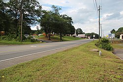
Keithsburg, population 205, is an unincorporated community in Cherokee County, Georgia, United States.[ citation needed ]

Contents

History

1915 map of Cherokee County featuring Keithsburg Cherokee1915.jpg
1915 map of Cherokee County featuring Keithsburg

Keithsburg was established in the mid nineteenth-century along the railroad northeast of Canton. The community was named after the local Keith family and its Keith Plantation, one of the oldest plantations in Cherokee County. During the Civil War, the Keith family buried its valuables and suspended its food in trees in order to hide it from the approaching Union Army. The soldiers found the food and, as vengeance for the family's deception, burned their house and hanged the family patriarch from a tree. However, his life was spared by the knot in the rope getting caught and failing to break his neck. The Keith house was rebuilt in 1865 from kiln-dried bricks made of clay from the nearby Etowah River. [1]

Current status

Today, the Keith property is in shambles, with kudzu covering what remains of the house and barns. Neither the county of Cherokee nor the city of Canton have expressed an interest in preserving the property. Remains of slave quarters and an Indian burial ground can be found on the property. [1]

Related Research Articles

<span class="mw-page-title-main">Pickens County, Georgia</span> County in Georgia, United States

Pickens County is a county located in the north-central portion of the U.S. state of Georgia. As of the 2020 census, the population was 33,216. The county seat is Jasper. Pickens County is part of the Atlanta-Sandy Springs-Roswell, Georgia metropolitan statistical area.

<span class="mw-page-title-main">Cherokee County, Georgia</span> County in Georgia, United States

Cherokee County is located in the US state of Georgia. As of the 2020 Census, the population was 266,620. The county seat is Canton. The county Board of Commissioners is the governing body, with members elected to office. Cherokee County is included in the Atlanta Metropolitan Area.

<span class="mw-page-title-main">Bartow County, Georgia</span> County in Georgia, United States

Bartow County is located in the northwestern part of the U.S. state of Georgia. As of the 2020 census, the population was 108,901, up from 100,157 in 2010. The county seat is Cartersville.

<span class="mw-page-title-main">Canton, Georgia</span> City in Georgia, United States

Canton is a city in and the county seat of Cherokee County, Georgia, United States. As of the 2010 census, the city had a population of 22,958, up from 7,709 in 2000.

<span class="mw-page-title-main">Holly Springs, Georgia</span> City in Georgia, United States

Holly Springs is a city in Cherokee County, Georgia, United States. The population was 9,189 as of the 2010 census, up from 3,195 in 2000.

<span class="mw-page-title-main">Nelson, Georgia</span> City in Georgia, United States

Nelson is a city in Pickens and Cherokee Counties, Georgia, United States. At the 2020 census, the population was 1,145. It is part of the Atlanta metropolitan area.

<span class="mw-page-title-main">Waleska, Georgia</span> City in Georgia, United States

Waleska is a city in Cherokee County, Georgia, United States. The population was 644 at the 2010 census.

<span class="mw-page-title-main">Toccoa, Georgia</span> City in Georgia, United States

Toccoa is a city in far Northeast Georgia near the border with South Carolina. It is the county seat of Stephens County, Georgia, United States, located about 50 miles (80 km) from Athens and about 90 miles (140 km) northeast of Atlanta. The population was 9,133 as of the 2020 census.

The Georgia Northeastern Railroad is a short line freight railroad which runs from the town of Elizabeth, Georgia to the city of Blue Ridge, Georgia. Goods hauled are mostly timber, grain, poultry, and marble products. The GNRR's subsidiary, the Blue Ridge Scenic Railway, also operates on this line north of Blue Ridge. Despite the name, it actually operates between north-central and northwest Georgia, from north-northwest metro Atlanta, and is a few counties away from northeast Georgia.

<span class="mw-page-title-main">Cherokee High School (Georgia)</span> Public high school in Canton, Georgia, United States

Cherokee High School is one of six public high schools of the Cherokee County School District in Cherokee County, Georgia, United States. It is located in Canton. Established in 1956, it replaced Canton High School, the county's first high school.

<span class="mw-page-title-main">Lebanon, Georgia</span>

Lebanon, Georgia is a Cherokee County community that is now absorbed into Holly Springs. The community was named after Lebanon in Western Asia. While the community is locally known and still referred to as "Toonigh", the community has a post office located in a small strip mall just south of the Georgia Northeastern Railroad that was posted as Lebanon, Georgia. Lebanon's Post Office ZIP code is 30146.

<span class="mw-page-title-main">Gold Ridge, Georgia</span>

Gold Ridge is the historical name of an unincorporated community in Cherokee County, Georgia, United States.

<span class="mw-page-title-main">Sutallee, Georgia</span>

Sutallee is an unincorporated community in western Cherokee County, Georgia, United States. Located about two miles northwest of current-day Lake Allatoona, it is one of the county's earliest white settlements. It is believed that former Georgia Governor and U.S. Senator Joseph E. Brown maintained a farm in the area, on lowlands near the Etowah River, and was there harvesting wheat when told of the surprising news that he had been nominated for governor. Sutallee derives its unique name, which is often spelled "Sutalee" or "Suttallee", from an old Cherokee village that was located near the Etowah River named "Sutali" — the Cherokee word for the number six. Sixes, a community that sits on the eastern side of Lake Allatoona, also derives its name from this Native American village. Today, Sutallee is traversed by Georgia Highway 20 and remains mostly rural.

<span class="mw-page-title-main">Macedonia, Georgia</span> Unincorporated community in Cherokee County, Georgia

<span class="mw-page-title-main">Hickory Flat, Georgia</span> Unincorporated community in Georgia, United States

Hickory Flat is an unincorporated community in southeastern Cherokee County, Georgia, United States. It geographic center is now a triangle formed by GA 140 on the north and east, Hickory Rd on the south, and East Cherokee Drive on the west. This triangle is now the business hub of the community with two shopping centers anchored by grocery stores. It also contains the Hickory Flat Public Library and the Sequoyah High School educational complex which includes feeder schools; Hickory Flat Elementary and Dean Rusk Middle School.

<span class="mw-page-title-main">Free Home, Georgia</span>

Free Home is an unincorporated community in the eastern part of Cherokee County, Georgia, United States. Centered at the intersection of state highways 20 and 372, the rural community has seen moderate suburbanization of the area since the late 1990s. It is home to Free Home Elementary School. The community is home to a Publix Supermarket center, which has a few stores/restaurants. There is also a Tractor Supply Company that was completed in September 2011.

<span class="mw-page-title-main">Little River (Etowah River tributary)</span> River in the United States

The Little River is a 29.3-mile-long (47.2 km) tributary of the Etowah River in the U.S. state of Georgia in the United States.

<span class="mw-page-title-main">Orange, Georgia</span>

Orange is an unincorporated community located in eastern Cherokee County between the communities of Macedonia and Lathemtown in the U.S. state of Georgia. Orange was the second community in Cherokee County upon the county's inception in 1832. This community was at its height during the later portion of the 18th century due to its location on the main highway into Forsyth County. It had a post office, a general store, and Orange United Methodist, one of the first churches in Cherokee.

<span class="mw-page-title-main">Judge William Wilson House</span> Historic house in Georgia, United States

The Judge William Wilson House was an antebellum house in Atlanta, Georgia. It was built on land in a community west of Atlanta that was then called Adamsville which Wilson had inherited from his father William "Dollar Mill" Wilson (1775–1839) in 1839, and as the area around it developed came to be located in the Fairburn Heights neighborhood, a suburban area west of the Perimeter (I-285). At the end, it was one of only a few remaining antebellum structures still standing in its original location within the Atlanta city limits.

Carters, formerly known as Carter’s Quarter, is an unincorporated community in Murray County, Georgia, United States. Nearby Carters Lake, impounded by Carters Dam, takes its name from the community. The community is located north of Oakman, Georgia.

References

  1. 1 2 "Keith Plantation, Canton, GA". Old House Dreams. September 16, 2010. Retrieved February 20, 2016.

External sources

34°16′28″N84°27′06″W / 34.27444°N 84.45167°W / 34.27444; -84.45167