Highgate Common

Last updated
Highgate Common
Site of Special Scientific Interest
Highgate Common - geograph.org.uk - 13068.jpg
Staffordshire UK location map.svg
Red pog.svg
Location within Staffordshire
Location Staffordshire
Grid reference SO 839 900
Coordinates 52°30′23″N2°14′24″W / 52.5064°N 2.2399°W / 52.5064; -2.2399
InterestBiological
Area115.92 hectares (1.159 km2; 0.4476 sq mi)
Notification 2007

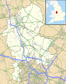
Highgate Common is a Staffordshire Wildlife Trust reserve containing a mix of heathland and woodland. It is about 116 hectares or 286 acres in size. [1] The common is a popular leisure destination and a Site of Special Scientific Interest, located in Southern Staffordshire, England.

Contents

Location

Highgate Common is situated to the west of the West Midlands conurbation, on a ridge above the Smestow valley. By road it is 1.2 miles from Swindon, 1.7 miles from Enville, 4.5 miles from Wombourne, 9 miles from Perton and 10 miles from Wolverhampton.

Management

Since April 2009 Highgate Common has been owned and managed by the Staffordshire Wildlife Trust. [2]

The site was previously managed by South Staffordshire District Council.

A warden is present most days and their duties are aided by various support staff and volunteers.

Wildlife

Highgate Common contains one of a small number of lowland heaths in Staffordshire, which are highly prized as habitats. However, the heath is not the whole of the common and the vegetation is very varied for such a small area. The sandy heath is covered mainly with heather, broom and gorse, all flowering plants that play an important part in hosting invertebrates. There are areas of woodland, with silver birch and pedunculate oak as canopy and common bracken as ground cover, as well as coniferous plantation. There are roadside verges, areas of acidic grassland, patches of bare sand and earth, and small areas of wet heath, including two artificial ponds. The varied habitat results in a wide variety of animal life.

Highgate has 140 recorded species of fauna of which 36 are rare either nationally or regionally, 82 species of invertebrate 20 of which are regionally scarce and 51 are nationally scarce and 14 heathland specialist species. Nationally rare are at least four species of mining bees, creating burrows that are host to the kleptoparasitic cuckoo bees of the genera Nomada and Sphecodes . Also nationally rare are solitary wasps and wingless wasps and species that are regionally important include small red-tailed bumble bees and solitary bees. [3]

Other animals, reptiles and insects include: common lizards, slowworms, grass snakes, rabbits, bush-crickets, moths, beetles, flies, and dragonflies.

Geology and landscape

Highgate Common Pool. The Pool, Highgate Common - geograph.org.uk - 102726.jpg
Highgate Common Pool.

The Common is located above the Smestow valley on the ridges of Mid-Severn Sandstone, a Bunter deposit of the Permian and Triassic periods, forming a series of low ridges on both sides of the Severn in Shropshire, Worcestershire and Staffordshire. Similar geology is prominently visible at nearby Kinver Edge and, further afield in the Midlands, at Cannock Chase and Sherwood Forest. Specifically, Highgate is mostly underlain by part of the Bridgnorth Sandstone Formation known as ‘Lower Mottled Soft Red Sandstone’. There are also small areas of Pleistocene sands and gravels.

The common is situated in a shallow valley on the plateau, like a dish sloping gently to the south. The land formation and vegetation together create a micro-climate warmer than expected for this part of England, with considerable impact on the local flora and fauna.

The thin, relatively dry, sandy soils were historically host to open woodland - predominantly birch, with some oak and beech. The early medieval] settlers clearly used the woods for pig-grazing, as is attested by important local Anglo-Saxon toponyms like Swindon and Kingswinford. After the Norman Conquest, the area became part of the vast Kinver Forest, which stretched as far north as the edge of Wolverhampton. In the later Middle Ages, and especially from the 16th century, the forest was denuded. The result was a sandy heathland - a landscape created by humans, but fragile and valuable to wildlife.

The ground is particularly hospitable to rabbits, which have excavated large warrens. It was turned over to agriculture during World War II and concrete roads and channels were put in. However, with careful management, including regular thinning and reduction of the rapidly encroaching trees, a diverse habitat has been recreated, consisting mainly of heathland - of which heather is the most dominant plant - and open woodland with occasional ponds and bogs, over hilly and often rough terrain.

Amenities

The Common is popular with walkers, especially dog walkers, and has a number of car parks. There are numerous footpaths, some way-marked and some affording wheelchair access, as well as bridle paths and several car parks. [4] The long distance Staffordshire Way forms part of the footpath network on the Common, linking it to many other visitor attractions throughout Staffordshire and neighbouring counties. There are seats and picnic tables at many locations on the Common.

A new Warden's office was opened in February 2010, incorporating toilets, a conference room, information points, an additional car park and picnic facilities.

Related Research Articles

<span class="mw-page-title-main">Staffordshire and Worcestershire Canal</span> Canal in the West Midlands, England

The Staffordshire and Worcestershire Canal is a navigable narrow canal in Staffordshire and Worcestershire in the English Midlands. It is 46 miles (74 km) long, linking the River Severn at Stourport in Worcestershire with the Trent and Mersey Canal at Haywood Junction by Great Haywood.

<span class="mw-page-title-main">Knettishall Heath</span>

Knettishall Heath is a 91.7-hectare (227-acre) biological Site of Special Scientific Interest west of Knettishall in Suffolk. A larger area of 176 hectares is the Knettishall Heath Nature Reserve, which is managed by the Suffolk Wildlife Trust.

<span class="mw-page-title-main">River Stour, Worcestershire</span> River in the West Midlands, England

The Stour(, rhymes with "flour") is a river flowing through the counties of Worcestershire, the West Midlands and Staffordshire in the West Midlands region of England. The Stour is a major tributary of the River Severn, and is about 25 miles (40 km) in length. It has played a considerable part in the economic history of the region.

<span class="mw-page-title-main">South Staffordshire</span> Non-metropolitan district in England

South Staffordshire is a local government district in Staffordshire, England. Its council is based in Codsall. Other notable settlements include Brewood, Cheslyn Hay, Coven, Essington, Featherstone, Four Ashes, Great Wyrley, Huntington, Kinver, Landywood, Penkridge, Perton, Wedge Mills, Weston-under-Lizard and Wombourne. The district covers a largely rural area lying immediately to the west and north-west of the West Midlands conurbation.

<span class="mw-page-title-main">Ashwood, Staffordshire</span> Human settlement in England

Ashwood is a small area of Staffordshire, England.

<span class="mw-page-title-main">Kinver Edge</span> Heath and woodland on the border of Staffordshire and Worcestershire, England

Kinver Edge is a high heath and woodland escarpment just west of Kinver, about four miles west of Stourbridge, and four miles north of Kidderminster, and is on the border between Worcestershire and Staffordshire, England. It is now owned by the National Trust.

<span class="mw-page-title-main">Wombourne</span> Human settlement in England

Wombourne is a large village and civil parish located in the district of South Staffordshire, in the county of Staffordshire, England. It is 4 miles (6 km) south-west of Wolverhampton and just outside the county and conurbation of the West Midlands.

<span class="mw-page-title-main">Staffordshire Way</span> Long-distance footpath in Staffordshire, England

The Staffordshire Way is a long-distance walk in Staffordshire, England. The path links with the Cheshire Gritstone Trail, the Heart of England Way and the North Worcestershire Path.

<span class="mw-page-title-main">River Penk</span> River in Staffordshire, England

The River Penk is a small river flowing through Staffordshire, England. Its course is mainly within South Staffordshire, and it drains most of the northern part of that district, together with some adjoining areas of Cannock Chase, Stafford, Wolverhampton, and Shropshire. It flows into the River Sow, which is a tributary of the River Trent, so its waters flow ultimately into the North Sea via the Humber Estuary.

<span class="mw-page-title-main">Breckland</span> Natural region in Norfolk and Suffolk, UK

Breckland in Norfolk and Suffolk is a 39,433 hectare Special Protection Area (SPA) under the European Union Directive on the Conservation of Wild Birds. The SPA partly overlaps the 7,544 hectare Breckland Special Area of Conservation. As a landscape region it is an unusual natural habitat of England. It comprises the gorse-covered sandy heath that lies mostly in the south of the county of Norfolk but also in the north of Suffolk. An area of considerable interest for its unusual flora and fauna, it lies to the east of another unusual habitat, the Fens, and to the south west of the Broads. The typical tree of this area is the Scots pine. Breckland is one of the driest areas in England.

<span class="mw-page-title-main">Bickerton Hill</span>

Bickerton Hill refers to two low red sandstone hills that form the southern end of the Mid Cheshire Ridge in Cheshire, north-west England. The high point, Raw Head, lies on the northerly hill and has an elevation of 227 metres. Parts of the southerly hill are also known as Larkton Hill.

<span class="mw-page-title-main">Swindon, Staffordshire</span> Human settlement in England

Swindon is a village and civil parish located in the district of South Staffordshire, in the county of Staffordshire, England. It is 6 miles (6 km) west of Dudley, 2 miles (6 km) northwest of Kingswinford and 2 miles (6 km) southwest of Wombourne. Swindon is located just outside the county and conurbation of the West Midlands. It borders the metropolitan boroughs of Dudley and Wolverhampton to the east and northwest. The parish which includes Swindon and the neighbouring villages of Hinksford and Smestow had a population of 1,279 recorded in the 2021 Census.

<span class="mw-page-title-main">Hothfield Common</span> Nature reserve in Kent, England

Hothfield Common is a 56.5-hectare (140-acre) biological Site of Special Scientific Interest north-east of Ashford in Kent. It is also a Local Nature Reserve, and is part of the 86-hectare (210-acre) Hothfield Heathlands nature reserve owned by Ashford Borough Council and managed by Kent Wildlife Trust.

<span class="mw-page-title-main">Broadmoor to Bagshot Woods and Heaths</span>

Broadmoor to Bagshot Woods and Heaths is a 1,696.3-hectare (4,192-acre) biological Site of Special Scientific Interest (SSSI) in Berkshire and Surrey that extend from a minority of the parish of Crowthorne including around Broadmoor Hospital in the west to Bagshot south-east, Bracknell north-east, and Sandhurst, south. It is part of the Thames Basin Heaths Special Protection Area. Two nature reserves which are managed by the Surrey Wildlife Trust are in the SSSI, Barossa nature reserve and Poors Allotment. Broadmoor Bottom, which is part of Wildmoor Heath, also falls within the SSSI; this reserve is managed by the Berkshire, Buckinghamshire and Oxfordshire Wildlife Trust.

Lowland heath is a Biodiversity Action Plan habitat as it is a type of ancient wild landscape. Natural England's Environmental Stewardship scheme describes lowland heath as containing dry heath, wet heath and valley mire communities, usually below 250 metres (820 ft) in altitude, on acidic soils and shallow peat, typically comprising heathers, gorses, fine grasses, wild flowers and lichens in a complex mosaic. Heathers and other dwarf shrubs usually account for at least 25% of the ground cover. By contrast, upland heath, which is above 300 metres (980 ft) in altitude, is called moorland, Dartmoor being an example.

Smestow Academy, also known as simply Smestow is a coeducational secondary school and sixth form located in the Castlecroft area of Wolverhampton, England.

The Smestow Brook, sometimes called the River Smestow, is a small river that plays an important part in the drainage of Wolverhampton, South Staffordshire, and parts of Dudley in the United Kingdom, and has contributed to the industrial development of the Black Country. It is the most important tributary of the River Stour, Worcestershire and part of the River Severn catchment.

<span class="mw-page-title-main">Wom Brook</span> Stream in Staffordshire, England

The Wom Brook is a stream in South Staffordshire, England. It flows through the large village of Wombourne, and has played an important part in its industrial history. It is an important tributary of the River Smestow and part of the Severn catchment.

<span class="mw-page-title-main">Sound Heath</span>

Sound Heath, also known as Sound Common, is an area of common land in Sound, near Nantwich in Cheshire, England, which includes heathland, grassland, scrub, woodland and wetland habitats. The majority of the area is designated a Site of Special Scientific Interest and a Local Nature Reserve.

<span class="mw-page-title-main">Poor's Allotment</span>

Poor's Allotment is a 28.57-hectare (70.6-acre) biological Site of Special Scientific Interest in Gloucestershire, notified in 1954. The site is listed in the 'Forest of Dean Local Plan Review' as a Key Wildlife Site (KWS).

References

52°30′23″N2°14′24″W / 52.5064°N 2.2399°W / 52.5064; -2.2399