Today, Sherwood Forest National Nature Reserve encompasses 424.75 hectares (1,049.6 acres),[4] surrounding the village of Edwinstowe and the site of Thoresby Hall. The reserve contains more than a thousand ancient oaks which are known to be more than 500 years old, with the Major Oak being twice that age.[3]
Etymology
Sherwood originally was named Sciryuda in 958 AD, meaning the "woodland belonging to the shire". Its name is derived from its status as the shire (or sher) wood of Nottinghamshire, which extended into several neighbouring counties (shires), bordered to the west by the River Erewash and the Forest of East Derbyshire.[5]
Sherwood Forest is within an area which used to be called "Birch Lund", which is Viking in origin, now known as Birklands.[6]
Evidence of flint tools have shown use in Sherwood Forest by prehistoric hunter gatherers. During the Iron Age and Roman periods human habitation and farming was common. In the 9th century farming made an impact on Sherwood's landscape.[8]
In 1066, in the invasion of England, William the Conqueror made Sherwood Forest a Royal Hunting Forest.[14][15] When the Domesday Book was compiled in 1086, the forest covered perhaps a quarter of Nottinghamshire (approximately 19,000 acres or 7,800 hectares) in woodland and heath subject to the forest laws.
The earliest notice of the forest at Sherwood was at the time of Henry II when William Peverel the Younger answered the plea of the forest, to which he profited and controlled the area.[16]
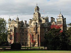
During the 12th and 13th centuries Christian Monastic Orders had established large estates within Sherwood Forest. Three Abbeys were founded Rufford Abbey, Newstead Abbey and Thurgarton Priory.[17]
Sherwood Forest in 1623 had a narrow escape from a fire which broke out. The only record of this occurrence is written in a letter which is preserved in the British Museum.[22]
Mansfield anciently became pre-eminent in importance among the towns of the forest.[25]
Geology
Sherwood Forest is established over an area underlain by the Permian and Triassic age New Red Sandstone.[26] The larger part of the Forest is found across the outcrop of pebbly sandstones known as the Chester Formation. The regional dip is a gentle one to the east, hence younger rocks are found in that direction and older ones exposed to the west. The local stratigraphy is (uppermost/youngest at top):
The Sherwood Forest Trust is a small charity that covers the ancient royal boundary and current national character area of Sherwood Forest.[29] Its aims are based on conservation, heritage and communities but also include tourism and the economy.
Nottinghamshire County Council and Forestry England jointly manage the ancient remnant of forest north of the village of Edwinstowe, providing walks, footpaths and a host of other activities.[30]
During the Second World War parts of Sherwood Forest were used extensively by the military for ammunition stores, POW camps and training areas.[34] Oil was produced at Eakring.[35] After the war, large ammunition dumps were abandoned in the forest and were not cleared until 1952, with at least 46,000 tons of ammunition in them.[36]
Part of the forest was opened to the public as a country park in 1969 by Nottinghamshire County Council, which manages a small part of the forest under lease from the Thoresby Estate. In 2002 a portion of Sherwood Forest was designated a national nature reserve by English Nature. In 2007 Natural England officially incorporated the Budby South Forest, Nottinghamshire's largest area of dry lowland heath, into the Nature Reserve, nearly doubling its size from 220 to 423 hectares (540 to 1,050 acres).[37]
A new Sherwood Forest Visitor Centre was authorised in 2015. In August 2018 the Royal Society for the Protection of Birds (RSPB) opened the new development with a shop and café, having been granted permission to manage the woods in 2015. Part of an agreement with Natural England was that the land where the existing 1970s visitor centre was located would be restored to wood pasture.[38][39][40]
Some portions of the forest retain many very old oaks, especially in the portion known as the Dukeries, south of the town of Worksop, which was so called because it used to contain four ducal residences, as well as a number of other country estates.
The River Idle, a tributary of the Trent, is formed in Sherwood Forest from the confluence of several minor streams.
From the 1870's to the mid 20th century, many villages were built to bring more workers to the mines near Sherwood Forest. The houses in these villages had living rooms and flushing toilets, a luxury that was made possible because the houses were built after the Public Health Act 1875[41]. The houses belonged to the colliery companies, which meant that if a worker lost their job, they would also lose their home, proving how dependent the workers were to the colliery companies. Edwinstowe, Annesley, Blidworth, and Ollerton all used to be colliery villages[42].
Tourism
Visitor Centre
Sherwood attracts around 350,000 tourists annually, many from other countries.[43] Each August the nature reserve hosts a week-long Robin Hood Festival. This event recreates a medieval atmosphere and features the major characters from the Robin Hood legend. The week's entertainment includes jousters and strolling players dressed in medieval attire, in addition to a medieval encampment complete with jesters, musicians, rat-catchers, alchemists and fire eaters.[44]
The Sherwood Forest Art and Craft Centre is in the former coach house and stables of Edwinstowe Hall.[45] The centre contains art studios and a cafe and hosts special events, including craft demonstrations and exhibitions.
Sherwood Forest is home to the Major Oak, an oak tree between 800 and 1,000 years old, and since the Victorian era, its limbs have been partially supported by scaffolding. The Major Oak was identified by Major Hayman Rooke in 1790. It is believed that the Major Oak took the name of Major Hayman Rooke.[48][49] The Major Oak used to be named the Cockpen Tree, after the cockfighting that once took place beneath it.[50]
Samplings of the Major Oak have been planted in the US ambassadors' Winfield House in London.[51]
Thynghowe, an important Danelaw meeting place where people came to resolve disputes and settle issues, was lost to history until its rediscovery in 2005–06 by local history enthusiasts[54] amidst the old oaks of an area known as the Birklands. Experts believe it may also yield clues about the boundary of the ancient Anglo-Saxon kingdoms of Mercia and Northumbria.
English Heritage inspected the site, confirming that it was known as 'Thynghowe' in 1334 and 1609.[55][56]
↑William Horner Groves, The History of Mansfield, (1894) retrieved on the 8th April 2023
↑Reed, Michael (1990). "The land of Britain". The Landscape of Britain: From the Beginnings to 1914. London: Routledge. p.11. ISBN978-0-415-01297-3. OCLC39848675.
↑"GeoIndex Onshore". British Geological Survey. Archived from the original on 2 July 2020. Retrieved 2 July 2020.
↑Book E Sloan, The Landscape studies of Hayman Rooke (1723-1806) - Antiquarianism, Archrology and Natural History in the 18th Century,2019,access date on 8 May 2025
↑Hight J, 2011, Britain's Tree Story, The history and legends of Britain's ancient trees, National Trust Books, p32, ISBN 9781907892202
↑Sapling grown from Sherwood Forest's Major Oak planted in US Ambassador's garden in London 2023|Mansfield Ashfield Chad, retrieved on the 3 April 2025
↑"Seven Man Made Wonders, Midlands - Sherwood Forest and the Major Oak". BBC Homepage, 28 October 2014, Archived retrieved on 3 April 2025
Fletcher, John. Ornament of Sherwood Forest from Ducal Estate to Public Park.
Gray, Adrian (2008). Sherwood Forest and the Dukeries (Phillimore).
Innes-Smith, Robert. The Dukeries & Sherwood Forest.
Sherwood Forest and the East Midlands Walks. (Jarrold Pathfinder Guides.)
Ottewell, David. Sherwood Forest in Old Photographs. (Britain in Old Photographs.)
Woodward, Guy H. and Woodward, Grace Steele. The Secrets of Sherwood Forest: Oil Production in England During World War II. University of Oklahoma Press, 1973.
This page is based on this Wikipedia article Text is available under the CC BY-SA 4.0 license; additional terms may apply. Images, videos and audio are available under their respective licenses.