List of ancient woods in England

Last updated

This list of ancient woods in England contains areas of ancient woodland in England larger than 10 hectares (25 acres). The list is arranged alphabetically by ceremonial county.

Contents

B

Bedfordshire

Bedfordshire UK location map.svg
Red pog.svg
Hanger Wood
Red pog.svg
King's and Baker's Woods
Red pog.svg
Kingswood, Houghton Conquest
Red pog.svg
Maulden Wood
Red pog.svg
Odell Great Wood
Red pog.svg
Potton Wood
Red pog.svg
Southill Woods
Red pog.svg
Swineshead Wood
Bedfordshire ancient woods

The woodlands of Bedfordshire cover 6.2% of the county. [1] Some two thirds of this (4,990 ha or 12,300 acres) is broad-leaved woodland, principally oak and ash. [2] A woodland Trust estimate of all ancient woodland in Bedfordshire (dating back to at least the year 1600), including woods of 0.1 ha (0.25 acres) and upward suggests an area of 1,468 ha (3,630 acres). [3] This list of Bedfordshire's ancient woodland shows only those woods of over 10 ha (25 acres), all of which have SSSI status, and cover a total of 628 ha (1,550 acres). Of the eight woods shown, five fall roughly on the line of heavily wooded sandstone that runs diagonally across the county south of Bedford. [4]

Neighbouring counties
Northants. Northants. Cambs. Cambs.
Bucks. Bedfordshire. Cambs.
Herts.
Bucks. Herts. Herts.
The principal Ancient Woods in Bedfordshire
No.NamePublic AccessLocationAreaReferences
HaAcres
1 Hanger Wood   Red x.svg 52°08′02″N0°32′52″W / 52.1339°N 0.5477°W / 52.1339; -0.5477 (Hanger Wood)
     SP 995494
2459SSSI [5]
2 King's and Baker's Woods   Green check.svg 51°57′23″N0°39′30″W / 51.9563°N 0.6582°W / 51.9563; -0.6582 (King's and Baker's Woods)
     SP 923295
212524SSSI [6] NNR [7] BNCPWT [8]
3 Kingswood, Houghton Conquest   Green check.svg 52°03′01″N0°28′39″W / 52.0503°N 0.4775°W / 52.0503; -0.4775 (Kingswood, Houghton Conquest)
     TL 045402
2664SSSI [9] Local Gov [10]
4 Maulden Wood   Green check.svg 52°02′14″N0°17′45″W / 52.0371°N 0.2957°W / 52.0371; -0.2957 (Maulden Wood)
     TL 170390
149368SSSI [11] FC [12]
5 Odell Great Wood   Green check.svg 52°13′15″N0°35′56″W / 52.2209°N 0.599°W / 52.2209; -0.599 (Odell Great Wood)
     SP 958590
86212SSSI [13] Local Gov [14]
6 Potton Wood   Green check.svg 52°08′09″N0°10′20″W / 52.1359°N 0.1721°W / 52.1359; -0.1721 (Potton Wood)
     TL 252502
85210SSSI [15] FC [16]
7 Southill Lake And Woods   Red x.svg 52°04′18″N0°20′12″W / 52.0718°N 0.3367°W / 52.0718; -0.3367 (Southill Lake And Woods)
     TL 141428
2562SSSI [17]
8 Swineshead Wood   Green check.svg 52°17′21″N0°26′45″W / 52.2891°N 0.4459°W / 52.2891; -0.4459 (Swineshead Wood)
     TL 061668
2152SSSI [18] WT [19]

Berkshire

Track through Windsor Forest Track in Holliday's Plain, Windsor Forest - geograph.org.uk - 110805.jpg
Track through Windsor Forest
Berkshire UK location map.svg
Red pog.svg
1
Red pog.svg
2
Red pog.svg
3
Red pog.svg
4
Red pog.svg
5
Red pog.svg
6
Red pog.svg
7
Red pog.svg
8
Red pog.svg
9
Red pog.svg
10
Red pog.svg
11
Red pog.svg
12
Red pog.svg
13
Red pog.svg
14
Red pog.svg
15
Berkshire ancient woods

Berkshire has woodland covering 18,304 ha (45,230 acres), which is 14.5% of its land area. [20] The woodlands listed below are all ancient woods of 10 ha (25 acres) or more, and these cover some 2,403 ha (5,940 acres). A major proportion of the area is the area of woodland along the Surrey and Buckinghamshire borders. This is Windsor Great Park and Forest, and as well as the woodland area listed here, it has vast tracts of heath and parkland. [21] Also in the east of the county are woodlands on the southern end of the Chiltern Hills. The great majority of the woods listed are in West Berkshire and follow the line of the chalk hills across the county. [22]

Neighbouring counties
Wilts. Oxen. Bucks. Bucks.
Wilts. Berkshire. London.
Wilts. Hants. Surrey
The principal Ancient Woods in Berkshire
No.NamePublic AccessLocationAreaReferences
HaAcres
1 Ashridge Wood    51°30′08″N1°16′52″W / 51.5023°N 1.281°W / 51.5023; -1.281 (Ashridge Wood)
     SU500784
1640SSSI [23]
2 Bisham Woods   Green check.svg 51°33′27″N0°46′00″W / 51.5574°N 0.7666°W / 51.5574; -0.7666 (Bisham Woods)
     SU856850
84208SSSI [24] WT [25]
3 Bowdown and Chamberhouse Woods   Green check.svg 51°23′07″N1°16′12″W / 51.3854°N 1.2699°W / 51.3854; -1.2699 (Bowdown and Chamberhouse Woods)
     SU509654
67166SSSI [26] BBOWT [27]
4 Catmore and Winterly Copses    51°23′27″N1°27′45″W / 51.3909°N 1.4624°W / 51.3909; -1.4624 (Catmore And Winterly Copses)
     SU375659
2562SSSI [28]
5 Combe Wood And Linkenholt Hanging    51°18′59″N1°29′21″W / 51.3164°N 1.4891°W / 51.3164; -1.4891 (Combe Wood And Linkenholt Hanging)
     SU357576
108267SSSI [29]
6 Coombe Wood, Frilsham    51°27′28″N1°13′01″W / 51.4579°N 1.217°W / 51.4579; -1.217 (Coombe Wood, Frilsham)
     SU545735
2049SSSI [30]
7 Enborne Copse    51°23′32″N1°22′45″W / 51.3923°N 1.3791°W / 51.3923; -1.3791 (Enborne Copse)
     SU433661
1230SSSI [31]
8 Great Thrift Wood    51°29′46″N0°44′48″W / 51.496°N 0.7467°W / 51.496; -0.7467 (Great Thrift Wood)
     SU871782
1435SSSI [32]
9 Irish Hill Copse    51°24′02″N1°25′09″W / 51.4006°N 1.4192°W / 51.4006; -1.4192 (Irish Hill Copse)
     SU405670
1640SSSI [33]
10 Kennet Valley Alderwoods    51°24′18″N1°25′35″W / 51.4051°N 1.4263°W / 51.4051; -1.4263 (Kennet Valley Alderwoods)
     SU400675
55136SSSI [34]
11 King's Copse    51°25′53″N1°10′17″W / 51.4315°N 1.1714°W / 51.4315; -1.1714 (King's Copse)
     SU577706
1435SSSI [35]
12 Redhill Wood    51°22′44″N1°23′37″W / 51.3789°N 1.3936°W / 51.3789; -1.3936 (Redhill Wood)
     SU423646
3074SSSI [36]
13 Snelsmore Common   Green check.svg 51°26′10″N1°20′23″W / 51.4361°N 1.3396°W / 51.4361; -1.3396 (Snelsmore Common)
     SU460710
103255SSSI [37] Local Gov [38]
14 Windsor Forest And Great Park   Green check.svg 51°26′54″N0°38′55″W / 51.4482°N 0.6487°W / 51.4482; -0.6487 (Windsor Great Park)
     SU940730
17774391SSSI [39] Crown Estate [40] [41]
Red pog.svg
Avon Gorge
Neighbouring counties
Estuary Glocs. Glocs.
Somerset City of Bristol Glocs.
Somerset Somerset Somerset

There is only one sizeable area of Ancient Woodland within Bristol. The Avon Gorge SSSI is partly within the city boundary, [42] but the woodland is mainly in Somerset, so is covered under that county.

Buckinghamshire

Druids Oak, the oldest tree in Burnham Beeches Druids Oak Burnham Beeches.JPG
Druids Oak, the oldest tree in Burnham Beeches
Entrance to Bernwood Forest Bernwood Forest - geograph.org.uk - 1730158.jpg
Entrance to Bernwood Forest

9.4% of the land area of Buckinghamshire is Woodland. [43]

C

Cambridgeshire

Entrance to Monks Wood, Cambridgeshire Monks Wood National Nature Reserve - geograph.org.uk - 847244.jpg
Entrance to Monks Wood, Cambridgeshire

The ancient woods listed here are those over 10 ha (25 acres). With one exception, these are all SSSIs. [44] The woods are distributed very unevenly. Large areas of the fenland in the north-eastern side of the county have none. There are significant numbers in the south, toward Suffolk. More of the woods are found in the western half of the county, with three near Peterborough.

Cambridgeshire UK location map.svg
Red pog.svg
1
Red pog.svg
2
Red pog.svg
3
Red pog.svg
4
Red pog.svg
5
Red pog.svg
6
Red pog.svg
7
Red pog.svg
8
Red pog.svg
9
Red pog.svg
10
Red pog.svg
11
Red pog.svg
12
Red pog.svg
13
Red pog.svg
14
Red pog.svg
15
Red pog.svg
16
Red pog.svg
17
Red pog.svg
18
Red pog.svg
19
Red pog.svg
20
Red pog.svg
21
Red pog.svg
22
Red pog.svg
23
Cambridgeshire ancient woods
Path through Buff Wood, Cambridgeshire Buffwood 4171.JPG
Path through Buff Wood, Cambridgeshire
The principal Ancient Woods in Cambridgeshire
No.NamePublic AccessLocation & map linksAreaReferences
HaAcres
1 Aversley Wood   Green check.svg 52°25′25″N0°17′28″W / 52.4236°N 0.2911°W / 52.4236; -0.2911 (Aversley Wood)
     TL163820
61151SSSI [45] WT [46] [47]
2 Balsham Wood    52°07′19″N0°19′11″E / 52.1219°N 0.3196°E / 52.1219; 0.3196 (Balsham Wood)
     TL589496
3585SSSI [48]
3 Bedford Purlieus NNR   Green check.svg 52°35′00″N0°27′49″W / 52.5833°N 0.4635°W / 52.5833; -0.4635 (Bedford Purlieus NNR)
     TL042995
208514SSSI [49] NNR [50] FC [51]
4 Brampton Wood   Green check.svg 52°19′02″N0°16′13″W / 52.3172°N 0.2703°W / 52.3172; -0.2703 (Brampton Wood)
     TL180702
132326SSSI [52] BCNPWT [53]
5 Buff Wood   Green check.svg 52°08′10″N0°07′36″W / 52.1361°N 0.1268°W / 52.1361; -0.1268 (Buff Wood)
     TL283503
1639SSSI [54] BCNPWT [55]
6 Carlton Wood    52°09′02″N0°24′58″E / 52.15051°N 0.4161°E / 52.15051; 0.4161 (Carlton Wood)
     TL654530
1025SSSI [56]
7 Gamlingay Wood   Green check.svg 52°09′57″N0°11′08″W / 52.1658°N 0.1855°W / 52.1658; -0.1855 (Gamlingay Wood)
     TL242535
46114SSSI [57] BCNPWT [58]
8 Hardwick Wood   Green check.svg 52°11′57″N0°01′13″W / 52.1991°N 0.0203°W / 52.1991; -0.0203 (Hardwick Wood)
     TL354575
1742SSSI [59] BCNPWT [60]
9 Hayley Wood   Green check.svg 52°09′33″N0°06′51″W / 52.1593°N 0.1141°W / 52.1593; -0.1141 (Hayley Wood)
     TL291529
52129SSSI [61] BCNPWT [62]
10 Kingston Wood and Outliers    52°10′06″N0°03′50″W / 52.1684°N 0.064°W / 52.1684; -0.064 (Kingston Wood and Outliers)
     TL325540
49121SSSI [63]
11 Langley Wood    52°03′24″N0°20′33″E / 52.0567°N 0.3424°E / 52.0567; 0.3424 (Langley Wood)
     TL607424
3177SSSI [64]
12 Little Paxton Wood    52°15′26″N0°17′14″W / 52.2572°N 0.2872°W / 52.2572; -0.2872 (Little Paxton Wood)
     TL170635
45111SSSI [65]
13 Madingley Wood    52°13′00″N0°02′57″E / 52.2168°N 0.0493°E / 52.2168; 0.0493 (Madingley Wood)
     TL401596
1538SSSI [66]
14 Monks Wood NNR   52°24′18″N0°14′15″W / 52.4049°N 0.2375°W / 52.4049; -0.2375 (Monks Wood NNR)
     TL200800
170420SSSI [67] NNR [50]
15 Out and Plunder Woods    52°10′03″N0°25′33″E / 52.1674°N 0.4258°E / 52.1674; 0.4258 (Out and Plunder Woods)
     TL660549
2869SSSI [68]
16 Over and Lawn Woods    52°06′35″N0°23′15″E / 52.1097°N 0.3876°E / 52.1097; 0.3876 (Over and Lawn Woods)
     TL636484
45111SSSI [69]
17 Perry Woods    52°17′06″N0°20′15″W / 52.2849°N 0.3375°W / 52.2849; -0.3375 (Perry Woods)
     TL135665
67165SSSI [70]
18 Ten Wood    52°10′31″N0°25′56″E / 52.1754°N 0.4321°E / 52.1754; 0.4321 (Ten Wood)
     TL664558
1742SSSI [71]
19 Thorpe Wood   Green check.svg 52°34′22″N0°17′28″W / 52.5729°N 0.2912°W / 52.5729; -0.2912 (Thorpe Wood)
     TL159986
1228SSSI [72] BCNPWT [73]
20 Warboys and Wistow Woods    52°25′11″N0°05′18″W / 52.4196°N 0.0883°W / 52.4196; -0.0883 (Warboys and Wistow Woods)
     TL301819
42103SSSI [74]
21 Waresley Wood    52°10′37″N0°09′21″W / 52.177°N 0.1558°W / 52.177; -0.1558 (Waresley Wood)
     T 262548
62153SSSI [75]
22 Weaveley and Sand Woods    52°10′21″N0°12′31″W / 52.1724°N 0.2086°W / 52.1724; -0.2086 (Weaveley and Sand Woods)
     TL226542
76188SSSI [76]
23 West, Abbot's and Lound Woods    52°35′54″N0°26′11″W / 52.5983°N 0.4364°W / 52.5983; -0.4364 (West, Abbot's and Lound Woods)
     TF060012
51126SSSI [77]

Cheshire

Cheshire UK location map.svg
Red pog.svg
1
Red pog.svg
2
Red pog.svg
3
Red pog.svg
4
Cheshire ancient woods

Cheshire has some 4% of its area under woodland - around half the national average. [78] Since 1994 the Mersey Community Forest has been promoting new woodland planting within the Merseyside and Cheshire region to alleviate this deficit, and also better manage the existing woodland to secure its future. [79] Cheshire has less ancient woodland, and in smaller units than most counties. Many of the ancient woodlands survive in steep valleys or cloughs, of small extent. [80] Taylor's Rough, Wellmeadow Wood, Warburton's Wood And Well Wood are examples of clough woodland too small for inclusion in this list. Most of the ancient woodland in the county is in units smaller than 10 ha (25 acres) and 65% of the area is in woods smaller than 5 ha (12 acres). [81] The list below is of ancient woodland larger than 10 ha (25 acres).

Some of the principal Ancient Woods in Cheshire
No.WoodlandPublic accessGrid ref. & map linkArea (ha)Area (acre)Citation website
1 Peckforton Woods Yes SJ 523577 54130 SSSI
2Roe Park WoodsYes SJ 860585 34.685 SSSI Wildlife Trust
3 Wettenhall and Darnhall Woods SJ 640624 52.6130 SSSI
4Wimboldsley Wood SJ 675642 1947 SSSI

City of London

No Ancient Woodland remains in the City of London although the City of London Corporation are directly responsible for large areas of woodland elsewhere, notably Epping Forest (Essex), Highgate Wood (Greater London) and Burnham Beeches (Bucks)

Cornwall

Old oak wood near Goodern Manor Farm, Cornwall Old oak wood near Goodern Manor Farm - geograph.org.uk - 69106.jpg
Old oak wood near Goodern Manor Farm, Cornwall

The county of Cornwall has woodland representing 7.5% of the Land Area. [82]

Steeple Woods -16.2 Ha (40 acres) [83] [84]

Devichoys Wood -16 Ha (40 acres) [85]

Cumbria

Footpath in Whinfell Forest, Cumbria Lowtheroasispath.jpg
Footpath in Whinfell Forest, Cumbria

9.5% of the land area of Cumbria is woodland. [86]

D

Derbyshire

Devon

Dorset

Durham

E

East Riding of Yorkshire

East Sussex

16.7% of the land area of East Sussex is woodland. [109]

Essex

G

Gloucestershire

11.2% of the land area of Gloucestershire is woodland. [123]

Greater London

Greater Manchester

H

Hampshire

17.7% of the Land Area of Hampshire is woodland. [146]

Herefordshire

Hertfordshire

9.5% of Hertfordshire's land area is woodland. [148]

I

Isle of Wight

In 2012 the Isle of Wight Biodiversity Partnership commissioned a revised Ancient Woodland Inventory for the island, and this was completed in 2014. This has a list of all identified ancient woodland sites on the Isle of Wight. [152]

K

Kent

10.6% of Kent's land area is wooded, and it has more ancient woodland than any other county. [155] [156]

L

Lancashire

Leicestershire

Bluebells in the Outwoods, Charnwood Forest, Leicestershire Outwoods - geograph.org.uk - 321821.jpg
Bluebells in the Outwoods, Charnwood Forest, Leicestershire

It is estimated that 2% of Leicestershire's land area is ancient woodland, of which half has been replaced by new plantings in recent times. [178] There are over 100 woods in Leicestershire believed to be ancient. [179] The sites listed below are those over 10 ha (25 acres) in size, and with one exception, all have SSSI status. [180] With one group of woods near Hinckley, in the south-west, the remainder fall into three broad areas. In East Leicestershire, close to the border with Rutland, are the woods near Leighfield Forest, an extensive Royal Forest which straddled the two counties. [181] North west of Leicester are the woods of Charnwood Forest. Further west are the woods of the coal measures toward the border with Derbyshire.

Leicestershire UK location map.svg
Red pog.svg
1
Red pog.svg
2
Red pog.svg
3
Red pog.svg
4
Red pog.svg
5
Red pog.svg
6
Red pog.svg
7
Red pog.svg
8
Red pog.svg
9
Red pog.svg
10
Red pog.svg
11
Red pog.svg
12
Red pog.svg
13
Red pog.svg
14
Leicestershire ancient woods
Neighbouring counties
Derbys. Notts. Lincs.
Staffs.
Warks.
Leicestershire. Rutland
Warks. Northants. Northants.
Launde Big Wood, Leicestershire, with Launde Wood Farm in the foreground Launde Wood Farm - geograph.org.uk - 884810.jpg
Launde Big Wood, Leicestershire, with Launde Wood Farm in the foreground
Some of the principal Ancient Woods in Leicestershire
No.WoodlandPublic accessLocationArea (ha)Area (acre)Designation
1Allexton WoodNo 52°35′10″N0°47′23″W / 52.5862°N 0.7896°W / 52.5862; -0.7896 (Allexton Wood)
     SP 821994
2664SSSI [182]
2Buddon Wood, QuornNo 52°43′31″N1°10′20″W / 52.7253°N 1.1723°W / 52.7253; -1.1723 (Buddon Wood, Quorn)
     SK560145
45111SSSI [183]
3Burbage and Sheepy WoodsYes 52°32′34″N1°20′01″W / 52.5429°N 1.3335°W / 52.5429; -1.3335 (Burbage and Sheepy Woods)
     SP 453941
52128SSSI [184] Local Gov. [185]
4 Cloud Wood, Breedon Yes 52°47′19″N1°22′59″W / 52.7886°N 1.3831°W / 52.7886; -1.3831 (Cloud Wood, Breedon)
     SK 417214
3586SSSI [186] Wildlife Trust [187]
5 Dimminsdale Yes 52°47′33″N1°26′33″W / 52.7925°N 1.4424°W / 52.7925; -1.4424 (Dimminsdale)
     SK 377 218
1640SSSI [188] Wildlife Trust [189]
6 Eye Brook Valley Woods Yes (part) 52°33′26″N0°46′17″W / 52.5573°N 0.7713°W / 52.5573; -0.7713 (Eye Brook Valley Woods)
     SP 834962
68168SSSI [190] Wildlife Trust [191]
7Grace Dieu Wood 52°44′56″N1°21′14″W / 52.7489°N 1.354°W / 52.7489; -1.354 (Grace Dieu Wood)
     SK437170
52128SSSI [192] National Forest [193]
8Hangingstone and Out Woods Yes (part) 52°44′37″N1°14′35″W / 52.7437°N 1.243°W / 52.7437; -1.243 (Outwoods)
     SK 512165
88217SSSI [194] Local Gov. [195]
9 Launde Big Wood and Launde Park Wood Yes 52°37′35″N0°50′20″W / 52.6263°N 0.8388°W / 52.6263; -0.8388 (Launde Big Wood and Launde Park Wood)
     SK 787038
80198SSSI [196] Wildlife Trust [197]
10Martinshaw WoodYes 52°39′36″N1°14′51″W / 52.6601°N 1.2474°W / 52.6601; -1.2474 (Martinshaw Wood)
     SK510072
103255Woodland Trust [198]
11Owston Woods 52°39′02″N0°50′01″W / 52.6505°N 0.8337°W / 52.6505; -0.8337 (Owston Woods)
     SK 790065
141348SSSI [199]
12Pasture and Asplin Woods, Breedon 52°47′25″N1°22′11″W / 52.7903°N 1.3697°W / 52.7903; -1.3697 (Pasture and Asplin Woods, Breedon)
     SK 426216
42104SSSI [200]
13Skeffington and Tilton Woods (Leighfield Forest) 52°37′00″N0°52′07″W / 52.6167°N 0.8685°W / 52.6167; -0.8685 (Skeffington and Tilton Woods)
     SK 767027
153378SSSI [201]
14 Swithland Wood Yes 52°42′27″N1°12′13″W / 52.7075°N 1.2037°W / 52.7075; -1.2037 (Swithland Wood)
     SK 539125
75185SSSI [202] [203]

Lincolnshire

M

Merseyside

N

Norfolk

North Yorkshire

Northamptonshire

A Panoramic in the north-east of Bucknell Wood, part of Whittlewood Forest Bucknell Wood - Bluebells.jpg
A Panoramic in the north-east of Bucknell Wood, part of Whittlewood Forest

The ancient woods of Northants are concentrated towards the south and west of the county, to that region bordering Bucks, Oxford and Beds. Many are managed by the Forestry Commission, although others are in private hands. They tend to occur on limestone soils in elevated country, and exhibit a diversity of habitats.

Northumberland

Nottinghamshire

O

Oxfordshire

Young coppice at Out Wood, Oxfordshire Out Wood - geograph.org.uk - 358591.jpg
Young coppice at Out Wood, Oxfordshire

The ancient woods of Oxfordshire are concentrated in three distinct areas. In the south are woods of the Chiltern Hills. A second cluster lies to the east of Oxford. The Cotswolds woods on the western side of the county include those in the Royal Forest of Wychwood. Oxfordshire has nearly 18,000 ha (44,000 acres) of woodland in total (6.9% of its area), two-thirds of which are in woods of over 10 ha (25 acres). 1,839 ha (4,540 acres) of woodland is represented in the 17 ancient woods listed below. Some 6,000 ha (15,000 acres) of woodland is split among the 3,390 woods smaller than 10 ha. [224] Many of these smaller woods may be ancient, but are not covered by this list. The list here covers woods of over 10 ha with SSSI status. [225]

Oxfordshire UK location map.svg
Red pog.svg
1
Red pog.svg
2
Red pog.svg
3
Red pog.svg
4
Red pog.svg
5
Red pog.svg
6
Red pog.svg
7
Red pog.svg
8
Red pog.svg
9
Red pog.svg
10
Red pog.svg
11
Red pog.svg
12
Red pog.svg
13
Red pog.svg
14
Red pog.svg
15
Red pog.svg
16
Red pog.svg
17
Oxfordshire ancient woods
Wychwood Forest, Oxfordshire Forest Trail, Wychwood Forest - geograph.org.uk - 1440049.jpg
Wychwood Forest, Oxfordshire
Some of the principal Ancient Woods in Oxfordshire
No.WoodlandPublic accessLocation & map linkArea (ha)Area (acre)Status
1 Aston Rowant Woods Yes (part) 51°40′46″N0°55′00″W / 51.6794°N 0.9166°W / 51.6794; -0.9166 (Aston Rowant Woods)
     SU750984
2664SSSI [226]
2Bear, Oveys and Great Bottom Woods 51°33′02″N1°00′07″W / 51.5506°N 1.0019°W / 51.5506; -1.0019 (Bear, Oveys and Great Bottom Woods)
     SU693840
45111SSSI [227]
3Bould Wood 51°52′55″N1°38′02″W / 51.882°N 1.634°W / 51.882; -1.634 (Bould Wood)
     SP253205
52128SSSI [228]
4 Harpsden Wood Yes 51°31′03″N0°54′17″W / 51.5174°N 0.9046°W / 51.5174; -0.9046 (Harpsden Wood)
     SU761804
3586SSSI [229]
Woodland Trust [230]
5Holly Wood LNR 51°47′08″N1°08′56″W / 51.7856°N 1.149°W / 51.7856; -1.149 (Holly Wood LNR)
     SP588100
1640SSSI [231]
6Holton Wood 51°46′03″N1°07′39″W / 51.7674°N 1.1276°W / 51.7674; -1.1276 (Holton Wood)
     SP603080
68168SSSI [232]
7Lambridge Wood 51°33′17″N0°56′34″W / 51.5546°N 0.9427°W / 51.5546; -0.9427 (Lambridge Wood)
     SU734845
52128SSSI [233]
8 Out Wood 51°53′03″N1°24′31″W / 51.8843°N 1.4086°W / 51.8843; -1.4086 (Out Wood)
     SP408208
88217SSSI [234]
9Pishill Woods 51°36′19″N0°58′08″W / 51.6052°N 0.969°W / 51.6052; -0.969 (Pishill Woods)
     SU715901
80198SSSI [235]
10Sarsgrove Wood 51°54′59″N1°33′29″W / 51.9164°N 1.558°W / 51.9164; -1.558 (Sarsgrove Wood)
     SP305243
103255SSSI [236]
11Stanton Great Wood 51°46′45″N1°08′57″W / 51.7793°N 1.1491°W / 51.7793; -1.1491 (Stanton Great Wood)
     SP588093
141348SSSI [237]
12Sturt Copse 51°49′56″N1°25′15″W / 51.8322°N 1.4209°W / 51.8322; -1.4209 (Sturt Copse)
     SP400150
42104SSSI [238]
13Waterperry Wood 51°46′35″N1°07′28″W / 51.7764°N 1.1245°W / 51.7764; -1.1245 (Waterperry Wood)
     SP605090
153378SSSI [239]
14Whitecross Green and Oriel Woods 51°49′30″N1°07′35″W / 51.825°N 1.1265°W / 51.825; -1.1265 (Whitecross Green and Oriel Woods)
     SP603144
75185SSSI [240]
Wildlife Trust [241]
15 Woodeaton Wood 51°47′51″N1°20′56″W / 51.7976°N 1.3488°W / 51.7976; -1.3488 (Woodeaton Wood)
     SP450112
9762,412SSSI [242]
16 Wychwood 51°50′23″N1°31′10″W / 51.8398°N 1.5195°W / 51.8398; -1.5195 (Wychwood)
     SP332158
5301,310SSSI [243]
Wildlife Trust [244] Wychwood Project [245]
17 Wytham Woods 51°46′17″N1°19′54″W / 51.7715°N 1.3318°W / 51.7715; -1.3318 (Wytham Woods)
     SP462083
61151SSSI [246]

R

Rutland

S

Shropshire

Somerset

Somerset is a rural county of rolling hills such as the Blackdown Hills, Mendip Hills, Quantock Hills and Exmoor National Park, and large flat expanses of land including the Somerset Levels. Many of the woodland areas have been designated as SSSIs with some being managed by the Avon Wildlife Trust or Somerset Wildlife Trust. Woodland covers seven per cent of the land area of the county. [253]

Some of the principal Ancient Woods in Somerset
WoodlandPublic accessCoordinates and map linkArea (ha)Area (acre)DesignationCitations
Aller and Beer Woods 51°04′15″N2°51′07″W / 51.0707°N 2.8520°W / 51.0707; -2.8520 (Aller and Beer Woods) 56.9141SSSI [254] [255]
Asham Wood 51°12′45″N2°25′25″W / 51.2124°N 2.4237°W / 51.2124; -2.4237 (Asham Wood) 140.6347SSSI [256]
Cheddar Wood Permit required 51°17′36″N2°47′50″W / 51.2932°N 2.7973°W / 51.2932; -2.7973 (Cheddar Wood) 86.9215SSSI [257]
Cogley Wood 51°06′32″N2°25′32″W / 51.1090°N 2.4256°W / 51.1090; -2.4256 (Cogley Wood) 60.7150SSSI [258]
Dunkery and Horner Woods Yes 51°09′43″N3°35′15″W / 51.1619°N 3.5874°W / 51.1619; -3.5874 (Dunkery and Horner Woods) 1,6043,964SSSI, NNR [259]
Edford Woods and Meadows 51°14′05″N2°28′52″W / 51.2347°N 2.4812°W / 51.2347; -2.4812 (Edford Woods and Meadows) 54.3134SSSI [260]
Great Breach and Copley Woods 51°05′06″N2°42′55″W / 51.0851°N 2.7152°W / 51.0851; -2.7152 (Great Breach and Copley Woods) 64.8160SSSI [261]
Harridge Wood [262]
Hawkcombe Woods 51°12′06″N3°35′36″W / 51.2017°N 3.5933°W / 51.2017; -3.5933 (Hawkcombe Woods) 101250Proposed NNR [263]
North Exmoor Yes 51°10′25″N3°43′04″W / 51.1736°N 3.7179°W / 51.1736; -3.7179 (North Exmoor) 12,005.329,666SSSI [264]
Leigh Woods Yes 51°27′47″N2°38′21″W / 51.4631°N 2.6392°W / 51.4631; -2.6392 (Leigh Woods) 155.4384SSSI, NNR [265] [266] [267] [268]
Limebreach Wood 51°26′59″N2°46′11″W / 51.4498°N 2.7698°W / 51.4498; -2.7698 (Limebreach Wood) [269]
Longleat Woods 51°11′25″N2°17′41″W / 51.1903°N 2.2947°W / 51.1903; -2.2947 (Longleat Woods) 249.9618SSSI [270]
Long Dole Wood and Meadows 51°18′13″N2°33′39″W / 51.3036°N 2.5608°W / 51.3036; -2.5608 (Long Dole Wood and Meadows) 9.824SSSI [271]
Neroche Forest 50°56′15″N3°02′12″W / 50.9375°N 3.0367°W / 50.9375; -3.0367 (Neroche Forest) [272]
Postlebury Wood 51°11′08″N2°22′24″W / 51.1856°N 2.3734°W / 51.1856; -2.3734 (Postlebury Wood) 87215SSSI [273]
Prior's Park & Adcombe Wood 50°56′50″N3°06′09″W / 50.9471°N 3.1026°W / 50.9471; -3.1026 (Prior's Park & Adcombe Wood) 103.6256SSSI [274]
Sparkford Wood 51°02′44″N2°33′12″W / 51.0455°N 2.5534°W / 51.0455; -2.5534 (Sparkford Wood) 8.421SSSI [275]
Thurlbear Wood and Quarrylands 50°59′01″N3°02′29″W / 50.9837°N 3.0413°W / 50.9837; -3.0413 (Thurlbear Wood and Quarrylands) 26.766SSSI [276]
Towerhouse Wood 51°26′39″N2°45′22″W / 51.4441°N 2.7561°W / 51.4441; -2.7561 (Towerhouse Wood) [277]
Twinhills Woods and Meadows 51°11′11″N2°38′02″W / 51.1863°N 2.6338°W / 51.1863; -2.6338 (Twinhills Woods and Meadows) 21.252SSSI [278]
Weston Big Wood Yes 51°28′17″N2°47′10″W / 51.4713°N 2.7860°W / 51.4713; -2.7860 (Weston Big Wood) 37.4893SSSI [279] [280]

South Yorkshire

Staffordshire

Suffolk

Surrey

22.4% of the Land Area of Surrey is woodland [296] this makes it the most wooded county in England. [155]

T

Tyne and Wear

W

Warwickshire

West Midlands

West Sussex

18.9% of West Sussex's land area is woodland. [311]

West Yorkshire

Wiltshire

Worcestershire

See also

Notes

  1. National Inventory of Woodland and Trees - County Report for Bedfordshire (PDF). Forestry Commission. 2002. p. 2. Archived from the original (PDF) on 12 October 2011.
  2. National Inventory of Woodland and Trees - County Report for Bedfordshire (PDF). Forestry Commission. 2002. p. 11. Archived from the original (PDF) on 12 October 2011.
  3. "Bedfordshire and Luton Habitat Action Plan: Lowland Mixed Deciduous Woodland" (PDF). Bedslife. Bedfordshire & Luton Biodiversity Partnership. 2008. Archived from the original (PDF) on 2 April 2012. Retrieved 20 September 2011.
  4. "Geology map of Bedfordshire". Bedfordshire Geology Group. Archived from the original on 2 April 2012. Retrieved 20 September 2011.
  5. "SSSI:Hanger Wood, Beds" (PDF). Natural England. 1998. Retrieved 25 November 2011.
  6. "SSSI:King's and Baker's Woods, Beds" (PDF). Natural England. 1998. Retrieved 25 November 2011.
  7. "Bedfordshire's National Nature Reserves". GOV.UK. Natural England. 3 June 2019. Archived from the original on 1 October 2015. Retrieved 28 August 2018.
  8. "King's Wood and Rammamere Heath". The Wildlife Trust for Bedfordshire, Cambridgeshire, Northamptonshire and Peterborough. 2006. Archived from the original on 26 May 2011. Retrieved 11 July 2011.{{cite web}}: CS1 maint: unfit URL (link)
  9. "SSSI:Kingswood, Houghton Conquest, Beds" (PDF). Natural England. 1998. Archived (PDF) from the original on 24 September 2015. Retrieved 25 November 2011.
  10. "Central Bedfordshire: Sites". Central Bedfordshire Council. Archived from the original on 6 October 2011. Retrieved 11 July 2011.
  11. "SSSI:Maulden Wood, Beds" (PDF). Natural England. 1998. Retrieved 25 November 2011.
  12. "Maulden Wood". Forestry Commission. Archived from the original on 2 June 2011. Retrieved 11 July 2011.
  13. "SSSI:Odell Great Wood, Beds" (PDF). Natural England. 1998. Retrieved 25 November 2011.
  14. "Harrold-Odell Country Park". Bedford Borough Council. Archived from the original on 28 September 2011. Retrieved 11 July 2011.
  15. "SSSI:Potton Wood, Beds" (PDF). Natural England. 1998. Retrieved 25 November 2011.
  16. "Potton Wood". Forestry Commission. Archived from the original on 23 November 2008. Retrieved 11 July 2011.
  17. "SSSI:Southill Lake And Woods, Beds" (PDF). Natural England. 1998. Retrieved 25 November 2011.
  18. "SSSI:Swineshead Wood, Beds" (PDF). Natural England. 1998. Retrieved 25 November 2011.
  19. "Swineshead & Spanoak Woods". Woodland Trust. Archived from the original on 29 March 2012.
  20. "National Inventory of Woodland and Trees County Report for Berkshire" (PDF). Forestry Commission. 2002. Archived from the original (PDF) on 12 October 2011. Retrieved 8 October 2011.
  21. "Focus on Berkshire". Ancient Tree Forum. Woodland Trust. Archived from the original on 1 June 2011. Retrieved 8 October 2011.
  22. "BGG - Berkshire Geology". Berkshire Geoconservation Group. Retrieved 22 February 2020.
  23. "SSSI: Ashridge Wood, Berks" (PDF). Natural England. Retrieved 5 February 2012.
  24. "SSSI: Bisham Woods, Berks" (PDF). Natural England. Retrieved 5 February 2012.
  25. "Bisham Woods". The Woodland Trust. Archived from the original on 22 December 2011. Retrieved 8 October 2011.
  26. "SSSI: Bowdown and Chamberhouse Woods, Berks" (PDF). Natural England. Retrieved 5 February 2012.
  27. "Bowdown Woods Nature Reserve". Berks, Bucks & Oxon Wildlife Trust. Archived from the original on 6 July 2010.
  28. "SSSI: Catmore And Winterly Copses, Berks" (PDF). Natural England. Retrieved 5 February 2012.
  29. "SSSI: Combe Wood And Linkenholt Hanging, Berks" (PDF). Natural England. Retrieved 5 February 2012.
  30. "SSSI: Coombe Wood, Frilsham, Berks" (PDF). Natural England. Retrieved 5 February 2012.
  31. "SSSI: Enborne Copse, Berks" (PDF). Natural England. Retrieved 5 February 2012.
  32. "SSSI: Great Thrift Wood, Berks" (PDF). Natural England. Retrieved 5 February 2012.
  33. "SSSI: Irish Hill Copse, Berks" (PDF). Natural England. Retrieved 5 February 2012.
  34. "SSSI: Kennet Valley Alderwoods, Berks" (PDF). Natural England. Retrieved 5 February 2012.
  35. "SSSI: King's Copse, Berks" (PDF). Natural England. Archived from the original (PDF) on 3 March 2016. Retrieved 5 February 2012.
  36. "SSSI: Redhill Wood, Berks" (PDF). Natural England. Retrieved 5 February 2012.
  37. "SSSI: Snelsmore Common, Berks" (PDF). Natural England. Retrieved 5 February 2012.
  38. "Snelsmore Common". West Berkshire Council. 26 August 2011. Archived from the original on 27 September 2011.
  39. "SSSI: Windsor Great Park, Berks" (PDF). Natural England. Retrieved 5 February 2012.
  40. "Windsor Great Park". The Crown Estate. Archived from the original on 16 October 2011. Retrieved 23 February 2014.
  41. "Welcome to Windsor Great Park". Windsor Great Park. Retrieved 22 February 2020.
  42. "Avon Gorge SSSI Citation" (PDF). Archived (PDF) from the original on 24 October 2012. Retrieved 23 October 2011.
  43. "National Inventory of Woodland and Trees : Buckinghamshire" (PDF). Forestry Commission. 2002. Archived from the original (PDF) on 30 October 2012. Retrieved 23 February 2014.
  44. "Sites of Special Scientific Interest search results for Cambridgeshire". Natural England. Archived from the original on 10 May 2012. Retrieved 27 April 2011.
  45. "SSSI: Aversley Wood, Cambs" (PDF). Natural England. Retrieved 5 February 2012.
  46. "Aversley Wood". The Woodland Trust. Archived from the original on 29 March 2012. Retrieved 27 March 2011.
  47. "Aversley Wood - Visiting Woods". Woodland Trust. Retrieved 22 February 2020.
  48. "SSSI: Balsham Wood, Cambs" (PDF). Natural England. Retrieved 5 February 2012.
  49. "SSSI: Bedford Purlieus NNR, Cambs" (PDF). Natural England. Retrieved 5 February 2012.
  50. 1 2 "Cambridgeshire's National Nature Reserves". GOV.UK. Natural England. Archived from the original on 1 December 2016. Retrieved 28 August 2018.
  51. "Bedford Purlieus National Nature Reserve". Forestry Commission. Archived from the original on 1 June 2011. Retrieved 27 April 2011.
  52. "SSSI: Brampton Wood, Cambs" (PDF). Natural England. Retrieved 5 February 2012.
  53. "Brampton Wood". Wildlife Trust for Beds, Cambs & Northants. Retrieved 22 February 2020.
  54. "SSSI: Buff Wood, Cambs" (PDF). Natural England. Retrieved 5 February 2012.
  55. "Buff Wood". The Wildlife Trust for Bedfordshire, Cambridgeshire, Northamptonshire and Peterborough. Archived from the original on 26 May 2011. Retrieved 28 March 2011.{{cite web}}: CS1 maint: unfit URL (link)
  56. "SSSI: Carlton Wood, Cambs" (PDF). Natural England. Retrieved 5 February 2012.
  57. "SSSI: Gamlingay Wood, Cambs" (PDF). Natural England. Retrieved 5 February 2012.
  58. "Gamlingay Wood". Wildlife Trust for Beds, Cambs & Northants. Retrieved 22 February 2020.
  59. "SSSI: Hardwick Wood, Cambs" (PDF). Natural England. Retrieved 5 February 2012.
  60. "Hardwick Wood". Wildlife Trust for Beds, Cambs & Northants. Retrieved 22 February 2020.
  61. "SSSI: Hayley Wood, Cambs" (PDF). Natural England. Retrieved 5 February 2012.
  62. "Hayley Wood". Wildlife Trust for Beds, Cambs & Northants. Retrieved 22 February 2020.
  63. "SSSI: Kingston Wood and Outliers, Cambs" (PDF). Natural England. Retrieved 5 February 2012.
  64. "SSSI: Langley Wood, Cambs" (PDF). Natural England. Retrieved 5 February 2012.
  65. "SSSI: Little Paxton Wood, Cambs" (PDF). Natural England. Retrieved 5 February 2012.
  66. "SSSI: Madingley Wood, Cambs" (PDF). Natural England. Retrieved 5 February 2012.
  67. "SSSI: Monks Wood NNR, Cambs" (PDF). Natural England. Retrieved 5 February 2012.
  68. "SSSI: Out and Plunder Woods, Cambs" (PDF). Natural England. Retrieved 5 February 2012.
  69. "SSSI: Over and Lawn Woods, Cambs" (PDF). Natural England. Retrieved 5 February 2012.
  70. "SSSI: Perry Woods, Cambs" (PDF). Natural England. Retrieved 5 February 2012.
  71. "SSSI: Ten Wood, Cambs" (PDF). Natural England. Retrieved 5 February 2012.
  72. "SSSI: Thorpe Wood, Cambs" (PDF). Natural England. Retrieved 5 February 2012.
  73. "Thorpe Wood". Wildlife Trust for Beds, Cambs & Northants. Retrieved 22 February 2020.
  74. "SSSI: Warboys and Wistow Woods, Cambs" (PDF). Natural England. Retrieved 5 February 2012.
  75. "SSSI: Waresley Wood, Cambs" (PDF). Natural England. Retrieved 5 February 2012.
  76. "SSSI: Weaveley and Sand Woods, Cambs" (PDF). Natural England. Retrieved 5 February 2012.
  77. "SSSI: West, Abbot's and Lound Woods, Cambs" (PDF). Natural England. Retrieved 5 February 2012.
  78. Ancient Semi-Natural Woodland LBAP Action Group. "Ancient Woodlands in the Cheshire Region". Cheshire Region Biodiversity Partnership. Archived from the original on 10 October 2007. Retrieved 9 May 2011.
  79. "What is The Mersey Forest?". The Mersey Forest. Archived from the original on 27 May 2011. Retrieved 9 May 2011.
  80. "Cheshire : Taylor's Rough & Wellmeadow Wood" (PDF). Natural England. Archived from the original (PDF) on 23 October 2012. Retrieved 23 February 2014.
  81. "Ancient Woodland". Cheshire Wildlife Trust. Archived from the original on 21 November 2010.
  82. "National Inventory of Woodland and Trees - County Report for Cornwall" (PDF). Forestry Commission. Archived from the original (PDF) on 30 October 2012. Retrieved 21 February 2014.
  83. "Steeple Woodland Nature Reserve". steeplewoods.moonfruit.com. Retrieved 15 March 2020.
  84. "Steeple Woods Nature Reserve Cornwall, tourist guide & map, events, accommodation, businesses, history, photos, videos". www.intocornwall.com. Retrieved 15 March 2020.
  85. "Devichoys Wood | Cornwall Wildlife Trust". www.cornwallwildlifetrust.org.uk. Retrieved 15 March 2020.
  86. "National Inventory of Woodland and Trees : Cumbria" (PDF). Forestry Commission. Archived from the original (PDF) on 30 October 2012. Retrieved 23 February 2014.
  87. "Shining Cliff Wood". Forestry England. Retrieved 27 October 2022.
  88. "Wistmans Wood". Visit Dartmoor. Retrieved 22 February 2020.
  89. "Duncliffe Wood". Woodland Trust. Retrieved 22 February 2020.
  90. "Holt Heath". Woodland Trust. Retrieved 22 February 2020.
  91. "Powerstock Common". Dorset AONB Partnership. Archived from the original on 5 November 2012. Retrieved 23 February 2014.
  92. "Powerstock Woods". Dorset Area of Outstanding Natural Beauty. Retrieved 22 February 2020.
  93. "Powerstock Common". Dorset Wildlife Trust. Retrieved 22 February 2020.
  94. "Thorncombe Wood Walkabouts". Dorset Council. Archived from the original on 30 August 2012. Retrieved 23 February 2014.
  95. "Thorncombe Wood Local Nature Reserve". Dorset Council. Retrieved 22 February 2020.
  96. "Brignall Banks SSSI" (PDF). Natural England. Retrieved 20 February 2020.
  97. "Castle Eden Dene" (PDF). Natural England. Retrieved 22 February 2020.
  98. "Castle Eden Dene NNR". Woodland Trust. Retrieved 22 February 2020.
  99. "Hawthorn Dene" (PDF). Natural England. Retrieved 22 February 2020.
  100. "Hawthorn Dene Nature Reserve". Durham Wildlife Trust. Retrieved 22 February 2020.
  101. "Hesleden Dene Nature Reserve". Durham Wildlife Trust. Retrieved 22 February 2020.
  102. Durkin, John. "Deepdale Nature Reserve". John Durkin Ecology. Retrieved 22 February 2020.
  103. "Deepdale Wood". Woodland Trust. Retrieved 22 February 2020.
  104. "Pontburn Woods". Woodland Trust. Retrieved 22 February 2020.
  105. "Derwent Gorge & Horsleyhope Ravine" (PDF). Natural England. Retrieved 22 February 2020.
  106. "Derwent Gorge and Muggleswick Woods". Durham's National Nature Reserves. Natural England. Retrieved 22 February 2020.
  107. "Burton Bushes". Woodland Trust. Retrieved 22 February 2020.
  108. "Burton Bushes". HU17.net – It’s all about Beverley!. 21 June 2009. Retrieved 22 February 2020.
  109. "National Inventory of Woodland and Trees : East Sussex" (PDF). Forestry Commission. Archived from the original (PDF) on 30 October 2012. Retrieved 23 February 2014.
  110. "Epping Forest". Woodland Trust. Retrieved 22 February 2020.
  111. Cole, Laura (December 2015). "The peoples' forest". Geographical Magazine.
  112. "Epping Forest". City of London. Retrieved 22 February 2020.
  113. Rackham 1992, p. 82.
  114. "Hadleigh Great Wood, Dodds Grove SSSI and Belfairs Park". Woodland Trust. Retrieved 22 February 2020.
  115. Rackham 1992, p. 62.
  116. "Hockley Woods" (PDF). Natural England. Retrieved 22 February 2020.
  117. "Hatfield Forest". National Trust. Retrieved 22 February 2020.
  118. "Hatfield Forest" (PDF). Natural England. Retrieved 22 February 2020.
  119. "Nevendon Bushes Local Nature Reserve". Basildon Council. Retrieved 22 February 2020.
  120. "Nevendon Bushes". Woodland Trust. Retrieved 22 February 2020.
  121. "Norsey Wood Local Nature Reserve". Basildon Council. Retrieved 22 February 2020.
  122. "Welcome to the Norsey Wood Society Home Page". Norsey Wood Society. Retrieved 22 February 2020.
  123. "National Inventory of Woodland and Trees : Gloucestershire" (PDF). Forestry Commission. Archived from the original (PDF) on 27 February 2014. Retrieved 23 February 2014.
  124. "Forest Of Dean". Woodland Trust. Retrieved 22 February 2020.
  125. "Lower Woods". Gloucestershire Wildlife Trust. Retrieved 22 February 2020.
  126. "Bluebell Wood". Haringey Council. Retrieved 22 February 2020.
  127. "Bluebell Wood, Haringey". Woodland Trust. Retrieved 22 February 2020.
  128. "Cherry Tree Wood". Barnet Council. Retrieved 22 February 2020.
  129. "Cherry Tree Wood". Woodland Trust. Retrieved 22 February 2020.
  130. "Coldfall Wood". Woodland Trust. Retrieved 22 February 2020.
  131. "Coldfall Wood". Haringey Council. Retrieved 22 February 2020.
  132. "Highgate Wood". City of London. Retrieved 22 February 2020.
  133. "About". Lesnes Abbey Woods. 25 September 2017. Retrieved 22 February 2020.
  134. "Oxleas Woods, Castle Wood and Jack Wood". Royal Borough of Greenwich. Retrieved 22 February 2020.
  135. "Oxleas Woodlands". Friends of Oxleas Woodlands. Retrieved 22 February 2020.
  136. "Oxleas Woodlands" (PDF). Natural England. Retrieved 22 February 2020.
  137. "Queen's Wood Local Nature Reserve". Haringey Council. Retrieved 22 February 2020.
  138. "Queens Wood". Woodland Trust. Retrieved 22 February 2020.
  139. "Ruislip Woods". Ruislip Woods National Nature Reserve. Retrieved 22 February 2020.
  140. "Ruislip Woods National Nature Reserve". London Borough of Hillingdon. 9 October 2019. Retrieved 22 February 2020.
  141. "Great North Wood". London Wildlife Trust. Retrieved 22 February 2020.
  142. "Scratchwood open space". Barnet Council. Retrieved 22 February 2020.
  143. "Moat Mount and Scratchwood". Woodland Trust. Retrieved 22 February 2020.
  144. "Borsdane Wood Local Nature Reserve (LNR)". Wigan Council. Retrieved 22 February 2020.
  145. "Borsdane Wood". Woodland Trust. Retrieved 22 February 2020.
  146. "National Inventory of Woodland and Trees : Hampshire" (PDF). Forestry Commission. Archived from the original (PDF) on 30 October 2012. Retrieved 23 February 2014.
  147. "Ancient Woodland". Visit The New Forest. Retrieved 22 February 2020.
  148. "National Inventory of Woodland and Trees : Hertfordshire" (PDF). Forestry Commission. Archived from the original (PDF) on 30 October 2012. Retrieved 23 February 2014.
  149. "Birchanger Wood". Birchanger Wood. Retrieved 22 February 2020.
  150. "Bush Wood". Woodland Trust. Retrieved 22 February 2020.
  151. Gamble, James; Gamble, Philip. "Whippendell Wood". Cassiobury Park. Retrieved 22 February 2020.
  152. Brownscombe, J. "A revision of the Isle of Wight Ancient Woodland Inventory". Wild on Wight. Isle of Wight Biodiversity Partnership. Archived from the original on 24 March 2016. Retrieved 19 April 2018.
  153. "Brading Copse". Woodland Trust. Retrieved 22 February 2020.
  154. "Parkhurst Forest". Forestry England. Retrieved 22 February 2020.
  155. 1 2 "England's most wooded region" (PDF). Forestry Commission. 2002. Archived from the original (PDF) on 3 September 2013. Retrieved 21 February 2014.
  156. "National Inventory of Woodland and Trees : Kent" (PDF). Forestry Commission. Archived from the original (PDF) on 30 October 2012. Retrieved 23 February 2014.
  157. Horn, Jenni (20 November 2013). "Chattenden Woods and Lodge Hill SSSI confirmed". Kent Online. Retrieved 22 February 2020.
  158. "Chattenden Woods and Lodge Hill SSSI" (PDF). Natural England. Retrieved 22 February 2020.
  159. "Cobham Wood and Mausoleum". Kent Downs. Retrieved 22 February 2020.
  160. "Cobham Wood and Mausoleum". National Trust. Retrieved 22 February 2020.
  161. "Combwell Wood" (PDF). Natural England. Retrieved 22 February 2020.
  162. "Darenth Wood and Ladies Wood". Woodland Trust. Retrieved 22 February 2020.
  163. "Darenth Woods site of specific scientific interest 'SSSI'". Dartford Borough Council. 27 November 2019. Retrieved 22 February 2020.
  164. "East Blean Wood NNR". Kent Wildlife Trust. Retrieved 22 February 2020.
  165. "East Blean Woods National Nature Reserve". Explore Kent. Retrieved 22 February 2020.
  166. "Ham Street Woods National Nature Reserve". Explore Kent. Retrieved 22 February 2020.
  167. "Ham Street Woods". Woodland Trust. Retrieved 22 February 2020.
  168. "Parsonage Wood". Kent Wildlife Trust. Retrieved 22 February 2020.
  169. "Parsonage Wood" (PDF). Natural England. Retrieved 22 February 2020.
  170. "Robins Wood" (PDF). Natural England. Retrieved 22 February 2020.
  171. "South Blean". Kent Wildlife Trust. Retrieved 22 February 2020.
  172. "West Blean and Thornden Woods". Kent Wildlife Trust. Retrieved 22 February 2020.
  173. "Blean Woods National Nature Reserve". Explore Kent. Retrieved 22 February 2020.
  174. "Westerham Wood" (PDF). Natural England. Retrieved 22 February 2020.
  175. "Yockletts Bank". Kent Wildlife Trust. Retrieved 22 February 2020.
  176. "Yockletts Bank Nature Reserve". Woodland Trust. Retrieved 22 February 2020.
  177. "Yockletts Bank" (PDF). Natural England. Retrieved 22 February 2020.
  178. Environment and Heritage Services (2000). Wooded Wonders (PDF). Leicestershire County Council. Archived from the original (PDF) on 4 October 2012.
  179. Squires 1994, p. 140.
  180. "Search results for Leicestershire". Sites of Special Scientific Interest. Natural England. Archived from the original on 28 February 2014. Retrieved 23 February 2014.
  181. Squires 1994, p. 49.
  182. "SSSI:Allexton Wood, Leicestershire" (PDF). Natural England. Retrieved 25 November 2011.
  183. "SSSI:Buddon Wood, Quorn, Leicestershire" (PDF). Natural England. Retrieved 25 November 2011.
  184. "SSSI:Burbage and Sheepy Woods, Leicestershire" (PDF). Natural England. Retrieved 25 November 2011.
  185. "About Burbage Common and Woods Visitor Centre". Burbage Common and woods. Hinckley & Bosworth Borough Council. Archived from the original on 29 June 2018. Retrieved 20 February 2020.
  186. "SSSI:Cloud Wood, Breedon, Leicestershire" (PDF). Natural England. Retrieved 25 November 2011.
  187. "Cloud Wood". Leicestershire and Rutland Wildlife Trust. Archived from the original on 20 August 2011. Retrieved 10 September 2011.
  188. "SSSI:Dimminsdale, Leicestershire" (PDF). Natural England. Retrieved 25 November 2011.
  189. "Dimminsdale". Leicestershire and Rutland Wildlife Trust. Archived from the original on 20 August 2011. Retrieved 10 September 2011.
  190. "SSSI:Eye Brook Valley Woods, Leicestershire" (PDF). Natural England. Retrieved 25 November 2011.
  191. "Great Merrible Wood". Leicestershire and Rutland Wildlife Trust. Archived from the original on 20 August 2011. Retrieved 10 September 2011.
  192. "SSSI:Grace Dieu Wood, Leicestershire" (PDF). Natural England. Retrieved 25 November 2011.
  193. "Grace Dieu Wood". National Forest. Retrieved 22 February 2020.
  194. "SSSI:Outwoods, Leicestershire" (PDF). Natural England. Retrieved 25 November 2011.
  195. "The Outwoods". Charnwood Borough Council. Archived from the original on 28 September 2011. Retrieved 10 September 2011.
  196. "SSSI:Launde Big Wood and Launde Park Wood, Leicestershire" (PDF). Natural England. Retrieved 25 November 2011.
  197. "Launde Woods". Leicestershire and Rutland Wildlife Trust. Archived from the original on 20 August 2011. Retrieved 10 September 2011.
  198. "Martinshaw Wood". Woodland Trust. Archived from the original on 29 March 2012. Retrieved 10 September 2011.
  199. "SSSI:Owston Woods, Leicestershire" (PDF). Natural England. Retrieved 25 November 2011.
  200. "SSSI:Pasture and Asplin Woods, Breedon, Leicestershire" (PDF). Natural England. Retrieved 25 November 2011.
  201. "SSSI:Skeffington and Tilton Woods, Leicestershire" (PDF). Natural England. Retrieved 25 November 2011.
  202. "SSSI:Swithland Wood, Leicestershire" (PDF). Natural England. Retrieved 25 November 2011.
  203. Woodward, S. F. (1992). Swithland Wood : a study of its history and vegetation. Leicestershire Museums, Arts and Records Service. ISBN   0-85022-303-2. OCLC   60086515.
  204. "Bradley & Dixon Wood". Woodland Trust. Retrieved 22 February 2020.
  205. "Legbourne Wood". Lincolnshire Wildlife Trust. Retrieved 22 February 2020.
  206. "Stapleford Woods". Forestry England. Retrieved 22 February 2020.
  207. "Stapleford Woods". Woodland Trust. Retrieved 22 February 2020.
  208. "Dibbinsdale Nature Reserve". Woodland Trust. Retrieved 22 February 2020.
  209. "Brotherton Park and Dibbinsdale Local Nature Reserve". Wirral Council. Retrieved 22 February 2020.
  210. "Foxley Wood". Norfolk Wildlife Trust. Retrieved 22 February 2020.
  211. "Wayland Wood". Norfolk Wildlife Trust. Retrieved 22 February 2020.
  212. "Grass Wood". Yorkshire Wildlife Trust. Retrieved 22 February 2020.
  213. "Nidd Gorge". Woodland Trust. Retrieved 22 February 2020.
  214. "Hazelborough Wood". Forestry England. Retrieved 22 February 2020.
  215. "Whittlewood Forest - Hazelborough Wood". Woodland Trust. Retrieved 22 February 2020.
  216. "Rockingham Forest" (PDF). Kettering Borough Council.
  217. "Welcome to Rockingham Forest Trust". Rockingham Forest Trust. Retrieved 22 February 2020.
  218. "Salcey Forest". Forestry England. Retrieved 22 February 2020.
  219. "The Forest". Whittlewood Project. University of Leicester. December 2003. Retrieved 22 February 2020.
  220. "Yardley Chase" (PDF). Natural England. Retrieved 22 February 2020.
  221. "Allen Banks and Staward Gorge". National Trust. Retrieved 22 February 2020.
  222. "Whittle Dene". Northumberland Wildlife Trust. Archived from the original on 22 February 2020. Retrieved 22 February 2020.{{cite web}}: CS1 maint: unfit URL (link)
  223. "About Sherwood Forest". Sherwood Forest. Retrieved 22 February 2020.
  224. "Data on Oxfordshire's Woodlands" (PDF). Oxfordshire County Council. 2002. Archived (PDF) from the original on 31 January 2016.
  225. "Search results for Oxfordshire". Sites of Special Scientific Interest. Natural England. Archived from the original on 28 February 2014. Retrieved 23 February 2014.
  226. "SSSI:Aston Rowant Woods, Oxfordshire" (PDF). Natural England. Retrieved 25 November 2011.
  227. "SSSI:Bear, Oveys and Great Bottom Woods, Oxfordshire" (PDF). Natural England. Retrieved 25 November 2011.
  228. "SSSI:Bould Wood, Oxfordshire" (PDF). Natural England. Retrieved 25 November 2011.
  229. "SSSI:Harpsden Wood, Oxfordshire" (PDF). Natural England. Retrieved 25 November 2011.
  230. "Harpsden & Peveril Woods". The Woodland Trust. Archived from the original on 29 March 2012. Retrieved 18 April 2011.
  231. "SSSI:Holly Wood, Leicestershire" (PDF). Natural England. Retrieved 25 November 2011.
  232. "SSSI:Holton Wood, Oxfordshire" (PDF). Natural England. Retrieved 25 November 2011.
  233. "SSSI:Lambridge Wood, Oxfordshire" (PDF). Natural England. Archived from the original (PDF) on 3 March 2016. Retrieved 25 November 2011.
  234. "SSSI:Out Wood, Oxfordshire" (PDF). Natural England. Retrieved 25 November 2011.
  235. "SSSI:Pishill Woods, Oxfordshire" (PDF). Natural England. Retrieved 25 November 2011.
  236. "SSSI:Sarsgrove Wood, Oxfordshire" (PDF). Natural England. Retrieved 25 November 2011.
  237. "SSSI:Stanton Great Wood, Oxfordshire" (PDF). Natural England. Retrieved 25 November 2011.
  238. "SSSI:Sturt Copse, Oxfordshire" (PDF). Natural England. Retrieved 25 November 2011.
  239. "SSSI:Waterperry Wood, Oxfordshire" (PDF). Natural England. Retrieved 25 November 2011.
  240. "SSSI:Whitecross Green and Oriel Woods, Oxfordshire" (PDF). Natural England. Retrieved 25 November 2011.
  241. "Whitecross Green Wood". Berks, Bucks & Oxon Wildlife Trust. Retrieved 22 February 2020.
  242. "SSSI:Woodeaton Wood, Oxfordshire" (PDF). Natural England. Retrieved 25 November 2011.
  243. "SSSI:Wychwood, Oxfordshire" (PDF). Natural England. Retrieved 25 November 2011.
  244. "Foxholes". Berks, Bucks & Oxon Wildlife Trust. Retrieved 22 February 2020.
  245. "History of the Wychwood Forest". The Wychwood Project. Retrieved 22 February 2020.
  246. "Wytham Woods" (PDF). Natural England. Retrieved 22 February 2020.
  247. Squires 1994, p. 133.
  248. "Burley Wood". NatureSpot. Retrieved 22 February 2020.
  249. Squires 1994, p. 117.
  250. "Prior's Coppice". Leicestershire and Rutland Wildlife Trust. Retrieved 22 February 2020.
  251. 1 2 "A Vision for Wyre" (PDF). Wyre Forest Landscape Partnership. Retrieved 22 February 2020.
  252. 1 2 "Wyre Forest". Forestry England. Retrieved 22 February 2020.
  253. "National inventory of woodland and trees: Somerset" (PDF). Forestry Commission. Archived from the original (PDF) on 14 October 2011. Retrieved 25 November 2011.
  254. "Aller and Beer Woods" (PDF). Natural England. Archived (PDF) from the original on 24 October 2012. Retrieved 25 November 2011.
  255. "Aller and Beer Woods". Somerset Wildlife Trust. Archived from the original on 31 January 2016. Retrieved 22 February 2020.
  256. "Asham Woods" (PDF). Natural England. Archived (PDF) from the original on 24 October 2012. Retrieved 25 November 2011.
  257. "Cheddar Wood" (PDF). Natural England. Archived (PDF) from the original on 24 October 2012. Retrieved 25 November 2011.
  258. "Cogley Wood" (PDF). Natural England. Archived (PDF) from the original on 24 October 2012. Retrieved 25 November 2011.
  259. "Dunkery & Horner Woods NNR". Special Sites. Natural England. Archived from the original on 5 June 2014. Retrieved 25 November 2011.
  260. "Edford Woods and Meadows" (PDF). Natural England. Archived (PDF) from the original on 24 October 2012. Retrieved 25 November 2011.
  261. "Great Breach and Copley Woods" (PDF). Natural England. Archived (PDF) from the original on 24 October 2012. Retrieved 25 November 2011.
  262. "Harridge Woods". Somerset Wildlife Trust. Archived from the original on 31 January 2016. Retrieved 25 November 2011.
  263. "Hawkcombe Woods NNR". Natural England. Archived from the original on 27 February 2012. Retrieved 25 November 2011.
  264. "North Exmoor" (PDF). Natural England. Archived (PDF) from the original on 24 October 2012. Retrieved 25 November 2011.
  265. "Avon Gorge SSSI" (PDF). Natural England. Archived (PDF) from the original on 24 October 2012. Retrieved 25 November 2011.
  266. "Leigh Woods NNR". Natural England. Archived from the original on 6 September 2011. Retrieved 25 November 2011.
  267. "Leigh Woods". Avon Gorge and Downs Wildlife project. Archived from the original on 23 September 2015. Retrieved 25 November 2011.
  268. "Leigh Woods". National Trust. Retrieved 22 February 2020.
  269. "National Character Area profile: 118: Bristol, Avon Valleys and Ridges" (PDF). Mendip Hills AONB. p. 7. Retrieved 29 November 2016.
  270. "Longleat Woods" (PDF). Natural England. Archived (PDF) from the original on 24 October 2012. Retrieved 25 November 2011.
  271. "Long Dole Wood and Meadows" (PDF). Natural England. Archived (PDF) from the original on 24 October 2012. Retrieved 4 December 2011.
  272. "Neroche Scheme". Neroche. Archived from the original on 20 September 2011. Retrieved 25 November 2011.
  273. "Postlebury Wood" (PDF). Natural England. Archived (PDF) from the original on 24 October 2012. Retrieved 25 November 2011.
  274. "Prior's Park & Adcombe Wood" (PDF). Natural England. Archived (PDF) from the original on 24 October 2012. Retrieved 25 November 2011.
  275. "Sparkford Wood" (PDF). Natural England. Archived (PDF) from the original on 24 October 2012. Retrieved 25 November 2011.
  276. "Thurlbear Wood and Quarrylands" (PDF). Natural England. Archived (PDF) from the original on 24 October 2012. Retrieved 25 November 2011.
  277. "Towerhouse Wood". Woodland Trust. Archived from the original on 29 September 2011. Retrieved 25 November 2011.
  278. "Twinhills Woods and Meadows" (PDF). Natural England. Archived (PDF) from the original on 24 October 2012. Retrieved 25 November 2011.
  279. "Weston Big Wood" (PDF). Natural England. Archived (PDF) from the original on 24 October 2012. Retrieved 25 November 2011.
  280. "Weston Big Wood". Reserves. Avon Wildlife Trust. Archived from the original on 26 September 2011. Retrieved 20 February 2020.
  281. "Bagger Wood". Woodland Trust. Retrieved 22 February 2020.
  282. "Walking: Oughtibridge outing". Sheffield Telegraph. 28 February 2017. ISSN   0307-1235 . Retrieved 22 February 2020.
  283. "11: Landscape and Visual" (PDF). High Speed Rail (Crewe to Manchester and West Midlands to Leeds) Working Draft Environmental Statement. Vol. 2: Community Area report LA13: Ravenfield to Clayton. HS2. 190 paragraph 11.3.4. Retrieved 22 February 2020.
  284. "Cannock Chase" (PDF). Natural England. Retrieved 22 February 2020.
  285. "Cannock Chase Forest Plan". Forestry England. 2015. Retrieved 22 February 2020.
  286. "Arger Fen & Spouse's Vale". Suffolk Wildlife Trust. Retrieved 22 February 2020.
  287. "Assington Thicks". Woodland Trust. Retrieved 22 February 2020.
  288. "Bradfield Woods National Nature Reserve". Suffolk Wildlife Trust. Retrieved 22 February 2020.
  289. "Bull's Wood Nature Reserve". Suffolk Wildlife Trust. Retrieved 22 February 2020.
  290. "Monument record WHA 013 - Calves Wood". Suffolk Heritage Explorer. Suffolk County Council. Retrieved 15 June 2023.
  291. "Foxburrow Farm Nature Reserve". Suffolk Wildlife Trust. Retrieved 22 February 2020.
  292. 1 2 Draft Joint response of Suffolk County Council and East Suffolk Council to EDF Energy's Stage 4 Public Consultation. September 2019. 75 paragraph 291. Retrieved 22 February 2020.
  293. "Snakes Wood". Suffolk Heritage Explorer. Suffolk County Council. Retrieved 22 February 2020.
  294. "Rendlesham Forest and Staverton Woodland Walk Guide" (PDF). The Suffolk Coast & Heaths Area of Outstanding Natural Beauty. 2016. Archived from the original (PDF) on 3 March 2019. Retrieved 22 February 2020.
  295. "Wolves Wood Nature Reserve, Suffolk". The RSPB. Retrieved 22 February 2020.
  296. "National Inventory of Woodland and Trees - Surrey" (PDF). Forestry Commission. 2002. Archived from the original (PDF) on 30 October 2012. Retrieved 21 February 2014.
  297. "Thornley Wood" (PDF). Natural England. Retrieved 22 February 2020.
  298. "Thornley Woodlands Centre". NewcastleGateshead. Retrieved 22 February 2020.
  299. "Derwent Walk Country Park and Derwenthaugh Park" (PDF). NewcastleGateshead. 2015. Retrieved 22 February 2020.
  300. "Stanley Burn". Woodland Trust. Retrieved 22 February 2020.
  301. "Gibside SSSI - SNIPES DENE WOOD (001)". Designated Sites View. Natural England. Retrieved 22 February 2020.
  302. Durking, J L (2009). Gibside Estate Flora 2009 (PDF). The Botanical Society of the British Isles. p. 6. Retrieved 22 February 2020.
  303. "Gibside" (PDF). Natural England. Retrieved 22 February 2020.
  304. "Lands Wood". Woodland Trust. Retrieved 22 February 2020.
  305. "Rough Hill Wood". Warwickshire Wildlife Trust. Retrieved 22 February 2020.
  306. "Rough Hill and Wirehill Woods" (PDF). Natural England. Retrieved 22 February 2020.
  307. "Ryton Wood". Warwickshire Wildlife Trust. Retrieved 22 February 2020.
  308. "Ryton Wood" (PDF). Natural England. Retrieved 22 February 2020.
  309. "Sutton Park" (PDF). Natural England. Retrieved 22 February 2020.
  310. "Rough Wood Chase Local Nature Reserve". Walsall Council. Retrieved 22 February 2020.
  311. "National Inventory of Woodland and Trees : West Sussex" (PDF). Forestry Commission. 2002. Archived from the original (PDF) on 30 October 2012. Retrieved 23 February 2014.
  312. "Woodland homes plan is rejected". BBC News. 16 March 2010. Retrieved 22 February 2020.
  313. "Kingley Vale" (PDF). South Downs National Park. February 2018. Retrieved 22 February 2020.
  314. "Landscape Character Area 8 Worth Forest" (PDF). Mid Sussex District Council. 2005. Retrieved 25 September 2022.
  315. "Where the Wild Things Are". The Gryphon. University of Leeds. 10 February 2017. Retrieved 22 February 2020.
  316. "Savernake Forest". Forestry England. Retrieved 22 February 2020.
  317. "Severnake Forest" (PDF). Natural England. Retrieved 22 February 2020.
  318. "VINCIENTS WOOD, Chippenham". Wiltshire Wildlife Trust. Retrieved 22 February 2020.
  319. "Grafton Wood". Worcestershire Wildlife Trust. Retrieved 22 February 2020.
  320. "Grafton Wood, Worcestershire". Butterfly Conservation. Retrieved 22 February 2020.
  321. "Future of butterfly woodland secured". BBC News. 1 November 2014. Retrieved 22 February 2020.
  322. "Pepper Wood". Woodland Trust. Archived from the original on 29 November 2014. Retrieved 18 October 2014.
  323. Royle, Julie (26 March 2007). "Shrawley Woods, Shrawley, near Worcester". Worcester News. Retrieved 22 February 2020.

Related Research Articles

<span class="mw-page-title-main">Woodland Trust</span> Woodland conservation charity in the UK

The Woodland Trust is the largest woodland conservation charity in the United Kingdom and is concerned with the creation, protection, and restoration of native woodland heritage. It has planted over 50 million trees since 1972.

<span class="mw-page-title-main">Bernwood Forest</span>

Bernwood Forest is a forest in England. Historically it was one of several forests of the ancient Kingdom of England and was a Royal hunting forest. It is thought to have been set aside as Royal hunting land when the Anglo-Saxon kings had a palace at Brill and church in Oakley, in the 10th century and was a particularly favoured place of Edward the Confessor, who was born in nearby Islip.

<span class="mw-page-title-main">Charnwood Forest</span> Upland area in Leicestershire, England

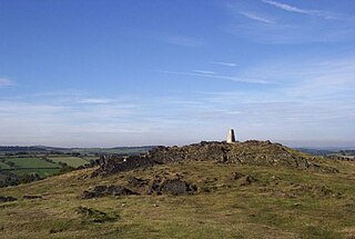
Charnwood Forest is a hilly tract in north-western Leicestershire, England, bounded by Leicester, Loughborough and Coalville. The area is undulating, rocky and picturesque, with barren areas. It also has some extensive tracts of woodland; its elevation is generally 600 feet (180 m) and upwards, the area exceeding this height being about 6,100 acres (25 km2). The highest point, Bardon Hill, is 912 feet (278 m). On its western flank lies an abandoned coalfield, with Coalville and other former mining villages, now being regenerated and replanted as part of the National Forest. The M1 motorway, between junctions 22 and 23, cuts through Charnwood Forest.

<span class="mw-page-title-main">Berkshire, Buckinghamshire and Oxfordshire Wildlife Trust</span> Wildlife conservation charity

The Berkshire, Buckinghamshire and Oxfordshire Wildlife Trust (BBOWT), is a Wildlife Trust covering the counties of Berkshire, Buckinghamshire and Oxfordshire in England.

<span class="mw-page-title-main">Broadmoor to Bagshot Woods and Heaths</span>

Broadmoor to Bagshot Woods and Heaths is a 1,696.3-hectare (4,192-acre) biological Site of Special Scientific Interest (SSSI) in Berkshire and Surrey that extend from a minority of the parish of Crowthorne including around Broadmoor Hospital in the west to Bagshot south-east, Bracknell north-east, and Sandhurst, south. It is part of the Thames Basin Heaths Special Protection Area. Two nature reserves which are managed by the Surrey Wildlife Trust are in the SSSI, Barossa nature reserve and Poors Allotment. Broadmoor Bottom, which is part of Wildmoor Heath, also falls within the SSSI; this reserve is managed by the Berkshire, Buckinghamshire and Oxfordshire Wildlife Trust.

<span class="mw-page-title-main">Bowdown and Chamberhouse Woods</span>

Bowdown and Chamberhouse Woods is a 67.9-hectare (168-acre) biological Site of Special Scientific Interest south of Thatcham in Berkshire. An area of 55 hectares is a nature reserve managed by the Berkshire, Buckinghamshire and Oxfordshire Wildlife Trust.

<span class="mw-page-title-main">Clyde Valley Woodlands National Nature Reserve</span>

The Clyde Valley Woodlands National Nature Reserve (NNR) comprises six separate woodland sites in the Clyde Valley region of South Lanarkshire, Scotland. These six sites are located along a 12 km section of the River Clyde and its tributaries, and lie close to built-up areas such as Hamilton and Lanark on the southern outskirts of Greater Glasgow. The sites can be easily accessed by about two million people living in the surrounding urban areas, making the reserve unique amongst Scotland's NNRs, most of which tend to be located in more remote areas. The six sites are:

<span class="mw-page-title-main">Dymock Woods SSSI</span> Biological Site of Special Scientific Interest in Gloucestershire, England

Dymock Woods is a 53-hectare (130-acre) biological Site of Special Scientific Interest in Gloucestershire, notified in 1990. The site is listed in the 'Forest of Dean Local Plan Review' as a Key Wildlife Site (KWS).

<span class="mw-page-title-main">Upper Wye Gorge</span>

Upper Wye Gorge is a Site of Special Scientific Interest (SSSI), noted for its biological and geological characteristics, around Symonds Yat in the Wye Valley on the Wales–England border. The site is listed in the 'Forest of Dean Local Plan Review' as a Key Wildlife Site (KWS).

<span class="mw-page-title-main">Astridge Wood</span> Biological Site of Special Scientific Interest in Gloucestershire, England

Astridge Wood is a 19.42-hectare (48.0-acre) biological Site of Special Scientific Interest in Gloucestershire, England, notified in 1985. The site is listed in the 'Forest of Dean Local Plan Review' as a Key Wildlife Site (KWS).

<span class="mw-page-title-main">Highbury Wood</span>

Highbury Wood is a 50.74-hectare (125.4-acre) biological Site of Special Scientific Interest in Gloucestershire, notified in 1983.

<span class="mw-page-title-main">Dancersend</span>

Dancersend is an 81.3-hectare (201-acre) Site of Special Scientific Interest (SSSI) south of Aston Clinton in Buckinghamshire. Part of the site is managed by the Forestry Commission and part by the Berkshire, Buckinghamshire and Oxfordshire Wildlife Trust (BBOWT). The BBOWT's 47 hectare nature reserve, called Dancersend with Pavis Woods, extends into fields west of the SSSI. It is in the Chilterns Areas of Outstanding Natural Beauty.

<span class="mw-page-title-main">Shabbington Woods Complex</span>

Shabbington Woods Complex is a 305.6-hectare (755-acre) biological Site of Special Scientific Interest (SSSI) between Horton-cum-Studley and Worminghall in Buckinghamshire. It comprises Shabbington Wood, Bernwood Forest, Hell Coppice, Oakley Wood and York's Wood. Shabbington Wood is owned by the Forestry Commission, and a small area of 7.5 hectares called Bernwood Meadows is managed by the Berkshire, Buckinghamshire and Oxfordshire Wildlife Trust.

References