
A canyon or gorge is a deep cleft between escarpments or cliffs resulting from weathering and the erosive activity of a river over geologic time scales. Rivers have a natural tendency to cut through underlying surfaces, eventually wearing away rock layers as sediments are removed downstream. A river bed will gradually reach a baseline elevation, which is the same elevation as the body of water into which the river drains. The processes of weathering and erosion will form canyons when the river's headwaters and estuary are at significantly different elevations, particularly through regions where softer rock layers are intermingled with harder layers more resistant to weathering.

The Derwent is a river in Yorkshire in the north of England. It flows from Fylingdales Moor in the North York Moors National Park, then southwards as far as its confluence with the River Hertford then westwards through the Vale of Pickering, south through Kirkham Gorge and the Vale of York, joining the River Ouse at Barmby on the Marsh. The confluence is unusual in that the Derwent converges on the Ouse at a shallow angle in an upstream direction.

Muggleswick is a village and civil parish in County Durham, England. It is situated a few miles to the west of Consett. the population was 130 at the 2001 Census reducing to 113 at the 2011 Census.

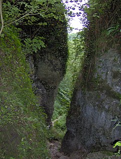
A ravine is a landform that is narrower than a canyon and is often the product of streambank erosion. Ravines are typically classified as larger in scale than gullies, although smaller than valleys. Ravines may also be called a cleuch, dell, ghout (Nevis), gill or ghyll, glen, gorge, kloof, and chine
Ebbor Gorge is a limestone gorge in Somerset, England, designated and notified in 1952 as a 63.5-hectare (157-acre) biological Site of Special Scientific Interest in the Mendip Hills. It was donated to the National Trust in 1967 and is now managed by Natural England as a national nature reserve.

Knott is a mountain in the northern part of the English Lake District. It is the highest point of the Back o'Skiddaw region, an area of wild and unfrequented moorland to the north of Skiddaw and Blencathra. Other tops in this region include High Pike, Carrock Fell and Great Calva. The fell's slopes are mostly smooth, gentle, and covered in grass, with a few deep ravines. It stands a long way from a road and requires a long walk across the moor top get to it; this, as well as the fact that it is hidden from the rest of the Lake District by the two aforementioned giants, make it one of the most unfrequented tops in the Lakes. When it is climbed it is most often from Mungrisdale or from the north via Great Sca Fell. The word Knott is of Cumbric origin, and means simply "hill".

Castle Crag is a hill in the North Western Fells of the English Lake District. It is the smallest hill included in Alfred Wainwright's influential Pictorial Guide to the Lakeland Fells, the only Wainwright below 1,000 feet (300 m).

The Vale of Pickering is a low-lying flat area of land in North Yorkshire, England. It is drained by the River Derwent. The landscape is rural with scattered villages and small market towns. It has been inhabited continuously from the Mesolithic period. The present economy is largely agricultural with light industry and tourism playing an increasing role.
Peakshole Water is a stream in the Derbyshire Peak District named after its source, Peak Cavern. It flows through the village of Castleton to join the River Noe in nearby Hope. Despite its name, much of its flow actually emerges from the Russet Well, a resurgence in a garden on the east side of the gorge below the main Peak Cavern entrance, described as the "main resurgence of the Castleton area", which drains a series of swallets on the other side of the Pennine watershed below Rushup Edge. The resurgence has been explored by cave divers to a depth of 82 feet (25 m) but further exploration was halted by a constriction.

Whinlatter is a small fell in the north west of the English Lake District, just north of the Whinlatter Pass. It is easily climbed from the top of the Whinlatter Pass, through the Forestry Commission plantations. The Whinlatter Visitor's Centre, a popular tourist attraction, is on the south side of the fell. The hill is part of a horseshoe around the valley of Aiken Beck. The fell's name originates from a combination of the Old Norse and Gaelic languages. With the Old Norse word 'hvin' meaning gorse or furze, and the Gaelic word 'lettir' meaning slope, the name translates as "The Gorse or furze-covered slope.".

Burbage Brook is an upper tributary stream of the River Derwent in the Peak District of England.
Coedmor National Nature Reserve is a nature reserve in Wales, located just south of Cardigan, between Llechryd Bridge and the Teifi Marshes in Ceredigion. It was established in order to protect the natural oak woodland on the slopes on either sides of the Teifi gorge.

The Bode Gorge is a 10 kilometres (6.2 mi) long ravine that forms part of the Bode valley between Treseburg and Thale in the Harz Mountains of central Germany. The German term, Bodetal, is also used in a wider sense to refer to the valleys of the Warme and Kalte Bode rivers that feed the River Bode.

Westernhope Burn Wood is a Site of Special Scientific Interest in the Wear Valley district of south-west County Durham, England. It occupies the steeply-incised ravine of the Westernhope Burn, a tributary of the River Wear, which it joins from the south about halfway between the villages of Eastgate and Westgate.
Sleightholme Beck Gorge – The Troughs is a Site of Special Scientific Interest in the Teesdale district of south-west County Durham, England. The site covers a gorge in the valley of Sleightholme Beck between the hamlet of Sleightholme and the confluence with the River Greta, some 3 km upriver from the village of Bowes.

The Alb is a river in the Black Forest. It arises from two headwaters, the Menzenschwander Alb and Bernauer Alb and flows in a southerly direction. It ends after 43.6 kilometres (27.1 mi) at a confluence with the High Rhine at Albbruck.

The Clyde Valley Woodlands National Nature Reserve (NNR) comprises six separate woodland sites in the Clyde Valley region of South Lanarkshire, Scotland. These six sites are located along a 12 km section of the River Clyde and its tributaries, and lie close to built-up areas such as Hamilton and Lanark on the southern outskirts of Greater Glasgow. The sites can be easily accessed by about two million people living in the surrounding urban areas, making the reserve unique amongst Scotland's NNRs, most of which tend to be located in more remote areas. The six sites are:

The Kondara Gorge is the gorge of the Kondara River in the southern spurs of the Gissar Range, north of Dushanbe in the Varzob District, one of the Districts of Republican Subordination, in western Tajikistan. It has been identified by BirdLife International as an Important Bird Area (IBA).
