| Pow Hill Bog | |
| Site of Special Scientific Interest | |
 Pow Hill Country Park and Derwent Reservoir | |
| Country | England |
|---|---|
| Region | North East |
| District | Wear Valley |
| Location | NZ009518 |
| - coordinates | 54°51′41″N1°59′12″W / 54.86139°N 1.98667°W Coordinates: 54°51′41″N1°59′12″W / 54.86139°N 1.98667°W |
| Area | 6.7 ha (16.6 acres) |
| Notification | 1986 |
| Management | Natural England |
| Area of Search | County Durham |
| Interest | Biological |
 Location of Pow Hill Bog SSSI, Co Durham | |
| Website: Map of site | |
Pow Hill Bog is a Site of Special Scientific Interest in the Wear Valley district of County Durham, England. It lies alongside Derwent Reservoir, approximately 2 km north-west of the village of Edmundbyers and adjacent to the Edmundbyers Common portion of the Muggleswick, Stanhope and Edmundbyers Commons and Blanchland Moor SSSI.

A Site of Special Scientific Interest (SSSI) in Great Britain or an Area of Special Scientific Interest (ASSI) in the Isle of Man and Northern Ireland is a conservation designation denoting a protected area in the United Kingdom and Isle of Man. SSSI/ASSIs are the basic building block of site-based nature conservation legislation and most other legal nature/geological conservation designations in the United Kingdom are based upon them, including national nature reserves, Ramsar sites, Special Protection Areas, and Special Areas of Conservation. The acronym "SSSI" is often pronounced "triple-S I".

Wear Valley was, from 1974 to 2009, a local government district in County Durham, England. Its council and district capital was Crook.

County Durham is a county in North East England. The county town is Durham, a cathedral city. The largest settlement is Darlington, closely followed by Hartlepool and Stockton-on-Tees. It borders Tyne and Wear to the north east, Northumberland to the north, Cumbria to the west and North Yorkshire to the south. The county's historic boundaries stretch between the rivers Tyne and Tees, thus including places such as Gateshead, Jarrow, South Shields and Sunderland.
The site contains two types of mire, a valley mire and a soligenous mire, the former a scarce habitat in County Durham. There are also areas of heathland and semi-improved grassland, as well as small plantations of larch and spruce. [1]

A bog or bogland is a wetland that accumulates peat, a deposit of dead plant material—often mosses, and in a majority of cases, sphagnum moss. It is one of the four main types of wetlands. Other names for bogs include mire, quagmire, and muskeg; alkaline mires are called fens. They are frequently covered in ericaceous shrubs rooted in the sphagnum moss and peat. The gradual accumulation of decayed plant material in a bog functions as a carbon sink.

Grasslands are areas where the vegetation is dominated by grasses (Poaceae); however, sedge (Cyperaceae) and rush (Juncaceae) families can also be found along with variable proportions of legumes, like clover, and other herbs. Grasslands occur naturally on all continents except Antarctica. Grasslands are found in most ecoregions of the Earth. For example, there are five terrestrial ecoregion classifications (subdivisions) of the temperate grasslands, savannas, and shrublands biome (ecosystem), which is one of eight terrestrial ecozones of the Earth's surface.

Larches are conifers in the genus Larix, of the family Pinaceae. Growing from 20 to 45 m tall, they are native to much of the cooler temperate northern hemisphere, on lowlands in the north and high on mountains further south. Larches are among the dominant plants in the boreal forests of Siberia and Canada. Although they are conifers, larches are deciduous trees that lose their needles in the autumn.
The wetter parts of the valley mire are characterised by an abundance of bog mosses, Sphagnum spp , in association with species such as common cottongrass, Eriophorum angustifolium , star sedge, Carex echinata , and bog asphodel, Narthecium ossifragum . The drier areas are heathland, with heather, Calluna vulgaris , hare's-tail cottongrass, Eriophorum vaginatum , cross-leaved heath, Erica tetralix , and common sedge, Carex nigra .

Sphagnum is a genus of approximately 380 accepted species of mosses, commonly known as "peat moss". Accumulations of Sphagnum can store water, since both living and dead plants can hold large quantities of water inside their cells; plants may hold 16–26 times as much water as their dry weight, depending on the species. The empty cells help retain water in drier conditions. Hence, as sphagnum moss grows, it can slowly spread into drier conditions, forming larger mires, both raised bogs and blanket bogs. Thus, Sphagnum can influence the composition of such habitats, with some describing Sphagnum as 'habitat manipulators'. These peat accumulations then provide habitat for a wide array of peatland plants, including sedges and ericaceous shrubs, as well as orchids and carnivorous plants. Sphagnum and the peat formed from it do not decay readily because of the phenolic compounds embedded in the moss's cell walls. In addition, bogs, like all wetlands, develop anaerobic soil conditions, which produces slower anaerobic decay rather than aerobic microbial action. Peat moss can also acidify its surroundings by taking up cations, such as calcium and magnesium, and releasing hydrogen ions. Under the right conditions, peat can accumulate to a depth of many meters. Different species of Sphagnum have different tolerance limits for flooding and pH, so any one peatland may have a number of different Sphagnum species.

Eriophorum angustifolium, commonly known as common cottongrass or common cottonsedge, is a species of flowering plant in the sedge family Cyperaceae. Native to North America, North Asia, and Northern Europe, it grows on peat or acidic soils, in open wetland, heath or moorland. It begins to flower in April or May and, after fertilisation in early summer, the small, unremarkable brown and green flowers develop distinctive white bristle-like seed-heads that resemble tufts of cotton; combined with its ecological suitability to bog, these characteristics give rise to the plant's alternative name, bog cotton.

Carex echinata is a species of sedge known by the common names star sedge and little prickly sedge.
The soligenous mire is characterised by sharp-flowered rush, Juncus acutiflorus , and purple moor-grass, Molinia caerulea . Several local species are also present, including narrow-leaved buckler-fern, Dryopteris carthusiana , lesser skullcap, Scutellaria minor , and grass of Parnassus, Parnassia palustris .

Juncus acutiflorus, also called sharp-flowered rush, is a rush or a grassy plant of the genus Juncus. As the name suggests, the plant has notable sharp-looking flowers, flowering between July and September.

Molinia caerulea, the purple moor-grass, is a species of grass that is native to Europe, west Asia, and north Africa. It grows in locations from the lowlands up to 2,300 m (7,546 ft) in the Alps. Like most grasses, it grows best in acid soils, ideally pH values of between 3.5 and 5, however, it can continue to live under more extreme conditions, sometimes to as low as 2. It is common on moist heathland, bogs and moorland throughout Britain. Introduced populations exist in northeastern and northwestern North America.
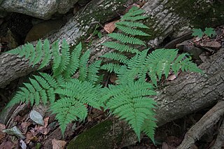
Dryopteris carthusiana is a species of fern native to damp forests throughout the Holarctic Kingdom. It is known as the narrow buckler-fern in the United Kingdom, and as the spinulose woodfern in North America.
The site is located within the Pow Hill Country Park, a recreational area managed by Durham County Council.

Durham County Council is the local authority of the non-metropolitan County Durham in North East England. Since 2009 it has been a unitary authority, having the powers of a non-metropolitan county and district council combined. From 1889 to 2009 it was a county council in a two-tier arrangement.


