
Lambert's Castle is an Iron Age hillfort in the county of Dorset in southwest England. Since 1981 it has been designated as a Site of Special Scientific Interest (SSSI) on account of its geology, archaeology and ecology. The hillfort is designated a scheduled monument together with a bowl barrow, the sites of a post-medieval fair and a telegraph station. The site was on the Heritage at Risk Register but was removed in 2022 as a result of the Hillforts and Habitats Project.
Chaceley Meadow is a 1.8-hectare (4.4-acre) biological Site of Special Scientific Interest in Gloucestershire, notified in 1954 and renotified in 1993. It lies on the eastern edge of Chaceley village and is about half a mile west of the River Severn.

Salmonsbury Meadows is an 18-hectare (44-acre) biological and geological Site of Special Scientific Interest in Gloucestershire, notified in 1985. The site is listed in the 'Cotswold District' Local Plan 2001-2011 as a Key Wildlife Site (KWS).

Range Farm Fields is a 12.8-hectare (32-acre) biological Site of Special Scientific Interest in Gloucestershire, near to Gloucester City, notified in 1996.

Wildmoorway Meadows is a 12.6-hectare (31-acre) biological Site of Special Scientific Interest in Gloucestershire, to the east of Fairford, notified in 1989. The site is listed in the 'Cotswold District' Local Plan 2001-2011 as a Key Wildlife Site (KWS).
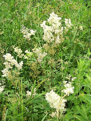
Winson Meadows is a 7.93-hectare (19.6-acre) biological Site of Special Scientific Interest in Gloucestershire, notified in 1974. The site is listed in the 'Cotswold District' Local Plan 2001-2011 as a Key Wildlife Site (KWS).

St Dunstan's Farm Meadows is a 10.2-hectare (25-acre) biological Site of Special Scientific Interest south-east of Heathfield in East Sussex. It is in the High Weald Area of Outstanding Natural Beauty.

Mill Meadows, Billericay is a 6.7-hectare (17-acre) biological Site of Special Scientific Interest (SSSI) in Billericay in Essex, England. It is part of the 36.8 hectare Mill Meadows Local Nature Reserve (LNR), which is owned and managed by Basildon District Council.
Aules Hill Meadows is the name given to a Site of Special Scientific Interest (SSSI) in Northumberland, England. The site, listed since 1992, is a set of four traditionally managed northern hay meadows, now rare in Northumberland.
Bamburgh Coast and Hills is the name given to a Site of Special Scientific Interest (SSSI) on the coast of north Northumberland, England. The site is one of the longest-standing SSSIs in England, having been listed since 1954, and displays the interaction of a fluid magma rock, now known as the Whin Sill, interacting with older sedimentary rock. Coastal erosion at the site enables sections of the geological strata to be seen. In turn, the soil associated with the Whin Sill gives rise to a distinct pattern of vegetation which on its own merits is at this site found notable.
Barrow Meadow is a Site of Special Scientific Interest (SSSI) in north Northumberland, England. The site is a species-rich hay meadow of a sort now rare in Northumberland.
Ashford Hill is a British national nature reserve next to the village of Ashford Hill in Hampshire. Part of the reserve is a designated a Site of Special Scientific Interest (SSSI). The site is one of Natural Englands nature reserves
Ron Ward's Meadow With Tadley Pastures is a site of Site of Special Scientific Interest (SSSI). It is based on the edge of Tadley in Hampshire, England. It is managed by the Hampshire and Isle of Wight Wildlife Trust.

Bishop Monkton Ings is a Site of Special Scientific Interest, or SSSI, situated east of Bishop Monkton village in North Yorkshire, England. It consists mostly of marshy, calcareous grassland, with some broadleaved woodland, and some fen alongside the two watercourses which run through the site. This varied wetland forms a habitat for a variety of plants, including the semi-parasitic marsh lousewort (Pedicularis palustris).
