
Fluorite (also called fluorspar) is the mineral form of calcium fluoride, CaF2. It belongs to the halide minerals. It crystallizes in isometric cubic habit, although octahedral and more complex isometric forms are not uncommon.

The Peak District is an upland area in England at the southern end of the Pennines. It is mostly in northern Derbyshire, but includes parts of Cheshire, Greater Manchester, Staffordshire, West Yorkshire and South Yorkshire. An area of diversity, it is usually split into the Dark Peak, where most moorland is found and the geology is gritstone, and the White Peak, a limestone area, known for valleys and gorges that cut through the limestone plateau. The Dark Peak forms an arc on the north, east and west sides; the White Peak makes up the central and southern tracts. It became the United Kingdom's first national park in 1951. Proximity to Manchester, Stoke-on-Trent, Derby and Sheffield brings millions of urban visitors every year. It is thought that 20 million people live within an hour's journey.

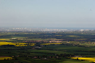
The Pennines, also known as the Pennine Chain or Pennine Hills, is a range of hills and mountains separating North West England from Yorkshire and North East England.

The Yorkshire Dales is an upland area of the Pennines in the historic county of Yorkshire, England, most of it in the Yorkshire Dales National Park created in 1954.

The North Pennines is the northernmost section of the Pennine range of hills which runs north–south through northern England. It lies between Carlisle to the west and Darlington to the east. It is bounded to the north by the Tyne Valley and to the south by the Stainmore Gap.
Teesdale is a dale, or valley, in Northern England. The dale is in the River Tees’s drainage basin, most water flows stem from or converge into said river, including the Skerne and Leven.

Weardale is a dale, or valley, of the east side of the Pennines in County Durham, England. Large parts of Weardale fall within the North Pennines Area of Outstanding Natural Beauty (AONB) – the second largest AONB in England and Wales. The upper valley is surrounded by high fells and heather grouse moors. The River Wear flows through Weardale before reaching Bishop Auckland and then Durham, meeting the sea at Sunderland.

Greenhow is a village in North Yorkshire, England, often referred to as Greenhow Hill. The term how derives from the Old Norse word haugr meaning a hill and a mound, so Greenhow literally means 'Green's hill or mound'.
Sir Kingsley Charles Dunham was one of the leading British geologists and mineralogists of the 20th century. He was a Professor of Geology at the University of Durham from 1950–71. He was later Professor Emeritus from 1967–2001. He was director of the British Geological Survey from 1967–75.

The West Pennine Moors is an area of the Pennines covering approximately 90 square miles (230 km2) of moorland and reservoirs in Lancashire and Greater Manchester, England. It is a Site of Special Scientific Interest.

The River Wear in North East England rises in the Pennines and flows eastwards, mostly through County Durham to the North Sea in the City of Sunderland. At 60 mi (97 km) long, it is one of the region's longest rivers, wends in a steep valley through the cathedral city of Durham and gives its name to Weardale in its upper reach and Wearside by its mouth.
Westgarth Forster was a geologist and mining engineer. He was the son of a mining engineer, and was born in Coalcleugh, Northumberland. He became a mining agent on Alston Moor, an area in the Pennines noted for its extensive lead mines, but died penniless in 1835.

Foster's Hush is a Site of Special Scientific Interest in the Teesdale district of west County Durham, England. It is located in the valley of Lune Head Beck, immediately south of the B6276 road, 6 km upstream of the Selset Reservoir dam.

Moorhouse and Cross Fell is a Site of Special Scientific Interest covering an extensive area of moorland in the Wear Valley district of west County Durham and the Eden district of Cumbria, England. It is contiguous with Upper Teesdale SSSI to the east and Appleby Fells SSSI to the south. The area covered extends roughly from an arc through the villages of Gamblesby, Leadgate and Garrigill southward as far as Milburn in the west and Cow Green Reservoir in the east. It includes the whole of Cross Fell, the summit of which, at 893 metres asl, is the highest point in the Pennines and in England outside the Lake District.

West Rigg Open Cutting is a Site of Special Scientific Interest in the Wear Valley district of west County Durham, England. It is a disused ironstone quarry, located just over 1 km north of the village of Westgate, in Weardale.
Harthope Moss, also known as Chapel Fell is a mountain pass in the English Pennines. The pass divides Weardale to the north and Teesdale to the south. The unclassified road over the pass connects the A689 at St John's Chapel, County Durham with the B6277 near Langdon Beck in Upper Teesdale, County Durham. It is the equal highest paved pass in England with the Killhope Cross on the A689, approximately 10 miles to the north on the other side of Burnhope Seat.
The geology of County Durham in northeast England consists of a basement of Lower Palaeozoic rocks overlain by a varying thickness of Carboniferous and Permo-Triassic sedimentary rocks which dip generally eastwards towards the North Sea. These have been intruded by a pluton, sills and dykes at various times from the Devonian Period to the Palaeogene. The whole is overlain by a suite of unconsolidated deposits of Quaternary age arising from glaciation and from other processes operating during the post-glacial period to the present. The geological interest of the west of the county was recognised by the designation in 2003 of the North Pennines Area of Outstanding Natural Beauty as a European Geopark.

Allendale Moors is a Site of Special Scientific Interest (SSSI) in Northumberland, England. The upland moorland ridge site is listed for its heath, flush and upland grassland which provide a habitat for a nationally important assemblage of moorland breeding birds.
