The Sussex Wildlife Trust (SWT) is a conservation charity which aims to protect natural life in Sussex. It was founded in 1961 and is one of 46 wildlife trusts across the UK and the Isle of Man and Alderney. As of 2019, it has 33,000 members and manages 2,000 hectares of land for nature. It is a registered charity and in the year to 31 March 2019 it had an income of £5.7 million and expenditure of £4 million, resulting in net income of £1.7 million.

Aston Rowant Cutting is a 3.5-hectare (8.6-acre) geological Site of Special Scientific Interest south of Aston Rowant in Oxfordshire. It is a Geological Conservation Review site.

River Avon System is a 475.9-hectare (1,176-acre) biological Site of Special Scientific Interest in Hampshire and Wiltshire, southern England. It is a Nature Conservation Review site, Grade I. It is part of the Avon Valley and New Forest Ramsar sites and is also part of two Special Protection Areas: Solent and Southampton Water, and the New Forest.

Weir Wood Reservoir is a 153.5-hectare (379-acre) biological Site of Special Scientific Interest west of Forest Row in East Sussex. It is in High Weald Area of Outstanding Natural Beauty and an area of 32.6 hectares is a Local Nature Reserve which is owned by Southern Water and managed by East Sussex County Council and Southern Water.

Windsor Forest and Great Park is a 1,778.9-hectare (4,396-acre) biological Site of Special Scientific Interest in Berkshire and Surrey, located south of Windsor. It is a Special Area of Conservation and Windsor Forest is a Nature Conservation Review site, Grade I. Landscaped woodland gardens are Grade I listed on the Register of Historic Parks and Gardens of Special Historic Interest. Windsor Great Park is a Royal Park of 2,020 hectares, including a deer park,

Chiddingfold Forest is a 542.5-hectare (1,341-acre) biological Site of Special Scientific Interest in Chiddingfold in Surrey and West Sussex. One part of it, Fir Tree Copse, is a nature reserve which is managed by the Surrey Wildlife Trust

Colyers Hanger is a 26.6-hectare (66-acre) biological Site of Special Scientific Interest south-east of Guildford in Surrey. It is a Nature Conservation Review site, Grade 2 and is part of St Martha's Hill and Colyer's Hanger nature reserve, which is managed by the Surrey Wildlife Trust.
Blow's Down is a 33.1-hectare (82-acre) biological Site of Special Scientific Interest in Dunstable in Bedfordshire. It was notified in 1989 under Section 28 of the Wildlife and Countryside Act 1981, and the local planning authority is Central Bedfordshire Council. The site forms around half of the 62.3-hectare (154-acre) Blow's Downs nature reserve, which is managed by the Wildlife Trust for Bedfordshire, Cambridgeshire and Northamptonshire.

Turners Hill SSSI is a 0.2-hectare (0.49-acre) geological Site of Special Scientific Interest in Turners Hill in West Sussex. It is a Geological Conservation Review site.

Stone Farm Rocks or Stone Hill Rocks is a 0.6-hectare (1.5-acre) geological Site of Special Scientific Interest south of East Grinstead in West Sussex. It is a Geological Conservation Review site.
Pamber Forest and Silchester Common is a 341.7-hectare (844-acre) biological Site of Special Scientific Interest in Tadley in Hampshire. Pamber Forest and Upper Inhams Copse is managed by the Hampshire and Isle of Wight Wildlife Trust and Pamber Forest is a Local Nature Reserve.

Gedgrave Hall Pit is a 0.65-hectare (1.6-acre) geological Site of Special Scientific Interest in Gedgrave, south of Saxmundham in Suffolk. It is a Geological Conservation Review site, and it is in the Suffolk Coast and Heaths Area of Outstanding Natural Beauty.

Forest Mere is a 14.6-hectare (36-acre) biological Site of Special Scientific Interest north of Midhurst in West Sussex.

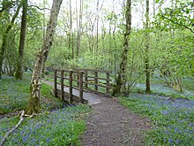
The Mens is a 205.2-hectare (507-acre) biological Site of Special Scientific Interest west of Billingshurst in West Sussex. It is a Nature Conservation Review site, Grade I and a Special Area of Conservation. An area of 166 hectares south of the A272 road is managed as a nature reserve by the Sussex Wildlife Trust.

Philpot's and Hook Quarries is a 2.6-hectare (6.4-acre) geological Site of Special Scientific Interest south-west of Sharpthorne in West Sussex. It is a Geological Conservation Review site.

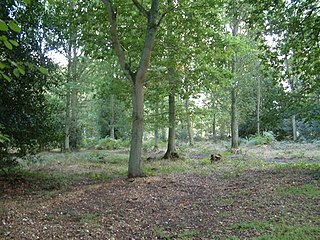
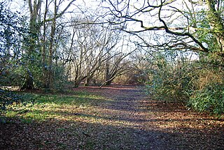
St Leonard's Forest SSSI is an 85.4-hectare (211-acre) biological Site of Special Scientific Interest east of Horsham in West Sussex. The SSSI is in two separate areas, with the western part being in the 289-hectare (710-acre) Forestry Commission managed St Leonard's Forest.

St Leonard's Park Ponds is a 3.9-hectare (9.6-acre) biological Site of Special Scientific Interest east of Horsham in West Sussex.
Binswood is a 62.5-hectare (154-acre) biological Site of Special Scientific Interest southeast of Alton in Hampshire.

Bramshott and Ludshott Commons is a 374.4-hectare (925-acre) biological Site of Special Scientific Interest near Grayshott in Hampshire. It is part of Wealden Heaths Phase II Special Protection Area.

Broxhead and Kingsley Commons is a 105.1-hectare (260-acre) biological Site of Special Scientific Interest north of Lindford in Hampshire. It is part of Wealden Heaths Phase II Special Protection Area for the Conservation of Wild Birds and Broxhead Common is a 41.8-hectare (103-acre) Local Nature Reserve owned and managed by Hampshire County Council.