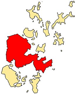
Orkney, also known as the Orkney Islands, is an archipelago in the Northern Isles of Scotland, situated off the north coast of the island of Great Britain. Orkney is 10 miles (16 km) north of the coast of Caithness and has about 70 islands, of which 20 are inhabited. The largest island, the Mainland, has an area of 523 square kilometres (202 sq mi), making it the sixth-largest Scottish island and the tenth-largest island in the British Isles. Orkney’s largest settlement, and also its administrative centre, is Kirkwall.
The Mainland, also known as Hrossey and Pomona, is the main island of Orkney, Scotland. Both of Orkney's burghs, Kirkwall and Stromness, lie on the island, which is also the heart of Orkney's ferry and air connections.

Stronsay is an island in Orkney, Scotland. It is known as Orkney's 'Island of Bays', owing to an irregular shape with miles of coastline, with three large bays separated by two isthmuses: St Catherine's Bay to the west, the Bay of Holland to the south and Mill Bay to the east. Stronsay is 3,275 hectares in area, and 44 metres in altitude at its highest point. It has a usually resident population of 349. The main village is Whitehall, home to a heritage centre.

Eday is one of the islands of Orkney, which are located to the north of the Scottish mainland. One of the North Isles, Eday is about 24 kilometres from the Orkney Mainland. With an area of 27 km2 (10 sq mi), it is the ninth-largest island of the archipelago. The bedrock of the island is Old Red Sandstone, which is exposed along the sea-cliffs.
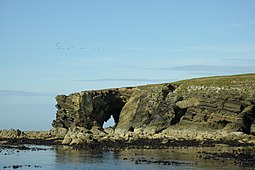
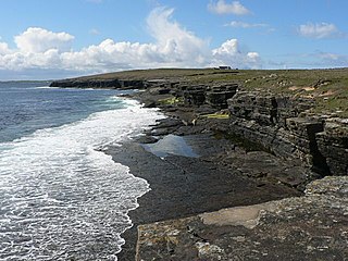
Westray is one of the Orkney Islands in Scotland, with a usual resident population of just under 600 people. Its main village is Pierowall, with a heritage centre, the 15th-century Lady Kirk church and pedestrian ferry service to nearby Papa Westray island. Westray has a number of archeological sites dating from 3500 BC, and remains of several Norse-Viking settlements. The spectacular sea cliffs around Noup Head are home to thousands of seabirds.
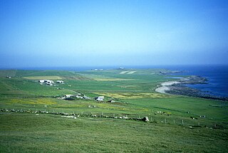
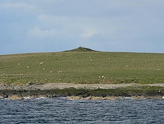
Papa Westray, also known as Papay, is one of the Orkney Islands in Scotland, United Kingdom. The fertile soil has long been a draw to the island.

Faray is a small island in Orkney, Scotland, lying between Eday and Westray. Previously inhabited, the low-lying island is now a successful grey seal breeding colony.

The Holm of Papa is a very small uninhabited island in the Orkney Islands. It is around 21 hectares in size. It can be visited from its neighbouring island Papa Westray, or Papay, an island less than a hundred metres west of the Holm.

Kili Holm is a tidal island in the Orkney Islands, linked to Egilsay. Unusually, like its neighbour Egilsay, it may have a partly Gaelic etymology, in this case from cille meaning a monk's cell. This may make it another “Papey” or island of the papar or culdees.
The Holm of Huip is a small island in the Orkney Islands, in Spurness Sound to the north west of Stronsay.

Rusk Holm is a small island in the Orkney Islands, near Faray to the west.

The Holm of Scockness is a small island in the Orkney Islands, between Rousay and Egilsay.

Linga Holm, commonly known as Linga, Midgarth and the Holm of Midgarth is an uninhabited Scottish island extending to approximately 57 hectares (0.22 sq mi) situated 700 metres (770 yd) west of Stronsay island in the Orkney archipelago. The name "Linga Holm" is derived from the Old Norse Lyngholm.
There are numerous islands containing the word holm, mainly in northern Europe. In many cases the name is derived from the Old Norse holmr, meaning "a small and rounded islet". These include:

The Lady Kirk at Pierowall is a ruined 17th-century church on the island of Westray, in Orkney, Scotland. The church was built in 1674, on the foundations of the 13th-century church. Two 17th-century grave-slabs, in excellent condition, are set into the interior wall of the chancel and are now protected by glass screens. The graves display fine lettering and 17th-century images of mortality, engraved in high relief. Historic Environment Scotland established the site as a scheduled monument in 2014.

St Magnus Bay is a large coastal feature in the north-west of Mainland Shetland, Scotland. Roughly circular in shape with a diameter of about 19 kilometres (12 mi), it is open to the North Atlantic Ocean to the west. The indented coastline to the north, south and east between Esha Ness in the north and the Ness of Melby in the south contains numerous bays, firths and voes and there are several islands around the perimeter. The waters of the bay are up to 165 metres (541 ft) deep and may have been the site of a substantial meteor impact.

St Boniface's Church, Papa Westray is a historic church and graveyard located on the island of Papa Westray in Orkney, Scotland. The site of the church dates back to the Iron Age and was possibly used later as a Christian monastery. The present church was built in the 12th century and was remodeled in 1710. A 12th century Norse hogback gravestone lies to the east of the church. Two Pictish cross-slabs were uncovered in the graveyard in the 20th century, and were later moved to museums. Historic Environment Scotland established the site as a scheduled monument in 1959.