Honnavar | |
|---|---|
Town | |
| Honnavar | |
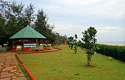      From top: View from Kasrkod beach, Basavaraja Durga Island, Jog falls, Honnavar lighthouse, Honnavar backwaters and backwaters boating | |
 Honnavar | |
| Coordinates: 14°16′48″N74°26′38″E / 14.28°N 74.4439°E | |
| Country | |
| State | Karnataka |
| Region | Uttara Kannada district |
| Elevation | 2 m (7 ft) |
| Population (2011) [1] | |
• Total | 19,109 [2] |
| Languages | |
| • Official | Kannada |
| Time zone | UTC+5:30 (IST) |
| Honnavar Town Panchayat | Municipality |
Honnavar is a town in Uttara Kannada district of Karnataka, India.

