Horns Bridge

Last updated

LD&ECR Viaduct
Approaching Horns Bridge on A61 - geograph.org.uk - 605196.jpg
Remaining arch of viaduct over the A61 road in 1984.
Coordinates 53°13′51.1″N1°25′17.5″W / 53.230861°N 1.421528°W / 53.230861; -1.421528 (Horns Bridge)
CarriesEx-Lancashire, Derbyshire and East Coast Railway
Crosses Chesterfield Loop, Midland Main Line, A61 road, A617 road, River Rother, River Hipper
Locale Chesterfield, Derbyshire
Characteristics
Design7 brick arches, 4 lattice deck girders and a bowstring bridge
Total length700 feet (210 m)
WidthTwin Standard Gauge Rail
Height63 feet (19 m)
History
OpenedFebruary 1897
ClosedMarch 1957
Location
Horns Bridge

Horns Bridge is a small area on the southeastern edge of Chesterfield, Derbyshire, England which was remarkable at one time for its congested intersection of roads, rivers, footpaths and railways.

Contents

Horns Bridge looking west, April 1972 Horns Bridge , Chesterfield.jpg
Horns Bridge looking west, April 1972
Horns Bridge and viaduct remnant, July 2013 ChesterfieldHornsBridgeViaductRemnant20130720.jpg
Horns Bridge and viaduct remnant, July 2013

Description

Three levels

Horns Bridge was all the more striking because the congestion was three-dimensional:

At ground level:

At middle level:

At high level

The best place to start to gain an impression of the pre-1960 Horns Bridge is a map. An OS map from the 1940s gives a good idea, [1] with a range of other old Black and White maps fleshing out detail. [2] Maps are two-dimensional, the aerial photograph in "Gt Central North of Nottingham" gives an idea of scale, complexity and height, [3] [4] which "The Changing Face of Chesterfield" [5] and the DVD [6] complement.

Ground level

At ground level, both rivers are prone to flooding, which last happened on a serious scale in 2007 but most recently in November 2019 and once again in February 2020 following storm Dennis. The Horns Bridge area and the inter-war floods are superbly shown in "The Changing Face of Chesterfield." [7] [8]

From Chesterfield town centre the Derby and Mansfield roads separate at Horns Bridge. Nowadays this happens at a large roundabout with several exits. In essence, the A617 Mansfield Road has been upgraded to a dual carriageway running South East to Junction 29 of the M1, incorporating in the process much of the trackbed of the GCR's "Chesterfield Loop." South of Horns Bridge the A61 Derby Road [9] is less changed, it is still a traditional two lane road. North of Horns Bridge, however, it has been dualled and re-routed to follow the alignment of the GCR Chesterfield Loop through the town, although bypassing the former GCR tunnel. The southern entrance to this tunnel can still be seen through the fence at the junction of Hollis Lane and Dixon's Road.

Travelling southwards from Sheffield Victoria, the GCR's double-track Chesterfield Loop branched West off the GCR's Main Line at Staveley and rejoined it at Heath. Its station in Chesterfield was Chesterfield Central, situated North of the Town Centre. The station closed on 5 March 1963. Tracks South of the station to Grassmoor [10] and Heath [11] were lifted in the Winter of 1963/4.

South from Chesterfield Central [12] [11] the line went immediately into Chesterfield Tunnel, from which it emerged a few hundred yards North of Horns Bridge. It then ran under the Brampton Branch, under a footbridge, under the Midland line, under another footbridge, under the LD&ECR line, over its junction with Hyde's Sidings and finally into open country. This plethora of activity was crammed into a few hundred yards at Horns Bridge.

The first footpath referred to above ran West to East from the main road. It immediately crossed the Loop Line to the West of the Midland Line using a footbridge known locally as "40 Steps." It then went under the Midland Line. The other footpath ran South to North to the East of the Midland line and crossed the Loop line between the Midland Line and Hyde's sidings. [13] Both footbridges were wonderful places for trainspotting, photography [14] [15] [16] and superb sketches and paintings by Chesterfield artist David Charlesworth.

Hyde's Sidings were laid by the GCR off the Loop and served factories to the East of the Midland line at the bottom of Hady Hill. The exit from the sidings onto the loop was protected by a gate, which was a source of mystery to lay observers. [17]

Middle level

At the middle level was the first railway into Chesterfield, the MR's main line from Sheffield Midland to London St Pancras, now widely known as the Midland Main Line. Chesterfield Midland was (and still is) North of the town centre, to the East of Chesterfield Central. Its four tracks crossed the Mansfield Road (Hasland Road) over Horns Bridge immediately East of the junction with Derby Road. The same general layout exists today, though the road junction is now a large roundabout, as described above. The western pair of tracks were used by all passenger trains [18] and some goods trains. The eastern pair were only used by goods trains. Nowadays some passenger services also use the eastern tracks, so healthy is the level of passenger traffic on the line, which has been chosen for electrification in the next few years.[ citation needed ]

The MR's Brampton Branch turned West off the main line between the Midland station and Horns Bridge. [19] It was single track and never a passenger railway. It was normally worked by an LMS "Jinty" tank. A curious survivor is a pair of "bridges to nowhere" built to serve the Brampton Branch when the major reconstruction of the roads and buildings in the Horns Bridge area took place in the 1980s. When the factories of Bryan Donkin and Chesterfield Cylinders were moved out of town and the land redeveloped to housing and retail in the early 21st century, the remaining tracks were lifted and the branch now forms the main part of the Hipper Valley Trail of the Chesterfield cycle network between Chesterfield railway station and Walton Dam. [20] As part of this work the original bridge across Lordsmill Street between the two modern "bridges to nowhere" was replaced.

High level

At high level was the most dramatic feature at Horns Bridge - the LD&ECR's main line which strode across all the features described above on a major viaduct. This structure consisted of seven brick arches and four girder spans, 63 feet high, flanked by substantial embankments in both directions. [21] [22] [23] [24] The line ran from Chesterfield Market Place to Lincoln Central. Horns Bridge was reputed to be one of only two places in the world where three railways crossed at one spot at three levels, the other being in the USA.[ citation needed ] Strictly, the lines didn't cross at exactly one spot, but that would be to split hairs. Passenger services from Market Place station ended on 3 December 1951, with total closure coming in March 1957. Tracks were lifted but the embankment and viaduct at Horns Bridge remained intact until 1960, when the metal girder spans were removed. [25] The brick uprights and arches remained in place like Megaliths [26] [27] [10] [11] [28] until 1985 when they and the embankment to the West were swept away for the road alterations mentioned above.

Today

The Horns Bridge that replaced the original (1840) brick arch in 1932 still carries the mainline over Hasland Road. The road is, however, closed to traffic, that having diverted onto the Hasland Bypass (A617) before reaching the roundabout. Today the only indication that the LD&ECR's massive engineering, land occupancy and buildings ever existed West of Horns Bridge is some blue brickwork beside this bridge, shown on an attached photograph. To the East of Horns Bridge the remnants of an embankment and cutting at Spital give some idea of the scale and cost of that undertaking. The GCR's Chesterfield Loop leaves no trace either, though the year stone from the construction of the tunnel has been restored by kindred spirits at the Chesterfield Canal.

Following the trend to adorn busy roundabouts the Horns Bridge traffic island now proudly displays a sculpture entitled 'Growth' by local designer, Melanie Jackson. All within sight of Chesterfield's iconic Crooked Spire.

'The design celebrates Chesterfield's strong industrial heritage, whilst also looking forward, towards the town's future growth and development. A large Weathering Steel, 'wheel' or 'cog' appears to grow out of the landscape, symbolising industry, the spokes twist upwards at the centre to form an opening flower - representing the town's growth and future, which is yet to unfold. The sculpture stands approximately 8 m tall and is 8 m wide. The design of the 'flower' is influenced by the flower of the Pomegranate Tree, which features on the towns coat of arms. The eight petals relate to the eight twisting facets of the town's famous spire and also represent eight community areas that make up Chesterfield, eight sculptural dry stone walls will radiate out from the artwork, blending the sculpture with the landscape. The inside of the opening 'flower petals' have a contrasting satin polished, stainless steel finish, bringing brightness and 'life' to the inside of the opening artwork. In the centre, a cluster of 'growing' anther (pollen) reach upwards, these are also stainless steel. Lighting beneath and within the structure gives a different, night time effect of the sculpture. The sculpture was manufactured by Chris Brammall Ltd.' https://www.melaniejacksondesigns.com/growth-chesterfield

Related Research Articles

<span class="mw-page-title-main">Chesterfield Market Place railway station</span> Former railway station in Derbyshire, England

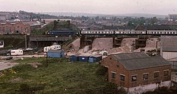
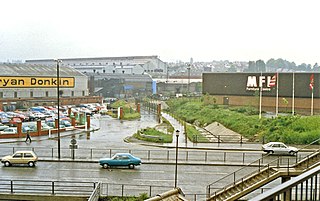
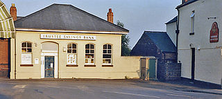
Chesterfield Market Place railway station was a former railway station in the centre of the town of Chesterfield, Derbyshire, England.

The Lancashire, Derbyshire and East Coast Railway (LD&ECR) was built to connect coalfields in Derbyshire and Nottinghamshire with Warrington and a new port on the Lincolnshire coast. It was a huge undertaking, and the company was unable to raise the money to build its line. With the financial help of the Great Eastern Railway it managed to open between Chesterfield and Lincoln with a branch towards Sheffield from 1896. Despite efforts to promote tourist travel, the passenger business was never buoyant, but collieries were connected to the line, at first and in succeeding years. The Great Eastern Railway, and other main line companies, transported coal to the southern counties, and the company's engines took coal to Immingham in great quantities. The company had a fleet of tank engines.

<span class="mw-page-title-main">Arkwright Town railway station</span> Former railway station in Derbyshire, England

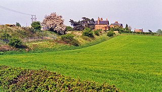
Arkwright Town railway station was in Arkwright Town, Derbyshire, England.

<span class="mw-page-title-main">Scarcliffe railway station</span> Former railway station in Derbyshire, England

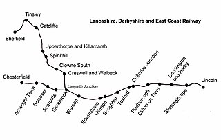
Scarcliffe railway station is a former railway station in Scarcliffe, Derbyshire, England.

<span class="mw-page-title-main">Shirebrook North railway station</span> Former railway station in Derbyshire, England

Shirebrook North railway station was a railway station serving the town of Shirebrook in Derbyshire, England. It was on the Lancashire, Derbyshire and East Coast Railway running from Chesterfield to Lincoln. The starion was also on the former Shirebrook North to Nottingham Victoria Line and the Sheffield District Railway. The station has since been demolished and housing now occupies parts of the site with some stub rails nearby serving a train scrapper.

<span class="mw-page-title-main">Warsop railway station</span> Former railway station in Nottinghamshire, England

Warsop railway station is a former railway station in Market Warsop, Nottinghamshire, England.

<span class="mw-page-title-main">Ollerton railway station</span> Former railway station in Nottinghamshire, England

Ollerton railway station is a former railway station in Ollerton, Nottinghamshire, England.

<span class="mw-page-title-main">Tuxford Central railway station</span> Former railway station in Nottinghamshire, England

Tuxford Central railway station is a former railway station in Tuxford, Nottinghamshire, England.

<span class="mw-page-title-main">Clowne South railway station</span> Former railway station in Derbyshire, England

Clowne South railway station is a former railway station in Clowne, Derbyshire, England.

<span class="mw-page-title-main">Dukeries Junction railway station</span> Former railway station in Nottinghamshire, England

Dukeries Junction, originally Tuxford Exchange, was a railway station near Tuxford, Nottinghamshire, England. The station opened in 1897 and closed in 1950. It was located at the bridge where the Lancashire, Derbyshire and East Coast Railway crossed over the East Coast Main Line (ECML), with sets of platforms on both lines. The high-level location is now part of the High Marnham Test Track.

<span class="mw-page-title-main">Duckmanton Tunnel</span>

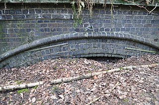
Duckmanton Tunnel is a former 501-yard (458-metre) long twin-track railway tunnel between Chesterfield and Arkwright Town in Derbyshire, England.

Boythorpe Viaduct was a railway viaduct in Chesterfield, England.

<span class="mw-page-title-main">Duckmanton Junction</span>

Duckmanton Junction is a former railway junction near Arkwright Town in Derbyshire, England.

<span class="mw-page-title-main">Clowne and Barlborough railway station</span> Former railway station in Derbyshire, England

Clowne & Barlborough is a former railway station in Clowne northeast of Chesterfield, Derbyshire, England.

<span class="mw-page-title-main">Glapwell railway station</span> Former railway station in Derbyshire, England

Glapwell is a former railway station in Glapwell, Derbyshire, England.

<span class="mw-page-title-main">Rowthorn and Hardwick railway station</span> Former railway station in Derbyshire, England

Rowthorn and Hardwick is a former railway station in Rowthorn, near Glapwell, Derbyshire, England.

The Clowne Branch is a disused railway line in north eastern Derbyshire, England. Which runs from Creswell to Staveley. Historically it ran to Chesterfield. It is now in use as a greenway.

The Doe Lea branch is a mothballed railway line in Derbyshire, England. It connected the Derbyshire towns of Chesterfield, Staveley and Bolsover to the Nottinghamshire town of Mansfield. It also had a branch line to Creswell via the Derbyshire town of Clowne.

Beighton Junction is a set of railway junctions near Beighton on the border between Derbyshire and South Yorkshire, England.

The Beighton Branch was a railway branch line built by the Lancashire, Derbyshire and East Coast Railway (LD&ECR) in north eastern Derbyshire, England.

References

  1. Horns Bridge via NPE Maps website
  2. Horns Bridge via old-maps website
  3. Kaye 1991, p. 21.
  4. Booth 2013, p. 15.
  5. Kaye 1985, pp. 1, 5, 7, 23.
  6. DVD 2005, 20 to 24 mins from start.
  7. Kaye 1985, p. 8.
  8. Kaye 1986, p. 20.
  9. Horns Bridge from Derby Road
  10. 1 2 Clemens 2002, 39 mins from start.
  11. 1 2 3 Marsden 2004a, 40 mins from start.
  12. Clemens 2002, 39 & 42 mins from start.
  13. Walker 1985, Plate 63.
  14. Kaye 1988, p. 59.
  15. Marsden 2004b, 62 mins from start.
  16. Waller 2004, p. 37.
  17. Kaye 1985, p. 11.
  18. MR lines approaching Horns Bridge from the south
  19. Pixton 2000, p. 69.
  20. "Cycle Routes Around Chesterfield" (PDF). Chesterfield City Council.
  21. Cupit & Taylor 1984, pp. 15, 46.
  22. Gilks 2002, p. 206.
  23. Booth 2013, p. 16.
  24. Cowlishaw 2006, p. 75.
  25. Kaye 1985, p. 10.
  26. Walker 1985, plates 111-4.
  27. Kaye 1991, pp. 8 & 9.
  28. Anderson 2013, p. 334.

Bibliography

Further reading