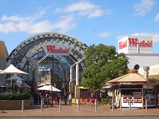
Liverpool is a suburb of Greater Western Sydney, in the state of New South Wales, Australia. It is located 27 kilometres (17 mi) south-west of the Sydney CBD. Liverpool is the administrative seat of the local government area of the City of Liverpool and is situated in the Cumberland Plain.

Macquarie Fields is a suburb of Sydney, in the state of New South Wales, Australia. Macquarie Fields is located 38 kilometres south-west of the Sydney central business district, in the local government area of the City of Campbelltown and is part of the Macarthur region.
Austral is a suburb of Sydney, in the state of New South Wales, Australia. It is 42 kilometres south-west of the Sydney central business district, in the local government area of the City of Liverpool.

Merrylands is a suburb in Greater Western Sydney, Australia. Merrylands is located 25 kilometres west of the Sydney central business district and is in the local government area of the Cumberland City Council.

West Hoxton is a suburb of Sydney, in the state of New South Wales, Australia. West Hoxton is located 40 kilometres west of the Sydney central business district, in the local government area of the City of Liverpool and is part of the Greater Western Sydney region.

Smithfield is a suburb of Sydney, in the state of New South Wales, Australia. Smithfield is located 25 kilometres (16 mi) west of the Sydney central business district, in the local government areas of the City of Fairfield and Cumberland Council. Located in the Greater Western Sydney region, the suburb is one of the largest in Fairfield City by area.
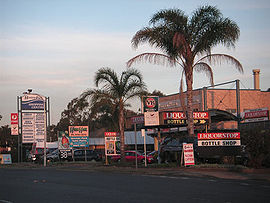
Rossmore is a suburb of Sydney, in the state of New South Wales, Australia.

Prestons is a suburb of Sydney, in the state of New South Wales, Australia 37 kilometres south-west of the Sydney central business district, in the local government area of the City of Liverpool.
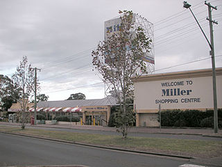
Miller is a suburb of Sydney in the state of New South Wales, Australia 38 kilometres south-west of the Sydney central business district, in the local government area of the City of Liverpool. Neighbouring suburbs include Hoxton Park, Hinchinbrook, Cartwright, Prestons, Sadleir and Busby.
Lurnea is a suburb of Sydney, in the state of New South Wales, Australia. It is 35 kilometres south-west of the Sydney central business district, in the local government area of the City of Liverpool.
Bringelly is a suburb of Sydney, in the state of New South Wales, Australia. It is located on the Northern Road between Penrith and Camden. It has a public school. Bringelly is also the name of a local hill.

Cartwright is a suburb in south-western Sydney, in the state of New South Wales, Australia 38 kilometres south-west of the Sydney central business district, in the local government area of the City of Liverpool.

Cecil Hills is a suburb of Sydney, in the state of New South Wales, Australia. Cecil Hills is located 38 kilometres west of the Sydney central business district, in the local government area of the City of Liverpool and is part of the Greater Western Sydney region.

Hinchinbrook is a suburb of Sydney, in the state of New South Wales, Australia. Hinchinbrook is located 39 kilometres south-west of the Sydney central business district, in the local government area of the City of Liverpool. It is bordered by Hoxton Park and Green Valley.

Horningsea Park is a suburb of Sydney, in the state of New South Wales, Australia. Horningsea Park is located 39 kilometres south-west of the Sydney central business district, in the local government area of the City of Liverpool and is part of the Greater Western Sydney region.

Middleton Grange is a suburb of Sydney, in the state of New South Wales, Australia. Middleton Grange is located 40 kilometres west of the Sydney central business district, in the local government area of the City of Liverpool and is part of the Greater Western Sydney region.
Cabramatta Creek, an urban watercourse of the Georges River catchment, is located in the south-western region of Sydney, in New South Wales, Australia.
Carnes Hill is a suburb of Sydney, in the state of New South Wales, Australia. Carnes Hill is located 38 kilometres southwest of the Sydney central business district, in the local government area of the City of Liverpool and is part of the Greater Western Sydney region.
Len Waters Estate is a small industrial estate of Sydney, in the state of New South Wales, Australia. Len Waters Estate is located 39 kilometres south-west of the Sydney central business district, in the local government area of the City of Liverpool.
Elizabeth Hills is a suburb of western Sydney, in the state of New South Wales, Australia. It is located 39 kilometres south-west of the Sydney central business district, in the local government area of Liverpool. Elizabeth Hills was gazetted as a suburb on 18 December 2009. Like the neighbouring suburb of Len Waters Estate, Elizabeth Hills had previously been part of the suburb of Cecil Hills.