
Campbelltown is a suburb located on the outskirts of the metropolitan area of Sydney, New South Wales, Australia. It is located in Greater Western Sydney 53 kilometres (33 mi) south-west of the Sydney central business district by road. Campbelltown is the administrative seat of the local government area of the City of Campbelltown. It is also acknowledged on the register of the Geographical Names Board of New South Wales as one of only four cities within the Sydney metropolitan area.

Greater Western Sydney (GWS) is a large region of the metropolitan area of Greater Sydney, New South Wales (NSW), Australia that generally embraces the north-west, south-west, central-west, far western and the Blue Mountains sub-regions within Sydney's metropolitan area and encompasses 13 local government areas: Blacktown, Blue Mountains, Camden, Campbelltown, Canterbury-Bankstown, Cumberland, Fairfield, Hawkesbury, Hills Shire, Liverpool, Parramatta, Penrith and Wollondilly. It includes Western Sydney, which has a number of different definitions, although the one consistently used is the region composed of ten local government authorities, most of which are members of the Western Sydney Regional Organisation of Councils (WSROC). Penrith, Hills Shire & Canterbury-Bankstown are not WSROC members. The NSW Government's Office of Western Sydney calls the region "Greater Western Sydney".

The Division of Macarthur is an Australian electoral division in the state of New South Wales.

Warnervale is a town in the Central Coast Council local government area in the Central Coast region in the state of New South Wales, Australia. It lies approximately 101 km north of Sydney, located west of Tuggerah Lake, a large shallow coastal lake, and just north of Wyong.

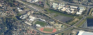
Ingleburn railway station is located on the Main South line, serving the Sydney suburb of Ingleburn. It is served by Sydney Trains T8 Airport & South line services.

Oakhurst is a suburb of Sydney, in the state of New South Wales, Australia 46 kilometres west of the Sydney central business district, in the local government area of the City of Blacktown. It is part of the Greater Western Sydney region.

Macquarie Park is a suburb in the Northern Sydney region of Sydney, New South Wales, Australia. Macquarie Park is located 13 kilometres north-west of the Sydney central business district in the local government area of the City of Ryde.
Marsden Park is a suburb of Sydney, in the state of New South Wales, Australia. Marsden Park is located 49 kilometres (30 mi) north-west of the Sydney central business district, in the Blacktown local government area and is part of the Greater Western Sydney region.

The City of Campbelltown is a local government area in the Macarthur region of south-western Sydney, in New South Wales, Australia. The area is located about 55 kilometres (34 mi) south west of the Sydney central business district and comprises 312 square kilometres (120 sq mi).

Sydenham is a suburb in the Inner West of Sydney, in the state of New South Wales, Australia. Sydenham is located 8 kilometres south of Sydney central business district and is part of the local government area of Inner West Council. Sydenham is surrounded by the suburbs of Marrickville, St Peters and Tempe.
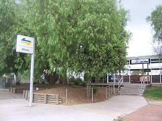
Minto is a suburb of Sydney, in the state of New South Wales, Australia. Minto is located 50 kilometres south-west of the Sydney central business district, in the local government area of the City of Campbelltown and is part of the Macarthur region.
Ingleburn is a suburb of Sydney, in the state of New South Wales, Australia 45 kilometres south-west of the Sydney central business district, in the local government area of City of Campbelltown. It is part of the Macarthur region. Ingleburn is located approximately halfway between the two commercial centres of Liverpool and Campbelltown.
Leumeah is a suburb of Sydney, in the state of New South Wales, Australia 52 kilometres south-west of the Sydney central business district, in the local government area of the City of Campbelltown. It is north of the suburb of Campbelltown and is part of the Macarthur region.

Denham Court is a suburb of Sydney, in the state of New South Wales, Australia located 44 kilometres (27 mi) south-west of the Sydney central business district, in the local government areas of the City of Campbelltown, City of Liverpool and City of Camden. It is part of the Macarthur region.

Englorie Park is a suburb of Sydney, in the state of New South Wales, Australia. Englorie Park is located 55 kilometres south-west of the Sydney central business district, in the local government area of the City of Campbelltown and is part of the Macarthur region.
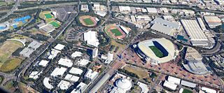
Sydney Olympic Park is a suburb of Greater Western Sydney, located 13 kilometres west of the Sydney central business district, in the local government area of the City of Parramatta Council. It is commonly known as Olympic Park but officially named Sydney Olympic Park. The area was part of the suburb of Lidcombe and known as "North Lidcombe", but between 1989 and 2009 was named "Homebush Bay". The names "Homebush Bay" and, sometimes, "Homebush" are still used colloquially as a metonym for Stadium Australia as well as the Olympic Park precinct as a whole, but Homebush is an older, separate suburb to the southeast, in the Municipality of Strathfield.

Macquarie Fields is an electoral district of the Legislative Assembly in the Australian state of New South Wales, located in the outer south-western suburbs of Sydney. It is currently represented by Anoulack Chanthivong of the Labor Party.
Bardia is a suburb of Sydney, in the state of New South Wales, Australia, located 38 kilometres south-west of the Sydney central business district, between Campbelltown and Liverpool. It is part of the Macarthur region.
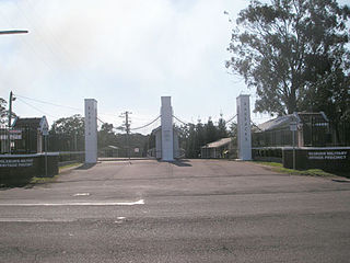
Ingleburn Military Heritage Precinct and Mont St Quentin Oval is a heritage-listed conservation area at the site of the former Ingleburn Army Camp at Campbelltown Road, Ingleburn, Sydney, New South Wales, Australia. The heritage buildings on site were built from 1939. It was added to the New South Wales State Heritage Register on 15 March 2013.
Landcom is a New South Wales Government–owned statutory corporation that is responsible for the delivery of new housing to meet the needs of people in the Australian state of NSW.

