Huntington Bay, New York

Last updated

Huntington Bay, New York
Incorporated Village of Huntington Bay
Huntington-bay-ny-map.gif
U.S. Census map of Huntington Bay
Location map Long Island.png
Red pog.svg
Huntington Bay, New York
Location on Long Island
USA New York location map.svg
Red pog.svg
Huntington Bay, New York
Location within the state of New York
Usa edcp location map.svg
Red pog.svg
Huntington Bay, New York
Location within the contiguous United States
Coordinates: 40°54′6″N73°24′47″W / 40.90167°N 73.41306°W / 40.90167; -73.41306
Country Flag of the United States.svg  United States
State Flag of New York.svg  New York
County Suffolk
Town Huntington
Incorporated 1924
Government
   Mayor Herbert Morrow
Area
[1]
  Total1.90 sq mi (4.91 km2)
  Land1.00 sq mi (2.59 km2)
  Water0.90 sq mi (2.32 km2)
Elevation
16 ft (5 m)
Population
 (2020)
  Total1,446
  Density1,448.90/sq mi (559.30/km2)
Time zone UTC-5 (Eastern (EST))
  Summer (DST) UTC-4 (EDT)
ZIP code
11743
Area code(s) 631, 934
FIPS code 36-37022
GNIS feature ID0953490
Website www.huntingtonbay.org

Huntington Bay is a village in the Town of Huntington in Suffolk County, on East Neck on the North Shore of Long Island, in New York, United States. The population was 1,425 at the time of the 2010 census. [2] It is considered part of the greater Huntington area, which is anchored by Huntington.

Contents

History

Huntington Bay incorporated as a village in 1924. [3]

In 2000, the Village and the Huntington Yacht Club were involved in a legal dispute over proposals for added floating piers made by the latter party. [4]

Geography

According to the United States Census Bureau, the village has a total area of 1.9 square miles (4.9 km2), of which 1.0 square mile (2.6 km2) is land and 0.89 square miles (2.3 km2), or 47.32%, is water. [2] [5]

Demographics

Historical population
CensusPop.Note
1930 357
1940 40814.3%
1950 58543.4%
1960 1,267116.6%
1970 1,78941.2%
1980 1,783−0.3%
1990 1,521−14.7%
2000 1,496−1.6%
2010 1,425−4.7%
2020 1,4461.5%
U.S. Decennial Census [6]

As of the census [7] of 2000, there were 1,496 people, 539 households, and 454 families residing in the village. The population density was 1,456.4 inhabitants per square mile (562.3/km2). There were 560 housing units at an average density of 545.2 per square mile (210.5/km2). The racial makeup of the village was 98.46% White, 0.07% African American, 0.94% Asian, and 0.53% from two or more races. Hispanic or Latino of any race were 1.27% of the population.

There were 539 households, out of which 33.4% had children under the age of 18 living with them, 75.9% were married couples living together, 5.4% had a female householder with no husband present, and 15.6% were non-families. 12.6% of all households were made up of individuals, and 8.2% had someone living alone who was 65 years of age or older. The average household size was 2.78 and the average family size was 3.02.

In the village, the population was spread out, with 23.7% under the age of 18, 5.6% from 18 to 24, 18.9% from 25 to 44, 35.4% from 45 to 64, and 16.4% who were 65 years of age or older. The median age was 46 years. For every 100 females, there were 98.4 males. For every 100 females age 18 and over, there were 95.4 males.

The median income for a household in the village was $151,816, and the median income for a family was $163,820. Males had a median income of $100,000 versus $55,893 for females. The per capita income for the village was $71,798. None of the families and 2.0% of the population were living below the poverty line, including no under eighteens and 2.9% of those over 64.

Government

As of September 2022, the Mayor of Huntington Bay is Herbert Morrow and the Village Trustees are Barbara Beuerlein, Mark Dara, Jay Meyer, and Don Rave. [8]

Village police

The Village of Huntington Bay has its own police department, which provides the entirety of the village with police protection. [9] The 2009-2010 police budget was $1,365,445.00. [10] [11]

Related Research Articles

<span class="mw-page-title-main">Huntington, Arkansas</span> City in Sebastian County, Arkansas, United States

Huntington is a city in Sebastian County, Arkansas, United States. It is part of the Fort Smith, Arkansas-Oklahoma Metropolitan Statistical Area. As of the 2010 Census the population was 635.

<span class="mw-page-title-main">Hampton Township, Michigan</span> Charter township in Michigan, United States

Hampton Charter Township is a charter township of Bay County in the U.S. state of Michigan. The township's population was 9,695 as of the 2020 Census and is included in the Bay City Metropolitan Statistical Area.

<span class="mw-page-title-main">Minnetonka Beach, Minnesota</span> City in Minnesota, United States

Minnetonka Beach is a community in Hennepin County, Minnesota, United States. The population was 539 at the 2010 census.

<span class="mw-page-title-main">Olympian Village, Missouri</span> City in Missouri, United States

Olympian Village is a city in Jefferson County, Missouri, United States. The population was 774 at the 2010 census. The city was named in honor of Greek myth and culture. Some street names include Parthenon Drive, Kronos Drive, Hercules Place, Plato Place, and Pheidippides Place.

<span class="mw-page-title-main">Calverton Park, Missouri</span> City in Missouri, United States

Calverton Park is a city in St. Louis County, Missouri, United States. The population was 1,293 at the 2010 census. The Village of Calverton Park incorporated as the City of Calverton Park in 2014.

<span class="mw-page-title-main">Sloan, New York</span> Village in New York, United States

Sloan is a village in Erie County, New York, United States. The population was 3,661 at the 2010 census. It is part of the Buffalo–Niagara Falls Metropolitan Statistical Area and is in the town of Cheektowaga.

<span class="mw-page-title-main">Mill Neck, New York</span> Village in New York, United States

Mill Neck is a village in the Town of Oyster Bay in Nassau County, on the North Shore of Long Island, in New York, United States. The population was 997 at the 2010 census.

<span class="mw-page-title-main">Asharoken, New York</span> Village in New York, United States

Asharoken is a village in the Town of Huntington in Suffolk County, on the North Shore of Long Island in New York. The population was 654 at the 2010 census.

<span class="mw-page-title-main">Lloyd Harbor, New York</span> Village in New York, United States

Lloyd Harbor is a village in the Town of Huntington in Suffolk County, on the North Shore of Long Island, in New York, United States. As of the 2010 census, the village's population was 3,660.

<span class="mw-page-title-main">Sodus Point, New York</span> Village in New York, United States

Sodus Point is a village in Wayne County, New York, United States. The population was 900 at the 2010 census. However, the last official US Census in 2020 recorded the population at 822. The name is derived from a nearby body of water, Sodus Bay. It is considered to be within the larger Rochester metropolitan area.

<span class="mw-page-title-main">Aberdeen, Ohio</span> Village in Ohio, United States

Aberdeen is a village in Huntington Township, Brown County, Ohio, United States, along the Ohio River 50 miles (80 km) southeast of Cincinnati. The population was 1,515 at the 2020 census.
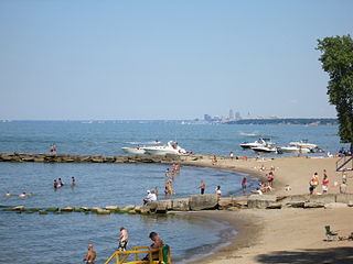
<span class="mw-page-title-main">Bay Village, Ohio</span> City in Ohio, United States

Bay Village is a city in western Cuyahoga County, Ohio, United States. Located along the southern shore of Lake Erie, the city is a western suburb of Cleveland and a part of the Cleveland metropolitan area. The population was 16,163 at the 2020 census.

<span class="mw-page-title-main">Woodmere, Ohio</span> Village in Ohio, United States

Woodmere is a village in Cuyahoga County, Ohio, United States. As of the 2020 census, Woodmere had a population of 641 residents. An eastern suburb of Cleveland, it is part of the Cleveland metropolitan area.
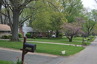
<span class="mw-page-title-main">Minerva Park, Ohio</span> Village in Ohio, United States

Minerva Park is a village in Franklin County, Ohio, United States. The population was 2,009 at the 2020 census.
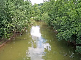
<span class="mw-page-title-main">Chesapeake, Ohio</span> Village in Ohio, United States

Chesapeake is a village in Lawrence County, Ohio, United States. The population was 691 as of the 2020 census. It lies across the Ohio River from Huntington, West Virginia, at the mouth of Symmes Creek.
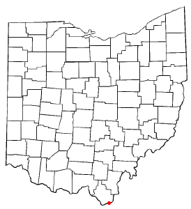
<span class="mw-page-title-main">Proctorville, Ohio</span> Village in Ohio, United States

Proctorville is a village in Lawrence County, Ohio, United States, along the Ohio River. The population was 523 at the 2020 census. The East End Bridge connects Proctorville to Huntington, West Virginia across the Ohio River.

<span class="mw-page-title-main">Belmore, Ohio</span> Village in Ohio, United States

Belmore is a village in Putnam County, Ohio, United States. The population was 65 at the 2020 census.
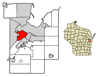
<span class="mw-page-title-main">Ashwaubenon, Wisconsin</span> Village in Wisconsin, United States

Ashwaubenon is a village in Brown County in the U.S. state of Wisconsin. The population was 16,991 at the 2020 census. A suburb of Green Bay, Ashwaubenon is part of the Green Bay Metropolitan Statistical Area and carries a Green Bay mailing address. Part of the Oneida Nation of Wisconsin is in Ashwaubenon.

<span class="mw-page-title-main">Tennyson, Wisconsin</span> Village in Wisconsin, United States

Tennyson is a village in Grant County, Wisconsin, United States, originally called Dutch Hollow. The population was 355 at the 2010 census.

<span class="mw-page-title-main">Huntington (CDP), New York</span> Place in New York, United States

Huntington is a hamlet and census-designated place (CDP) located within the Town of Huntington in Suffolk County, on the North Shore of Long Island, in New York, United States. The population was 18,406 at the 2010 census. The hamlet serves as the Town Seat of the Town of Huntington.

References

  1. "ArcGIS REST Services Directory". United States Census Bureau. Retrieved September 20, 2022.
  2. 1 2 "Geographic Identifiers: 2010 Demographic Profile Data (G001): Huntington Bay village, New York". U.S. Census Bureau, American Factfinder. Archived from the original on February 12, 2020. Retrieved December 20, 2012.
  3. "About Huntington Bay Village". Incorporated Village of Huntington Bay, NY. Retrieved September 8, 2022.
  4. Ain, Stewart (October 1, 2000). "A Ruling That's Sure to Roil the Waters". The New York Times. ISSN   0362-4331 . Retrieved September 8, 2022.
  5. "US Gazetteer files: 2010, 2000, and 1990". United States Census Bureau. February 12, 2011. Retrieved April 23, 2011.
  6. "Census of Population and Housing". Census.gov. Retrieved June 4, 2015.
  7. "U.S. Census website". United States Census Bureau . Retrieved January 31, 2008.
  8. "Huntington Bay Elected Officials and Staff". Incorporated Village of Huntington Bay, NY. Retrieved September 8, 2022.
  9. "Village Police". Village of Huntington Bay. Archived from the original on May 29, 2009. Retrieved April 5, 2009.
  10. "Village of Huntington Bay: Budget". Archived from the original on June 7, 2009. Retrieved April 4, 2009.
  11. "openbook". openbookny. Retrieved September 12, 2009.