Related Research Articles

Silicon Valley is a region in the southern part of the San Francisco Bay Area in Northern California that serves as a global center for high technology, innovation, venture capital, and social media. It corresponds roughly to the geographical Santa Clara Valley. San Jose is Silicon Valley's largest city, the third-largest in California, and the tenth-largest in the United States; other major Silicon Valley cities include Sunnyvale, Santa Clara, Redwood City, Mountain View, Palo Alto, Menlo Park, and Cupertino. The San Jose Metropolitan Area has the third-highest GDP per capita in the world, according to the Brookings Institution.

Southern California is a geographic and cultural region that generally comprises the southernmost counties of California, and is the second most populous urban agglomeration in the United States. The region contains ten counties: Imperial, Kern, Los Angeles, Orange, Riverside, San Bernardino, San Diego, Santa Barbara, San Luis Obispo and Ventura counties. The Colorado Desert and the Colorado River are located on southern California's eastern border with Arizona, and the Mojave Desert is located north on California's Nevada border. Southern California's southern border is part of the Mexico–United States border.

Imperial County is a county in the U.S. state of California. As of the 2010 census, the population was 174,528. The county seat is El Centro. Established in 1907 from a division of San Diego County, it was the last county to be formed in California.
Brawley is a city in the Imperial Valley and within Imperial County, southern California, United States.
El Centro is a city in and county seat of Imperial County, California, United States. El Centro is the largest city in the Imperial Valley, the east anchor of the Southern California Border Region, and the core urban area and principal city of the El Centro metropolitan area which encompasses all of Imperial County. El Centro is also the largest American city to lie entirely below sea level. The city, located in southeastern California, is 113 miles (182 km) from San Diego and less than 20 miles (32 km) from the Mexican city of Mexicali.

Heber is a census-designated place (CDP) in Imperial County, California. Heber is located 4.5 miles (7 km) north-northwest of Calexico. The population was 4,275 at the 2010 census, up from 2,566 in 2000.

Imperial is a city in Imperial County, California. Imperial is located 4 miles (6.4 km) north of El Centro.
Salton City is a census-designated place (CDP) in Imperial County, California. The population was 3,763 at the 2010 census, up from 978 in 2000. It is the largest Imperial County development on the Salton coast. It is part of the El Centro, California Metropolitan Statistical Area. Although planned and developed as a large resort community with an extensive road, water, sewer and power grid capable of supporting 40,000 residents on 12,000 residential lots, demand for property in Salton City fell drastically short of the planners' expectations. As of the 2010 census, 81% of the surveyed lots in Salton City remain undeveloped, and 38% of the habitable residences in Salton City are unoccupied, giving it an eerie, mostly-abandoned appearance and leading some to call it a modern ghost town.

Blythe is a city in eastern Riverside County, California, United States. It is in the Palo Verde Valley of the Lower Colorado River Valley region, an agricultural area and part of the Colorado Desert along the Colorado River, approximately 224 miles (360 km) east of Los Angeles and 150 miles (240 km) west of Phoenix. Blythe was named after Thomas Henry Blythe, a San Francisco financier, who established primary water rights to the Colorado River in the region in 1877. The city was incorporated on July 21, 1916. The population was 20,817 at the 2010 census.

Imperial Beach is a residential beach city in San Diego County, California, with a population of 26,324 at the 2010 census. The city is the southernmost city in California and the West Coast of the United States. It is in the South Bay area of San Diego County, 14.1 miles (22.7 km) south of downtown San Diego and 5 miles (8 km) northwest of downtown Tijuana, Mexico.

The Imperial Valley lies in the California counties of Imperial and Riverside in southeastern Southern California with an urban area centered on the city of El Centro. The Valley is bordered by the Colorado River to the east and, in part, the Salton Sea to the west. Farther west lies the San Diego and Imperial County border. To the north is the Coachella Valley region of Riverside County, which together with Imperial Valley form the Salton Trough, or the Cahuilla Basin, also the county line of Imperial and Riverside counties, and to the south the international boundary with the U.S. state of California and Baja California.
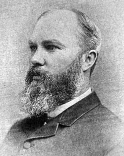
George Chaffey was a Canadian–born engineer who with his brother William developed large parts of Southern California, including what became the community of Etiwanda and cities of Ontario, and Upland. They undertook similar developments in Australia which became the city of Mildura, and the town of Renmark and Paringa.

The economy of California is the largest in the United States, boasting a $3.2 trillion gross state product as of 2019. If California were a sovereign nation (2019), it would rank as the world's fifth largest economy, ahead of the UK, France, and behind Germany, Japan, China and United States. Additionally, California's Silicon Valley is home to some of the world's most valuable technology companies, including Apple, Alphabet Inc., and Facebook. In total, over 10% of Fortune 1000 companies were based in California in 2018, the most of any state.

The Alamo River flows west and north from the Mexicali Valley across the Imperial Valley (California). The 52-mile-long (84 km) river drains into the Salton Sea.
The California Development Company was formed in 1896 as a replacement for the defunct Colorado River Irrigation Company, which had been started a few years earlier for the purpose of planning an irrigation system for the lower Colorado Desert in California. The rich, silty soil of the area was found to be suitable for agriculture, but wells tapping groundwater brought up an inadequate supply of water for such a hot, arid region. The California Development Company took over the project of diverting Colorado River water into the Coachella and Imperial Valleys in the Salton Sink, a dry lake bed which today contains the Salton Sea, hoping to turn the desert green with agricultural fields. The first canals were being constructed by 1900 under the guidance of chief engineer George Chaffey.

The city of Simi Valley, in the eponymous valley, is in the southeast corner of Ventura County, California, United States, 40 miles (64 km) from downtown Los Angeles, making it part of the Greater Los Angeles Area. The city sits next to Thousand Oaks, Moorpark, and Chatsworth. The city's 2019 population has been estimated at 125,613, up from 124,243 in 2010. The city of Simi Valley is surrounded by the Santa Susana Mountain range and the Simi Hills, west of the San Fernando Valley, and northeast of the Conejo Valley. It grew as a commuter bedroom community for the cities in the Los Angeles area and the San Fernando Valley when a freeway was built over the Santa Susana Pass.
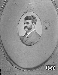
Oliver M. Wozencraft was a prominent early American settler in California. He had substantial involvement in negotiating treaties between California Native American Indian tribes and the United States of America. Later, Wozencraft promoted a plan to provide irrigation to the Imperial Valley.

The Alamo Canal was a 14 mi (23 km) long waterway that connected the Colorado River to the head of the Alamo River. The canal was constructed to provide irrigation to the Imperial Valley. A small portion of the canal was located in the United States but the majority of the canal was located in Mexico. The Alamo Canal is also known as the Imperial Canal.
The Yuma Project is a U.S. Bureau of Reclamation project built to irrigate over 68,000 acres (280 km2) of land in Yuma County, Arizona and parts of Imperial County, California. The project is designed to exploit year-round farming conditions and water from the Colorado River. It consists of the Laguna Diversion Dam, pumping plants, a power plant, a 53-mile (85 km) system of canals, 218 miles (351 km) of lateral canals, levees and drains. The project began in 1903 and the majority of the work was completed by 1915. It was the first dam and reclamation project on the Colorado River and workers had to overcome many natural and logistical obstacles to build and maintain it. The Laguna Diversion Dam was replaced by the Imperial Dam as the Project's water source between 1941 and 1948. Today, it serves 275 farms and over 94,000 people.

Temescal Valley is a census-designated place in Riverside County, California. Temescal Valley sits at an elevation of 1,138 feet (347 m). The 2010 United States census reported Temescal Valley's population was 22,535.
References
- ↑ Kevin Starr (1991). Material Dreams: Southern California Through the 1920s. Oxford University Press, USA. p. 26. ISBN 978-0-19-507260-0 . Retrieved 25 July 2010.
- ↑ Harry Thomas Cory; William Phipps Blake (1915). The Imperial Valley and the Salton Sink. San Francisco: John J. Newbegin. p. 1258 . Retrieved 25 July 2010.
California Development Company.
Colorado River system | |||||||||
|---|---|---|---|---|---|---|---|---|---|
| Jurisdictions |
|     | |||||||
| Canyons |
| ||||||||
| Natural features |
| ||||||||
| Tributaries | |||||||||
| Engineering |
| ||||||||
| Designated areas | |||||||||
| Related topics | |||||||||
