Inglis, Oregon | |
|---|---|
 Inglis  Inglis | |
| Coordinates: 46°07′34″N123°07′30″W / 46.126°N 123.125°W | |
| Country | United States |
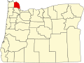
| State | Oregon |
| County | Columbia |
| Elevation | 16 ft (5 m) |
| Time zone | UTC-8 (Pacific (PST)) |
| • Summer (DST) | UTC-7 (PDT) |
| ZIP code | 97016 |
| Area codes | 503 and 971 |
Inglis is an unincorporated community in Columbia County, Oregon, United States. [1] Inglis post office was established on September 30, 1902, and was named after the first postmaster, John E. Inglis. [2] The post office closed in 1910, then reopened in 1914, finally closing in 1918. [2] The railroad station at this locale was named Inglis Station. [2]