Inishkeel

Last updated

Inishkeel
Native name:
Inis Caoil
Building at SE end of Inishkeel Island - geograph.org.uk - 1161356.jpg
Building at the south east end of Inishkeel
Island of Ireland location map.svg
Red pog.svg
Inishkeel
Geography
Location Atlantic Ocean
Coordinates 54°50′51″N8°27′22″W / 54.84750°N 8.45611°W / 54.84750; -8.45611 Coordinates: 54°50′51″N8°27′22″W / 54.84750°N 8.45611°W / 54.84750; -8.45611
Area0.391 km2 (0.151 sq mi) [1]
Administration
Province Ulster
County Donegal
Demographics
Population0 (2011 [2] )

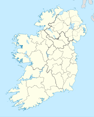
Inishkeel (Irish : Inis Caoil) [3] is a small tidal island and a townland [1] off the coast of County Donegal, Ireland. The closest village on the mainland is Narin.

Contents

Geography

The island is located in Gweebarra Bay around 250 m from the coast. A sandy tidal bank connects, with low tide, the island with the mainland. [3]

History

St Conall Cael's Bell St Conall's Bell.jpg
St Conall Cael's Bell

During the 6th century A.D. a small community of monks settled on the island. Their religious leader was Saint Conall Cael, from whom the island later derived its name. During the following centuries Inishkeel was a traditional destination of pilgrimages. Remains of the church and the connected buildings as well as some carved stones can be seen on the island. [4] For its artistical and archeological importance the island was declared National Monument (code: DG064-003). [5] A bell known as St Conall Cael's Bell remained on Inishkeel up to the 19th century and was then acquired by the British Museum. [6]

Demography

A small community used to live on Inishkeel in the past, and in year 1841 23 inhabitants were registered on the island. [7] The island was later abandoned and in 2011 census had no inhabitants. [2]

Related Research Articles

Inishowen Peninsula in Ireland

Inishowen is a peninsula in the north of County Donegal in Ireland. Inishowen is the largest peninsula on the island of Ireland.

Enniscrone Town in Connacht, Ireland

Enniscrone – also spelt Inniscrone and officially named Inishcrone – is a small seaside town in County Sligo, Ireland. Its sandy beach, tourist campsite, and golf course all attract visitors. As of the 2016 census, the town had a population of 1,156 people.

Arranmore Island in Ulster, Ireland

Árainn Mhór is an island off the west coast of County Donegal, Ireland. Arranmore is the largest inhabited island of County Donegal, with a population of 469 in 2016, down from 514 in 2011, 528 in 2006, 543 in 2002, and over 600 in 1996. The island is part of the Donegal Gaeltacht, with most of the inhabitants speaking Ulster Irish.

Great Island

Great Island is an island in Cork Harbour, at the mouth of the River Lee and close to the city of Cork, Ireland. The largest town on the island is Cobh. The island's economic and social history has historically been linked to the naval, ship-building, and shipping activities in the town's environs.

Tory Island Island in Ulster, Ireland

Tory Island, or simply Tory, is an island 14.5 kilometres off the north-west coast of County Donegal, Ireland, and is the most remote inhabited island of Ireland. It is also known in Irish as Oileán Thoraí or, historically, Oileán Thúr Rí. The word Tory comes from the Middle Irish word Tóraidhe, which means “bandit.”

Moville Town in Ulster, Republic of Ireland

Moville is a coastal town located on the Inishowen Peninsula of County Donegal, Ireland, close to the northern tip of the island of Ireland. It is the first coastal town of the Wild Atlantic Way when starting on the northern end.

Ballintra Village in Ulster, Ireland

Ballintra is a village in the parish of Drumholm in the south of County Donegal, Ireland, just off the N15 between Donegal town and Ballyshannon. Ballintra lies on the northern bank of the Blackwater river.. The river rises in the hills that lie inland from the town, and flows through a number of small lakes before spilling over a small waterfall in a gorge behind the village.

Inishark

Inishark or Inishshark, sometimes called Shark Island, is a small island neighbouring the larger Inishbofin in County Galway, Ireland.

Rosguill

Rosguill is a peninsula situated in north-north-west County Donegal, Ireland. Lying between the peninsulae of Fanad to the east and Horn Head to the west, Rosguill is a dichotomy of heathland and ocean. With the great Sheephaven Bay with its mellow waters and pure-white strands on the one hand, and the treacherous sand banks of Mulroy Bay on the other. Between, a mixture of bog, hill and pastureland, the ancient walls, remnants of cattle enclosures, and the various evidences of fortification are proof of the area's use since antiquity. The Parish of Rosguill is an alternative name for the Parish of Mevagh, which covers the peninsula and an equally sized hinterland.

Eochaid mac Colla, better known as Saint Dallán or Dallán Forgaill, was an early Christian Irish poet and saint known as the writer of the "Amra Coluim Chille" and, traditionally, "Rop Tú Mo Baile".

Banagh Barony in Ulster, Republic of Ireland

Banagh is a historic barony in County Donegal in Ireland. Patrick Weston Joyce said the name Banagh came from Enna Bogaine, son of Conall Gulban, son of Niall of the Nine Hostages. It was created along with Boylagh when the former barony of Boylagh and Banagh was split in 1791 by an Act of the Parliament of Ireland.

Boylagh Barony in Ulster, Republic of Ireland

Boylagh is a historic barony in County Donegal in Ireland. Patrick Weston Joyce said the name Boylagh comes from the territory of the O'Boyles. It was created along with Banagh when the former barony of Boylagh and Banagh was split in 1791 by an Act of the Parliament of Ireland.

Clonallan

Clonallan is a civil parish in County Down, Northern Ireland. It is situated in the historic barony of Iveagh Upper, Upper Half. The parish has an area of 11,464 acres.

Inishsirrer

Inishsirrer is a small island and a townland off the coast of Gweedore, County Donegal, Ireland.

Eighter Island

Eighter Island is a small island and a townland off the coast of County Donegal, Ireland. The closest town on the mainland is Burtonport.

Inishcoo

Inishcoo is a small island and a townland off the coast of County Donegal, Ireland. The closest town on the mainland is Burtonport.

Isle of Doagh Island in Ireland

The Isle of Doagh is a small peninsula in the north of Inishowen on the north coast of County Donegal in Ulster, Ireland. It once was an island. Over time, the channel between Doagh and the mainland silted up and it became joined to the mainland. Nevertheless, the area continued to be referred as the Isle of Doagh or Doagh Island. The area comprises five townlands; Ballymacmoriarty, Carrickabraghy, Carrowreagh, Fegart and Lagacurry. Doagh Island is very near the village of Ballyliffin.

Inishturk South

Inishturk is a small island and a townland of County Galway, in Ireland. The island is also referred as Inishturk South in order to tell it apart from the Inishturk island located in County Mayo.

Inishfree

Inishfree refers to two small islands off the coast of County Donegal in the north of Ireland. Inishfree Upper is the larger of the two at around 0.6 square miles (1.6 km2). It is often known simply as "Inishfree".

Tullygallan

Tullygallan is a townland in the civil parish of Drumhome, Roman Catholic parish of Drumholm, barony of Tirhugh, County Donegal, Ireland.

References

Church ruins and a carved stone on the island Church ruins, Inishkeel island. - geograph.org.uk - 135936.jpg
Church ruins and a carved stone on the island
  1. 1 2 "Inishkeel Townland, Co. Donegal". www.townlands.ie. Cóipcheart Townlands.ie. Retrieved 9 May 2016.
  2. 1 2 Population (Number) by Off Shore Island, Year and Sex Central Statistics Office
  3. 1 2 Liam Ronayne (2000). Donegal: South of the Gap. Dundurn. ISBN   9781900935159 . Retrieved 9 May 2016.
  4. "Inishkeel Monastic Site". www.megalithicireland.com. Retrieved 9 May 2016.
  5. National Monuments in State Care: Ownership & Guardianship (PDF). National Monuments Service / Seirbhís na Séadcomharthaí Náisiúnta. 2009. Retrieved 19 April 2021.
  6. Rowena Loverance (2007). Christian Art. Harvard University Press. ISBN   9780674024793 . Retrieved 9 May 2016.
  7. Commissioners 4th Rpt, p.15 Newport West E Division

See also

Commons-logo.svg Media related to Inishkeel at Wikimedia Commons