Dunfanaghy is a small town, former fishing port, and commercial centre on the north coast of County Donegal, Ireland. It lies on Donegal's North West coast, specifically the west side of Sheephaven Bay, on the N56 road, 30 km north-west of Letterkenny.

The Rosses is a traditional 'district' in the west of County Donegal in Ulster, the northern province in Ireland. The Rosses has a population of over 7,000 centred on the town of Dungloe, which acts as the educational, shopping and civic centre for the area. Defined by physical boundaries in the form of rivers, as well as history and language use, the area has a distinctive identity, separate from the rest of County Donegal. The extensive district lies between the parish and district of Gweedore to the north and the town of Glenties to the south. A large part of the Rosses is in the Gaeltacht, which means that Irish is the spoken language. The Rosses, Cloughaneely and Gweedore, known locally as "the three parishes", with 16,000 Irish speakers, together form a social and cultural region different from the rest of the county, with Gweedore serving as the main centre for socialising and industry. Gaeltacht an Láir is another Irish-speaking area.

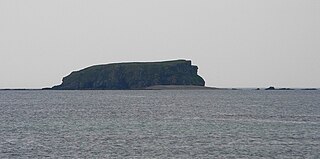
Tory Island, or simply Tory, is an island 14.5 kilometres off the north-west coast of County Donegal, Ireland, and is the most remote inhabited island of Ireland. The name means "place of steep rocky heights".

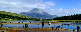
Gweedore is a Gaeltacht (Irish-speaking) district and parish located on the Atlantic coast of County Donegal in the north-west of Ireland. Gweedore stretches some 26 kilometres (16 mi) from Glasserchoo and Bloody Foreland in the north to Crolly in the south and around 14 kilometres (9 mi) from Dunlewey in the east to Magheraclogher and Magheralosk in the west, and is sometimes described as one of Europe's most densely populated rural areas. It is the largest Irish-speaking parish in Ireland with a population of around 4,065, and is also the home of the northwest regional studios of the Irish-language radio service RTÉ Raidió na Gaeltachta, as well as an external campus of the University of Galway. Gweedore includes the settlements of Brinlack, Bunbeg, Derrybeg, Crolly and Dunlewey, and sits in the shade of County Donegal's highest peak, Errigal.

Inishbofin, also Inishbofinne, is an island and townland off the coast of Machaire Uí Rabhartaigh (Magheraroarty), County Donegal, Ireland.

An Fál Carrach, sometimes called Na Crois Bhealaí is a small Gaeltacht town and townland in north-west County Donegal, Ireland. The settlement is in the old parish of Cloughaneely.

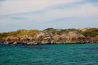
Gola is a small island off the coast of Gweedore, County Donegal, Ireland. It was unpopulated as late as 1996 but more recently people have started to return. A ferry service operates during the summer holiday season and on request for the remainder of the year.

An Bun Beag, meaning "the small river mouth", is a small Gaeltacht village and townland in County Donegal, Ireland. It is officially the smallest townland in Gaoth Dobhair (Gweedore), but today the name Bunbeg is used to describe a large region of the parish. It is situated between Derrybeg and the townland of Dore and is home to many of Gweedore's amenities and businesses. The Clady River flows into the Crolly River beside Bunbeg Quay, on the south-western outskirts of Bunbeg.
Glashedy Island is an uninhabited island approximately 1 mile (2 km) off Pollan strand, 2 miles (3 km) west of Trawbreaga Bay, and about 4 miles (6 km) south of Malin Head, Donegal, Ireland. Glashedy Island has an area of 22,548 m2 which is equivalent to 2.25 hectares. At its highest point, it is 119 ft high.
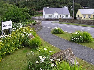
Croithlí or Croichshlí is a village in the Gaeltacht parishes and traditional districts of Gweedore and The Rosses in the west of County Donegal in Ulster, the northern province in Ireland. The two 'districts' are separated by the Crolly River. It has one convenience shop/restaurant and petrol station and one public house, Páidí Óg's. Crolly is located in two baronies: the Gweedore part of the village is in the Barony of Kilmacrenan, while The Rosses part of the village is in the Barony of Boylagh, the Crolly River being the boundary between the two baronies.

Inch Island is in Lough Swilly, a sea lough in County Donegal on the northern coast of Ireland. Inch is also the name of the civil parish covering the island.

Inishmeane is a small island and a townland off the coast of Gweedore, County Donegal, Ireland and was once home to a vibrant fishing community. The island has been unpopulated for decades but in recent years some people have started to return.
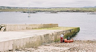
Eighter Island is a small island and a townland off the coast of County Donegal, Ireland. The closest town on the mainland is Burtonport.

Inishcoo is a small island and a townland off the coast of County Donegal, Ireland. The closest town on the mainland is Burtonport.

Inishkeel is a small tidal island and a townland off the coast of County Donegal, Ireland. The closest village on the mainland is Narin.

Inishturk is a small island and a townland of County Galway, in Ireland. The island is also referred as Inishturk South in order to tell it apart from the Inishturk island located in County Mayo.
Turbot is a small island and a townland of County Galway, in Ireland, also referred as Inishturbot and Talbot Island.

Inishfarnard meaning Island of the tall fern is a small island and a townland off Kilcatherine Point, in County Cork, Ireland.
Inishfree refers to two small islands off the coast of County Donegal in the north of Ireland. Inishfree Upper is the larger of the two at around 0.6 square miles (1.6 km2). It is often known simply as "Inishfree".
The Clady River is a small river in Gweedore, a district in the north-west of County Donegal in Ulster, the northern province in Ireland. The river flows entirely within the Civil Parish of Tullaghobegly.