Intermodal passenger transport

Last updated
A bus stop inside London (Heathrow) Airport, England. Bus.stop.arp.750pix.jpg
A bus stop inside London (Heathrow) Airport, England.
Bicycle rack on a bus of the Los Angeles Metro LA Metro 20 bus with bicycles.jpg
Bicycle rack on a bus of the Los Angeles Metro

Intermodal passenger transport, also called mixed-mode commuting, involves using two or more modes of transportation in a journey. Mixed-mode commuting is often used to combine the strengths (and offset the weaknesses) of various transportation options. A major goal of modern intermodal passenger transport is to reduce dependence on the automobile as the major mode of ground transportation and increase use of public transport. To assist the traveller, various intermodal journey planners such as Rome2rio and Google Transit have been devised to help travellers plan and schedule their journey.

Contents

Mixed-mode commuting often centers on one type of rapid transit, such as regional rail, to which low-speed options (i.e. bus, tram, or bicycle) are appended at the beginning or end of the journey. [1] Trains offer quick transit from a suburb into an urban area, where passengers can choose a way to complete the trip. Most transportation modes have always been used intermodally; for example, people have used road or urban railway to an airport or inter-regional railway station.

History

Woodside Ferry Terminal, Birkenhead Heritage Tramway and Woodside bus station Woodside, Birkenhead - geograph.org.uk - 1200337.jpg
Woodside Ferry Terminal, Birkenhead Heritage Tramway and Woodside bus station
Train with marked place for bicycle transportation. Koleje Slaskie.- oznaczenie przestrzeni na rowery 02.jpg
Train with marked place for bicycle transportation.

Intermodal transport has existed for about as long as passenger transport itself. People switched from carriages to ferries at the edge of a river too deep to ford. In the 19th century, people who lived inland switched from train to ship for overseas voyages. Hoboken Terminal in Hoboken, New Jersey, was built to let commuters to New York City from New Jersey switch to ferries to cross the Hudson River in order to get to Manhattan. A massive ferry slip, now in ruins, was incorporated into the terminal building. Later, when a subway was built through tunnels under the Hudson, now called the PATH, a station stop was added to Hoboken Terminal. More recently, the New Jersey Transit's Hudson-Bergen Light Rail system has included a stop there. Ferry service has recently been revived, but passengers must exit the terminal and walk across the pier to the more modest ferry slip.

With the opening of the Woodside and Birkenhead Dock Street Tramway in 1873, [2] Birkenhead Dock railway station probably became the world's first tram to train interchange station. [3]

Urban mixed-mode commuting

Public transportation systems such as train or metro systems have the most efficient means and highest capacity to transport people around cities. Therefore, mixed-mode commuting in the urban environment is largely dedicated to first getting people onto the train network and once off the train network to their final destination.

Automobile to public transport nodes

Although automobiles are conventionally used as a single-mode form of transit, they also find use in a variety of mixed-mode scenarios. They can provide a short commute to train stations, airports, and piers, where all-day "park and ride" lots are often available. Used in this context, cars offer commuters the relative comfort of single-mode travel, while significantly reducing the financial and environmental costs.

Taxicabs and rental cars also play a major role in providing door-to-door service between airports or train stations and other points of travel throughout urban, suburban, and rural communities.

(Automobiles can also be used as the centerpiece of a multi-mode commute, with drivers resorting to walking or cycling to their final destination. Commuters to major cities take this route when driving is convenient, but parking options at the destination are not readily available.)

Park and ride

Park and ride at Schofields railway station, Australia Schofields Railway Station Kiss and Ride.jpg
Park and ride at Schofields railway station, Australia

Transport planners often try to encourage automobile commuters to make much of their journey by public transport. One way of doing this is to provide car parking places at train or bus stations where commuters can drive to the station, park their cars and then continue on with their journey on the train or bus: this is often called "park and ride".

Similar to park and ride is what is often termed "kiss and ride". Rather than drive to the train or bus station and park the commuter is driven to the station by a friend or relative (parent, spouse etc.) The "kiss" refers to the peck on the cheek as the commuter exits the car. Kiss and ride is usually conducted when the train/bus/ferry station is close to home, so that the driver dropping the commuter off has a short journey to and from home.

Bus to public transport nodes

Chicago's Jefferson Park Transit Center is an intermodal hub for bus and train commuters. Jefferson Park Bus Hub.jpg
Chicago's Jefferson Park Transit Center is an intermodal hub for bus and train commuters.

Many large cities link their railway network to their bus network. This enables commuters to get to places that are not serviced directly by rail as they are often considered to be too far for walking.

Feeder buses are a specific example of this; feeder buses service local neighbourhoods by taking travellers from their homes to nearby train stations which is important if the distances are too far to comfortably walk; at the end of the working day the buses take the travellers home again. Feeder buses work best when they are scheduled to arrive at the railway station shortly before the train arrives allowing enough time for commuters to comfortably walk to their train, and on the commuters' return journey buses are scheduled to arrive shortly after the train arrives so that the buses are waiting to take the commuters home. If train and bus services are very frequent then this scheduling is unimportant as the commuter will in any case have a very short wait to interchange.

Bike and ride

A Parkiteer bicycle parking station at Sunshine railway station, Melbourne in Australia Former Sunshine Parkiteer bike cage.jpg
A Parkiteer bicycle parking station at Sunshine railway station, Melbourne in Australia

All around the world bicycles are used to get to and from train and other public transportation stations; this form of intermodal passenger transport is often called "bike and ride". To safeguard against theft or vandalism of parked bicycles at these train, bus, and ferry stations, "bike and ride" transport benefits greatly from secure bicycle parking facilities such as bicycle parking stations being available.

Some train, bus, and ferry systems allow commuters to take their bicycles aboard, [4] allowing cyclists to ride at both ends of the commute, though sometimes this is restricted to off-peak travel periods: in such cases, folding bicycles may be permitted where regular bicycles are not. In some cities, bicycles are permitted aboard trains and buses. [5] [6]

Public bicycles at Euston train and bus station Barclays Cycle Hire, Euston - IMG 0788.JPG
Public bicycles at Euston train and bus station

In some cities a public bicycle rental programme allows commuters to take a public bike between the public transport station and a docking station near their origin or destination.

The use of "bike and ride" instead of a car can cut costs for fuel and parking, and some families no longer need to own and operate multiple cars. Environmental benefits can also increase (i.e. less pollution) [7] and reduced traffic congestion can deliver significant cost savings to the city and local government.

Many transit agencies have begun installing bike racks on the front of buses, as well as in the interior of buses, trains, and even on ferries. These transit bike racks allow cyclists the ability to ride their bicycle to the bus/train/ferry, take the mode of transportation, then ride again to their final destination. These types of racks combined with increased bike infrastructure and bike parking have made bike commuting a frequent topic of discussion by cities and local government.

Inter-regional mixed mode commuting

Intermodal passenger transport involving air travel

Frankfurt Airport long-distance station FRA fernbf2.jpg
Frankfurt Airport long-distance station

Many cities have extended subway or rail service to major urban airports. This provides travellers with an inexpensive, frequent and reliable way to get to their flights as opposed to driving or being driven, and contending with full up parking, or taking taxis and getting caught in traffic jams on the way to the airport. Many airports now have some mass transit link, including London, Sydney, Munich, Hong Kong, Vancouver, Philadelphia, Cleveland, New York City (JFK), Delhi, and Chennai.

Airportferry connection

At the Hong Kong International Airport, ferry services to various piers in the Pearl River Delta are provided. Passengers from Guangdong can use these piers to take a flight at the airport, without passing through customs and immigration control, effectively like having a transit from one flight to another. The airport is well-connected with expressways and an Airport Express train service. A seaport and logistics facilities will be added in the near future. Kansai International Airport is also connected to Kobe Airport with ferries. The Toronto Island ferry connects Billy Bishop Toronto City Airport to mainland Toronto, where passengers can connect to the Toronto streetcar system or with airport shuttle buses which transports to bus, subway and rail connections at Union Station.

Automobiles on trains

Several passenger rail systems offer services that allow travelers to bring their automobiles with them. These usually consist of automobile carrying wagons attached to normal passenger trains, but some special trains operate solely to transport automobiles. This is particularly of use in areas where trains may travel but automobiles cannot, such as the Channel Tunnel. Another system called NIMPR is designed to transport electric vehicles on high speed trains.

Trains on boats

A train ferry is a ship designed to carry railway vehicles. While usually used to carry freight vehicles, passenger cars can also be carried. In other places passengers move between passenger cars to a passenger ferry.

Trainferry connection

Prior to the widespread use of automobiles, the San Francisco Bay Area featured a complex network of ferry services which connected numerous interurban and streetcar systems in the North and East Bay to the San Francisco Ferry Building, where several city streetcar lines began service. The opening of the rail-carrying San Francisco–Oakland Bay Bridge and automotive Golden Gate Bridge almost entirely supplanted these services.

Sonoma–Marin Area Rail Transit commuter rail is expected to feature a connection with the Golden Gate Ferry and service to San Francisco Ferry Building at Larkspur Landing. The Hercules station is to be the first direct Amtrak-to-ferry transit hub in the San Francisco Bay. [8] [9] [10]

The Staten Island Railway, while operated by the Metropolitan Transportation Authority, does not have a physical connection to the rest of New York City's rail network. As such, transfers to Manhattan are facilitated by the free Staten Island Ferry.

Transfer facilities

In recent years, an increasing emphasis has been placed on designing facilities that make such transfers easier and more seamless. These are intended to help passengers move from one mode (or form) of transportation to another. An intermodal station may service air, rail, and highway transportation for example.

In some cases, facilities were merged or transferred into a new facility, as at the William F. Walsh Regional Transportation Center in Syracuse, New York, or South Station in Boston, Massachusetts. In other cases new facilities, such as the Alewife Station In Cambridge, Massachusetts, were built from the start to emphasize intermodalism.

Regional transit systems in the United States often include regional intermodal transit centers that incorporate multiple types of rail and bus services alongside park and ride amenities. Until the completion of San Francisco Transbay Transit Center, the Millbrae Intermodal Terminal in California is the largest intermodal transit center west of the Mississippi which includes direct on-platform connections between BART, the Bay Area's regional rail system, Caltrain, the San Francisco Peninsula's commuter rail, and SamTrans, the regional bus service for San Mateo County. The uniqueness of this transfer facility is that turnstiles are located on the platforms between rail services in addition to on a separate concourse to allow for direct transfers. [11] Millbrae Intermodal Terminal is also planned to be incorporated into the California High-Speed Rail project as one of two stations between San Francisco and San Jose.

Assessment

Advantages

Mixed mode commuting combines the benefits of walking, bicycle commuting, or driving with the benefits of rapid transit while offsetting some of the major disadvantages of each. The use of a bicycle can, for example, make an (inexpensive compared to a car) 20 mile light-rail or suburban rail journey attractive even if the endpoints of the journey each sit 1 mile out from the stations: the 30 minutes walking time becomes 8 minutes bicycling.

As in the example above, location plays a large role in mixed mode commuting. Rapid transit such as express bus or light rail may cover most of the distance, but sit too far out from commute endpoints. At 3 mph walking, 2 miles represents about 40 minutes of commute time; whereas a bicycle may pace 12 mph leisurely, cutting this time to 10 minutes. When the commuter finds the distance between the originating endpoint (e.g. the home) and the destination (e.g. the place of employment) too far to be enjoyable or practical, commute by car or motorcycle to the station may remain practical, as long as the commute from the far end station to the destination is practical by walking, a carry-on cycle, or another rapid transit such as a local or shuttle bus.

In general, locations close to major transit such as rail stations carry higher land value and thus higher costs to rent or purchase. A commuter may select a location further out than practical walking distance but not more than practical cycling distance to reduce housing costs. Similarly, a commuter can close an even further distance quickly with an ebike, motorcycle, or car, allowing for the selection of a more preferred living area somewhat further from the station than would be viable by walking or simple bicycle.

Other cost advantages of mixed mode commuting include lower vehicle insurance via Pay As You Drive programs; lower fuel and maintenance costs; and increased automobile life. In the most extreme cases, a mixed-mode commuter may opt to car share and pay only a small portion of purchase, fuel, maintenance, and insurance, or to live car-free. These cost benefits are offset by costs of transit, which can vary. A Maryland MTA month pass valid for MTA Light Rail, Metro Subway, and City Bus costs $64, [12] while a month pass for the Baltimore to DC MARC costs $175.00 [13] and a DC MetroRail 7 day pass costs $47 totaling $182. [14] In most of Europe de:Verkehrsverbund and mode neutral pricing eliminate the need to have several different tickets for public transit across different modes. Mobility as a service intends to take this a step further, offering one price per trip from door to door, no matter which mode is used for which part of the trip.

Disadvantages

The effectiveness of a mixed-mode commute can be measured in many ways: speed to destination, convenience, security, environmental impact, and proximity to mass transit are all factors. Because mixed-mode commutes rely on a certain degree of coordination, scheduling issues with mass transit can often be an issue. For example, a sometimes-late train can be an annoyance, and an often-late train can make a commute impractical. [15]

Weather can also be a factor. Even when the use of an automobile is involved, the transition from one mode of transportation to another often exposes commuters to the elements. As a result, multi-mode commuters often travel prepared for inclement weather.

In the United States fare integration is often lacking, making passengers "pay extra for the 'privilege' of having a connection". This is largely a non-issue in European cities where all modes of local public transit follow the same ticketing scheme and a ticket for e.g. the metro will be valid on buses or commuter rail.

See also

Related Research Articles

<span class="mw-page-title-main">Transportation in Boston</span> Overview of transportation in Boston, Massachusetts, United States

Transportation in Boston includes roadway, subway, regional rail, air, and sea options for passenger and freight transit in Boston, Massachusetts. The Massachusetts Port Authority (Massport) operates the Port of Boston, which includes a container shipping facility in South Boston, and Logan International Airport, in East Boston. The Massachusetts Bay Transportation Authority (MBTA) operates bus, subway, short-distance rail, and water ferry passenger services throughout the city and region. Amtrak operates passenger rail service to and from major Northeastern cities, and a major bus terminal at South Station is served by varied intercity bus companies. The city is bisected by major highways I-90 and I-93, the intersection of which has undergone a major renovation, nicknamed the Big Dig.

<span class="mw-page-title-main">Light rail</span> Form of passenger urban rail transit

Light rail transit (LRT) is a form of passenger urban rail transit characterized by a combination of tram and rapid transit features. While its rolling stock is similar to that of a traditional tram, it operates at a higher capacity and speed and often on an exclusive right-of-way. In many cities, light rail transit systems more closely resemble, and are therefore indistinguishable from, traditional underground or at-grade subways and heavy-rail metros.

<span class="mw-page-title-main">Commuting</span> Periodically recurring travel between ones place of residence and place of work, or study

Commuting is periodically recurring travel between one's place of residence and place of work or study, where the traveler, referred to as a commuter, leaves the boundary of their home community. Regarding occupation, it is also colloquially called the journey to work. By extension, it can sometimes be any regular or often repeated travel between locations, even when not work-related. The modes of travel, time taken and distance traveled in commuting varies widely across the globe. Most people in least-developed countries continue to walk to work. The cheapest method of commuting after walking is usually by bicycle, so this is common in low-income countries but is also increasingly practised by people in wealthier countries for environmental and health reasons. In middle-income countries, motorcycle commuting is very common.

<span class="mw-page-title-main">Transportation in New York City</span> Overview of urban transportation network

The transportation system of New York City is a network of complex infrastructural systems. New York City, being the most populous city in the United States, has a transportation system which includes one of the largest and busiest subway systems in the world; the world's first mechanically ventilated vehicular tunnel; and an aerial tramway. New York City is home to an extensive bus system in each of the five boroughs; citywide and Staten Island ferry systems; and numerous yellow taxis and boro taxis throughout the city. Private cars are less used compared to other cities in the rest of the United States.

<span class="mw-page-title-main">Transportation in the San Francisco Bay Area</span> Overview of transportation in the San Francisco Bay Area, California, United States

People in the San Francisco Bay Area rely on a complex multimodal transportation infrastructure consisting of roads, bridges, highways, rail, tunnels, airports, seaports, and bike and pedestrian paths. The development, maintenance, and operation of these different modes of transportation are overseen by various agencies, including the California Department of Transportation (Caltrans), the Association of Bay Area Governments, San Francisco Municipal Transportation Agency, and the Metropolitan Transportation Commission. These and other organizations collectively manage several interstate highways and state routes, eight passenger rail networks, eight trans-bay bridges, transbay ferry service, local and transbay bus service, three international airports, and an extensive network of roads, tunnels, and bike paths.

<span class="mw-page-title-main">Transport in Greater Tokyo</span> Overview of the transportation network in Greater Tokyo

The transport network in Greater Tokyo includes public and private rail and highway networks; airports for international, domestic, and general aviation; buses; motorcycle delivery services, walking, bicycling, and commercial shipping. While the nexus is in the central part of Tokyo, every part of the Greater Tokyo Area has rail or road transport services. There are also a number of ports offering sea and air transport to the general public.
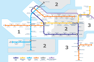
<span class="mw-page-title-main">Transportation in Vancouver</span>

Transportation in Vancouver, British Columbia, has many of the features of modern cities worldwide. Unlike many large metropolises, Vancouver has no freeways into or through the downtown area. A proposed freeway through the downtown was rejected in the 1960s by a coalition of citizens, community leaders and planners. This event "signalled the emergence of a new concept of the urban landscape" and has been a consistent element of the city's planning ever since.

Transportation in the Canadian city of Toronto forms the hub of the road, rail and air networks in the Greater Toronto Area and much of southern Ontario. There are many forms of transport in the city, including railways, highways, and public transit. Toronto also has an extensive network of bicycle lanes and multi-use trails and paths.

<span class="mw-page-title-main">Transport in Sydney</span> Overview of transport in Sydney, Australia

Transport in Sydney is provided by an extensive network of public transport operating modes including metro, train, bus, ferry and light rail, as well as an expansive network of roadways, cycleways and airports. According to the 2006 census, in terms of travel to work or study Sydney has the highest rate of public transport usage among the Australian capital cities of 26.3% with more than 80% of weekday trips to/from Central Sydney being made by public transport. According to the New South Wales State Plan, the state has Australia's largest public transport system. The public transport network is regulated by Transport for NSW.
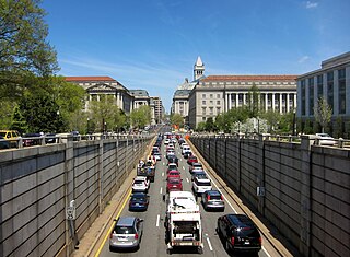
<span class="mw-page-title-main">Transportation in Washington, D.C.</span> Overview of the transportation in Washington, DC

Washington, D.C. has a number of different modes of transportation available for use. Commuters have a major influence on travel patterns, with only 28% of people employed in Washington, D.C. commuting from within the city, whereas 33.5% commute from the nearby Maryland suburbs, 22.7% from Northern Virginia, and the rest from Washington, D.C.'s outlying suburbs.
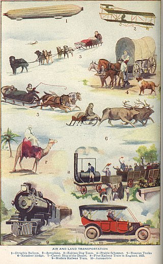
<span class="mw-page-title-main">Outline of transport</span> Overview of and topical guide to transport

The following outline is provided as an overview of and topical guide to transport:
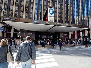
<span class="mw-page-title-main">Transport hub</span> Place where passengers and cargo are exchanged

A transport hub is a place where passengers and cargo are exchanged between vehicles and/or between transport modes. Public transport hubs include railway stations, rapid transit stations, bus stops, tram stops, airports and ferry slips. Freight hubs include classification yards, airports, seaports and truck terminals, or combinations of these. For private transport by car, the parking lot functions as a unimodal hub.

<span class="mw-page-title-main">Land transport</span> Mode of transport

Land transport is the transport or movement of people, animals or goods from one location to another location on land. This is in contrast with other main types of transport such as maritime transport and aviation. The two main forms of land transport can be considered to be rail transport and road transport.

<span class="mw-page-title-main">Passenger train</span> Train used to carry people

A passenger train is a train used to transport people along a railroad line. These trains may consist of unpowered passenger railroad cars hauled by one or more locomotives, or may be self-propelled; self propelled passenger trains are known as multiple units or railcars. Passenger trains stop at stations or depots, where passengers may board and disembark. In most cases, passenger trains operate on a fixed schedule and have priority over freight trains.

<span class="mw-page-title-main">Transport</span> Human-directed movement of things or people between locations

Transport or transportation is the intentional movement of humans, animals, and goods from one location to another. Modes of transport include air, land, water, cable, pipelines, and space. The field can be divided into infrastructure, vehicles, and operations. Transport enables human trade, which is essential for the development of civilizations.

<span class="mw-page-title-main">Transport in Bangkok</span>

Bangkok has 9.7 million automobiles and motorbikes, a number the government says is eight times more than can be properly accommodated on existing roads. And those numbers are increasing by 700 additional cars and 400 motorbikes every day. Charoen Krung Road, the first road to be built by Western techniques, was completed in 1864. Since then, the road network has expanded to accommodate the sprawling city's needs. Besides roads, Bangkok is served by several other transport systems. Bangkok's canals and ferries historically served as a major mode of transport, but they have long since been eclipsed by land traffic. A complex elevated expressway network and Tollway helps bring traffic into and out of the city centre, but Bangkok's rapid growth has put a large strain on infrastructure. By the late-1970s, Bangkok became known as "the city of traffic disaster". Although rail transport was introduced in 1893 and electric trams served the city from 1894 to 1968, it was only in 1999 that Bangkok's first rapid transit system began operation. Older public transport systems include an extensive bus network and boat services which still operate on the Chao Phraya and two canals. Taxis appear in the form of cars, motorcycles, and tuk-tuks.
<span class="mw-page-title-main">Public transportation in the United States</span> Publicly financed transit services in the country

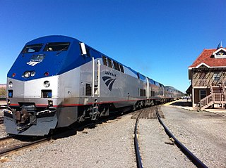
The United States is serviced by a wide array of public transportation, including various forms of bus, rail, ferry, and sometimes, airline services. Most established public transit systems are located in central, urban areas where there is enough density and public demand to require public transportation. In more auto-centric suburban localities, public transit is normally, but not always, less frequent and less common. Most public transit services in the United States are either national, regional/commuter, or local, depending on the type of service. Sometimes "public transportation" in the United States is an umbrella term used synonymously with "alternative transportation", meaning any form of mobility that excludes driving alone by automobile. This can sometimes include carpooling, vanpooling, on-demand mobility, infrastructure that is oriented toward bicycles, and paratransit service.
<span class="mw-page-title-main">Public transport</span> Shared transportation service for use by the general public

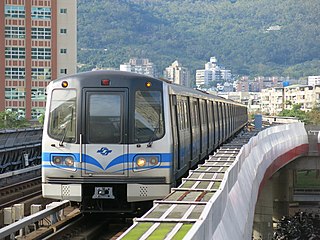
Public transport is a system of transport for passengers by group travel systems available for use by the general public unlike private transport, typically managed on a schedule, operated on established routes, and that may charge a posted fee for each trip. There is no rigid definition of which kinds of transport are included, and air travel is often not thought of when discussing public transport—dictionaries use wording like "buses, trains, etc." Examples of public transport include city buses, trolleybuses, trams and passenger trains, rapid transit and ferries. Public transport between cities is dominated by airlines, coaches, and intercity rail. High-speed rail networks are being developed in many parts of the world.

<span class="mw-page-title-main">Transportation in Jacksonville, Florida</span> Overview of transportation in Jacksonville, Florida

The Jacksonville transportation network includes ground, air, and sea options for passenger and freight transit. The Jacksonville Port Authority (Jaxport) operates the Port of Jacksonville, which includes container shipping facilities at Blount Island Marine Terminal, the Talleyrand Marine Terminal and the Dames Point Marine Terminal. Jacksonville Aviation Authority managers Jacksonville International Airport in Northside, as well as several smaller airports. The Jacksonville Transportation Authority (JTA) operates bus, people mover, and park-n-ride services throughout the city and region. A major bus terminal at the intermodal Rosa Parks Transit Station serves as JTA's main transit hub. Various intercity bus companies terminate near Central Station. Amtrak operates passenger rail service to and from major cities throughout North America. The city is bisected by major highways, I-95 and I-10, I-295 creates a full beltway around the city.

The following outline is provided as an overview of and topical guide to public transport:

References

  1. Tony Morton (2008-05-27). "Myth: Park-and-Ride facilities will encourage public transport use". Public Transport Users Association, Victoria, Australia. Retrieved 2008-07-26.
  2. Maund 2009 , p. 10
  3. "Station Name: Birkenhead Dock". Disused Stations. Retrieved 3 March 2016.
  4. Herman, Michele; Komanoff, Charles; Orcutt, Jon; Perry, David (1999-01-01). "Bicycles and Transit". Transportation Alternatives. Retrieved 2008-07-26.
  5. Sherwood Stranieri (2008-04-25). "Mixed-Mode Commuting in Boston". Using Bicycles. Retrieved 2008-04-26.
  6. Crios (2008-06-15). "Is a folding bicycle right for a train commute in Chicago?". Metafilter. Retrieved 2008-07-26.
  7. Michael Replogle (1992-12-01). "Bicycle Access To Public Transportation: Learning From Abroad" (PDF). Environmental Defense Fund. Archived from the original (PDF) on 2008-07-19. Retrieved 2008-07-26.
  8. Hercules profile, access date July 11, 2008
  9. Waterfront plan could be headed to ballot in Hercules Archived 2012-02-10 at the Wayback Machine , by Tom Lochner, July 1, 2008, access date July 11, 2008
  10. West Contra Costa Transit Advisory Council Action Plan Minutes
  11. "Millbrae - bart.gov". www.bart.gov.
  12. "Light RailLink - Maryland Transit Administration". mta.maryland.gov.
  13. "MARC Train - Maryland Transit Administration". mta.maryland.gov.
  14. DC MetroRail fares Archived 2013-10-05 at the Wayback Machine
  15. Potomac Survey Research (2000-02-01). "Commuting Behavior Research" (PDF). Montgomery County Department of Public Works and Transportation. Retrieved 2008-07-26.

Sources