Jeanne d'Arc Basin

Last updated
Jeanne d'Arc Basin Jeanne dArc Basin.jpg
Jeanne d'Arc Basin
Vein of coarsely crystalline halite in fractured dolomite interbed cored in the Upper Triassic to lowermost Jurassic Argo Formation at the Cormorant N-83 well drilled at the south end of the Jeanne d'Arc Basin. Cormorant N-83 2978.20m Argo Fm.jpg
Vein of coarsely crystalline halite in fractured dolomite interbed cored in the Upper Triassic to lowermost Jurassic Argo Formation at the Cormorant N-83 well drilled at the south end of the Jeanne d'Arc Basin.
Pebble to cobble conglomerate bed of the Upper Jurassic (Tithonian) Jeanne d'Arc Formation cored at the Hibernia O-35 well drilled in the Hibernia oilfield. Hibernia O-35 4533.55m Jeanne d'Arc Fm.jpg
Pebble to cobble conglomerate bed of the Upper Jurassic (Tithonian) Jeanne d'Arc Formation cored at the Hibernia O-35 well drilled in the Hibernia oilfield.
Thin coal seam with underclay pervasively churned by roots as cored from the Lower Cretaceous (Berriasian to lower Valanginian) Hibernia Formation at the Hibernia K-14 well in the Hibernia oilfield. Hibernia K-14 3907.80m.jpg
Thin coal seam with underclay pervasively churned by roots as cored from the Lower Cretaceous (Berriasian to lower Valanginian) Hibernia Formation at the Hibernia K-14 well in the Hibernia oilfield.
Sharp-based, laminated sandstone storm bed above pervasively bioturbated fair weather lower shoreface bed cored in the Lower Cretaceous (upper Aptian to lower Albian) Ben Nevis Formation at the West Ben Nevis B-75 discovery well. West Ben Nevis B-75 2027.85m Ben Nevis Fm.jpg
Sharp-based, laminated sandstone storm bed above pervasively bioturbated fair weather lower shoreface bed cored in the Lower Cretaceous (upper Aptian to lower Albian) Ben Nevis Formation at the West Ben Nevis B-75 discovery well.

The Jeanne d'Arc Basin is an offshore sedimentary basin located about 340 kilometres (~210 miles) to the basin centre, east-southeast of St. John's, Newfoundland and Labrador. This basin formed in response to the large scale plate tectonic forces that ripped apart the super-continent Pangea and also led to sea-floor spreading in the North Atlantic Ocean. This basin is one of a series of rift basins that are located on the broad, shallow promontory of continental crust known as the Grand Banks of Newfoundland off Canada's east coast. The basin was named after a purported 20 metres (11 fathom) shoal labelled as "Ste. Jeanne d'Arc" on out-dated bathymetric charts [1] and which was once thought to represent a local exposure of basement rocks similar to the Virgin Rocks. [2]

Contents

Basin formation

The upper crust beneath the wide shoals of the Grand Banks region is composed of old Precambrian and Paleozoic strata that were moderately deformed by compression during the collisions of ancient continental plates during final assembly of the super-continent Pangea in Devonian to Carboniferous times. [3] [4] Later, these old 'basement' rocks were subjected to multiple episodes of stretching during the Mesozoic and the strain of that extension was expressed in growth of large rips in the rock fabric known as faults. The crust was thinned in areas of stretching and the synchronous growth of faults allowed those areas to subside; that is, to sink relative to surrounding areas, thereby creating rift basins. The Jeanne d'Arc Basin is one of these areas of rift subsidence that is bounded and transected by extensional faults which record the plate tectonic history of the North Atlantic region. [5] [6]

As the Jeanne d'Arc rift basin subsided, it was gradually in-filled with sediments eroded from adjacent areas of crustal uplift. Characteristics of the sedimentary basin fill and their relationships to the extensional history of the Jeanne d'Arc Basin have been variably described by numerous authors with general agreement on the applicability of rift concepts to the basin. [7] There are, however, divergent conclusions regarding the number of Mesozoic rift episodes which affected the Jeanne d'Arc Basin (i.e. two or three), their ages of initiation and duration, and the orientations of extensional stresses that created different fault sets active during the rift episodes. [8] [9] [10] [11] [12] [13] [14] [15] [16] [17] Rift episodes were followed by initiation of sea-floor spreading first to the south, then to the east, and finally to the northeast of the Grand Banks area. [5] Widely faulted and moderately rotated Upper Triassic to Lower Cretaceous beds within the rift basin were subsequently buried beneath a relatively unstructured cover of Upper Cretaceous and Tertiary strata. [18] These latter minimally deformed strata were deposited on the newly established passive margin. [19] The current passive margin conditions were established when the last rifted border to the three-sided promontory of continental crust underlying the Grand Banks bathymetric feature formed along its northeast margin near the start of Late Cretaceous times.

Geology and hydrocarbon prospectivity

Effective combinations of a number of geological factors must occur for a basin to have generated, trapped and preserved hydrocarbons (oil and/or gas). The nature of the sediments deposited during and after the three rift episodes which affected the Jeanne d'Arc Basin [9] [10] and the numerous complex structures formed in response to the changing stress regimes through Mesozoic time have proven critical to the basin's hydrocarbon prospectivity. [19] [7] First, large volumes of halite salt of the Argo Formation were precipitated in the basin during the Late Triassic to earliest Jurassic. [20] [21] [22] [15] These salt beds with interbeds of dolomite were precipitated atop and adjacent to continental clastic facies (alluvial plain sandstones and red shales) of the Eurydice Formation. The presence of this thick salt unit throughout the Jeanne d'Arc Basin has been an important factor in subsequent structural deformation and hydrocarbon trap formation during later rift episodes. It provided a widespread interval of low shear strength which acted as a sub-horizontal detachment horizon between vertically stacked zones of strain. [23] Consequently, precipitation of salt during the first Mesozoic rift episode resulted in partial isolation of crustal extension from extension and creation of structural traps of the overlying sedimentary column during subsequent rift episodes recognized in the Jeanne d'Arc Basin.

One element that is absolutely essential for successful exploration and development is the presence of a stratigraphic unit that is capable of hydrocarbon generation. The presence of an excellent quality Upper Jurassic source rock in the Jeanne d'Arc Basin was first identified in well cuttings from the Egret K-36 exploration well. [24] This Kimmeridgian package of organic-rich, thinly interbedded and finely laminated marlstones and calcareous shales was formally defined as the Egret Member of the Rankin Formation. [14] These economically important beds have been demonstrated to be present across the Jeanne d'Arc Basin. [25] [26] [27] Microscopic analyses identified abundant bituminous/liptinitic detrital material and a lack of terrestrial organic matter. [26] These characteristics indicate that the Egret Member is dominated by marine-derived Type II organic matter deposited under reducing conditions. [28] Hydrocarbons trapped throughout the Jeanne d'Arc Basin were mainly sourced from the prolific Egret Member. [28]

After accumulation and preservation of abundant organic matter in the Egret Member, three major sandstone units were deposited during two subsequent episodes of crustal rifting. The Jeanne d'Arc, Hibernia and Ben Nevis-Avalon sandstones provide numerous tilted and faulted hydrocarbon-bearing reservoirs throughout the Jeanne d'Arc Basin. Both the Jeanne d'Arc and the Hibernia formations are dominated by medium to coarse-grained sandstones that were deposited under high energy conditions by extinct rivers flowing from the south end of the basin [14] [29] during growth of northerly-trending normal faults. [9] [30] The Hibernia Formation also contains thin coal seams attesting to occasional establishment of swamp conditions. [31] In contrast, the dominantly fine-grained sandstones of the stacked Avalon and Ben Nevis formations were mostly deposited in shallow to marginal marine settings affected by frequent storms. [32] [33] [34] The Avalon sandstones were deposited when the shoreline migrated northward during uplift of the southern basin margin while the Ben Nevis sandstones were deposited as the shoreline retreated southward in a 'stuttering' fashion synchronous with growth of a new set of normal faults in response to NE-SW-oriented extension. [35]

After termination of extensional faulting near the end of Albian time, the Jeanne d'Arc Basin and its surrounding margins subsided as a region. Consequently, the basin was buried beneath a northeastward-thickening wedge of mostly un-deformed Upper Cretaceous and Tertiary strata. Continued burial of the Egret Member source rock during this final episode of passive margin conditions resulted in heating and maturation of the source rock such that it gradually passed through the "oil window" over an increasingly large area of the basin. [28] This burial process resulted in generation of large volumes of petroleum and migration into the overlying structural and stratigraphic traps.

Petroleum exploration and development

Licences conferring rights to hydrocarbon exploration on the Grand Banks of Newfoundland were first awarded by the Canadian government in the mid-1960s. The first exploration well in the Jeanne d'Arc Basin was the Murre G-67 well drilled in the southern, relatively uplifted end of the basin by the oil majors Amoco and Imperial Oil in 1971. [1] Soon after, a small, non-commercial amount of oil was test flowed in early 1973 at the Adolphus 2K-41 exploration well drilled in the much more deeply buried northern end of the Jeanne d'Arc Basin by Mobil Oil Canada and Gulf Canada. The Egret K-36 well, drilled jointly by Amoco, Imperial and Skelly in 1973, was a critical milestone in establishment of the basin's hydrocarbon prospectivity. Egret K-36 encountered the prolific oil source rock later assigned the name Egret Member, [14] plus thick tilted beds of porous sandstones of the Jeanne d'Arc and Hibernia formations. [36] Despite this early establishment that all the components needed for an active petroleum system were present, there was a four-year hiatus in drilling in the Jeanne d'Arc Basin following termination of the Adolphus D-50 well in January 1975. The first well spud after the drilling lull proved that giant oil fields could be found in this basin. [36] The Hibernia P-15 discovery well, initiated on May 27, 1979, encountered and test flowed oil from the Jeanne d'Arc, Hibernia and Ben Nevis formations. This well heralded a vibrant era of oil exploration and development that has significantly impacted the economy of the province of Newfoundland and Labrador.

Including Hibernia P-15, there have been eighteen officially declared Significant Discoveries in the Jeanne d'Arc Basin and on the adjacent structural high area to the East [19] up to the first quarter of 2012. These are:

Additionally, the North Amethyst K-14 exploration well, terminated on November 12, 2006 was declared a Commercial Discovery and was awarded a Production Licence effective November 19, 2007 by the Canada-Newfoundland and Labrador Offshore Petroleum Board, a joint federal-provincial regulatory agency.

As of 2022, there are five oil producing fields in the Jeanne d'Arc Basin:

North Amethyst is the first tie-back field in the Jeanne d'Arc Basin, with production tied into the White Rose Field facilities. [7] The Hibernia oilfield has also been expanded into the Hibernia South Extension area. A number of adjacent fault blocks that comprise the composite Hebron oil field [43] are expected to host the next hydrocarbon production facility.

Notes

  1. 1 2 Amoco & Imperial 1973.
  2. Howie 1970.
  3. King et al. 1986.
  4. Bell & Howie 1990.
  5. 1 2 Ziegler 1988.
  6. Withjack & Schlische 2005.
  7. 1 2 3 Enachescu 2009.
  8. Hubbard, Pape & Roberts 1985.
  9. 1 2 3 Enachescu 1987.
  10. 1 2 Sinclair 1988.
  11. Tankard & Welsink 1989.
  12. Tankard, Welsink & Jenkins 1989.
  13. Hiscott et al. 1990.
  14. 1 2 3 4 McAlpine 1990.
  15. 1 2 Grant & McAlpine 1990.
  16. Keen & Dehler 1993.
  17. Driscoll & Hogg 1995.
  18. Deptuck et al. 2003.
  19. 1 2 3 Energy Branch 2000.
  20. Jansa, Bujak & Williams 1980.
  21. Holser et al. 1988.
  22. Balkwill & Legall 1989.
  23. Withjack & Callaway 2000.
  24. Swift & Williams 1980.
  25. vonderDick et al. 1989.
  26. 1 2 Fowler et al. 1990.
  27. Creaney & Allison 1987.
  28. 1 2 3 Fowler & McAlpine 1995.
  29. Enachescu, Harding & Emery 1994.
  30. Sinclair et al. 1994.
  31. 1 2 Brown, McAlpine & Yole 1989.
  32. Harding 1988.
  33. Hiscott et al. 1990.
  34. 1 2 Spila, Pemberton & Sinclair 2005.
  35. Sinclair 1993.
  36. 1 2 3 Arthur et al. 1982.
  37. Tankard & Welsink 1987.
  38. Hurley et al. 1992.
  39. Wilcox, Couturier & Hewitt 1991.
  40. Skaug, Kerwin & Katay 2001.
  41. Richards et al. 2010.
  42. Kaderali, Jones & Howlett 2007.
  43. Rees & Spratt 2005.

Related Research Articles

<span class="mw-page-title-main">Sedimentary basin</span> Regions of long-term subsidence creating space for infilling by sediments

Sedimentary basins are region-scale depressions of the Earth's crust where subsidence has occurred and a thick sequence of sediments have accumulated to form a large three-dimensional body of sedimentary rock. They form when long-term subsidence creates a regional depression that provides accommodation space for accumulation of sediments. Over millions or tens or hundreds of millions of years the deposition of sediment, primarily gravity-driven transportation of water-borne eroded material, acts to fill the depression. As the sediments are buried, they are subject to increasing pressure and begin the processes of compaction and lithification that transform them into sedimentary rock.

An aulacogen is a failed arm of a triple junction. Aulacogens are a part of plate tectonics where oceanic and continental crust is continuously being created, destroyed, and rearranged on the Earth’s surface. Specifically, aulacogens are a rift zone, where new crust is formed, that is no longer active.

<span class="mw-page-title-main">Rift</span> Geological linear zone where the lithosphere is being pulled apart

In geology, a rift is a linear zone where the lithosphere is being pulled apart and is an example of extensional tectonics. Typical rift features are a central linear downfaulted depression, called a graben, or more commonly a half-graben with normal faulting and rift-flank uplifts mainly on one side. Where rifts remain above sea level they form a rift valley, which may be filled by water forming a rift lake. The axis of the rift area may contain volcanic rocks, and active volcanism is a part of many, but not all, active rift systems.

<span class="mw-page-title-main">Terra Nova oil field</span>

Terra Nova is an oil field development project based off the coast of Newfoundland, discovered in 1984 by Petro-Canada. Terra Nova is the first harsh environment development in North America to use a Floating Production Storage and Offloading (FPSO) vessel, Terra Nova. Production from the field began in January 2002 off the coast of Newfoundland, with an expected life of 15–17 years. After stopping production in 2019, the project restructured in 2021, moving to Ferrol, Spain for repairs. Terra Nova is expected to be back in production in Newfoundland at the end of 2022.

<span class="mw-page-title-main">Hibernia oil field</span> Oil field in the North Atlantic Ocean

Hibernia is an oil field in the North Atlantic Ocean, approximately 315 kilometres (196 mi) east-southeast of St. John's, Newfoundland, Canada, in 80 m of water.

<span class="mw-page-title-main">History of the petroleum industry in Canada (frontier exploration and development)</span>

Canada's early petroleum discoveries took place near population centres or along lines of penetration into the frontier.

<span class="mw-page-title-main">Sirte Basin</span>

The Sirte Basin is a late Mesozoic and Cenozoic triple junction continental rift along northern Africa that was initiated during the late Jurassic Period. It borders a relatively stable Paleozoic craton and cratonic sag basins along its southern margins. The province extends offshore into the Mediterranean Sea, with the northern boundary drawn at the 2,000 meter (m) bathymetric contour. It borders in the north on the Gulf of Sidra and extends south into northern Chad.

<span class="mw-page-title-main">Porcupine Seabight</span> Deep-water oceanic basin on the continental margin of the northeastern Atlantic

The Porcupine Seabight or Porcupine Basin is a deep-water oceanic basin located on the continental margin in the northeastern portion of the Atlantic Ocean. It can be found in the southwestern offshore portion of Ireland and is part of a series of interconnected basins linked to a failed rift structure associated with the opening of the Northern Atlantic Ocean. The basin extends in a North-South direction and was formed during numerous subsidence and rifting periods between the Late Carboniferous and Late Cretaceous. It is bordered by the

The Newfoundland Ridge is an ocean ridge in the northern Atlantic Ocean, located on the east coast of Canada. It was the site for major volcanic activity in the Barremian–Aptian period.

<span class="mw-page-title-main">Peter Ziegler</span> Swiss geologist

Peter Alfred Ziegler was a Swiss geologist, who made contributions to the understanding of the geological evolution of Europe and the North Atlantic borderlands, of intraplate tectonics and of plate tectonic controls on the evolution and hydrocarbon potential of sedimentary basins. Ziegler's career consists of 33 years as exploration geologist with the petroleum industry, 30 of which with Shell, and 20 years of university teaching and research.

The Orphan Basin is an area approximately 400 km east-north-east of St. John's, Newfoundland and Labrador in Canada. Two exploratory oil wells have been drilled there as it is estimated to have oil reserves of 6-8 billion barrels. Chevron intends to drill a third well in 2012.

<span class="mw-page-title-main">Northern North Sea basin</span>

The North Sea is part of the Atlantic Ocean in northern Europe. It is located between Norway and Denmark in the east, Scotland and England in the west, Germany, the Netherlands, Belgium and France in the south.

The Halibut Field is an oil field, within the Gippsland Basin offshore of the Australian state of Victoria. The oil field is located approximately 64 km offshore of southeastern Australia. The total area of this field is 26.9 km2 and is composed of 10 mappable units.

<span class="mw-page-title-main">Delta Field (Niger Delta)</span>

The Delta Field is located offshore from Nigeria on Oil Mining Leases (OML) 49 and 95. This is located within the Niger Delta Basin and sits in 12 feet of water. In 1965, the Delta 1 well was completed and the Delta Field opened in 1968 for production.

<span class="mw-page-title-main">Bolivar Coastal Fields</span>

The Bolivar Coastal Fields (BCF), also known as the Bolivar Coastal Complex, is located on the eastern margin of Lake Maracaibo, Venezuela. Bolivar Coastal Field is the largest oil field in South America with its 6,000-7,000 wells and forest of related derricks, stretches thirty-five miles along the north-east coast of Lake Maracaibo. They form the largest oil field outside of the Middle East and contain mostly heavy oil with a gravity less than 22 degrees API. Also known as the Eastern Coast Fields, Bolivar Coastal Oil Field consists of Tía Juana, Lagunillas, Bachaquero, Ceuta, Motatán, Barua and Ambrosio. The Bolivar Coast field lies in the Maracaibo dry forests ecoregion, which has been severely damaged by farming and ranching as well as oil exploitation. The oil field still plays an important role in production from the nation with approximately 2.6 million barrels of oil a day. It is important to note that the oil and gas industry refers to the Bolivar Coastal Complex as a single oilfield, in spite of the fact that the oilfield consists of many sub-fields as stated above.

<span class="mw-page-title-main">Lusitanian Basin</span> Geological formation off the coast of Portugal

The Lusitanian Basin is a rift basin located on both the mainland and continental shelf off the west-central coast of Portugal. It covers an area measuring 20,000 square kilometres (7,700 sq mi) and extends north-south from Porto to Lisbon. The basin varies between approximately 130 kilometres (81 mi) and 340 kilometres (210 mi) in width and belongs to a family of periatlantic basins such as the Jeanne d'Arc Basin. To the east of the Lusitanian Basin lies the Central Plateau of the Iberian Peninsula. A marginal horst system lies to the west. The Alentejo and Algarve Basins connect to the southern end of the Lusitanian Basin. In the north, it connects to the Porto and Galicia Basins via an undersea ridge.

<span class="mw-page-title-main">Hebron-Ben Nevis oil field</span>

Hebron Oil Field, located off the coast of Newfoundland, is the fourth field to come on to production in the Jeanne d'Arc Basin. Discovered in 1981 and put online in 2017, the Hebron field is estimated to contain over 700 million barrels of producible hydrocarbons. The field is contained within a fault-bounded Mesozoic rift basin called the Jeanne d'Arc Basin.

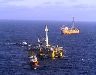
In addition to terrestrial oil wells, Canada also extracts oil via offshore drilling.

<span class="mw-page-title-main">Canadian Arctic Rift System</span> North American geological structure

The Canadian Arctic Rift System is a major North American geological structure extending from the Labrador Sea in the southeast through Davis Strait, Baffin Bay and the Arctic Archipelago in the northwest. It consists of a series of interconnected rifts that formed during the Paleozoic, Mesozoic and Cenozoic eras. Extensional stresses along the entire length of the rift system have resulted in a variety of tectonic features, including grabens, half-grabens, basins and faults.

References

45°N50°W / 45°N 50°W / 45; -50