Jerome County, Idaho

Last updated

Jerome County
Jerome county courthouse 2009.jpg
Jerome County Courthouse
Jerome County, Idaho seal.png
Map of Idaho highlighting Jerome County.svg
Location within the U.S. state of Idaho
Idaho in United States.svg
Idaho's location within the U.S.
Coordinates: 42°41′N114°16′W / 42.69°N 114.26°W / 42.69; -114.26
CountryFlag of the United States.svg United States
StateFlag of Idaho.svg  Idaho
FoundedFebruary 8, 1919
Seat Jerome
Largest cityJerome
Area
  Total602 sq mi (1,560 km2)
  Land597 sq mi (1,550 km2)
  Water5.0 sq mi (13 km2)  0.8%
Population
 (2020)
  Total24,237
  Density40/sq mi (16/km2)
Time zone UTC−7 (Mountain)
  Summer (DST) UTC−6 (MDT)
Congressional district 2nd
Website www.jeromecountyid.us

Jerome County is a county in the U.S. state of Idaho. As of the 2020 Census the county had a population of 24,237. [1] The county seat and largest city is Jerome. [2] The county was created by the Idaho Legislature on February 8, 1919, by a partition of Lincoln County. It was named after either Jerome Hill, a developer of the North Side Irrigation Project, his son-in-law Jerome Kuhn, or his grandson Jerome Kuhn, Jr. [3]

Contents

Jerome County is part of the Twin Falls, ID Micropolitan Statistical Area.

The Minidoka Relocation Camp, one of ten Japanese American internment camps set up during World War II, was located in Hunt of Jerome County, six miles (9.7 km) north west of Eden.

History

Jerome county's settlements are among Idaho's youngest. While Jerome County was located quite close to the Oregon Trail and subsequent stagecoach lines, it was also divided from them by the 500 ft (150 m) deep Snake River Canyon. The depth of the canyon also eliminated the possibility of drawing water for farming operations. Together, those factors made the area unattractive to early Idahoans looking to settle during the territorial and early statehood era. Construction of the railroad across Idaho in the 1880s also bypassed the Jerome area with the route being run 16 miles (26 km) north of the present center of Jerome City. A ferry commenced operation at Shoshone Falls on April 15, 1884, facilitating travel between the railroad and settlements south of the Snake River. [4]

The Schodde settlement on Jerome County's western border north of Milner was established as the Schoddie Precinct under Lincoln County with a 1900 census population of 24. [5] Completion of the Milner Dam and associated Northside Canal in 1905 brought a water supply to the north side of the Snake River that also brought farmers to the region. [6] Eden and Hazelton were settled starting in 1905. Settlement at Jerome commenced September 30, 1907, and the Idaho Southern Railway reached Jerome on December 28, 1908. By the 1910 Census, Jerome Village contained 970 residents having been incorporated in 1909. Also by that time, Lincoln County established two precincts of Hillsdale (400 residents) and Jerome (2,032 residents). The towns of Eden and Hazelton were part of the Hillsdale precinct and the Schoddie precinct ceased to exist. [7] [8] By the 1920 Census, Eden and Hazelton also were incorporated as villages.

Jerome, Eden, and Hazelton were all part of Lincoln County at their formation. Eden and Hazelton became part of Minidoka County at its creation in 1913. Jerome County became the 43rd of Idaho's 44 counties on February 8, 1911. It is three days older than Caribou County. [9]

Geography

According to the U.S. Census Bureau, the county has a total area of 602 square miles (1,560 km2), of which 597 square miles (1,550 km2) is land and 5.0 square miles (13 km2) (0.8%) is water. [10]

Adjacent counties

Demographics

Historical population
CensusPop.Note
1920 5,729
1930 8,35845.9%
1940 9,90018.4%
1950 12,08022.0%
1960 11,712−3.0%
1970 10,253−12.5%
1980 14,84044.7%
1990 15,1382.0%
2000 18,34221.2%
2010 22,37422.0%
2020 24,2378.3%
2023 (est.)25,479 [11] 5.1%
U.S. Decennial Census [12]
1790–1960, [13] 1900–1990, [14]
1990–2000, [15] 2010, [16] 2020 [1]

2000 census

As of the census [17] of 2000, there were 18,342 people, 6,298 households, and 4,805 families residing in the county. The population density was 31 inhabitants per square mile (12/km2). There were 6,713 housing units at an average density of 11 per square mile (4.2/km2). The racial makeup of the county was 86.99% White, 0.23% Black or African American, 0.69% Native American, 0.27% Asian, 0.05% Pacific Islander, 9.84% from other races, and 1.94% from two or more races. 17.17% of the population were Hispanic or Latino of any race. 15.4% were of English, 15.3% German, 11.6% American and 6.2% Irish ancestry.

There were 6,298 households, out of which 39.10% had children under the age of 18 living with them, 63.80% were married couples living together, 7.60% had a female householder with no husband present, and 23.70% were non-families. 19.50% of all households were made up of individuals, and 8.70% had someone living alone who was 65 years of age or older. The average household size was 2.89 and the average family size was 3.33.

In the county, the population was spread out, with 31.50% under the age of 18, 8.90% from 18 to 24, 27.10% from 25 to 44, 20.20% from 45 to 64, and 12.30% who were 65 years of age or older. The median age was 33 years. For every 100 females, there were 104.60 males. For every 100 females age 18 and over, there were 104.50 males.

The median income for a household in the county was $34,696, and the median income for a family was $39,083. Males had a median income of $28,036 versus $20,194 for females. The per capita income for the county was $15,530. 13.90% of the population and 10.70% of families were below the poverty line. 17.90% of those under the age of 18 and 9.90% of those 65 and older were living below the poverty line.

2010 census

As of the 2010 United States Census, there were 22,374 people, 7,540 households, and 5,656 families residing in the county. [18] The population density was 37.5 inhabitants per square mile (14.5/km2). There were 8,101 housing units at an average density of 13.6 per square mile (5.3/km2). [19] The racial makeup of the county was 80.0% white, 1.3% American Indian, 0.3% black or African American, 0.3% Asian, 0.1% Pacific islander, 15.8% from other races, and 2.1% from two or more races. Those of Hispanic or Latino origin made up 31.0% of the population. [18] In terms of ancestry, 16.7% were German, 11.4% were English, 8.8% were American, and 7.0% were Irish. [20]

Of the 7,540 households, 42.5% had children under the age of 18 living with them, 58.7% were married couples living together, 9.6% had a female householder with no husband present, 25.0% were non-families, and 20.3% of all households were made up of individuals. The average household size was 2.95 and the average family size was 3.39. The median age was 31.7 years. [18]

The median income for a household in the county was $39,188 and the median income for a family was $45,947. Males had a median income of $30,889 versus $23,383 for females. The per capita income for the county was $16,947. About 12.0% of families and 15.5% of the population were below the poverty line, including 23.1% of those under age 18 and 7.6% of those age 65 or over. [21]

Major highways

National protected areas

Communities

Cities

Unincorporated community

Politics

United States presidential election results for Jerome County, Idaho [22]
Year Republican Democratic Third party
No.%No.%No.%
2020 5,73473.14%1,89324.15%2132.72%
2016 4,64468.79%1,32919.69%77811.52%
2012 4,80471.52%1,69925.29%2143.19%
2008 4,89771.52%1,79426.20%1562.28%
2004 5,17778.68%1,34420.43%590.90%
2000 4,41873.55%1,36022.64%2293.81%
1996 3,35854.82%1,67927.41%1,08817.76%
1992 2,97244.23%1,73925.88%2,00929.90%
1988 3,83064.32%1,98533.33%1402.35%
1984 4,91378.49%1,28420.51%620.99%
1980 4,96274.90%1,36820.65%2954.45%
1976 3,18861.81%1,80034.90%1703.30%
1972 3,66175.11%88818.22%3256.67%
1968 2,78560.52%97621.21%84118.27%
1964 3,11363.00%1,82837.00%00.00%
1960 3,03158.49%2,15141.51%00.00%
1956 3,12764.71%1,70535.29%00.00%
1952 3,80774.21%1,31825.69%50.10%
1948 2,12849.43%2,12449.34%531.23%
1944 2,15755.34%1,74144.66%00.00%
1940 2,52057.17%1,88142.67%70.16%
1936 1,29734.33%2,37462.84%1072.83%
1932 1,39337.86%2,21960.32%671.82%
1928 2,05072.41%75926.81%220.78%
1924 1,11746.76%89637.51%37615.74%
1920 1,73868.91%78431.09%00.00%

Education

School districts include: [23]

The county is in the catchment area, and the taxation zone, for College of Southern Idaho. [24]

See also

Related Research Articles

<span class="mw-page-title-main">Lincoln County, West Virginia</span> County in West Virginia, United States

Lincoln County is a county in the U.S. state of West Virginia. As of the 2020 census, the population was 20,463. Its county seat is Hamlin. The county was created in 1867 and named for Abraham Lincoln.

<span class="mw-page-title-main">Twin Falls County, Idaho</span> County in Idaho, United States

Twin Falls County is a county in the south central part of the U.S. state of Idaho. As of the 2020 census, the population was 90,046, making it the fifth-most populous county in Idaho. The county seat and largest city is Twin Falls. Twin Falls County is part of the Twin Falls, ID Twin Falls Metropolitan Statistical Area.

<span class="mw-page-title-main">Power County, Idaho</span> County in Idaho, United States

Power County is a county located in the U.S. state of Idaho. As of the 2020 Census, the county had a population of 7,878. The county seat and largest city is American Falls. The county was created by the Idaho Legislature on January 30, 1913, by a partition of Cassia County. It is named for an early hydroelectric power plant (1902) at the American Falls.

<span class="mw-page-title-main">Minidoka County, Idaho</span> County in Idaho, United States

Minidoka County is a county located in the U.S. state of Idaho. As of the 2020 census, the population was 21,613. The county seat and largest city is Rupert.

<span class="mw-page-title-main">Lincoln County, Idaho</span> County in Idaho, United States

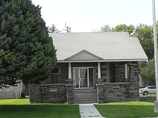
Lincoln County is a county located in the U.S. state of Idaho. As of the 2020 census, the population was 5,127. The county seat and largest city is Shoshone. The county is named after President Abraham Lincoln. The Idaho Territory was created in 1863, during the Lincoln Administration of 1861–65.

<span class="mw-page-title-main">Gooding County, Idaho</span> County in Idaho, United States

Gooding County is a county located in the U.S. state of Idaho. As of the 2020 census, the population was 15,598. Its county seat is Gooding. The county was created by the Idaho Legislature on January 28, 1913, by a partition of Lincoln County. It is named for Frank R. Gooding, the 7th governor and a United States Senator from Idaho.

<span class="mw-page-title-main">Custer County, Idaho</span> County in Idaho, United States

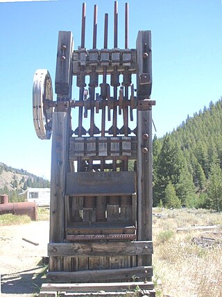
Custer County is a rural mountain county in the center of the U.S. state of Idaho. As of the 2020 census, the population was 4,275, making it the fifth-least populous county in Idaho. The county seat is Challis. Established in 1881, the county was named for the General Custer Mine, where gold was discovered five years earlier. Custer County relies on ranching, mining, and tourism as its main resources.

<span class="mw-page-title-main">Cassia County, Idaho</span> County in Idaho, United States

Cassia County is a county in the U.S. state of Idaho. As of the 2020 Census the county had a population of 24,655. The county seat and largest city is Burley. Cassia County is included in the Burley, ID Micropolitan Statistical Area.

<span class="mw-page-title-main">Bonneville County, Idaho</span> County in Idaho, United States

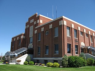
Bonneville County is a county located in the U.S. state of Idaho. As of the 2020 census, the population was 123,964, making it the fourth-most populous county in Idaho and the most populous in eastern Idaho. Its county seat and largest city is Idaho Falls. Bonneville County was established in 1911 and named after Benjamin Bonneville (1796–1878), a French-born officer in the U.S. Army, fur trapper, and explorer in the American West. Benjamin was the son of Nicholas Bonneville of France, an Illuminati member who had written the "Illuminati Manifesto for World Revolution" in 1792, which played a significant role in the French revolution. Bonneville County is part of the Idaho Falls Metropolitan Statistical Area.

<span class="mw-page-title-main">Bonner County, Idaho</span> County in Idaho, United States

Bonner County is a county in the northern part of the U.S. state of Idaho. As of the 2020 census, the population was 47,110. The county seat and largest city is Sandpoint. Partitioned from Kootenai County and established in 1907, it was named for Edwin L. Bonner, a ferry operator.

<span class="mw-page-title-main">Blaine County, Idaho</span> County in Idaho, United States

Blaine County is a county in the U.S. state of Idaho. As of the 2020 United States Census, the population was 24,272. The county seat and largest city is Hailey. It is also home to the Sun Valley ski resort, adjacent to Ketchum.

<span class="mw-page-title-main">Bear Lake County, Idaho</span> County in Idaho, United States

Bear Lake County is a county in the U.S. state of Idaho. As of the 2020 United States Census the county had a population of 6,372. The county seat is Paris, and Montpelier is the largest city.

<span class="mw-page-title-main">Eden, Idaho</span> City in Idaho, United States

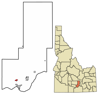
Eden is a city in Jerome County, Idaho, United States. The population was 405 at the 2010 census. It is part of the Twin Falls, Idaho Metropolitan Statistical Area.

<span class="mw-page-title-main">Hazelton, Idaho</span> City in Idaho, United States

Hazelton is a city in Jerome County, Idaho, United States. The population was 807 at the 2020 census. It is part of the Twin Falls, Idaho Micropolitan Statistical Area.

<span class="mw-page-title-main">Jerome, Idaho</span> City in Idaho, United States

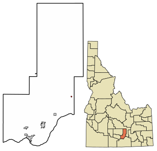
Jerome is a city in and county seat of Jerome County, Idaho, United States. The population was 10,890 at the 2010 census, up from 7,780 in 2000. The city is the county seat of Jerome County, and is part of the Twin Falls Micropolitan Statistical Area. It is the second largest city in Idaho's Magic Valley region, second only to Twin Falls which is located 10 miles (16 km) southeast. Jerome's economy is largely agrarian, with dairy farming being one of the main revenue sources for the local economy.

<span class="mw-page-title-main">Acequia, Idaho</span> City in Idaho, United States

Acequia is a city in Minidoka County, Idaho, United States. The population was 131 at the 2020 census. It is part of the Burley, Idaho Micropolitan Statistical Area. The town is named for the Spanish word for canal.

<span class="mw-page-title-main">Heyburn, Idaho</span> City in Idaho, United States

Heyburn is a city in Minidoka County, Idaho, United States. The population was 3,700 at the 2020 census, up from 3,089 in 2010. It is part of the Burley micropolitan area.

<span class="mw-page-title-main">Minidoka, Idaho</span> City in Idaho, United States

Minidoka is a city in Minidoka County, Idaho, United States. The population was 86 at the 2020 census, down from 112 in 2010. It is part of the Burley, Idaho Micropolitan Statistical Area.

<span class="mw-page-title-main">Paul, Idaho</span> City in Idaho, United States

Paul is a city in Minidoka County, Idaho, United States. founded in 1907. The population was 1,195 at the 2020 census. It is part of the Burley, Idaho Micropolitan Statistical Area. The town received its name from Charles H. Paul, an engineer who worked on the Minidoka Project.

<span class="mw-page-title-main">Rupert, Idaho</span> City in Idaho, United States

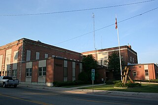
Rupert is the county seat and largest city of Minidoka County, Idaho. It is part of the Burley Micropolitan Statistical Area. The population was 6,082 at the 2020 census, up from 5,554 in 2010.

References

  1. 1 2 "Jerome County, Idaho". United States Census Bureau . Retrieved June 25, 2023.
  2. "Find a County". National Association of Counties. Archived from the original on May 9, 2015. Retrieved June 7, 2011.
  3. Idaho.gov - Jerome County Archived April 29, 2009, at the Wayback Machine accessed May 29, 2009
  4. "Idaho State Historical Society Reference Series: Snake River Ferries" (PDF). Idaho State Historical Society. Archived (PDF) from the original on May 2, 2012. Retrieved February 21, 2017.
  5. Census Reports Volume I: Twelfth Census of the United States, Taken in the Year 1900 (PDF). Washington: United States Census Office. 1901. p. 112. Archived (PDF) from the original on September 14, 2015. Retrieved February 21, 2017.
  6. Yost, Joe. "Milner Dam". Archived from the original on April 8, 2001. Retrieved February 21, 2017.
  7. "Jerome County Facts". ancestry.com. Retrieved February 21, 2017.
  8. Thirteenth Census of the United States Taken in the Year 1910 (PDF). Washington: Government Printing Office. 1913. p. 417. Archived (PDF) from the original on October 3, 2006. Retrieved February 21, 2017.
  9. Idaho Atlas of Historical County Boundaries. Chicago: The Newberry Library. 2010. pp. 117, 133–134, 141.
  10. "US Gazetteer files: 2010, 2000, and 1990". United States Census Bureau. February 12, 2011. Retrieved April 23, 2011.
  11. "Annual Estimates of the Resident Population for Counties: April 1, 2020 to July 1, 2023". United States Census Bureau. Retrieved March 31, 2024.
  12. "U.S. Decennial Census". United States Census Bureau. Retrieved June 30, 2014.
  13. "Historical Census Browser". University of Virginia Library. Retrieved June 30, 2014.
  14. "Population of Counties by Decennial Census: 1900 to 1990". United States Census Bureau. Retrieved June 30, 2014.
  15. "Census 2000 PHC-T-4. Ranking Tables for Counties: 1990 and 2000" (PDF). United States Census Bureau. Archived (PDF) from the original on March 27, 2010. Retrieved June 30, 2014.
  16. "State & County QuickFacts". United States Census Bureau. Archived from the original on July 17, 2011. Retrieved June 30, 2014.
  17. "U.S. Census website". United States Census Bureau . Retrieved January 31, 2008.
  18. 1 2 3 "DP-1 Profile of General Population and Housing Characteristics: 2010 Demographic Profile Data". United States Census Bureau. Archived from the original on February 13, 2020. Retrieved January 9, 2016.
  19. "Population, Housing Units, Area, and Density: 2010 - County". United States Census Bureau. Archived from the original on February 13, 2020. Retrieved January 9, 2016.
  20. "DP02 SELECTED SOCIAL CHARACTERISTICS IN THE UNITED STATES – 2006-2010 American Community Survey 5-Year Estimates". United States Census Bureau. Archived from the original on February 13, 2020. Retrieved January 9, 2016.
  21. "DP03 SELECTED ECONOMIC CHARACTERISTICS – 2006-2010 American Community Survey 5-Year Estimates". United States Census Bureau. Archived from the original on February 13, 2020. Retrieved January 9, 2016.
  22. Leip, David. "Dave Leip's Atlas of U.S. Presidential Elections". uselectionatlas.org. Retrieved April 4, 2018.
  23. "2020 CENSUS - SCHOOL DISTRICT REFERENCE MAP: Jerome County, ID" (PDF). U.S. Census Bureau . Retrieved March 12, 2024. - Text list
  24. "Community Colleges" (PDF). Legislative Budget Book. Idaho Legislature. 2016. p. 1-81 (PDF p. 3/9). - See area 1 in: "TITLE 33 EDUCATION CHAPTER 21 JUNIOR COLLEGES". Idaho Legislature . Retrieved March 12, 2024.