
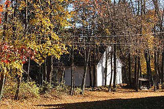
Saunderstown is a small village and historic district in the towns of Narragansett and North Kingstown in Washington County, Rhode Island, United States.

Castle Hill Lighthouse is located on Narragansett Bay in Newport, Rhode Island at the end of the historic Ocean Drive. It is an active navigation aid for vessels entering the East Passage between Conanicut Island and Aquidneck Island. The lighthouse was completed in 1890 on property formerly belonging to the naturalist, oceanographer, and zoologist Alexander Agassiz of Harvard University. Agassiz sold the land to the United States Government for the lighthouse for $1

Carolina is a village that straddles the border of the towns of Charlestown and Richmond on the Pawcatuck River in Washington County, Rhode Island. Rhode Island Route 112 passes through the village. Carolina is identified as a census-designated place for reporting of data from the 2010 census.

The Smithfield Road Historic District is a rural historic district in North Smithfield, Rhode Island along Old Smithfield Road. It extends along Old Smithfield Road north from its junction with Sayles Hill Road, and is roughly bisected by Spring Brook. It includes eight historic houses or farmsteads, two 19th-century cemeteries, and a dam on Spring Brook just east of the road. The district encompasses a cross-section of the development of agricultural properties in North Smithfield over the 19th century, with properties dating from 1811 to 1932. The district covers 170 acres (69 ha), which includes lands currently and formerly in agricultural use.

The William Whalley Homestead is an historic farmstead at 33 Burchard Avenue, Little Compton, Rhode Island. The main house is a 1-1/2 story wood frame structure, probably built sometime between 1815 and 1830. The property includes a barn and second outbuilding dating to the late 19th century, bounded by a low stone wall. The main house is a fairly typical Cape style house, five bays wide, with a central chimney. The property as a whole is a well-preserved example of a typical 19th-century farmstead in the area.

The Windmill Hill Historic District is a historic district encompassing a large rural landscape in Jamestown, Rhode Island. It is bounded on the north by Eldred Avenue, on the east by East Shore Road, on the south by Great Creek, and on the west by Narragansett Bay. The area's historical resources included six farmsteads, as well as the Quaker Meetinghouse, the Jamestown Windmill, and its associated miller's house and barn. The area is predominantly rolling hills with open pastureland and forest. The district was listed on the National Register of Historic Places in 1978. The area is also rich in prehistoric evidence of Native American occupation, which is the subject of the Jamestown Archeological District listing on the National Register.

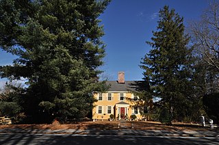
Greenvale Farm is an historic farm and 19th-century summer estate at 582 Wapping Road in Portsmouth, Rhode Island. Historically used for farmland, a portion of this 53-acre (21 ha) was transformed into an expansive country estate in the 1860s by John Barstow, a Boston merchant. It is located at the end of a narrow dirt lane, and is set overlooking the Sakonnet River. The main house, designed by John Hubbard Sturgis and built in 1864-65, is an exuberant implementation of the Stick style with Gothic features. It has asymmetric form, with a variety of projections, dormers, gables, and cross-gables, with a variety of exterior finishes. The estate continues to be owned by Barstow descendants.

The Dexter Arnold Farmstead is a historic farmstead on Chopmist Hill Road in Scituate, Rhode Island. The main house, a 2-1/2 story wood frame structure five bays wide, with a large central chimney, was built in 1813. The 3.6-acre (1.5 ha) property also has five outbuildings which appear to be near contemporaries to the house, a relative rarity in rural Rhode Island. The main barn survived into the 20th century, but was destroyed by the New England Hurricane of 1938. The property also includes a small family cemetery. The house, built by Dexter Arnold in land belonging to his father, remained in family hands until 1975.

The Brown Avenue Historic District is a rural historic district in Johnston, Rhode Island, USA. The district encompasses a rural and agricultural landscape centered on a 1-mile (1.6 km) stretch in the midsection of Brown Avenue, which runs between Hartford Avenue and Greenville Avenue. There are five farmsteads, with the Dame Farmstead at its center, whose farmhouses date to the late 18th century. A number of these farms are no longer in production, and part of the district is in Snake Den State Park.
The John Cole Farm is an historic colonial farm on Reservoir Road in the far northeast of Cumberland, Rhode Island. The main farmhouse, a 1-1/2 story Cape style wood-frame structure, was built c. 1770 by John Cole not long after his acquisition of the property. The property, including a half-dozen outbuildings, has had only minimal intrusion of modern 20th-century amenities, and is a well-kept example of vernacular rural architecture of the late 18th century.
The Whipple–Cullen House and Barn is an historic farmstead on Old River Road in Lincoln, Rhode Island. The main house is a 2-1/2 story wood frame structure, five bays wide, with a large central chimney and a gable roof. An addition extends to the rear, and a 19th-century porch is on the side of the house. The barn, dating to the late 19th century, is north of the house, and there is a former farm shed, now converted to a garage, to its south. The property is located across the street from the Lincoln town offices. The house, built c. 1740, is one of the town's least-altered 18th century houses, and the barn is a rare survivor of the town's agrarian past.

Black Farm, also known as the Isaac Collins Farm, is a historic farm in Hopkinton, Rhode Island bounded by Woodville Alton Road and Wood Road. The 264-acre (107 ha) was first developed by John Collins beginning in 1710, and saw agricultural use for over 200 years. The main house dates to the late 18th century, and is a 1-1/2 story gambrel-roofed post-and-beam structure. Other outbuildings include 19th century barns, a corn crib, and a guest cottage added in the 1930s. Set some distance off from this complex of buildings is the foundational remnant of what was probably an ice house: it consists of granite blocks and is eight feet in height.

The Henry Marchant Farm is an historic farm on South County Trail in rural western South Kingstown, Rhode Island. The main house of the farm is a 2-1/2 story wood frame structure, probably built by Joseph Babcock. Construction is traditionally dated to the 1750s, but architectural evidence suggests it may have been built earlier—possibly between 1720 and 1740. The house has well-preserved vernacular Federal styling, including a main entry framed by Doric pilasters and an entablature. The farmstead includes an early 20th-century barn, a carriage house, and an old privy, as well as the family cemetery of the Marchant family. The property was purchased in 1774-75 by Henry Marchant, a leading Newport merchant and politician.

The Spink Farm is a historic farm at 1325 Shermantown Road in North Kingstown, Rhode Island. The only surviving element of the farmstead on this 55-acre (22 ha) farm is the main house, a 2-1/2 story five-bay wood frame structure built in 1798 by Isaac Spink. The house exhibits modest Federal styling, its doorway flanked by small sidelight windows and simple pilasters, and topped by a shallow hood. The interior follows a typical center-chimney plan, with its original Federal period fireplace mantels intact. The house has been extended to the rear by a kitchen ell and porch, both added in the 20th century. The house is one of a small number of 18th-century farmsteads left in the town.

The Richard Briggs Farm is a historic farm at 830 South Road in East Greenwich, Rhode Island. The 72-acre (29 ha) farm, established in 1704 by Richard Briggs on land given to him by his father, who had acquired it in the 1670s. The farm is one of the oldest in the town, and is one of its few remaining farms that is still largely intact. Construction of the core of the main house, a 2-1/2 story timber frame structure with a large central chimney, was traditionally ascribed to Briggs, but architectural evidence suggests it was built c. 1735-55, probably by Briggs' son John after his father's death. This structure has had two major additions, an ell to the west built c. 1820-50, and a northern ell built in the 1930s and further extended in following decades. The property includes a barn which may be contemporaneous to the original house.

Forge Farm is an historic farm at 40 Forge Road in Warwick, Rhode Island. Established in the mid-17th century by the Greene family, it is one of the oldest farms in Rhode Island. It was the birthplace of General Nathanael Greene, a prominent American general in the American Revolutionary War. The core of the main house was built in 1684 by James Greene, son of John Greene, who purchased the land from local Native Americans. It has been extended and altered numerous times in the 18th and 19th centuries. Nathanael Greene was born in this house in 1742, and the farm was owned for many years by Nathanael's brother Christopher, and wife, Deborah (Ward) Greene, daughter of Continental Congress member Samuel Ward.

Fry's Hamlet Historic District is a historic district at 2068, 2153, 2196, and 2233 South County Trail in East Greenwich, Rhode Island. The district encompasses about 272 acres (110 ha) of a predominantly rural and agricultural landscape. The central characteristic of the district is a cluster of three farmsteads, including four primary dwellings, four barns, and numerous additional outbuildings. Three of the four houses were built in the 18th century, and are associated with the Fry and Spencer families that long farmed this area.

The Wilbor House is a historic house museum at 548 West Main Road in Little Compton, Rhode Island, and currently serves as the headquarters of the Little Compton Historical Society. The property includes eight buildings of historical significance, six of which were part of the Wilbor farmstead, a complex that was used for farming between 1690 and 1955, when the property was acquired by the historical society. The house is a 2-1/2 story wood frame structure, whose oldest portion was probably a stone ender built by Samuel Wilbor, and whose western half was added c. 1740, giving it a Georgian appearance. The five farm outbuildings all date to the 19th century.

The Spencer–Shippee–Lillbridge House, also known as the Crossways Farm and Walnut Brook Farm, is a historic farmstead at 12 Middle Road in East Greenwich, Rhode Island. The main house is a 2 1/2 story timber frame structure, five bays wide and three bays deep, whose construction date is traditionally given as 1772. There is, however, architectural evidence that it may be older. The building has a small 19th century addition, whose purpose was to provide a staircase for hired farmhands to reach the attic, where their living space was. The downstairs spaces have retained much of their original Georgian fabric, although a pantry space has been converted into a modern kitchen. There are five outbuildings on the 1.3-acre (0.53 ha) property, including a 19th-century wagon shed and horse barn. The house, once the centerpiece of a 225-acre (91 ha) farm, was held by members of the interrelated Spencer, Shippee, and Lillbridge families from its inception until 2001.

The Peabody-Fitch House, also known as Narramissic Farm, is a historic farm property on Ingalls Road in Bridgton, Maine. It is a well-preserved late 18th to early 19th century farmstead, now owned and operated by the local historical society as a museum property. It was listed on the National Register of Historic Places in 1989.


