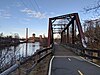
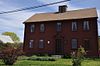
This is intended to be a complete list of the properties and districts on the National Register of Historic Places in Kent County, Rhode Island, United States. Latitude and longitude coordinates are provided for many National Register properties and districts; these locations may be seen together in a map.[1]
There are 80 properties and districts listed on the National Register in the county, including 1 National Historic Landmark.
This is a list of the National Register of Historic Places listings in Charlevoix County, Michigan.
This is intended to be a complete list of the properties and districts on the National Register of Historic Places in Scott County, Iowa, United States. Latitude and longitude coordinates are provided for many National Register properties and districts; these locations may be seen together in a map.
This is a list of the National Register of Historic Places listings in Erie County, Ohio.
This is a list of the National Register of Historic Places listings in Bristol County, Rhode Island.
This is a list of the National Register of Historic Places listings in Newport County, Rhode Island.
This is a list of the National Register of Historic Places listings in Providence County, Rhode Island.
This is a list of the National Register of Historic Places listings in Washington County, Rhode Island.
This is a list of the National Register of Historic Places listings in Providence, Rhode Island.
This is a list of the National Register of Historic Places listings in Pawtucket, Rhode Island.
This is a list of the National Register of Historic Places listings in Belmont County, Ohio.
This is intended to be a complete list of properties and districts listed on the National Register of Historic Places on Manhattan Island below 14th Street, which is a significant portion of the New York City borough of Manhattan. In turn, the borough of Manhattan is coterminous with New York County, New York. For properties and districts in other parts of Manhattan Island, the mainland neighborhood of Marble Hill, and the other islands of New York County, see National Register of Historic Places listings in Manhattan. The locations of National Register properties and districts may be seen in an online map by clicking on "Map of all coordinates".
This is intended to be a complete list of historic properties and districts listed on the National Register of Historic Places located on islands other than Manhattan Island but still in New York County, New York. For all properties and districts in the borough of Manhattan, see National Register of Historic Places listings in New York County, New York. The locations of National Register properties and districts may be seen in an online map by clicking on "Map of all coordinates".
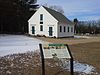
This is a list of the National Register of Historic Places listings in Kent County, Maryland.
This is a list of the National Register of Historic Places listings in Charles City County, Virginia.
This is a list of the National Register of Historic Places listings in Mecklenburg County, Virginia.
This is a list of the National Register of Historic Places listings in New Kent County, Virginia.
This is a list of the National Register of Historic Places listings in Rock Island County, Illinois.
This is a list of the National Register of Historic Places listings in Dearborn County, Indiana.
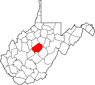
This is a list of the National Register of Historic Places listings in Braxton County, West Virginia.
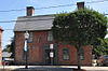
This is a list of the National Register of Historic Places listings in Kent County, Texas.
References
↑ The latitude and longitude information provided in this table was derived originally from the National Register Information System, which has been found to be fairly accurate for about 99% of listings. Some locations in this table may have been corrected to current GPS standards.
1 2 Numbers represent an alphabetical ordering by significant words. Various colorings, defined here, differentiate National Historic Landmarks and historic districts from other NRHP buildings, structures, sites or objects.
↑ The eight-digit number below each date is the number assigned to each location in the National Register Information System database, which can be viewed by clicking the number.
This page is based on this Wikipedia article Text is available under the CC BY-SA 4.0 license; additional terms may apply. Images, videos and audio are available under their respective licenses.