National Register of Historic Places listings in Warwick, Rhode Island

Last updated

This is a list of Registered Historic Places in Warwick, Rhode Island , which has been transferred from and is an integral part of National Register of Historic Places listings in Kent County, Rhode Island.

Contents: Counties in Rhode Island

Bristol | Kent | Newport | Providence | Washington


    This National Park Service list is complete through NPS recent listings posted February 9, 2024. [1]
Map all coordinates using: OpenStreetMap
[2] Name on the Register [3] ImageDate listed [4] Location City or townDescription
1 Apponaug Historic District
Apponaug Historic District WarwickRI ApponaugHD 2.jpg
Apponaug Historic District
February 23, 1984
(#84001833)
3376, 3384, 3387, 3391, 3397-3399, and 3404 Post Rd.
41°38′18″N71°27′04″W / 41.638333°N 71.451111°W / 41.638333; -71.451111 (Apponaug Historic District)
Warwick
2 John Waterman Arnold House
John Waterman Arnold House John Waterman Arnold House.jpg
John Waterman Arnold House
September 10, 1971
(#71000013)
11 Roger Williams Ave.
41°45′18″N71°23′56″W / 41.755°N 71.398889°W / 41.755; -71.398889 (John Waterman Arnold House)
Warwick
3 Budlong Farm
Budlong Farm WarwickRI BudlongFarm.jpg
Budlong Farm
August 18, 1983
(#83000165)
595 Buttonwoods Ave.
41°41′24″N71°25′38″W / 41.69°N 71.427222°W / 41.69; -71.427222 (Budlong Farm)
Warwick
4 Buttonwoods Beach Historic District
Buttonwoods Beach Historic District WarwickRI Buttonwoods 4.jpg
Buttonwoods Beach Historic District
February 23, 1984
(#84001834)
Roughly bounded by Brush Neck Cove, Greenwich Bay, Cooper and Promenade Aves.
41°41′09″N71°24′49″W / 41.685833°N 71.413611°W / 41.685833; -71.413611 (Buttonwoods Beach Historic District)
Warwick
5 Cedar Hill
Cedar Hill WarwickRI CloudsHill.jpg
Cedar Hill
December 22, 2014
(#14001077)
4157 Post Rd.
41°40′42″N71°27′10″W / 41.6783°N 71.4528°W / 41.6783; -71.4528 (Cedar Hill)
Warwick Now the Clouds Hill Victorian Museum.
6 Conimicut Lighthouse
Conimicut Lighthouse Conimicut Light in Narragansett Bay in Warwick Rhode Island.jpg
Conimicut Lighthouse
March 30, 1988
(#88000269)
East of Conimicut Pt. in the Providence River
41°43′01″N71°20′45″W / 41.716944°N 71.345833°W / 41.716944; -71.345833 (Conimicut Lighthouse)
Warwick
7 Cowesett Pound
Cowesett Pound WarwickRI CowesettPound.jpg
Cowesett Pound
September 4, 1987
(#87000994)
Cowesett Rd.
41°41′08″N71°27′44″W / 41.685556°N 71.462222°W / 41.685556; -71.462222 (Cowesett Pound)
Warwick
8 District Four School
District Four School WarwickRI FormerDistrictFourSchool.jpg
District Four School
April 14, 1997
(#97000318)
1515 W. Shore Rd.
41°42′24″N71°23′03″W / 41.706667°N 71.384167°W / 41.706667; -71.384167 (District Four School)
Warwick
9 East Greenwich Historic District
East Greenwich Historic District East Greenwich Downtown.jpg
East Greenwich Historic District
June 13, 1974
(#74000036)
Roughly bounded by Kenyon Ave., Division, Peirce, and London Sts., Greenwich Cove and Dark Entry Brook
41°39′43″N71°27′17″W / 41.661944°N 71.454722°W / 41.661944; -71.454722 (East Greenwich Historic District)
East Greenwich and Warwick
10 Elizabeth Spring
Elizabeth Spring WarwickRI ElizabethSpring.jpg
Elizabeth Spring
August 18, 1983
(#83000166)
Off Forge Rd.
41°38′51″N71°27′25″W / 41.6475°N 71.456944°W / 41.6475; -71.456944 (Elizabeth Spring)
Warwick
11 Forge Farm
Forge Farm WarwickRI ForgeFarm.jpg
Forge Farm
January 11, 1974
(#74000037)
40 Forge Rd.
41°38′19″N71°27′06″W / 41.638611°N 71.451667°W / 41.638611; -71.451667 (Forge Farm)
Warwick
12 Forge Road Historic District
Forge Road Historic District WarwickRI ForgeRoadHD 1.jpg
Forge Road Historic District
February 23, 1984
(#84001861)
Forge Rd. from Ives Rd. to the Potowomut River
41°38′18″N71°27′04″W / 41.638333°N 71.451111°W / 41.638333; -71.451111 (Forge Road Historic District)
Warwick
13 Capt. Oliver Gardiner House
Capt. Oliver Gardiner House WarwickRI GardinerHouse.jpg
Capt. Oliver Gardiner House
August 18, 1983
(#83000167)
4451 Post Rd.
41°40′10″N71°26′57″W / 41.669444°N 71.449167°W / 41.669444; -71.449167 (Capt. Oliver Gardiner House)
Warwick
14 Gaspee Point
Gaspee Point GaspeePoint1.jpg
Gaspee Point
June 8, 1972
(#72000018)
Off Namquid Dr.
41°44′38″N71°22′42″W / 41.743889°N 71.378333°W / 41.743889; -71.378333 (Gaspee Point)
Warwick
15 Caleb Gorton House
Caleb Gorton House Caleb Gorton House.jpg
Caleb Gorton House
August 18, 1983
(#83000168)
987 Greenwich Ave.
41°42′30″N71°27′53″W / 41.708333°N 71.464722°W / 41.708333; -71.464722 (Caleb Gorton House)
Warwick
16 Caleb Greene House
Caleb Greene House Caleb Greene House.jpg
Caleb Greene House
November 28, 1978
(#78000063)
15 Centerville Rd.
41°41′55″N71°27′39″W / 41.698611°N 71.460833°W / 41.698611; -71.460833 (Caleb Greene House)
Warwick
17 Moses Greene House
Moses Greene House WarwickRI MosesGreeneHouse.jpg
Moses Greene House
August 18, 1983
(#83000169)
11 Economy Ave.
41°42′49″N71°22′16″W / 41.713611°N 71.371111°W / 41.713611; -71.371111 (Moses Greene House)
Warwick
18 Peter Greene House
Peter Greene House WarwickRI PeterGreeneHouse.jpg
Peter Greene House
August 18, 1983
(#83000170)
1124 W. Shore Rd.
41°42′55″N71°22′34″W / 41.715278°N 71.376111°W / 41.715278; -71.376111 (Peter Greene House)
Warwick
19 Richard Wickes Greene House
Richard Wickes Greene House WarwickRI RichardWickesGreeneHouse.jpg
Richard Wickes Greene House
August 18, 1983
(#83000171)
27 Homestead Ave.
41°40′51″N71°22′49″W / 41.680833°N 71.380278°W / 41.680833; -71.380278 (Richard Wickes Greene House)
Warwick
20 Greene-Bowen House
Greene-Bowen House Greene-Bowen House.jpg
Greene-Bowen House
May 2, 1974
(#74000038)
100 Mill Wheel Rd.
41°41′26″N71°25′19″W / 41.690556°N 71.421944°W / 41.690556; -71.421944 (Greene-Bowen House)
Warwick
21 Greene-Durfee House
Greene-Durfee House WarwickRI GreeneDurfeeHouse.jpg
Greene-Durfee House
August 18, 1983
(#83000172)
1272 W. Shore Rd.
41°42′46″N71°22′48″W / 41.712778°N 71.38°W / 41.712778; -71.38 (Greene-Durfee House)
Warwick
22 Greenwich Cove Site January 4, 1980
(#80000077)
Address Restricted
Warwick
23 Greenwich Mills
Greenwich Mills Greenwich Mills Warwick RI.jpg
Greenwich Mills
December 20, 2006
(#06001151)
42 Ladd St.
41°40′01″N71°26′52″W / 41.666944°N 71.447778°W / 41.666944; -71.447778 (Greenwich Mills)
Warwick
24 Hopelands
Hopelands WarwickRI Hopelands.jpg
Hopelands
August 18, 1983
(#83000173)
Wampanoag Rd.
41°39′27″N71°25′02″W / 41.6575°N 71.417222°W / 41.6575; -71.417222 (Hopelands)
Warwick Now the campus of the Rocky Hill School.
25 Indian Oaks
Indian Oaks Aldrich Mansion Indian Oaks 16 finished.jpg
Indian Oaks
August 18, 1983
(#83000174)
836 Warwick Neck Ave.
41°40′55″N71°22′35″W / 41.681944°N 71.376389°W / 41.681944; -71.376389 (Indian Oaks)
Warwick
26 Knight Estate
Knight Estate Knight Estate in Warwick RI.jpg
Knight Estate
February 23, 1984
(#84001864)
486 East Ave.
41°43′06″N71°28′54″W / 41.718333°N 71.481667°W / 41.718333; -71.481667 (Knight Estate)
Warwick
27 Lambert Farm Site, RI-269 November 3, 1983
(#83003798)
Address Restricted
Warwick
28 Meadows Archeological District November 3, 1983
(#83003800)
Address Restricted
Warwick
29 Pawtuxet Village Historic District
Pawtuxet Village Historic District Pawtuxet Baptist Church, Pawtuxet RI.jpg
Pawtuxet Village Historic District
April 24, 1973
(#73000050)
Bounded roughly by Bayside, S. Atlantic, and Ocean Aves., Pawtuxet and Providence rivers, and Post Rd.
41°45′49″N71°23′27″W / 41.763611°N 71.390833°W / 41.763611; -71.390833 (Pawtuxet Village Historic District)
Warwick
30 Pontiac Mills
Pontiac Mills Pontiac Mills RI.jpg
Pontiac Mills
June 5, 1972
(#72000019)
Knight St.
41°43′35″N71°28′13″W / 41.726389°N 71.470278°W / 41.726389; -71.470278 (Pontiac Mills)
Warwick
31 Rhode Island State Airport Terminal
Rhode Island State Airport Terminal Old Terminal Rhode Island.jpg
Rhode Island State Airport Terminal
August 18, 1983
(#83000175)
572 Occupasstuxet Rd.
41°43′54″N71°25′44″W / 41.731667°N 71.428889°W / 41.731667; -71.428889 (Rhode Island State Airport Terminal)
Warwick
32 Christopher Rhodes House
Christopher Rhodes House Christopher Rhodes House, Pawtuxet RI.jpg
Christopher Rhodes House
March 31, 1971
(#71000015)
25 Post Rd.
41°45′49″N71°23′29″W / 41.763611°N 71.391389°W / 41.763611; -71.391389 (Christopher Rhodes House)
Warwick
33 Trafalgar Site, RI-639 November 3, 1983
(#83003801)
Address Restricted
Warwick
34 Warwick Civic Center Historic District
Warwick Civic Center Historic District Warwick City Hall.jpg
Warwick Civic Center Historic District
June 27, 1980
(#80000079)
Post Rd.
41°41′57″N71°27′31″W / 41.699167°N 71.458611°W / 41.699167; -71.458611 (Warwick Civic Center Historic District)
Warwick
35 Warwick Lighthouse
Warwick Lighthouse Warwick Lighthouse in Rhode Island.jpg
Warwick Lighthouse
March 30, 1988
(#88000268)
1350 Warwick Neck Ave.
41°40′01″N71°22′43″W / 41.666944°N 71.378611°W / 41.666944; -71.378611 (Warwick Lighthouse)
Warwick
36 John R. Waterman House
John R. Waterman House WarwickRI JohnRWatermanHouse.jpg
John R. Waterman House
August 18, 1983
(#83000176)
100 Old Homestead Rd.
41°43′16″N71°23′43″W / 41.721111°N 71.395278°W / 41.721111; -71.395278 (John R. Waterman House)
Warwick
37 Oliver A. Wickes House
Oliver A. Wickes House WarwickRI OliverWickesHouse.jpg
Oliver A. Wickes House
August 18, 1983
(#83000177)
794 Major Potter Rd.
41°40′25″N71°28′30″W / 41.673611°N 71.475°W / 41.673611; -71.475 (Oliver A. Wickes House)
Warwick

See also

Related Research Articles

<span class="mw-page-title-main">National Register of Historic Places listings in Bristol County, Rhode Island</span>

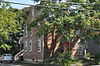
This is a list of the National Register of Historic Places listings in Bristol County, Rhode Island.

<span class="mw-page-title-main">National Register of Historic Places listings in Kent County, Rhode Island</span>

This is a list of the National Register of Historic Places listings in Kent County, Rhode Island.

<span class="mw-page-title-main">National Register of Historic Places listings in Providence County, Rhode Island</span>

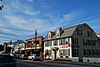
This is a list of the National Register of Historic Places listings in Providence County, Rhode Island.

<span class="mw-page-title-main">National Register of Historic Places listings in Washington County, Rhode Island</span>

This is a list of the National Register of Historic Places listings in Washington County, Rhode Island.

<span class="mw-page-title-main">National Register of Historic Places listings in Pawtucket, Rhode Island</span>

This is a list of the National Register of Historic Places listings in Pawtucket, Rhode Island.

This is a list of Registered Historic Places in Barrington, Rhode Island, which has been transferred from and is an integral part of National Register of Historic Places listings in Bristol County, Rhode Island

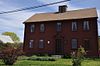
List of Registered Historic Places in Bristol, Rhode Island, which has been transferred from and is an integral part of National Register of Historic Places listings in Bristol County, Rhode Island

List of Registered Historic Places in Warren, Rhode Island, which has been transferred from and is an integral part of National Register of Historic Places listings in Bristol County, Rhode Island

List of Registered Historic Places in Coventry, Rhode Island, which has been transferred from and is an integral part of National Register of Historic Places listings in Kent County, Rhode Island

List of Registered Historic Places in East Greenwich, Rhode Island, which has been transferred from and is an integral part of National Register of Historic Places listings in Kent County, Rhode Island

List of Registered Historic Places in West Greenwich, Rhode Island, which has been transferred from and is an integral part of National Register of Historic Places listings in Kent County, Rhode Island

List of Registered Historic Places in West Warwick, Rhode Island, which has been transferred from and is an integral part of National Register of Historic Places listings in Kent County, Rhode Island

This is a list of Registered Historic Places in Jamestown, Rhode Island, which has been transferred from and is an integral part of National Register of Historic Places listings in Newport County, Rhode Island.

This is a list of Registered Historic Places in Little Compton, Rhode Island, which has been transferred from and is an integral part of National Register of Historic Places listings in Newport County, Rhode Island.

This is a list of Registered Historic Places in Middletown, Rhode Island, which has been transferred from and is an integral part of National Register of Historic Places listings in Newport County, Rhode Island.

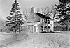
This is a list of Registered Historic Places in Portsmouth, Rhode Island, which has been transferred from and is an integral part of National Register of Historic Places listings in Newport County, Rhode Island.

This is a list of Registered Historic Places in Tiverton, Rhode Island, which has been transferred from and is an integral part of National Register of Historic Places listings in Newport County, Rhode Island.

This is a list of Registered Historic Places in Westerly, Rhode Island.

This is a list of Registered Historic Places in Central Falls, Rhode Island.

This is a list of Registered Historic Places in Cranston, Rhode Island.

References

  1. National Park Service, United States Department of the Interior, "National Register of Historic Places: Weekly List Actions", retrieved February 9, 2024.
  2. Numbers represent an alphabetical ordering by significant words. Various colorings, defined here, differentiate National Historic Landmarks and historic districts from other NRHP buildings, structures, sites or objects.
  3. "National Register Information System". National Register of Historic Places . National Park Service. March 13, 2009.
  4. The eight-digit number below each date is the number assigned to each location in the National Register Information System database, which can be viewed by clicking the number.