
U.S. Route 10 or U.S. Highway 10 (US 10) is an east–west United States Numbered Highway located in the Midwest and Great Lakes regions of the U.S. Unlike most U.S. Highways with "0" as the last digit of its route number, US 10 is not a cross-country highway. US 10 was one of the original long-haul highways, running from Detroit, Michigan, to Seattle, Washington, but then lost much of its length when new Interstate Highways were built on top of its right-of-way.

U.S. Route 14 or U.S. Highway 14 (US 14), an east–west route, is one of the original United States Numbered Highways of 1926. It currently has a length of about 1,445 miles (2,326 km), for much of which it runs roughly parallel to Interstate 90 (I-90).

U.S. Route 77 is a major north–south United States Numbered Highway which extends for 1,305 miles (2,100 km) in the central United States. As of 2005, Its southern terminus is in Brownsville, Texas, at Veteran's International Bridge on the Mexican border, where it connects with both Mexican Federal Highway 101 and Mexican Federal Highway 180, and the highway's northern terminus is in Sioux City, Iowa, at an interchange with Interstate 29 (I-29), less than 1⁄2 mile (800 m) north of the Nebraska state line.

U.S. Route 81 or U.S. Highway 81 (US 81) is a major north–south U.S. highway that extends for 1,220 miles (1,960 km) in the central United States and is one of the original United States Numbered Highways established in 1926 by the American Association of State Highway Officials.

U.S. Route 281 (US 281) is a north–south United States Numbered Highway. At 1,875 miles (3,018 km) it is the longest continuous three-digit U.S. Route.

U.S. Route 83 (US 83) is a major north–south United States Numbered Highway that extends 1,885 miles (3,034 km) in the central United States. Only four other north–south routes are longer: US 1, US 41, US 59, and US 87, while US 83 follows a straighter north-south path than all of these. Nearly half of its mileage is in the state of Texas. The highway's northern terminus is north of Westhope, North Dakota, at the Canadian border, where it continues as Manitoba Highway 83 (PTH 83). The southern terminus is at the Veterans International Bridge in Brownsville, Texas. Together, US 83 and PTH 83 form a continuously numbered north-south highway with a combined distance of 3,450 kilometres (2,140 mi).
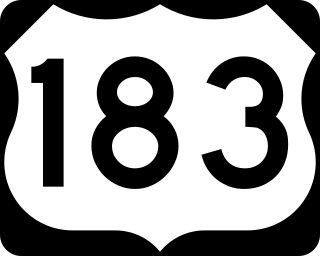
U.S. Route 183 (US 183) is a north–south United States highway. The highway's northern terminus is in Presho, South Dakota, at an intersection with Interstate 90. Its southern terminus is in Refugio, Texas, at the southern intersection of U.S. Highway 77 and Alternate US 77.

U.S. Highway 16 (US 16) is an east–west United States Numbered Highway between Rapid City, South Dakota, and Yellowstone National Park in Wyoming. The highway's eastern terminus is at a junction with Interstate 90 (I-90)/US 14, concurrent with I-190, in Rapid City. The western terminus is the east entrance to Yellowstone National Park, concurrent with US 14 and US 20. US 16 used to extend all the way to Michigan but has been truncated in favor of I-90 and I-96.

U.S. Highway 18 (US 18) is an east–west United States Numbered Highway in the Midwestern United States. The western terminus is in Orin, Wyoming, at an interchange with Interstate 25 (I-25). Its eastern terminus is in downtown Milwaukee, Wisconsin. However, US 18 runs concurrent with other U.S. Highways from its western terminus to Mule Creek Junction, Wyoming. US 18 is one of the original U.S. Highways of 1926. The US 18 designation was originally proposed for a road in Michigan from Grand Haven east to Detroit. This roadway was eventually designated as US 16.

U.S. Route 85 (US 85) is a 1,479-mile-long (2,380 km) north–south United States Highway that travels in the Mountain and Northern Plains states of the United States. The southern terminus of the highway is at the Mexican border in El Paso, Texas, connecting with Mexican Federal Highway 45. The northern terminus is at the Canadian border in Fortuna, North Dakota, where the route continues north as Saskatchewan Highway 35. The highway route is part of the CanAm Highway. Sections of US 85 are designated as the Theodore Roosevelt Expressway.

U.S. Route 212 (US 212) is a spur of US 12. It runs for 949 miles (1,527 km) from Yellowstone National Park to Minnesota Highway 62 at Edina, Minnesota. It does not intersect US 12 now, but it once had an eastern terminus at US 12 in St. Paul, Minnesota. US 212 passes through the states of Minnesota, South Dakota, Wyoming, and Montana. It goes through the cities of Watertown, South Dakota and Billings, Montana.
Three Forks is an unincorporated community in Pennington County, South Dakota, United States. It lies at the intersection of U.S. Routes 16 and 385, just north of Hill City along Spring Creek. A small general store featuring fuel is open year-round; other businesses are open seasonally, including a campground, a motel, a miniature golf-course, and an ice-cream stand. The campground is the site of an annual Octoberfest event, and the area is heavily patronized during the Sturgis Motorcycle Rally in August of each year. In recent years, considerable residential development of the immediate area has swollen its population.

Wyoming Highway 24 (WYO 24), also known as the Bear Lodge Highway, is a 46.72-mile (75.19 km) state highway in Crook County, Wyoming, United States. that connects U.S. Route 14 (US 14) in Carlile Junction with South Dakota Highway 34 (SD 34) at the South Dakota state line. The route passes through the northern portion of the Bear Lodge Mountains, part of the Black Hills National Forest. The highway also passes by Devils Tower National Monument.
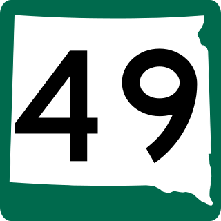
South Dakota Highway 49 is a 35.134-mile (56.543 km) long state route that runs north to south in south-central South Dakota. It begins at a junction with South Dakota Highway 47 just south of the White River, and terminates at the junction of U.S. Highway 18 and U.S. Highway 183 in Colome.

The Theodore Roosevelt Expressway, is made up of several existing highways between Rapid City, South Dakota and the Port of Raymond between Saskatchewan and Montana. It is the northern third of the Ports-to-Plains Alliance. The corridor is approximately 445 miles (716 km) long with the majority of the highway two lanes. Congress designated the route as one of 80 National Highway System High-Priority Corridors in 2005 by the Intermodal Surface Transportation Efficiency Act. The designation did not create new design standards or create new eligibility for any additional federal funding.
U.S. Highway 14 (US 14) in the U.S. state of Wyoming runs east to west across the northern part of the state. The road connects South Dakota on the east with Yellowstone National Park on the west. It is mostly a two-lane surface road except for several sections that it shares with Interstate 90 (I-90).

U.S. Highway 2 (US 2) is a 358.090-mile-long (576.290 km) United States Numbered Highway in North Dakota, which runs from the Montana state line east to the Red River at Grand Forks. The route connects the cities of Williston, Minot, and Grand Forks. Of the 358 miles (576 km) of US 2 in North Dakota, all but the westernmost 12 miles (19 km) have four lanes.
Maverick Junction, South Dakota, United States, is an unincorporated community and census-designated place (CDP) located in Fall River County at the intersection of South Dakota Highway 79 and US Highways 18 and 385, approximately five miles southeast of Hot Springs. The population was 46 at the 2020 census.

South Dakota Highway 314 (SD 314) is a 3.751-mile-long (6.037 km) state highway in southwestern Yankton County, South Dakota, United States, that runs from South Dakota Highway 50 (SD 50) to the western city limits of Yankton.

South Dakota Highway 79 (SD 79) is a 209-mile (336 km) state highway in western South Dakota, United States, that runs from Maverick Junction near the Black Hills National Forest to the North Dakota state line.

