
Achill Island is the largest of the Irish isles and lies off the west coast of Ireland in County Mayo. It has a population of 2,345. Its area is 148 km2 (57 sq mi). Achill is attached to the mainland by Michael Davitt Bridge, between the villages of Achill Sound and Polranny. A bridge was first completed here in 1887. Other centres of population include the villages of Keel, Dooagh, Dooega, Dooniver, and Dugort. The parish's main Gaelic football pitch and secondary school are on the mainland at Polranny. Early human settlements are believed to have been established on Achill around 3000 BC. The island is 87% peat bog. The parish of Achill consists of Achill Island, Achillbeg, Inishbiggle and the Corraun Peninsula.

Bus Éireann is a state-owned bus and coach operator providing services throughout Ireland, with the exception of Dublin and the Greater Dublin Area, where bus services are provided by sister company Dublin Bus. It is a subsidiary of Córas Iompair Éireann (CIÉ). The company's primary hub is Busáras, Central Bus Station, located in Store Street, Central Dublin.

Rail transport in Ireland is provided by Iarnród Éireann in the Republic of Ireland and by Northern Ireland Railways in Northern Ireland.

Glenties is a town in County Donegal, Ireland. It is situated where two glens meet, north-west of the Bluestack Mountains, near the confluence of two rivers. Glenties is the largest centre of population in the parish of Iniskeel. Glenties has won the Irish Tidy Towns Competition five times in 1958, 1959, 1960, 1962 and 1995 and has won a medal many other times. As of 2016, the population is 805.
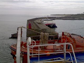
The village of Rosslare Harbour, also known as Ballygeary, grew up to serve the needs of the harbour of the same name, first developed in 1906 by the Great Western Railway and the Great Southern and Western Railway to accommodate steamferry traffic between Great Britain and Ireland. This port also serves France and Spain, traffic is mainly roll-on roll-off (RoRo). Rosslare Harbour railway station opened on 30 August 1906.

Rosslare Strand, or simply Rosslare, is a village and seaside resort in County Wexford, Ireland. The name Rosslare Strand is used to distinguish it from the nearby community of Rosslare Harbour, site of the Rosslare Europort.

Louisburgh is a small town on the southwest corner of Clew Bay in County Mayo, Ireland. It is home to Sancta Maria College and the Gráinne O'Malley Interpretive Centre.

Murrisk is a village in County Mayo, Ireland, on the south side of Clew Bay, about 8 km west of Westport and 4 km east of Lecanvey.
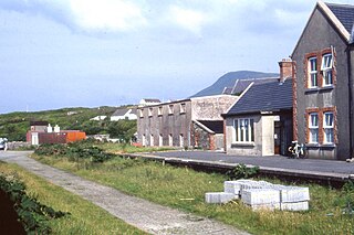
Gob an Choire or Gob a' Choire, formerly anglicised as Gubacurra, is a Gaeltacht village in County Mayo, Ireland. It lies on the east coast of Achill Island and is the first settlement one reaches after crossing the Michael Davitt Bridge, a swing bridge that joins Achill Island to Corraun Peninsula on the mainland. In ancient times the southern entrance was guarded by Carrickkildavnet Castle.

Lecanvey or Leckanvy is a seaside village in County Mayo, Ireland, between Westport and Louisburgh, about 2 km west of Murrisk. It has a small beach with Lecanvey Pier. To the south is Croagh Patrick. To the west is Clare Island.

Mulranny —sometimes spelled as 'Mallaranny', 'Mulrany', 'Malaranny', 'Mullaranny', 'Mullranny' or 'Mulranny'—is a seaside village on the isthmus between Clew Bay and Blacksod Bay in County Mayo, Ireland. Mulranny, located at the foot of the Nephin Mountain Range, has a number of blue flag beaches and a coastal lagoon. The Corraun Peninsula, which contains three mountain peaks, is situated across Clew Bay.
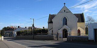
Raharney is a village in east County Westmeath, Ireland. It has a population of 221 according to the 2016 census.
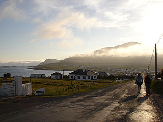
Dooagh is a village located on Achill Island in County Mayo, Ireland. It is best known for the nearby Keem Bay, a Blue Flag beach.
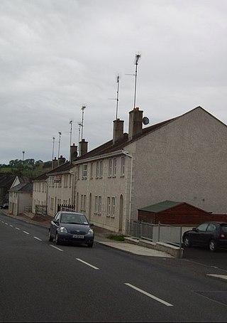
Kilnaleck or Kilnalec is a small village in County Cavan, Ireland on the R154 regional road. Kilnaleck was once the centre of a mining boom when in 1879 some local businessmen and a school headmaster decided to develop the coal that existed nearby. However, the coal was very deep and hard to extract and the mine was forced to close. The village is part of Crosserlough parish.
Tomás Ó Raghallaigh (1881-1966) was an Irish language academic and writer.
Pollagh is a village on Achill Island off the coast of County Mayo. It is surrounded by the villages of Keel, County Mayo and Dooagh.

Dumha Éige is a village in the south west of Achill Island on the west coast of Ireland in County Mayo. It is in the Gaeltacht and is the home of Coláiste Acla. It once had a National School. The scenic area is part of the Achill Atlantic Drive. Dumha Éige/Dooega has a Blue Flag beach, a church, a pub and guesthouse.
An Caol, from the Gaelic for "narrow", may refer to:
The R319 road is a regional road in County Mayo, Ireland. It is the main road to Achill Island from the rest of the country.


