
Shammer is a small village beside the village of Kilkelly in County Mayo, Ireland. [1]
Shammer is a small village beside the village of Kilkelly in County Mayo, Ireland. [1]

Kilkelly is a small village in Kilmovee civil parish, County Mayo, Ireland. It is just south of Ireland West Airport Knock on the N17, a national primary road running between Galway and Sligo.

The N59 road is a national secondary road in Ireland. It commences in County Sligo, south of Sligo Town at the Belladrehid interchange with the N4 north of Ballysadare. The route circles around the west of Ireland, passing west from Sligo into County Mayo and through Ballina. The N59 continues around Mayo, proceeding indirectly to Westport. Continuing south through Mayo into County Galway, the road passes through the village of Leenaun. The 182-year-old bridge in the centre of the village, carrying the road across the River Lahill, collapsed in floods on 18 July 2007. Due to the local terrain and road network, the diversionary route for getting from the south of the village to Westport was 110 km long. A temporary bridge was opened eight days after the floods, on 27 July. It has since been replaced by a new bridge.

The N26 road is a national primary road in northeast County Mayo in Ireland connecting the N5 road at Swinford with the N58 at Foxford and then on to the N59 road at Ballina. The road also meets six regional roads along its route, and it is 29.79 kilometres (18.51 mi) long.
Charlestown–Bellahy is an urban area crossing the boundaries of County Mayo and County Sligo in Ireland. It comprises the adjoining villages of Charlestown, County Mayo, and Bellaghy, County Sligo. It had a population of 753 at the 2002 census.
The Roman Catholic Diocese of Achonry is a Roman Catholic diocese in the western part of Ireland. It is one of the five suffragan sees of the Archdiocese of Tuam. The diocese was often called the "bishopric of Luighne" in the Irish annals. It was not established at the Synod of Rathbreasail, but Máel Ruanaid Ua Ruadáin signed as "bishop of Luighne" at the Synod of Kells.
Drummin is a small village in County Mayo, Ireland, near the town of Westport.

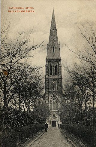
Kilmovee is a village and civil parish in County Mayo, Ireland. It is a mainly rural parish on the R325 road, midway between Kilkelly and Ballaghaderreen.

Costello is one of the ancient baronies of Ireland. Unusually for an Irish barony, it straddles two counties: County Mayo and County Roscommon. It comprises the modern day districts of Kilkelly, Kilmovee, Killeagh, Kilcolman, and Castlemore.

Tulrahan, also spelt Tulrohaun, is a village in County Mayo, Ireland. It is located off the R327 regional road roughly midway between Claremorris and Cloonfad.

The Boyle River is a river in Ireland. Forming part of the Shannon River Basin, it flows from Lough Gara on the Sligo/Roscommon county border and thence through the town of Boyle to Lough Key. From there is continues eastwards through the village of Knockvicar to the River Shannon at Lough Drumharlow, near Carrick-on-Shannon. The length of the Boyle River is 64.4 km (40mi). The area of its basin is 725 km2.
Ballyglass is a small village in central County Mayo in Ireland. It is situated about 10 miles from Castlebar, and closer to Claremorris and Ballinrobe.

Delphi is a locality in County Mayo, Ireland. Its English name was coined by the Marquis of Sligo, who built a famous hunting lodge there.

Dumha Éige is a village in the south west of Achill Island on the west coast of Ireland in County Mayo. It is in the Gaeltacht and is the home of Coláiste Acla. It once had a National School. The scenic area is part of the Achill Atlantic Drive. Dumha Éige/Dooega has a Blue Flag beach, a church, a pub and guesthouse.

The River Robe is a river in County Mayo, Ireland. It rises near Ballyhaunis, then flows generally west for 64 kilometres (40 mi), where it drains into Lough Mask.
Turlough, is a village in County Mayo, Ireland, 6 km northeast of Castlebar. It is known for the presence of the Museum of Country Life, and for its well-preserved and unusually squat round tower, built between 900 and 1200.

The R375 road is a regional road in central County Mayo in Ireland. It connects the R320 road at Swinford to the N17 road at Liscosker, 11 kilometres (6.8 mi) away.
Pollatoomary is the deepest explored underwater cave in Ireland. It has been explored to an underwater depth of 113 metres (371 ft). The explored limit of Pollatoomary is also 23 metres (75 ft) deeper underwater than that of the terminal sump in Wookey Hole Caves in Somerset, England, which previously held the record for the deepest underwater cave in Britain and Ireland.
Kilmovee Shamrocks are a Gaelic Athletic Association club located in County Mayo. The club focuses primarily on the sport of Gaelic football and represents and draws players from the villages of Kilkelly and Kilmovee and the surrounding parish. The club is a member of the East Mayo Division and as of 2017 has been promoted to the Mayo Junior Championship.
Midfield is a village, in the barony of Gallen, in County Mayo, in Ireland. It is located close to the towns of Kilkelly, Kiltimagh, and Swinford, and to Ireland West (Knock) Airport.
53°52′46″N8°50′55″W / 53.87944°N 8.84861°W
| | This article related to the geography of County Mayo, Ireland is a stub. You can help Wikipedia by expanding it. |
