Keetley
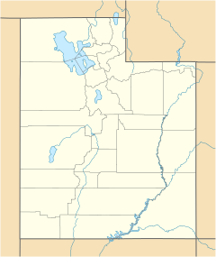
Location of Keetley within Utah
Keetley is a ghost town located in northeastern Wasatch County, Utah, United States. [1]
Keetley is a ghost town located in northeastern Wasatch County, Utah, United States. [1]
The town was located along the former routing of U.S. Route 40 (US‑40), north of the former town of Hailstone and east of Keetley Station. [2] (Keetley Junction was further north along US‑40, at its junction with Utah State Route 248.) [3]
The town began as a mining community, with a spur of the Union Pacific Railroad increasing the economic interest in the community for a short time. The village was submerged by the waters of Jordanelle Reservoir in 1995 along with Hailstone and Jordanelle.
The town began as a mining camp. Its first name was Camp Florence[ ambiguous ], for the first "lady" to visit the camp. It became a Pony Express station and a center for the area's mining and lumber industries. As it grew into a town, it was renamed for Jack Keetley, a Pony Express rider and local mining supervisor. [4]
During World War II Keetley was used as a 'voluntary' relocation camp for many Japanese-Americans. Fred Isamu Wada approached the mayor of Keetley, George Fisher, with the idea of leasing the land with the promise of bringing Japanese farm labor. While initial reaction was unfavorable, the fears were quickly allayed as it was shown that those relocating were not going to be a burden on the locals.
A large, 150-acre (61 ha) farm was established after much intense labor to clear the land of the ubiquitous rocks. While the women and children tended to chickens, pigs, and goats, the men went to work farming sugar beets.
The settlement lasted until the end of World War II when two-thirds returned to their homes in California and the rest scattered to other communities in Utah.
Because of its proximity to Park City and the Jordanelle Reservoir, while the site of Keetley itself (along with the former towns of Hailstone and Jordanelle) is now completely submerged by the reservoir, the surrounding area is today the site of new construction, bringing in large resort-style home developments such as Hideout Canyon, Todd Hollow and Deer Mountain. In 2008 the town of Hideout was incorporated in this area.

Wasatch County is a county in the U.S. state of Utah. As of the 2020 United States Census, the population was 34,788. Its county seat and largest city is Heber City. The county was named for a Ute word meaning "mountain pass" or "low place in the high mountains".

U.S. Route 189 is a spur of U.S. Route 89. It currently runs for 322 miles (518 km) from Provo, Utah at Interstate 15 to Jackson, Wyoming. The highway was not part of the original 1926 U.S. Highway system. The highway was created in the 1930s, absorbing former U.S. Route 530 and a portion of U.S. Route 30S. The portion through Provo Canyon has been designated the Provo Canyon Scenic Byway by the state of Utah.

Jordanelle Reservoir is a reservoir in Wasatch County, Utah, United States, just north of Heber City.

The Roan Cliffs are a series of desert mountains and cliffs in eastern Utah and western Colorado, in the western United States that are distinct from the Book Cliffs.

State Route 32 (SR-32) is a state highway in Wasatch and Summit Counties in the U.S. state of Utah. Most of the highway is an old routing of U.S. Route 189 that became disconnected from the rest of US-189 during the construction of the Jordanelle Reservoir. SR-32 runs for 29.053 miles (46.756 km) from US-40 and US-189 north of Heber City to I-80 near Wanship. Although signed US-189 or US-189 Alternate for most of its history, the highway pre-dates the creation of U.S. Highways and has had several numerical designations and route changes through the years.
Black Rock is an unincorporated community and near-ghost town in the Beaver Bottoms in southern Millard County, Utah, United States, approximately 20 miles (32 km) north of Milford.
Chester is an unincorporated community in central Sanpete County, Utah, United States.
Ticaboo is an unincorporated community in far southeastern Garfield County, Utah, United States.
State Route 248 is a highway in northern Utah that connects Park City with Kamas. In Park City it is known as Kearns Boulevard.

Vivian Park is an unincorporated community in northeastern Utah County, Utah, United States.
Hailstone was a town in northern Wasatch County, Utah, United States.
Shivwits is an unincorporated community in west-central Washington County, Utah, United States. It is occupied by the Shivwits Band of Paiutes.

Park City Hospital is a full-service community hospital in Park City, Utah, United States. It is located at 900 Round Valley Drive at the northwest corner of Keetley Junction US-40/US-189 and SR-248. It a service of Intermountain Healthcare, a nonprofit health care system serving the Intermountain West.

Maple Canyon is a canyon in the northeastern San Pitch Mountains in northern Sanpete County, Utah, United States Nearly all of the canyon, except the western end, is located within the Uinta National Forest. The mouth of the canyon is in the northwestern Sanpete Valley, south of Fountain Green and just northwest of the unincorporated community of Freedom, at an elevation of 6,017 feet (1,834 m).

Salduro is a ghost town located in Tooele County, Utah, United States.
Deadman Lake is a lake near the northern edge of Uintah County, Utah, United States.
Jordanelle was a community in northern Wasatch County, Utah, United States.
Diamond is a ghost town in eastern Juab County, Utah, United States. The Diamond Cemetery is listed on the National Register of Historic Places.
Currant Creek is a stream in eastern Juab County and southern Utah County in northern Utah, United States.
Municipalities and communities of Wasatch County, Utah, United States | ||
|---|---|---|
| Cities | 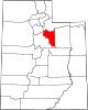 | |
| Towns | ||
| CDP | ||
| Unincorporated community | ||
| Indian reservation | ||
| Ghost towns | ||
| Footnotes | ‡This populated place also has portions in an adjacent county or counties | |
40°38′08″N111°24′53″W / 40.63556°N 111.41472°W
| | This article about a location in Utah is a stub. You can help Wikipedia by expanding it. |