Kenilworth, New Jersey

Last updated

Kenilworth, New Jersey
Kenilworth Municipal Building.jpg
Kenilworth Municipal Building
Kenilworth Seal.png
Kenilworth nj 039.png
Map of Kenilworth in Union County. Inset: Location of Union County highlighted in the State of New Jersey.
Census Bureau map of Kenilworth, New Jersey.png
Census Bureau map of Kenilworth, New Jersey
Location map of Union County, New Jersey.svg
Red pog.svg
Kenilworth
Location in Union County
USA New Jersey relief location map.svg
Red pog.svg
Kenilworth
Location in New Jersey
Usa edcp relief location map.png
Red pog.svg
Kenilworth
Location in the United States
Coordinates: 40°40′41″N74°17′17″W / 40.678089°N 74.288114°W / 40.678089; -74.288114 [1] [2]
Country Flag of the United States.svg  United States
State Flag of New Jersey.svg  New Jersey
County Union
Incorporated May 13, 1907
Named for Kenilworth Castle
Government
[3]
  Type Borough
  BodyBorough Council
   Mayor Linda Karlovitch (D, term ends December 31, 2027) [4] [5]
   Municipal clerk Angela Lazzari [6]
Area
[7]
  Total2.15 sq mi (5.57 km2)
  Land2.15 sq mi (5.56 km2)
  Water0.00 sq mi (0.01 km2)  0.19%
  Rank398th of 565 in state
17th of 21 in county [1]
Elevation
[8]
115 ft (35 m)
Population
  Total8,427
  Estimate 
(2022) [9] [11]
8,277
  Rank282nd of 565 in state
17th of 21 in county [12]
  Density3,925.0/sq mi (1,515.5/km2)
   Rank166th of 565 in state
14th of 21 in county [12]
Time zone UTC−05:00 (Eastern (EST))
  Summer (DST) UTC−04:00 (Eastern (EDT))
ZIP Code
07033 [13] [14]
Area code 908 [15]
FIPS code 3403936690 [1] [16] [17]
GNIS feature ID0885267 [1] [18]
Website www.kenilworthborough.com

Kenilworth is a borough in Union County, in the U.S. state of New Jersey. As of the 2020 United States census, the borough's population was 8,427, [9] [10] an increase of 513 (+6.5%) from the 2010 census count of 7,914, [19] [20] which in turn reflected an increase of 239 (+3.1%) from the 7,675 counted in the 2000 census. [21]

Contents

Kenilworth was incorporated as a borough by an act of the New Jersey Legislature on May 13, 1907, from portions of Cranford and Union Township, based on the results of a referendum held on June 18, 1907. [22]

History

Upsala College Upsala College Hv8Dbild.png
Upsala College

In the late 1890s, the New Orange Industrial Association purchased land in Cranford and Union that was subdivided into building lots. The firm brought in several large industries and lured Upsala College from Brooklyn with an offer of cash and free land for its campus. [23]

Because New Orange was often confused with one of The Oranges in Essex County, the name "Kenilworth" was chosen when the borough was incorporated in 1907. [24] The name Kenilworth came from a literary society (The Kenilworth Club) which the businessmen belonged to. The Kenilworth Club was named in honor of the novel Kenilworth written in 1821 by Sir Walter Scott. The novel refers to England's Kenilworth Castle located in Kenilworth, England. [25] [26]

Geography

According to the United States Census Bureau, the borough had a total area of 2.15 square miles (5.57 km2), including 2.15 square miles (5.56 km2) of land and <0.01 square miles (0.01 km2) of water (0.19%). [1] [2]

The upper reaches of Rahway River Parkway along tributaries of the Rahway River run through the borough.

The borough is bordered to the north and east by Union Township, to the southeast by Roselle Park, to the southwest by Cranford, and to the northwest by Springfield Township. [27] [28] [29]

Parks and recreation

Lenape Park is a 450-acre (180 ha) wildlife reserve and park that is part of the Rahway River Parkway in Union County. The park also includes portions of Cranford, Springfield and Westfield. [30] An approximately 4.5-mile off-road paved pedestrian path stretches eastbound from Mountainside Police Headquarters in Mountainside, through Echo Lake Park in Westfield, Lenape Park in Westfield and Cranford, Black Brook Park in Kenilworth, and ending near 505 North Michigan Avenue in Kenilworth.

Kenilworth RVRR rail trail

Galloping Hill Golf Course in November 2022 Galloping Hill Golf Course in November 2022.jpg
Galloping Hill Golf Course in November 2022
Kenilworth, New Jersey
Lines of the abandoned Rahway Valley Railroad

Area residents have proposed a 7.3-mile pedestrian linear park along the "main line" of the abandoned Rahway Valley Railroad that would run through Kenilworth. [31] [32] The rail trail would run eastbound from Overlook Medical Center on the edge of downtown Summit and head south through Springfield, Union, over Route 22 to Kenilworth. In Kenilworth, it would pass between Party City and Burger King on Route 22, run behind Retro Fitness, running south past the Galloping Hill Golf Course, and end at the southwest edge of Roselle Park at the Cranford border.

A northern portion of the rail trail on the RVRR main line is under construction as the Summit Park Line, with a footbridge over Morris Avenue installed in October 2022. [33] [34] In parallel, advocates have been pushing for immediate development of the portion of the RVRR Main Line south of Route 22, running past the Galloping Hill Golf Course through Kenilworth and Roselle Park. The New Jersey Department of Transportation, which owns the railbed, has been working to clear it in anticipation of possible future trail use for pedestrians and cyclists. [35] [36]

Demographics

Historical population
CensusPop.Note
1910 779
1920 1,31268.4%
1930 2,24371.0%
1940 2,4519.3%
1950 4,922100.8%
1960 8,37970.2%
1970 9,1659.4%
1980 8,221−10.3%
1990 7,574−7.9%
2000 7,6751.3%
2010 7,9143.1%
2020 8,4276.5%
2022 (est.)8,277 [9] [11] −1.8%
Population sources:
1910–1920 [37] 1910 [38] 1910–1930 [39]
1940–2000 [40] 2000 [41] [42]
2010 [19] [20] 2020 [9] [10]

2010 census

The 2010 United States census counted 7,914 people, 2,841 households, and 2,102 families in the borough. The population density was 3,668.3 per square mile (1,416.3/km2). There were 2,924 housing units at an average density of 1,355.3 per square mile (523.3/km2). The racial makeup was 88.07% (6,970) White, 2.91% (230) Black or African American, 0.14% (11) Native American, 3.84% (304) Asian, 0.03% (2) Pacific Islander, 3.31% (262) from other races, and 1.71% (135) from two or more races. Hispanic or Latino of any race were 15.52% (1,228) of the population. [19]

Of the 2,841 households, 31.6% had children under the age of 18; 55.2% were married couples living together; 13.3% had a female householder with no husband present and 26.0% were non-families. Of all households, 21.2% were made up of individuals and 10.5% had someone living alone who was 65 years of age or older. The average household size was 2.78 and the average family size was 3.26. [19]

21.8% of the population were under the age of 18, 7.8% from 18 to 24, 26.7% from 25 to 44, 28.1% from 45 to 64, and 15.6% who were 65 years of age or older. The median age was 40.9 years. For every 100 females, the population had 93.9 males. For every 100 females ages 18 and older there were 90.0 males. [19]

The Census Bureau's 2006–2010 American Community Survey showed that (in 2010 inflation-adjusted dollars) median household income was $76,500 (with a margin of error of +/− $8,607) and the median family income was $84,097 (+/− $6,220). Males had a median income of $58,327 (+/− $7,147) versus $42,589 (+/− $5,730) for females. The per capita income for the borough was $31,959 (+/− $2,853). About 4.0% of families and 5.7% of the population were below the poverty line, including 11.6% of those under age 18 and 4.5% of those age 65 or over. [43]

2000 census

As of the 2000 United States census [16] there were 7,675 people, 2,854 households, and 2,117 families residing in the borough. The population density was 3,584.9 inhabitants per square mile (1,384.1/km2). There were 2,926 housing units at an average density of 1,366.7 per square mile (527.7/km2). The racial makeup of the borough was 92.30% White, 2.30% African American, 0.25% Native American, 2.88% Asian, 1.80% from other races, and 1.38% from two or more races. Hispanic or Latino residents of any race were 8.64% of the population. [41] [42]

There were 2,854 households, out of which 28.6% had children under the age of 18 living with them, 58.4% were married couples living together, 11.9% had a female householder with no husband present, and 25.8% were non-families. 21.4% of all households were made up of individuals, and 11.0% had someone living alone who was 65 years of age or older. The average household size was 2.69 and the average family size was 3.15. [41] [42]

In the borough the population was spread out, with 20.8% under the age of 18, 6.9% from 18 to 24, 30.8% from 25 to 44, 23.3% from 45 to 64, and 18.2% who were 65 years of age or older. The median age was 40 years. For every 100 females, there were 94.2 males. For every 100 females age 18 and over, there were 90.7 males. [41] [42]

The median income for a household in the borough was $59,929, and the median income for a family was $66,500. Males had a median income of $40,808 versus $34,698 for females. The per capita income for the borough was $24,343. About 1.9% of families and 2.0% of the population were below the poverty line, including 2.2% of those under age 18 and 3.2% of those age 65 or over. [41] [42]

Economy

Companies headquartered in Kenilworth include Maingear, a privately held computer manufacturer specializing in custom gaming computers, desktops, custom laptops, media center computers and workstations, all of which are manufactured in the United States. [44]

Merck & Co. announced plans in October 2013 to move its global headquarters to Kenilworth from Whitehouse Station in Readington Township, on a site that the company had previously used as a manufacturing facility, with the relocation to be completed by 2015. [45] The campus had been used as the global headquarters for Schering-Plough, which was acquired by Merck in 2009. [46] In April 2020, Merck announced that it would be moving its global headquarters from Kenilworth to Rahway by the end of 2023. [47]

Arts and culture

Since 2004, the Hudson Shakespeare Company has brought their Shakespeare in the Park programs to the Kenilworth Library known as the "Bard on the Boulevard". The Friends of the Kenilworth Library, with the assistance of a grant from the Union County Office of Cultural Affairs, sponsor these events. [48]

Government

Local government

Kenilworth is governed under the borough form of New Jersey municipal government, which is used in 218 municipalities (of the 564) statewide, making it the most common form of government in New Jersey. [49] The governing body is comprised of the mayor and the borough council, with all positions elected at-large on a partisan basis as part of the November general election. The mayor is elected directly by the voters to a four-year term of office. The borough council is comprised of six members elected to serve three-year terms on a staggered basis, with two seats coming up for election each year in a three-year cycle. [3] The borough form of government used by Kenilworth is a "weak mayor / strong council" government in which council members act as the legislative body with the mayor presiding at meetings and voting only in the event of a tie. The mayor can veto ordinances subject to an override by a two-thirds majority vote of the council. The mayor makes committee and liaison assignments for council members, and most appointments are made by the mayor with the advice and consent of the council. [50] [51]

As of 2024, the mayor of Kenilworth is Democrat Linda Karlovitch, serving a four-year term of office ending December 31, 2027. Members of the Kenilworth Borough Council are Council President John Zimmerman, Jr. (R, 2024), Patrick Boyle (D, 2026), Joseph Finistrella (R, 2024), Toni Giordano Picerno (D, 2026), William Mauro (R, 2025), and Savino Scorese (R, 2025). [4] [52] [53] [54] [55] [56]

In August 2020, the borough council appointed Louis DeMondo to fill the seat expiring in December 2021 that had been vacated the previous month following the resignation of Robert Schielke. [57] In November 2020, Joseph Finistrella was elected to serve the balance of the term of office, defeating DeMondo.

In January 2020, the borough council appointed Daniel Lopez to fill the seat expiring in December 2020 that had been held by Linda Karlovitch until she resigned from her council seat to take office as mayor. [58]

In May 2016, the borough council again appointed Scott Pentz, this time to fill the seat expiring in December 2016 that had been vacated by Brian Joho when he resigned from office. [59]

In January 2016, the borough council appointed former councilmember Lawrence Clementi to fill the seat expiring in December 2017 that had been held by Anthony DeLuca, until he resigned from the council to take office as mayor; Clementi will serve on an interim basis until the November 2016 general election, when voters will choose a candidate to serve the balance of the term of office. [60]

In July 2015, the borough council selected Scott Pentz from a list of three candidates nominated by the Republican municipal committee to fill the seat expiring in December 2016 that had been held by Barbara Macecsko, until she resigned from office the previous month. [61] Pentz served on an interim basis until the November 2015 general election, when he lost to Democrat Kay Anne Ceceri, who was elected to serve the balance of the term of office. [62]

Mayor Kathi Fiamingo resigned her position in April 2014 after being selected to serve as a tax court judge. [63] Council President Scott Klinder was chosen by the borough council to fill Fiamingo's vacant mayoral seat and serve in that role until the November 2014 general election, when a successor would be chosen. Kevin Leary was then chosen to fill Klinder's vacant council seat. [64] In the November 2014 general election, Republican Fred M. Pugliese won the special election for the remaining term through December 2015 of the mayoral seat, while Democrats Anthony DeLuca and Nicholas Mascaro won both of the council seats up for election for terms starting January 1, 2015. [65] Richard LoForte was appointed to fill Pugliese's vacant council seat expiring in December 2015.

Mayors of Kenilworth

#MayorYears in OfficeNotes
1Charles C. Boyd (D)1907–1909First mayor
2William J. Hoiles (R)1910–1913
3John Hiller (R)1914–1915
4Charles C. Boyd (D)1916–1919
5Oswald Nitschke (D)1919–1922
6William J. Hoiles (R)1922–1923
7Charles A. Kosmutza (R)1924–1925
8August J. Stahl (R)1926–1927
9Oswald Nitschke (D)1928–1929
10August J. Stahl (R)1930–1931
11Oswald Nitschke (D)1932–1933
12Charles A. Kosmutza (R)1934–1935
13Anthony Grippo (R)1936–1939
14Max J. Berzin (R)1940–1947
15Fred V. Pitten (R)1948–1951
16William Lister (R)1952–1953
17Robert Krueger (R)1954–1955
18Walter E. Boright (D)1956–1961
19William J. Ahern, Jr. (D)1962–1969
20William E. Conrad, Jr. (R)1970–1975
21Livio Mancino (D, I)1976–1987
22Joseph A. Benintente (R)1988–1990Ill during term; Dennis Schultz served as acting mayor for most of 1989; resigned in January 1990
23Eugene Pepe (D)1990Acting mayor until 1990 election
24Joseph J. Rego (R)1990–1995
25Michael A. Tripodi (R)1996–2003
26Gregg F. David (D)2004–2007
27Kathi Fiamingo (R)2008–2014First female mayor; resigned after becoming a tax judge
28Scott Klinder (R)2014Acting mayor until 2014 election
29Fred Pugliese (R)2014–2015
30Anthony DeLuca (D)2016–2019
31Linda Karlovitch (D)2020–

Federal, state, and county representation

Kenilworth is located in the 10th Congressional District [66] and is part of New Jersey's 20th state legislative district. [67]

For the 118th United States Congress , New Jersey's 10th congressional district is represented by Donald Payne Jr. ( D , Newark ). [68] [69] New Jersey is represented in the United States Senate by Democrats Cory Booker ( Newark , term ends 2027) [70] and Bob Menendez ( Englewood Cliffs , term ends 2025). [71] [72]

For the 2024-2025 session , the 20th legislative district of the New Jersey Legislature is represented in the State Senate by Joseph Cryan ( D , Union Township ) and in the General Assembly by Reginald Atkins (D, Roselle ) and Annette Quijano (D, Elizabeth ). [73]

Union County is governed by a Board of County Commissioners, whose nine members are elected at-large to three-year terms of office on a staggered basis with three seats coming up for election each year, with an appointed County Manager overseeing the day-to-day operations of the county. At an annual reorganization meeting held in the beginning of January, the board selects a Chair and Vice Chair from among its members. [74] As of 2024, Union County's County Commissioners are:

Rebecca Williams (D, Plainfield, 2025), [75] Joesph Bodek (D, Linden, 2026), [76] James E. Baker Jr. (D, Rahway, 2024), [77] Michele Delisfort (D, Union Township, 2026), [78] Sergio Granados (D, Elizabeth, 2025), [79] Bette Jane Kowalski (D, Cranford, 2025), [80] Vice Chair Lourdes M. Leon (D, Elizabeth, 2026), [81] Alexander Mirabella (D, Fanwood, 2024) [82] and Chair Kimberly Palmieri-Mouded (D, Westfield, 2024). [83] [84]

Constitutional officers elected on a countywide basis are: Clerk Joanne Rajoppi (D, Union Township, 2025), [85] [86] Sheriff Peter Corvelli (D, Kenilworth, 2026) [87] [88] and Surrogate Christopher E. Hudak (D, Clark, 2027). [89] [90]

Politics

As of March 2011, there were a total of 4,891 registered voters in Kenilworth, of which 1,496 (30.6% vs. 41.8% countywide) were registered as Democrats, 1,076 (22.0% vs. 15.3%) were registered as Republicans and 2,317 (47.4% vs. 42.9%) were registered as Unaffiliated. There were 2 voters registered as either Libertarians or Greens. [91] Among the borough's 2010 Census population, 61.8% (vs. 53.3% in Union County) were registered to vote, including 79.1% of those ages 18 and over (vs. 70.6% countywide). [91] [92]

In the 2012 presidential election, Republican Mitt Romney received 1,775 votes (52.6% vs. 32.3% countywide), ahead of Democrat Barack Obama with 1,535 votes (45.5% vs. 66.0%) and other candidates with 39 votes (1.2% vs. 0.8%), among the 3,376 ballots cast by the borough's 5,167 registered voters, for a turnout of 65.3% (vs. 68.8% in Union County). [93] [94] In the 2008 presidential election, Republican John McCain received 2,064 votes (55.5% vs. 35.2% countywide), ahead of Democrat Barack Obama with 1,564 votes (42.0% vs. 63.1%) and other candidates with 54 votes (1.5% vs. 0.9%), among the 3,721 ballots cast by the borough's 5,039 registered voters, for a turnout of 73.8% (vs. 74.7% in Union County). [95] In the 2004 presidential election, Republican George W. Bush received 1,949 votes (54.0% vs. 40.3% countywide), ahead of Democrat John Kerry with 1,589 votes (44.0% vs. 58.3%) and other candidates with 32 votes (0.9% vs. 0.7%), among the 3,608 ballots cast by the borough's 4,927 registered voters, for a turnout of 73.2% (vs. 72.3% in the whole county). [96]

In the 2013 gubernatorial election, Republican Chris Christie received 66.2% of the vote (1,357 cast), ahead of Democrat Barbara Buono with 32.1% (657 votes), and other candidates with 1.7% (35 votes), among the 2,099 ballots cast by the borough's 5,073 registered voters (50 ballots were spoiled), for a turnout of 41.4%. [97] [98] In the 2009 gubernatorial election, Republican Chris Christie received 1,442 votes (59.9% vs. 41.7% countywide), ahead of Democrat Jon Corzine with 759 votes (31.5% vs. 50.6%), Independent Chris Daggett with 148 votes (6.1% vs. 5.9%) and other candidates with 25 votes (1.0% vs. 0.8%), among the 2,408 ballots cast by the borough's 4,996 registered voters, yielding a 48.2% turnout (vs. 46.5% in the county). [99]

Education

The Kenilworth Public Schools serves students in pre-kindergarten through twelfth grade. As of the 2018–19 school year, the district, comprised of two schools, had an enrollment of 1,466 students and 126.0 classroom teachers (on an FTE basis), for a student–teacher ratio of 11.6:1. [100] Schools in the district (with 2018–19 enrollment data from the National Center for Education Statistics [101] ) are Warren G. Harding Elementary School [102] with 690 students in grades Pre-K–6 and David Brearley Middle School [103] / David Brearley High School [104] with 757 students in grades 7–12. [105] [106]

Students from Winfield Township attend David Brearley High School as part of a sending/receiving relationship with the Winfield Township School District. [107]

Kenilworth is home to a Roman Catholic elementary school at St. Theresa's, which was founded in 1954 and serves students in pre-school through eighth grade through the Salesians of Don Bosco. [108] [109]

Transportation

View north along the Garden State Parkway in Kenilworth 2021-06-05 12 24 50 View north along New Jersey State Route 444 (Garden State Parkway) from the overpass for Union County Route 509 (Kenilworth Boulevard-Galloping Hill Road) in Kenilworth, Union County, New Jersey.jpg
View north along the Garden State Parkway in Kenilworth

Roads and highways

As of May 2010, the borough had a total of 29.62 miles (47.67 km) of roadways, of which 24.22 miles (38.98 km) were maintained by the municipality, 4.00 miles (6.44 km) by Union County and 0.04 miles (0.064 km) by the New Jersey Department of Transportation. [110]

Kenilworth is served by two county routes, County Route 509 and County Route 617. CR 509 (Boulevard) runs west–east through the borough, connecting it to Cranford, Springfield and Westfield in one direction and Union and Roselle Park in the other. CR 617 (Michigan Avenue) runs north–south, connecting Union and U.S. Route 22 at its north end to Roselle Park and Route 28 at its south end. The Garden State Parkway cuts northeast–southwest through the town, with Interchange 138 at CR 509 serving much of the town's long-distance travelers. [111]

Public transportation

NJ Transit provides bus service between Kenilworth and the Port Authority Bus Terminal in Midtown Manhattan in New York City and to New Jersey points, including the city of Elizabeth and nearby Union County College in Cranford. Local service is available on the 58 route, which is a direct descendant of Kenilworth's trolley route in the early 20th century. [112]

The closest NJ Transit rail station is Roselle Park, less than a mile from the Kenilworth border and offering direct service into New York City's Penn Station on the Raritan Valley Line. [113]

The Rahway Valley Railroad passed through the community but is currently out of service, the final train on the line having left the borough in April 1992. Originally established as the New York and New Orange Railroad, the line stretched 11.8 miles (19.0 km) from Aldene (now known as Roselle Park) to Summit. The headquarters of the railroad were located in Kenilworth, originally in Kenilworth's Victorian-style station house until that was severely damaged in a 1974 fire, after which railroad offices were moved into a trailer and then an unused railroad club car. [114] [115]

Newark Liberty International Airport is approximately 9 miles (14 km) from Kenilworth.

Notable people

People who were born in, residents of, or otherwise closely associated with Kenilworth include:

Related Research Articles

<span class="mw-page-title-main">Cranford, New Jersey</span> Township in Union County, New Jersey, US

Cranford is a township in Union County, in the U.S. state of New Jersey, located 18 miles (29 km) southwest of Manhattan. As of the 2020 United States census, the township's population was 23,847, an increase of 1,222 (+5.4%) from the 2010 census count of 22,625, which in turn reflected an increase of 47 (+0.2%) from the 22,578 counted in the 2000 census.

<span class="mw-page-title-main">Union County, New Jersey</span> County in New Jersey, United States

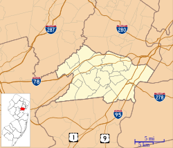
Union County is a county in the northern part of the U.S. state of New Jersey. As of the 2020 United States census, the county was the state's seventh-most-populous county with a population of 575,345, its highest decennial count ever and an increase of 38,846 (+7.2%) from the 2010 census count of 536,499. Its county seat is Elizabeth, which is also the most populous municipality in the county, with a 2020 census population of 137,298, and the largest by area, covering 13.46 square miles (34.9 km2). The county serves as a transition point between the Central Jersey and North Jersey regions of the state.

<span class="mw-page-title-main">Raritan, New Jersey</span> Borough in Somerset County, New Jersey, US

Raritan is a borough in Somerset County, in the U.S. state of New Jersey. As of the 2020 United States census, the borough's population was 7,835, an increase of 954 (+13.9%) from the 2010 census count of 6,881, which in turn reflected an increase of 543 (+8.6%) from the 6,338 counted in the 2000 census.

<span class="mw-page-title-main">Clark, New Jersey</span> Township in Union County, New Jersey, US

Clark is a township in southern Union County, in the U.S. state of New Jersey. As of the 2020 United States census, the township's population was 15,544, an increase of 788 (+5.3%) from the 2010 census count of 14,756, which in turn reflected an increase of 159 (+1.1%) from the 14,597 counted in the 2000 census.

<span class="mw-page-title-main">Fanwood, New Jersey</span> Borough in Union County, New Jersey, US

Fanwood is a borough in Union County, in the U.S. state of New Jersey. Located on a ridge in northern-central New Jersey, the borough is a commuter town of New York City in the New York metropolitan area. Fanwood is located in the Raritan Valley and Rahway Valley regions. As of the 2020 United States census, the borough's population was 7,774, an increase of 456 (+6.2%) from the 2010 census count of 7,318, which in turn reflected an increase of 144 (+2.0%) from the 7,174 counted in the 2000 census.

<span class="mw-page-title-main">Garwood, New Jersey</span> Borough in Union County, New Jersey, United States

Garwood is a borough in Union County, in the U.S. state of New Jersey. As of the 2020 United States census, the borough's population was 4,454, an increase of 228 (+5.4%) from the 2010 census count of 4,226, which in turn reflected an increase of 73 (+1.8%) from the 4,153 counted in the 2000 census.

<span class="mw-page-title-main">Linden, New Jersey</span> City in Union County, New Jersey, US

Linden is a city in southeastern Union County, in the U.S. state of New Jersey. It is part of the New York Metropolitan Area, located about 13 miles (21 km) southwest of Manhattan and bordering Staten Island, a borough of New York City, across the Arthur Kill. As of the 2020 United States census, the city's population was 43,738, an increase of 3,239 (+8.0%) from the 2010 census count of 40,499, which in turn reflected an increase of 1,105 (+2.8%) from the 39,394 counted in the 2000 census.

<span class="mw-page-title-main">Mountainside, New Jersey</span> Borough in Union County, New Jersey, US

Mountainside is a borough in Union County, in the U.S. state of New Jersey. The borough is located on a ridge in northern-central New Jersey, within the Raritan Valley and Rahway Valley regions in the New York metropolitan area. As of the 2020 United States census, the borough's population was 7,020, an increase of 335 (+5.0%) from the 2010 census count of 6,685, which in turn reflected an increase of 83 (+1.3%) from the 6,602 counted in the 2000 census.

<span class="mw-page-title-main">New Providence, New Jersey</span> Borough in Union County, New Jersey, US

New Providence is a borough on the northwestern edge of Union County, in the U.S. state of New Jersey. It is located on the Passaic River, which forms the county boundary with Morris County bordering Chatham Township. As of the 2020 United States census, the borough's population was 13,650, an increase of 1,479 (+12.2%) from the 2010 census count of 12,171, which in turn reflected increase of 264 (+2.2%) from the 11,907 counted in the 2000 census.

<span class="mw-page-title-main">Rahway, New Jersey</span> City in Union County, New Jersey, US

Rahway is a city in southern Union County, in the U.S. state of New Jersey. A bedroom community of New York City, it is centrally located in the Rahway Valley region, in the New York metropolitan area. The city is 15 miles (24 km) southwest of Manhattan and 5 miles (8.0 km) west of Staten Island.

<span class="mw-page-title-main">Roselle, New Jersey</span> Borough in Union County, New Jersey, US

Roselle is a borough located in Union County in the U.S. state of New Jersey. As of the 2020 United States census, the borough's population was 22,695, an increase of 1,610 (+7.6%) from the 2010 census count of 21,085, which in turn reflected a decline of 189 (−0.9%) from the 21,274 counted in the 2000 census.

<span class="mw-page-title-main">Roselle Park, New Jersey</span> Borough in Union County, New Jersey, US

Roselle Park is a borough in Union County, in the U.S. state of New Jersey. As of the 2020 United States census, the borough's population was 13,967, an increase of 670 (+5.0%) from the 2010 census count of 13,297, which in turn reflected reflected an increase of 16 (+0.1%) from the 13,281 counted in the 2000 census.

<span class="mw-page-title-main">Springfield Township, Union County, New Jersey</span> Township in Union County, New Jersey, US

Springfield Township is a township in Union County, in the U.S. state of New Jersey. The township is located on a ridge in northern-central New Jersey, within the Raritan Valley and Rahway Valley regions in the New York metropolitan area. As of the 2020 United States census, the township's population was 17,178, the highest recorded at any decennial census, an increase of 1,361 (+8.6%) from the 2010 census count of 15,817, which in turn reflected an increase of 1,388 (+9.6%) from the 14,429 counted in the 2000 census.

<span class="mw-page-title-main">Union Township, Union County, New Jersey</span> Township in Union County, New Jersey, United States

Union Township is a township in Union County, in the U.S. state of New Jersey. In the 18th century, the area that is now Union was then called Connecticut Farms. As of the 2020 United States census, the township's population was 59,728, an increase of 3,086 (+5.4%) from the 2010 census count of 56,642, which in turn reflected an increase of 2,237 (+4.1%) from the 54,405 counted in the 2000 census.

<span class="mw-page-title-main">Winfield Township, New Jersey</span> Township in Union County, New Jersey, United States

Winfield Township is a township in Union County, in the U.S. state of New Jersey. As of the 2020 United States census, the township's population was 1,423, its lowest decennial census and a decrease of 48 (−3.3%) from the 2010 census count of 1,471, which in turn reflected a decline of 43 (−2.8%) from the 1,514 counted in the 2000 census. The township is the sixth-smallest municipality in the state. Winfield and Linden share the same ZIP Code.

<span class="mw-page-title-main">Roselle Park High School</span> High school in Mercer County, New Jersey, United States

Roselle Park High School is a four-year public high school located in Roselle Park, in Union County, in the U.S. state of New Jersey, operating as the lone secondary school of the Roselle Park School District. Since 2007, Roselle Park High School serves students in ninth through twelfth grades. The school has been accredited by the Middle States Association of Colleges and Schools Commission on Elementary and Secondary Schools since 1928.

<span class="mw-page-title-main">Rahway Valley Railroad</span>

The Rahway Valley Railroad (RVRR) was a short-line railroad in the Northeastern United States which connected the Lehigh Valley Railroad in Roselle Park and the Central Railroad of New Jersey in Cranford with the Delaware, Lackawanna and Western in Summit. Operating over a span of 95 years from 1897 until 1992 in Union County, New Jersey, in its prime it was one of the most successful short line railroads in U.S. history, turning a profit during the Great Depression.

<span class="mw-page-title-main">David Brearley High School</span> High school in Union County, New Jersey, United States

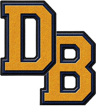
David Brearley High School is a four-year comprehensive public high school that serves students in ninth through twelfth grades from Kenilworth in Union County, in the U.S. state of New Jersey, operating as the lone secondary school of the Kenilworth Public Schools. The school is named for David Brearley, a signer of the United States Constitution.

<span class="mw-page-title-main">Rahway River Parkway</span> Greenway of parkland along the banks the main stem Rahway River

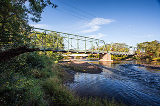
The Rahway River Parkway is a greenway of parkland along the banks the main stem Rahway River and its tributaries in Union County, New Jersey, United States. Created in the 1920s, it was one of the inaugural projects of the newly-created Union County Parks Commission. It was designed by the Olmsted Brothers firm, sons of landscape architect Frederick Law Olmsted. The Rahway River Greenway plan expands on the original design. Many of the crossings of the river are late 19th century or early 20th century bridges. The East Coast Greenway uses paths and roads along the parkway.

References

  1. 1 2 3 4 5 2019 Census Gazetteer Files: New Jersey Places, United States Census Bureau. Accessed July 1, 2020.
  2. 1 2 US Gazetteer files: 2010, 2000, and 1990, United States Census Bureau. Accessed September 4, 2014.
  3. 1 2 2012 New Jersey Legislative District Data Book, Rutgers University Edward J. Bloustein School of Planning and Public Policy, March 2013, p. 90.
  4. 1 2 Mayor & Council, Borough of Kenilworth. Accessed January 4, 2024.
  5. 2023 New Jersey Mayors Directory, New Jersey Department of Community Affairs, updated February 8, 2023. Accessed February 10, 2023.
  6. Administrator & Borough Clerk, Borough of Kenilworth. Accessed March 30, 2023.
  7. "ArcGIS REST Services Directory". United States Census Bureau. Retrieved October 11, 2022.
  8. U.S. Geological Survey Geographic Names Information System: Borough of Kenilworth, Geographic Names Information System. Accessed March 6, 2013.
  9. 1 2 3 4 5 QuickFacts Kenilworth borough, New Jersey, United States Census Bureau. Accessed January 14, 2023.
  10. 1 2 3 Total Population: Census 2010 - Census 2020 New Jersey Municipalities, New Jersey Department of Labor and Workforce Development. Accessed December 1, 2022.
  11. 1 2 Annual Estimates of the Resident Population for Minor Civil Divisions in New Jersey: April 1, 2020 to July 1, 2022, United States Census Bureau, released May 2023. Accessed May 18, 2023.
  12. 1 2 Population Density by County and Municipality: New Jersey, 2020 and 2021, New Jersey Department of Labor and Workforce Development. Accessed March 1, 2023.
  13. Look Up a ZIP Code for Kenilworth, NJ, United States Postal Service. Accessed June 18, 2012.
  14. Zip Codes, State of New Jersey. Accessed August 28, 2013. Source also lists 07098 for Kenilworth, but USPS web site lists this as invalid.
  15. Area Code Lookup - NPA NXX for Kenilworth, NJ, Area-Codes.com. Accessed August 28, 2013.
  16. 1 2 U.S. Census website, United States Census Bureau. Accessed September 4, 2014.
  17. Geographic Codes Lookup for New Jersey, Missouri Census Data Center. Accessed April 1, 2022.
  18. US Board on Geographic Names, United States Geological Survey. Accessed September 4, 2014.
  19. 1 2 3 4 5 DP-1 - Profile of General Population and Housing Characteristics: 2010 for Kenilworth borough, Union County, New Jersey Archived February 12, 2020, at archive.today , United States Census Bureau. Accessed June 18, 2012.
  20. 1 2 Profile of General Demographic Characteristics: 2010 for Kenilworth borough Archived September 9, 2014, at the Wayback Machine , New Jersey Department of Labor and Workforce Development. Accessed June 18, 2012.
  21. Table 7. Population for the Counties and Municipalities in New Jersey: 1990, 2000 and 2010, New Jersey Department of Labor and Workforce Development, February 2011. Accessed May 1, 2023.
  22. Snyder, John P. The Story of New Jersey's Civil Boundaries: 1606-1968, Bureau of Geology and Topography; Trenton, New Jersey; 1969. p. 239. Accessed June 18, 2012.
  23. Boright, Walter E. "Remembering when Kenilworth was a college town, Upsala College days revisited", Cranford Chronicle, September 21, 2010. Accessed May 17, 2013. "Its first president was Rev. Lars Herman Beck. In 1898 it was lured to Kenilworth, then known as New Orange, by investors of the New Orange Industrial Association who offered the college 14 acres of free land on a hill at the top of No. 21st St. and a few thousand dollars."
  24. History, Borough of Kenilworth. Accessed June 19, 2022.
  25. Historian's Corner, Borough of Kenilworth. Accessed June 19, 2022.
  26. Hutchinson, Viola L. The Origin of New Jersey Place Names, New Jersey Public Library Commission, May 1945. Accessed September 2, 2015.
  27. Areas touching Kenilworth, MapIt. Accessed February 25, 2020.
  28. Union County Municipal Profiles, Union County, New Jersey. Accessed February 25, 2020.
  29. New Jersey Municipal Boundaries, New Jersey Department of Transportation. Accessed November 15, 2019.
  30. Lenape Park, Union County, New Jersey. Accessed June 2, 2020.
  31. "RVRR Main Line w landmarks". Google My Maps.
  32. "Abandoned Rahway Valley Railroad -Proposed Rails to Trails Route "Flyover"" via www.youtube.com.
  33. "The Latest News on the Summit Park Line Project in Summit NJ".
  34. "Park Line Pedestrian Bridge Officially Installed In Summit". Summit, NJ Patch. October 24, 2022.
  35. "NJDOT Clearing Out Abandoned Railway Property in Roselle Park; Union County to Apply For a Grant to Convert it into a Trail Through Roselle Park and Kenilworth". TAPinto.
  36. "Union County Connects – A County Connected by Trails". unioncountyconnects.org.
  37. Compendium of censuses 1726-1905: together with the tabulated returns of 1905, New Jersey Department of State, 1906. Accessed October 16, 2013.
  38. Thirteenth Census of the United States, 1910: Population by Counties and Minor Civil Divisions, 1910, 1900, 1890, United States Census Bureau, p. 339. Accessed June 18, 2012.
  39. Fifteenth Census of the United States: 1930 - Population Volume I, United States Census Bureau, p. 719. Accessed June 18, 2012.
  40. Table 6: New Jersey Resident Population by Municipality: 1940 - 2000, Workforce New Jersey Public Information Network, August 2001. Accessed May 1, 2023.
  41. 1 2 3 4 5 Census 2000 Profiles of Demographic / Social / Economic / Housing Characteristics for Kenilworth borough, New Jersey Archived August 24, 2014, at the Wayback Machine , United States Census Bureau. Accessed May 17, 2013.
  42. 1 2 3 4 5 DP-1: Profile of General Demographic Characteristics: 2000 - Census 2000 Summary File 1 (SF 1) 100-Percent Data for Kenilworth borough, Union County, New Jersey Archived February 12, 2020, at archive.today , United States Census Bureau. Accessed May 17, 2013.
  43. DP03: Selected Economic Characteristics from the 2006-2010 American Community Survey 5-Year Estimates for Kenilworth borough, Union County, New Jersey Archived February 12, 2020, at archive.today , United States Census Bureau. Accessed June 18, 2012.
  44. Mainger: Company Profile, Inc. . Accessed October 16, 2013.
  45. Friedman, Alexi. "In about-face, Merck will shutter Summit campus and make Kenilworth its headquarters", The Star-Ledger , October 1, 2013. Accessed October 16, 2013. "But today, the drugmaker announced an about-face, saying it had re-evalutated its real estate needs, and had decided to make the Kenilworth campus its global headquarters and shutter the Summit location. The Whitehouse Station campus will still close as planned, officials said. It has been Merck's global headquarters since 1992."
  46. Friedman, Alexi. "Merck to close manufacturing facility on its Kenilworth campus and lay off 113 employees", The Star-Ledger , August 1, 2013. Accessed January 9, 2014. "Whitehouse Station-based Merck acquired Schering-Plough — whose world headquarters were in the 100-acre Kenilworth campus — for $41 billion in 2009."
  47. Katzwer, Yael. "Merck plans to move headquarters from Kenilworth back to Rahway", Union News Daily, May 10, 2020. Accessed June 19, 2022. "Merck announced last week that it will be consolidating its New Jersey operations into a single headquarters in Rahway by the end of 2023. While this is a boon for Rahway, it is a blow for Kenilworth, which has served as the home of Merck’s headquarters since 2015."
  48. Staff. "Bard on the Boulevard coming to Kenilworth Library", Cranford Chronicle, June 6, 2014. Accessed October 22, 2014.
  49. Inventory of Municipal Forms of Government in New Jersey, Rutgers University Center for Government Studies, July 1, 2011. Accessed June 1, 2023.
  50. Cerra, Michael F. "Forms of Government: Everything You've Always Wanted to Know, But Were Afraid to Ask" Archived September 24, 2014, at the Wayback Machine , New Jersey State League of Municipalities. Accessed November 30, 2014.
  51. "Forms of Municipal Government in New Jersey", p. 6. Rutgers University Center for Government Studies. Accessed June 1, 2023.
  52. 2021 Municipal Data Sheet, Borough of Kenilworth. Accessed June 19, 2022.
  53. Union County Elected Officials, Union County, New Jersey Clerk. Accessed April 30, 2022.
  54. General Election November 7, 2023 Official Results, Union County, New Jersey, updated November 22, 2023. Accessed January 3, 2024.
  55. General Election November 8, 2022 Official Results, Union County, New Jersey, updated November 21, 2022. Accessed January 1, 2023.
  56. General Election November 2, 2021 Official Results, Union County, New Jersey, updated November 15, 2021. Accessed January 1, 2022.
  57. Wildstein, David. "Kenilworth Democrats name Demondo to vacant council seat Elizabeth police officer fills Schielke seat", New Jersey Globe, August 26, 2020. Accessed August 27, 2020. "Louis Demondo, an Elizabeth police officer and the former president of the Hispanic Law Enforcement Association of Union County, was appointed tonight to fill the Kenilworth Borough Council seat vacated last month by Robert Schielke."
  58. Cuppari, Telina. "Kenilworth Reorganization Meeting Swears in New Mayor and Council", TAP into Kenilworth, January 9, 2020. Accessed February 25, 2020. "Four members of the community were sworn into the council. Linda Karlovitch as the Mayor of Kenilworth, Kay Ceceri as Councilwoman, and Daniel Lopez and Mark David as Councilmen. Lopez is new and was appointed to the vacant seat."
  59. Mayor and Council Regular Meeting Minutes for May 25, 2016, Borough of Kenilworth. Accessed August 4, 2016. "Whereas, a vacancy occurred on Council prior to the term expiration of December 31, 2016. "Whereas, the governing body of the Borough of Kenilworth has reviewed the two (2) candidates submitted by the Municipal Republican Committee to fill the vacancy. Be It Resolved That, Scott Pentz be appointed Councilman of the Borough of Kenilworth pursuant to N.J.S.A. 40A:16-4. et. Seq.... Oath of Office was administered to Councilman Pentz by Mayor Deluca."
  60. Mayor and Council Regular Meeting Minutes for January 13, 2016, Borough of Kenilworth. Accessed August 4, 2016. "Whereas, a vacancy occurred on Council prior to the term expiration of December 31, 2017. Whereas, the unexpired term for Council member of the Borough of Kenilworth will go to the polls at the November 8, 2016 General Election; and Be It Resolved That, Larry Clementi be appointed Councilman of the Borough of Kenilworth pursuant to N.J.S.A. 40A:16-4. et. Seq.... Oath of Office was administered by Mayor Deluca."
  61. Mayor and Council Regular Meeting Minutes for July 8, 2015, Borough of Kenilworth. Accessed August 4, 2016. "Whereas, Councilwoman Barbara Macecsko has vacated office prior to the December 31, 2016 expiration of her term. Be It Resolved That, pursuant to N.J.S.A. 40A:16-3. et. Seq., Scott Pentz be appointed Councilman and Chairman for Public Safety, of the Borough of Kenilworth until the certification of the 2015 General Election results. Oath of Office was administered to Scott Pentz."
  62. November 5, 2015 General Election Official Results, Union County, New Jersey, updated November 9, 2015. Accessed August 3, 2016.
  63. Hehl, Cheryl. "Kenilworth mayor resigns, appointed as tax court judge; Councilman Pugliese to step in as acting mayor", Union News Daily, April 4, 2014. Accessed November 5, 2014. "It has been several years since Gov. Chris Christie nominated Mayor Kathi Fiamingo as a tax court judge, but it took until last week for the Senate Judiciary Committee to sign off on it."
  64. Renna, Joe. "Scott Klinder elected Mayor of Kenilworth", RennaMedia.com, May 1, 2014. Accessed November 5, 2014. "Scott Klinder was elected Mayor by the Kenilworth Borough Council at their April 9th, 2014 public meeting.... Former councilman Kevin Leary was also sworn in at the April 9th meeting to fulfill the remainder of Klinder's term."
  65. Haydon, Tom; and Lannan, Katie. "Union County election results 2014", NJ Advance Media for NJ.com, November 4, 2014. Accessed November 5, 2014.
  66. 2022 Redistricting Plan, New Jersey Redistricting Commission, December 8, 2022.
  67. Municipalities Sorted by 2023-2031 Legislative District, New Jersey Department of State. Accessed September 1, 2023.
  68. Directory of Representatives: New Jersey, United States House of Representatives. Accessed January 3, 2019.
  69. Biography, Congressman Donald M. Payne Jr. Accessed January 3, 2019. "U.S. Representative Donald M. Payne, Jr. is a lifelong resident of Newark, New Jersey."
  70. U.S. Sen. Cory Booker cruises past Republican challenger Rik Mehta in New Jersey, PhillyVoice. Accessed April 30, 2021. "He now owns a home and lives in Newark's Central Ward community."
  71. Biography of Bob Menendez, United States Senate, January 26, 2015. "Menendez, who started his political career in Union City, moved in September from Paramus to one of Harrison's new apartment buildings near the town's PATH station.."
  72. Home, sweet home: Bob Menendez back in Hudson County. nj.com. Accessed April 30, 2021. "Booker, Cory A. - (D - NJ) Class II; Menendez, Robert - (D - NJ) Class I"
  73. Legislative Roster for District 20, New Jersey Legislature. Accessed January 18, 2024.
  74. Home Page, Union County, New Jersey. Accessed May 20, 2022.
  75. Chair Rebecca Williams Archived November 2, 2022, at the Wayback Machine , Union County, New Jersey. Accessed May 20, 2022.
  76. Vice Chair Christopher Hudak Archived May 28, 2022, at the Wayback Machine , Union County, New Jersey. Accessed May 20, 2022.
  77. Commissioner James E. Baker Jr., Union County, New Jersey. Accessed May 20, 2022.
  78. Commissioner Angela R. Garretson, Union County, New Jersey. Accessed May 20, 2022.
  79. Commissioner Sergio Granados, Union County, New Jersey. Accessed May 20, 2022.
  80. Commissioner Bette Jane Kowalski, Union County, New Jersey. Accessed May 20, 2022.
  81. Commissioner Lourdes M. Leon, Union County, New Jersey. Accessed May 20, 2022.
  82. Commissioner Alexander Mirabella, Union County, New Jersey. Accessed May 20, 2022.
  83. Commissioner Kimberly Palmieri-Mouded, Union County, New Jersey. Accessed May 20, 2022.
  84. 2022 County Data Sheet, Union County, New Jersey. Accessed May 20, 2022.
  85. County Clerk Joanne Rajoppi, Union County Votes. Accessed May 20, 2022.
  86. Clerks, Constitutional Officers Association of New Jersey. Accessed May 20, 2022.
  87. Sheriff Peter Corvelli, Union County Sheriff's Office. Accessed May 20, 2022.
  88. Sheriffs, Constitutional Officers Association of New Jersey. Accessed May 20, 2022.
  89. Office of the Union County Surrogate, Union County, New Jersey. Accessed May 20, 2022.
  90. Surrogates, Constitutional Officers Association of New Jersey. Accessed May 20, 2022.
  91. 1 2 Voter Registration Summary - Union, New Jersey Department of State Division of Elections, March 23, 2011. Accessed May 17, 2013.
  92. GCT-P7: Selected Age Groups: 2010 - State -- County Subdivision; 2010 Census Summary File 1 for New Jersey Archived February 12, 2020, at archive.today , United States Census Bureau. Accessed May 17, 2013.
  93. Presidential November 6, 2012 General Election Results - Union County Archived February 1, 2014, at the Wayback Machine , New Jersey Department of State Division of Elections, March 15, 2013. Accessed May 17, 2013.
  94. Number of Registered Voters and Ballots Cast November 6, 2012 General Election Results - Union County Archived February 1, 2014, at the Wayback Machine , New Jersey Department of State Division of Elections, March 15, 2013. Accessed May 17, 2013.
  95. 2008 Presidential General Election Results: Union County, New Jersey Department of State Division of Elections, December 23, 2008. Accessed May 17, 2013.
  96. 2004 Presidential Election: Union County, New Jersey Department of State Division of Elections, December 13, 2004. Accessed May 17, 2013.
  97. "Governor - Union County" (PDF). New Jersey Department of Elections. January 29, 2014. Retrieved December 24, 2014.
  98. "Number of Registered Voters and Ballots Cast - November 5, 2013 - General Election Results - Union County" (PDF). New Jersey Department of Elections. January 29, 2014. Retrieved December 24, 2014.
  99. 2009 Governor: Union County Archived October 17, 2012, at the Wayback Machine , New Jersey Department of State Division of Elections, December 31, 2009. Accessed May 17, 2013.
  100. District information for Kenilworth School District, National Center for Education Statistics. Accessed April 1, 2020.
  101. School Data for the Kenilworth Public Schools, National Center for Education Statistics. Accessed April 1, 2020.
  102. Warren G. Harding Elementary School, Kenilworth Public Schools. Accessed June 2, 2020.
  103. David Brearley Middle School, Kenilworth Public Schools. Accessed June 2, 2020.
  104. David Brearley High School, Kenilworth Public Schools. Accessed June 2, 2020.
  105. Schools, Kenilworth Public Schools. Accessed June 2, 2020.
  106. New Jersey School Directory for the Kenilworth Public Schools, New Jersey Department of Education. Accessed February 1, 2024.
  107. David Brearly Middle/High School 2016 School Report Card Archived August 8, 2017, at the Wayback Machine , New Jersey Department of Education. Accessed August 7, 2017. "David Brearley Middle-High School serves students in Grades 7-12 from Kenilworth, Winfield, and surrounding communities that who participate in the School Choice Program."
  108. Our Philosophy, St. Theresa School. Accessed October 16, 2013.
  109. Union County Catholic Elementary Schools Archived August 18, 2016, at the Wayback Machine , Roman Catholic Archdiocese of Newark. Accessed July 20, 2016.
  110. Union County Mileage by Municipality and Jurisdiction, New Jersey Department of Transportation, May 2010. Accessed July 14, 2014.
  111. Garden State Parkway Straight Line Diagram, New Jersey Department of Transportation, January 1997. Accessed July 21, 2014.
  112. Union County Bus / Rail Connections, NJ Transit, backed up by the Internet Archive as of July 26, 2010. Accessed June 18, 2012.
  113. Raritan Valley Line Archived October 15, 2013, at the Wayback Machine , NJ Transit. Accessed July 21, 2014.
  114. Boright, Walter. "Remembering the New York and New Orange Railroad, the little railroad that helped build Kenilworth", Cranford Chronicle, April 17, 2011. Accessed October 16, 2013.
  115. Boright, Walter E. "Rahway Valley Railroad: The little railroad that helped build Kenilworth, Part II", Cranford Chronicle, May 12, 2011. Accessed October 16, 2013.
  116. "Being a Multi-Sport Youth Athlete Helped NFL Legend Mike Chalenski Reach the League", National Football lLeague, October 5, 2021. Accessed June 24, 2022. "Mike Chalenski played youth football in Kenilworth, New Jersey because that's what everyone did growing up.... Chalenski excelled as a multi-sport athlete. He was also a baseball and basketball star at David Brearley High School."
  117. Remnick, David. "Is This the End of Rico? With The Sopranos, the Mob genre is on the brink.", The New Yorker , April 2, 2001. Accessed April 30, 2015. "The first blow to the DeCavalcantes came in the early sixties, when the F.B.I. planted a bug in the Kenilworth offices of the don, Simone Rizzo DeCavalcante, known as Sam the Plumber—plumbing supplies being one of his favored businesses."
  118. Manual of the Legislature of New Jersey, Volume 200, Part 2, p. 216. J.A. Fitzgerald. "John P. Gallagher, Rep., Middletown.... Mr. Gallagher was born in Kenilworth on Feb. 2, 1932."
  119. Gambaccini, Peter. Eulogy for Sheldon Karlin, NY Runner, March / April 2000, at Central Park Track Club. Accessed January 8, 2018. "Karlin, only 49, died while walking near his home in Livingston, New Jersey, on January 16. He was known to have arteriosclerosis, and had suffered a mild heart attack in December.... Karlin was born in Newark and raised in Kenilworth, New Jersey, where he became captain of his high school cross country team and a conference champion in track."
  120. Attner, Paul. "Monster mashers" Archived January 15, 2008, at the Wayback Machine , Sporting News , August 4, 1997. Accessed April 22, 2011. "We are entering a run-stuffer's favorite offseason haunt. A restaurant. This one is Italian; it is located a few miles from Siragusa's hometown in Kenilworth, N.J."
  121. Miller, Randy. "N.J. native Tony Siragusa loses NFL broadcasting gig with Fox", NJ Advance Media for NJ.com, March 17, 2016. Accessed June 23, 2022. "Meantime, Siragusa has other working adventures. The Kenilworth native and Brearley High alum is a co-host for Man Caves, a reality show on DIY network that recreates living spaces."