
Calcutta is an unincorporated community and census-designated place in southeastern Columbiana County, Ohio, United States. The population was 3,941 at the 2020 census. Historically a rural town, Calcutta grew as businesses from neighboring East Liverpool moved into larger shopping centers clustered around Ohio State Route 170.
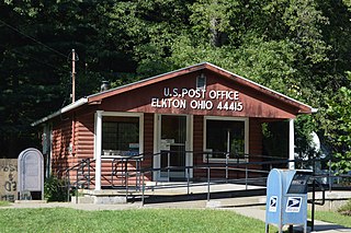
Elkton is an unincorporated community located in central Elkrun Township, Columbiana County, Ohio, United States. It lies along State Route 154 at the confluence of Elk Run and the Little Beaver Creek and has the ZIP code 44415. It is home to the Federal Correctional Institution, Elkton, a male low-security federal prison. Additionally, Elkton is home to one of the shortest covered bridges in the United States, the Church Hill Road Covered Bridge.

Homeworth is an unincorporated community and census-designated place in southwestern Knox Township, Columbiana County, Ohio, United States. The population was 492 as of the 2020 census. It is part of the Salem micropolitan area, about 16.5 miles (26.6 km) east of Canton, and has a post office with the ZIP code 44634.

Winn is an unincorporated community and census-designated place (CDP) in Isabella County in the U.S. state of Michigan. The CDP had a population of 166 at the 2020 census. The community is located within Fremont Township.

Hanover Township is one of the eighteen townships of Columbiana County, Ohio, United States. The 2020 census reported 3,459 people living in the township.

North Benton is an unincorporated community in northern Smith Township, Mahoning County, Ohio, United States. It has a post office with the ZIP code 44449. It lies along State Route 14 between Salem and Ravenna.

Damascus is an unincorporated community and census-designated place in southern Mahoning and northern Columbiana counties in the U.S. state of Ohio. As of the 2020 census, it had a population of 418. The community lies at the intersection of U.S. Route 62 and State Routes 173 and 534.

East Springfield is a census-designated place (CDP) in northwestern Salem Township, Jefferson County, Ohio, United States. It has a post office with the ZIP code 43925. It lies along State Route 43, 16 miles (26 km) northwest of the county seat of Steubenville and 17 miles (27 km) southeast of Carrollton. The community is part of the Weirton–Steubenville, WV-OH Metropolitan Statistical Area.
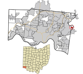
Camp Dennison is a census-designated place (CDP) just outside Indian Hill in southern Symmes Township, Hamilton County, Ohio, United States. It has a post office with the ZIP code 45111. The population was 384 at the 2010 census.
Winona is an unincorporated community in southeastern Butler Township, Columbiana County, Ohio, United States. It has a post office with the ZIP code 44493.

West Point is an unincorporated community in northern Madison Township, Columbiana County, Ohio, United States. A former coal town, it lies along U.S. Route 30 at its intersection with State Routes 45 and 518, it has the ZIP code 44492. It is part of the Salem micropolitan area.

North Georgetown is an unincorporated community in western Knox Township, Columbiana County, Ohio, United States. Although unincorporated, it has a post office, with the ZIP code of 44665. The town itself is located at the intersection of Georgetown Road and Rochester Road.
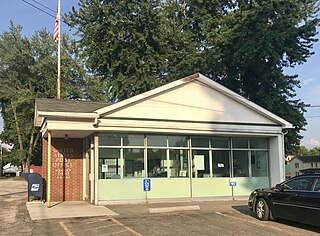
Negley is an unincorporated community and census-designated place in Middleton Township, Columbiana County, Ohio, United States. The population was 274 at the 2020 census. It is part of the Salem micropolitan area, 22 miles (35 km) south of Youngstown.

East Rochester is an unincorporated community and census-designated place (CDP) in southern West Township, Columbiana County, Ohio, United States. The population was 224 as of the 2020 census. It lies along U.S. Route 30, and has a post office with the ZIP code 44625. It is a part of the Salem micropolitan area, about 20 miles (32 km) east of Canton.

Little Hocking is a census-designated place in southern Belpre Township, Washington County, Ohio, United States. It has a post office with the ZIP code 45742. The population of the CPD was 244 at the 2020 census.

Southington is an unincorporated community in central Southington Township, Trumbull County, Ohio, United States. It lies at the intersection of U.S. Route 422 with State Route 305 and has a post office with the ZIP code 44470. It is part of the Youngstown–Warren metropolitan area.

Lake is an unincorporated community in Clare County in the U.S. state of Michigan. The community is located within Garfield Township. As an unincorporated community, Lake has no legal autonomy of its own but does have its own post office with the 48632 ZIP Code.
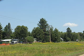
Pearson is an unincorporated community in the town of Ainsworth, Langlade County, Wisconsin, United States. Pearson is 5 miles (8 km) west of Pickerel and 17 miles (27 km) north-northeast of Antigo, the county seat of Langlade County. The community is situated on Pickerel Creek near its confluence with the Wolf River. County Highway T runs through Pearson; the closest state highway to the community is Wisconsin State Highway 55 in Pickerel. Pearson had a post office, which closed on May 4, 1996; ZIP code 54462 still serves the community. The Northeast Illinois Council of the Boy Scouts of America runs a summer camp, Ma-Ka-Ja-Wan Scout Reservation, in Pearson. The Pickerel Volunteer Fire Department Station is located east of the community on Johnson Road.
The Buckeye Council is a local council of the Boy Scouts of America that serves eastern Ohio and parts of northern West Virginia. Headquartered in Canton, Ohio, Buckeye Council serves more than 10,000 scouts and has more than 4,000 campers participate in its successful summer camp programs.
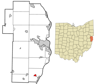
Connorville is an unincorporated community and census-designated place in southern Jefferson County, Ohio, United States. The population was 160 at the 2020 census. It is part of the Weirton–Steubenville metropolitan area.


