Kilmelford

Last updated

Kilmelford
Kilmelford.jpg
Looking to Kilmelford from Ceann Mòr (119 m)
Argyll and Bute UK location map.svg
Red pog.svg
Kilmelford
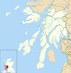
Location within Argyll and Bute
OS grid reference NM845125
Council area
Lieutenancy area
  • Argyll and Bute
Country Scotland
Sovereign state United Kingdom
Post town OBAN
Postcode district PA34
Police Scotland
Fire Scottish
Ambulance Scottish
UK Parliament
Scottish Parliament
List of places
UK
Scotland
56°15′54″N5°28′49″W / 56.26500°N 5.48028°W / 56.26500; -5.48028

Kilmelford (Scottish Gaelic : Cill Mheallaird) is a village in Argyll and Bute, Scotland.

Contents

It is situated near the head of the west coast sea loch, Loch Melfort, on the A816 Lochgilphead to Oban road about 15 miles (24 km) south of Oban. [1]
Points of interest

Related Research Articles

<span class="mw-page-title-main">Argyll</span> Historic county in Scotland

Argyll, sometimes called Argyllshire, is a historic county and registration county of western Scotland.

<span class="mw-page-title-main">Kerrera</span> Island in the Scottish Inner Hebrides

Kerrera is an island in the Scottish Inner Hebrides, close to the town of Oban. In 2016 it had a population of 45, divided into two communities in the north and south of the island.

<span class="mw-page-title-main">Slate Islands</span>

The Slate Islands are an island group in the Inner Hebrides, lying immediately off the west coast of Scotland, north of Jura and southwest of Oban. The main islands are Seil, Easdale, Luing, Shuna, Torsa and Belnahua. Scarba and Kerrera, which lie nearby are not usually included.

<span class="mw-page-title-main">Seil</span>

Seil is one of the Slate Islands, located on the east side of the Firth of Lorn, 7 miles southwest of Oban, in Scotland. Seil has been linked to the mainland by bridge since the late 18th century.

Easdale is one of the Slate Islands, in the Firth of Lorn, Scotland. Once the centre of the Scottish slate industry, there has been some recent island regeneration by the owners. This is the smallest of the Inner Hebrides' inhabited islands and is "home to traditional white-washed cottages, a small pub and disused slate quarries". One of the latter, filled with water, is used for swimming.

<span class="mw-page-title-main">Luing</span>

Luing is one of the Slate Islands, Firth of Lorn, in the west of Argyll in Scotland, about 16 miles (26 km) south of Oban. The island has an area of 1,430 hectares and is bounded by several small skerries and islets. It has a population of around 200 people, mostly living in Cullipool, Toberonochy, and Blackmillbay.

<span class="mw-page-title-main">Belnahua</span>

Belnahua is one of the Slate Islands, in the Firth of Lorn in Scotland, known for its deserted slate quarries. The bedrock that underpins its human history is part of the Scarba Conglomerate Formation and its value has been on record since the 16th century. Likely uninhabited before commercial quarrying commenced, under the control of the Stevenson family during the 19th century the population expanded to over 150 before the island was abandoned again in 1914.

<span class="mw-page-title-main">West Highland Line</span> Railway line in Scotland

The West Highland Line is a railway line linking the ports of Mallaig and Oban in the Scottish Highlands to Glasgow in Central Scotland. The line was voted the top rail journey in the world by readers of independent travel magazine Wanderlust in 2009, ahead of the notable Trans-Siberian line in Russia and the Cuzco to Machu Picchu line in Peru. The ScotRail website has since reported that the line has been voted the most scenic railway line in the world for the second year running.

<span class="mw-page-title-main">Crianlarich</span> Human settlement in Scotland

Crianlarich is a village in Stirling council area and in the registration county of Perthshire, Scotland, around 6 miles (10 km) north-east of the head of Loch Lomond. The village bills itself as "the gateway to the Highlands".

<span class="mw-page-title-main">Lochbuie, Mull</span> Human settlement in Scotland

Lochbuie is a settlement on the Isle of Mull in Scotland about 22 kilometres (14 mi) west of Craignure.

<span class="mw-page-title-main">Killin</span> Village in Perthshire, Scotland

Killin (; is a village in Perthshire in the central highlands of Scotland. Situated at the western head of Loch Tay, it is administered by the Stirling Council area. Killin is a historic conservation village and sits within the Loch Lomond and The Trossachs National Park. It is the central settlement of the historic region of Breadalbane.

<span class="mw-page-title-main">Connel</span> Human settlement in Scotland

Connel is a village in Argyll and Bute, Scotland. It is situated on the southern shore of Loch Etive. The Lusragan Burn flows through the village and into the loch.

The Oban Times is a local, weekly newspaper, published in Oban, Argyll and Bute on a Thursday. It covers the West Highlands and Islands of Scotland, reporting on issues from the Mull of Kintyre to Kyle of Lochalsh on the mainland, to the Inner and Outer Hebridean Islands with Argyll, and Lochaber as its heartlands.

The Bridge of Awe was a triple-spanned arch bridge near Taynuilt in Argyll, Scotland.

<span class="mw-page-title-main">Oban</span> Coastal town in Scotland

Oban is a resort town within the Argyll and Bute council area of Scotland. Despite its small size, it is the largest town between Helensburgh and Fort William. During the tourist season, the town can have a temporary population of up to over 24,000 people. Oban occupies a setting in the Firth of Lorn. The bay forms a near perfect horseshoe, protected by the island of Kerrera; and beyond Kerrera, the Isle of Mull. To the north, is the long low island of Lismore and the mountains of Morvern and Ardgour.

Events from the year 1934 in Scotland.

<span class="mw-page-title-main">Asknish Bay</span> Bay on the west coat of Scotland

Asknish Bay is a small, remote, southwest-facing coastal embayment, located next to the small settlement of Arduaine within Argyll and Bute, Scotland. To the east of the bay lies Arduaine Point, which makes up the west most southern coast of Loch Melfort to the north. It is 12 miles (20 km) south southwest of large west coast town of Oban.

<span class="mw-page-title-main">Kames Bay, Loch Melfort</span> Bay in Argyll and Bute, Scotland, UK

Kames Bay is small remote tidal north by northwest facing coastal embayment forming part of the southern coast of Loch Melfort within Argyll and Bute, Scotland.

References

  1. "Kilmelford: Overview". Gazetteer for Scotland. Retrieved 27 December 2017.
  2. "An Sithean". Canmore, Historic Environment Scotland. Retrieved 11 January 2019.
  3. "Kilmelford Church". Undiscovered Scotland. Retrieved 11 January 2019.
  4. "Easdale Island Folk Museum" . Retrieved 11 January 2019.