Klagetoh, Arizona

Last updated

Klagetoh, Arizona
USA Arizona location map.svg
Red pog.svg
Klagetoh
Usa edcp location map.svg
Red pog.svg
Klagetoh
Coordinates: 35°30′03″N109°31′41″W / 35.50083°N 109.52806°W / 35.50083; -109.52806
CountryUnited States
State Arizona
County Apache
Area
[1]
  Total0.34 sq mi (0.87 km2)
  Land0.34 sq mi (0.87 km2)
  Water0.00 sq mi (0.00 km2)
Elevation
[2]
6,437 ft (1,962 m)
Population
 (2020)
  Total181
  Density540.30/sq mi (208.72/km2)
Time zone UTC-7 (MST)
  Summer (DST) UTC-6 (MDT)
ZIP code
86505 [3]
Area code 928
FIPS code 04-38250
GNIS feature ID2582807 [2]

Klagetoh is a census-designated place (CDP) in Apache County, Arizona, United States. The population was 242 at the 2010 census. [4]

Contents

History

Missionaries transcribed “Łeeyi’ tó” as Klagetoh. “Łeeyi’ tó” translates as underground water which is now an abandoned well. It was the first well to be developed and used by the community. The abandoned well is located approximately ⅛ of a mile east of the Red Mesa Store. [5]

The people who pioneered Klagetoh itself are not remembered, at least by name. The Anasazi had a thriving settlement here once, perhaps with almost as many residents as the 6,000-person chapter boasts today. [6]

Rug

Navajo rugs from the Klagetoh area are among the most popular because of their bold clear cut designs. The Klagetoh weaving is distinguished by strong central design motifs, complex bordering, and a combination of grey, black, white, and red yarns. It is very similar to the Ganado rugs, but with a predominantly gray background instead of the Ganado's red. [7]

Music

Klagetoh is home to the Klagetoh Maiden Singers [8] and Klagetoh Swingers. [9] The Klagetoh Maiden Singers are Joycetta Bonnie, Rose M. Bonnie, Winnie Bonnie, Marie E. Brown, and Bertha Johnson. The Klagetoh Swingers are Ted B. Bonnie, Ned Tsosie Clark, Frank J. Begay, Robert P. Roan, Arthur P. Roan, Bennie Silversmith, and Johnny Dealison.

Major clans

Tódich'iinii, Áshįįhí, Tsi'najinii, Tsénjikiinii, Tabaaha, Bitahnnii, Totsonii. Many Klagetoh residents have both Tsin'najinii and Tsenjikiinii in their lineage. [6]

Notable people

Geography

Klagetoh is located along U.S. Route 191, approximately 14 miles (23 km) south of Ganado and 23 miles (37 km) north of Chambers.

According to the United States Census Bureau, the CDP has a total area of 0.34 square miles (0.87 km2), all land. [4]

Climate

According to the Köppen Climate Classification system, Klagetoh has a semi-arid climate, abbreviated "BSk" on climate maps. [10] Temperatures range from an average maximum temperature in the low to mid-90s Fahrenheit (°F) during the summer months (June–August) to an average minimum temperature in the high teens to low 20s during winter months (December–January). Total average annual precipitation in the vicinity of the study area is about 6.5 inches, with the majority typically occurring during July, August, and September. The total average annual snowfall is a little over 5 inches, with the majority typically occurring during December (Western Regional Climate Center [WRCC] 2011).

Education

It is in the Ganado Unified School District, [11] which operates Ganado High School.

Demographics

Historical population
CensusPop.Note
2010 242
2020 181−25.2%
U.S. Decennial Census [12]

Related Research Articles

<span class="mw-page-title-main">Apache County, Arizona</span> County in Arizona, United States

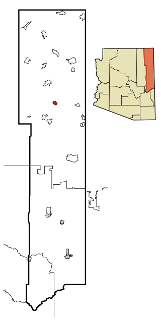
Apache County is in the northeast corner of the U.S. state of Arizona. Shaped in a long rectangle running north to south, as of the 2020 census, its population was 66,021. The county seat is St. Johns.

<span class="mw-page-title-main">Burnside, Arizona</span> CDP in Apache County, Arizona

Burnside is a native village and census-designated place (CDP) on the Navajo Nation in Apache County, Arizona, United States. The population was 537 at the 2010 census.

<span class="mw-page-title-main">Chinle, Arizona</span> Census-designated place in Arizona, United States

Chinle is a census-designated place (CDP) in Apache County, Arizona, United States. The name in Navajo means 'flowing out' and is a reference to the location where the water flows out of the Canyon de Chelly. The population was 4,518 at the 2010 census.

<span class="mw-page-title-main">Ganado, Arizona</span> CDP in Apache County, Arizona

Ganado is a chapter of the Navajo Nation and census-designated place (CDP) in Apache County, Arizona, United States. The population was 1,210 at the 2010 census.

<span class="mw-page-title-main">Houck, Arizona</span> CDP in Apache County, Arizona

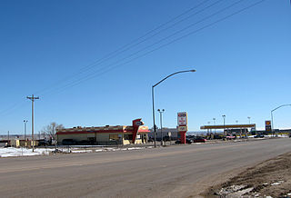
Houck is a census-designated place (CDP) in Apache County, Arizona, United States. The population was 1,024 at the 2010 census.

<span class="mw-page-title-main">Lukachukai, Arizona</span> CDP in Apache County, Arizona

Lukachukai is a census-designated place (CDP) in Apache County, Arizona, United States. The population was 1,701 at the 2010 census. It is within the Navajo Nation.

<span class="mw-page-title-main">McNary, Arizona</span> CDP in Apache and Navajo Counties, Arizona

McNary is a census-designated place (CDP) in Apache and Navajo counties in the U.S. state of Arizona, on the Fort Apache Indian Reservation. The population was 528 at the 2010 census.

<span class="mw-page-title-main">Nazlini, Arizona</span> CDP in Apache County, Arizona

Nazlini is a census-designated place (CDP) in Apache County, Arizona, United States. The population was 489 at the 2010 census. Nearby are Nazlini Creek and Nazlini Canyon. Nazlini Canyon is the site of many Native American ruins and campsites that were abandoned when erosion made them unusable.

<span class="mw-page-title-main">St. Michaels, Arizona</span> CDP in Apache County, Arizona

St. Michaels is a chapter of the Navajo Nation and a census-designated place (CDP) in Apache County, Arizona, United States. The Navajo Nation Government Campus is located within the chapter at Window Rock.

<span class="mw-page-title-main">Steamboat, Arizona</span> CDP in Apache County, Arizona

Steamboat is a census-designated place (CDP) in Apache County, Arizona, United States, that includes Steamboat Canyon and Steamboat Trading Post. The population was 284 at the 2010 census.

<span class="mw-page-title-main">Teec Nos Pos, Arizona</span> Census-designated place in Arizona, United States

Teec Nos Pos is a census-designated place (CDP) in Apache County, Arizona, United States. The population was 507 at the 2020 census. It is the western terminus of U.S. Route 64.

<span class="mw-page-title-main">Window Rock, Arizona</span> Capital of the Navajo Nation in Arizona, United States

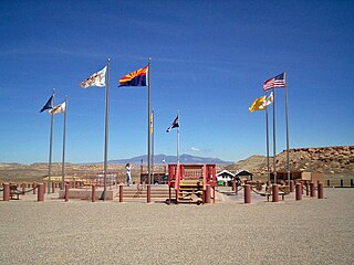
Window Rock, known in Navajo as Tségháhoodzání, is a city and census-designated place that serves as the capital of the Navajo Nation, the largest Native American tribe by both land and tribal enrollment. The capital lies within the boundaries of the St. Michaels Chapter, adjacent to the Arizona and New Mexico state line. Window Rock is the site of the Navajo Nation governmental campus, which contains the Navajo Nation Council, Navajo Nation Supreme Court, the offices of the Navajo Nation President and Vice President, and many Navajo government buildings.

<span class="mw-page-title-main">Tuba City, Arizona</span> Town in Coconino County, Arizona

Tuba City is an unincorporated town and census-designated place in Coconino County, Arizona, on the Navajo Nation, United States. It is the second-largest community in Coconino County. The population of the census-designated place (CDP) was 8,611 at the 2010 census.

<span class="mw-page-title-main">Greasewood, Arizona</span> CDP in Navajo County, Arizona

Greasewood is a census-designated place (CDP) in Navajo County, Arizona, United States. The population was 547 at the 2010 census.

<span class="mw-page-title-main">Kayenta, Arizona</span> CDP in Navajo County, Arizona

Kayenta is a U.S. town which is part of the Navajo Nation and is in Navajo County, Arizona, United States. Established November 13, 1986, the Kayenta Township is unique in being the only "township" existing under the laws of the Navajo Nation.

<span class="mw-page-title-main">Hubbell Trading Post National Historic Site</span> Cultural landmark in Apache County, Arizona, US

Hubbell Trading Post National Historic Site is a historic site on Highway 191, north of Chambers, with an exhibit center in Ganado, Arizona. It is considered a meeting ground of two cultures between the Navajo and the settlers who came to the area to trade.

Ganado Unified School District is located in Ganado, Arizona, Apache County. The district includes four schools: Ganado High School, Ganado Middle School, Ganado Intermediate School and Ganado Primary School. Ganado Primary School is known for effectively using a holistic approach to language and culture and as "one of the best examples of a school culture that supports professional development".

<span class="mw-page-title-main">Cornfields, Arizona</span> CDP in Apache County, Arizona

Cornfields is a chapter of the Navajo Nation and a census-designated place (CDP) in Apache County, Arizona, United States. The population was 255 at the 2010 census.

Wide Ruins is a chapter of the Navajo Nation and a census-designated place (CDP) in Apache County, Arizona, United States. The population was 176 at the 2010 census.

The Klagetoh Chapter House is a historic chapter house of the Navajo Nation in Klagetoh, Arizona. The landmark building is significant for its association with Annie Dodge Wauneka (1910–1997), a leading figure in local chapter and Navajo Nation affairs and role model for women's involvement Navajo affairs. Built in 1963, it is one of the few surviving permanent structures associated with Wauneka's life. It was designated a National Historic Landmark in 2021, and continues to serve the area community as a meeting place.

References

  1. "2020 U.S. Gazetteer Files". United States Census Bureau. Retrieved October 29, 2021.
  2. 1 2 U.S. Geological Survey Geographic Names Information System: Klagetoh, Arizona
  3. "Klagetoh AZ ZIP Code". zipdatamaps.com. 2023. Retrieved May 3, 2023.
  4. 1 2 "Geographic Identifiers: 2010 Demographic Profile Data (G001): Klagetoh CDP, Arizona". U.S. Census Bureau, American Factfinder. Archived from the original on February 12, 2020. Retrieved April 18, 2013.
  5. "Klagetoh Chapter". navajoprofile.wind.enavajo.org. Retrieved July 3, 2020.
  6. 1 2 "Annie and the Anasazi". www.navajotimes.com. Retrieved July 3, 2020.
  7. "Klagetoh". rief Overview of the Chapter. Division of Community Development.
  8. "Klagetoh Maiden Singers : Indian House Records". www.indianhouse.com. Retrieved July 3, 2020.
  9. "Navajo Songs About Love The Klagetoh Swingers Vol. 1 : Indian House Records". www.indianhouse.com. Retrieved July 3, 2020.
  10. Climate Summary for Klagetoh, Arizona
  11. "2020 CENSUS - SCHOOL DISTRICT REFERENCE MAP: Apache County, AZ" (PDF). U.S. Census Bureau. p. 3/4 (sheet 2). Retrieved January 13, 2022.
  12. "Census of Population and Housing". Census.gov. Retrieved June 4, 2016.