
Navajo County is in the northern part of the U.S. state of Arizona. As of the 2010 census, its population was 107,449. The county seat is Holbrook.
Chinle is a census-designated place (CDP) in Apache County, Arizona, United States. The name in Navajo means "flowing out" and is a reference to the location where the water flows out of the Canyon de Chelly. The population was 4,518 at the 2010 census.
Fort Defiance is a census-designated place (CDP) in Apache County, Arizona, United States. It is also located within the Navajo Nation. The population was 3,624 at the 2010 census.

St. Michaels is a chapter of the Navajo Nation and a census-designated place (CDP) in Apache County, Arizona, United States. The Navajo Nation Government Campus is located within the chapter at Window Rock.

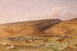
Window Rock is a census-designated place that serves as the seat of government and capital of the Navajo Nation, the largest territory in North America of a sovereign Native American nation. The capital lies within the boundaries of the St. Michaels Chapter, adjacent to the Arizona and New Mexico state line. Window Rock is the site of the Navajo Nation governmental campus, which contains the Navajo Nation Council, Navajo Nation Supreme Court, the offices of the Navajo Nation President and Vice President, and many Navajo government buildings.

Tuba City is an unincorporated town in Coconino County, Arizona, on the Navajo Nation, United States. It is the second-largest community in Coconino County. The population of the census-designated place (CDP) was 8,611 at the 2010 census.

Jeddito is a census-designated place (CDP) in Navajo County, Arizona, United States. The population was 293 at the 2010 census.

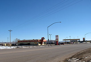
Kayenta is a U.S. census-designated place (CDP) which is part of the Navajo Nation and is in Navajo County, Arizona, United States. The population was 5,189 at the 2010 census. Kayenta is located 25 miles (40 km) south of Monument Valley and contains a number of hotels and motels which serve visitors to Monument Valley. Like other places on the Navajo Nation, it is illegal to serve alcohol. Arizona does not observe Daylight Time; however, the Navajo reservation does.

Church Rock is a census-designated place (CDP) in McKinley County, New Mexico, United States. The population was 1,128 at the 2010 census. Church Rock is named for Church Rock, a prominent natural landmark with the same name.

Crownpoint is a census-designated place (CDP) on the Navajo Nation in McKinley County, New Mexico. The population was 2,500 at the time of the 2010 census. It is located along the Trails of the Ancients Byway, one of the designated New Mexico Scenic Byways.

Rock Springs is a census-designated place (CDP) in McKinley County, New Mexico, United States. The population was 558 at the 2000 census.

Tohatchi is a census-designated place (CDP) in McKinley County, New Mexico, in the Southwestern United States. It is known as a health services and education hub along Highway 491. The population was reported to be 785 at the 2020 census. As Tohatchi is located on the Navajo Nation, it is designated federal trust land.

Shiprock is a census-designated place (CDP) on the Navajo reservation in San Juan County, New Mexico, United States. The population was 7,718 people in the 2020 census. It is part of the Farmington Metropolitan Statistical Area.

Aneth is a census-designated place (CDP) in San Juan County, Utah, United States. The population was 598 at the 2000 census. The origin of the name Aneth is obscure.

The Navajo Nation is a Native American territory covering about 17,544,500 acres, occupying portions of northeastern Arizona, northwestern New Mexico and a smaller portion covering southeastern Utah, in the United States. This is the largest land area retained by a Native American tribe in the United States. By area, the Navajo Nation is larger than ten U.S. states. In 2010, the total population of Navajo tribal members was 332,129 with 173,667 living within the boundaries of the reservation and 158,462 tribal members outside of the reservation. Metropolitan areas accounted for 26 percent of the population, border towns accounted for ten percent, and the remaining 17 percent were living elsewhere in the U.S. The seat of government is located in Window Rock, Arizona.

The Ramah Navajo Indian Reservation is a non-contiguous section of the Navajo Nation lying in parts of west-central Cibola and southern McKinley counties in New Mexico, United States, just east and southeast of the Zuni Indian Reservation. It has a land area of 230.675 sq mi (597.445 km²), over 95 percent of which is designated as off-reservation trust land. According to the 2000 census, the resident population is 2,167 persons. The Ramah Reservation's land area is less than one percent of the Navajo Nation's total area.

Sanders is a census-designated place (CDP) in Apache County, Arizona, United States. Sanders is located at the junction of U.S. Route 191 and Interstate 40. As of the 2010 census, it had a population of 630.

Cornfields is a chapter of the Navajo Nation and a census-designated place (CDP) in Apache County, Arizona, United States. The population was 255 at the 2010 census.
Klagetoh is a census-designated place (CDP) in Apache County, Arizona, United States. The population was 242 at the 2010 census.

Navajo Mountain is a chapter straddling the Utah/Arizona border. The bulk of the chapter lies in San Juan County, Utah, with portions in Coconino and Navajo counties in Arizona. It is one of the eighteen chapters which make up the Western Agency, one of five agencies which make up the Navajo Nation. As of the 2010 census, the chapter had a total population of 542, of whom 501 were Navajo. It has an estimated elevation of 5,886 feet (1,794 m) above sea level.


