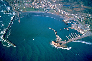
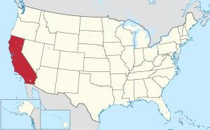
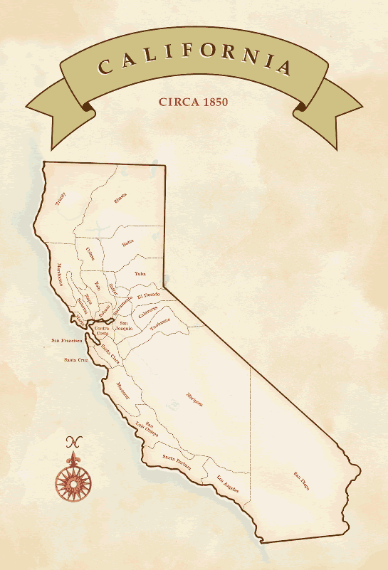
Del Norte County is a county at the far northwest corner of the U.S. state of California, along the Pacific Ocean adjacent to the Oregon border. Its population is 27,743 as of the 2020 census, down from 28,610 from the 2010 census. The county seat and only incorporated city is Crescent City. Del Norte was pioneered and populated by Azorean Portuguese settlers and dairy farmers, which may account for the local pronunciation of the county name. Locals pronounce the county name as Del Nort, not Del Nor-teh as would be expected in Spanish.
Weitchpec is an unincorporated community within the Yurok reservation in Humboldt County, California, United States. It is located 35 miles (56 km) northeast of Eureka, at an elevation of 361 feet. The ZIP Code is 95546.
Forks of Salmon is an unincorporated community of Siskiyou County in northern California, USA. The town is situated at the confluence of the north and south forks of the Salmon River, hence its name. The ZIP Code is 96031. The community is inside area code 530.

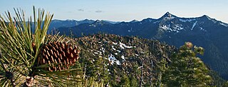
Klamath National Forest is a 1,737,774-acre national forest, in the Klamath Mountains and Cascade Range, located in Siskiyou County in northern California, but with a tiny extension into southern Jackson County in Oregon. The forest contains continuous stands of ponderosa pine, Jeffrey pine, Douglas fir, red fir, white fir, lodgepole pine, Baker Cypress, and incense cedar. Old growth forest is estimated to cover some 168,000 acres (680 km2) of the forest land. Forest headquarters are located in Yreka, California. There are local ranger district offices located in Fort Jones, Happy Camp, and Macdoel, all in California. The Klamath was established on May 6, 1905. This forest includes the Kangaroo Lake and the Sawyers Bar Catholic Church is located within the boundaries of the Forest. The Forest is managed jointly with the Butte Valley National Grassland.

The Six Rivers National Forest is a U.S. National Forest located in the northwestern corner of California. It was established on June 3rd, 1947 by U.S. President Harry S. Truman from portions of Klamath, Siskiyou and Trinity National Forests. Its over one million acres (4,000 km2) of land contain a variety of ecosystems and 137,000 acres (550 km2) of old growth forest. It lies in parts of four counties; in descending order of forestland area they are Del Norte, Humboldt, Trinity, and Siskiyou counties. The forest is named after the Eel, Van Duzen, Klamath, Trinity, Mad, and Smith rivers, which pass through or near the forest's boundaries.
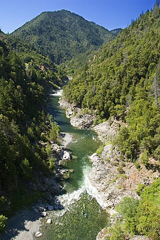
The Salmon River is a 19.6-mile-long (31.5 km) tributary to the Klamath River in western Siskiyou County, California.
The Rogue River–Siskiyou National Forest is a United States National Forest in the U.S. states of Oregon and California. The formerly separate Rogue River and Siskiyou National Forests were administratively combined in 2004. Now, the Rogue River–Siskiyou National Forest ranges from the crest of the Cascade Range west into the Siskiyou Mountains, covering almost 1.8 million acres (7,300 km2). Forest headquarters are located in Medford, Oregon.
Orleans, is an unincorporated community in Humboldt County, California. It is located 12 miles (19 km) northeast of Weitchpec along State Route 96, at an elevation of 404 feet. The ZIP Code is 95556. It is within the area code 530. It is within the historical territory of the Karuk Tribe of California.
Apyu is a former Karok settlement in Humboldt County, California. It was located about 1 mile (1.6 km) above the Salmon River mouth near the upper rapids above the mouth of the Salmon across from Ishipishi. Its precise location is unknown. It was approximately 0.5 miles (0.80 km) east of Somes Bar, a community in Siskiyou County.
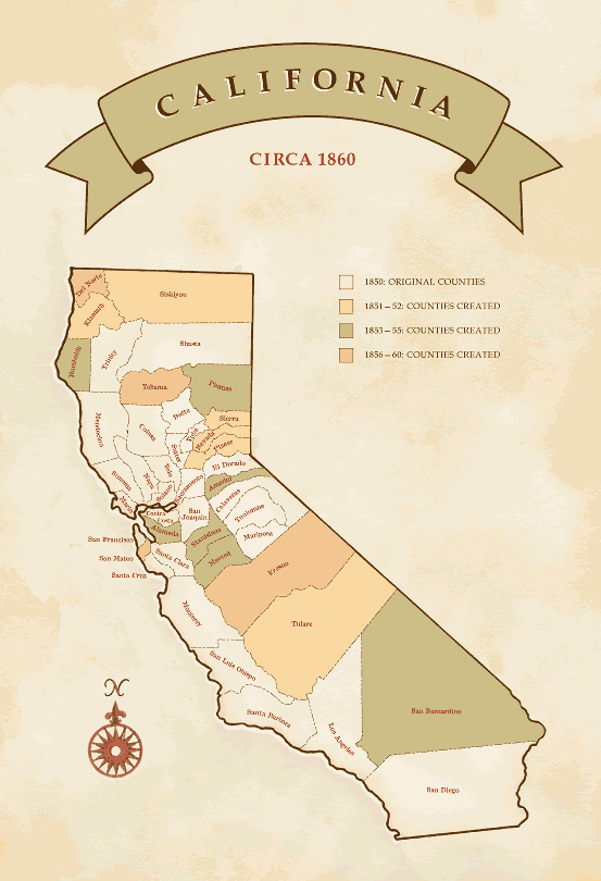
Martins Ferry is a former settlement in Klamath County and later in Humboldt County, California. It lay on the Klamath River, at an elevation of 315 feet (96 m). It still appeared on maps in 1983.
Opegoi is a former Karok settlement in Humboldt County, California. It was located on the Klamath River opposite the mouth of Red Cap Creek, at an elevation of 341 feet.
Somes Bar or Sommes Bar, is an unincorporated community in Siskiyou County, California, United States. Somes Bar is located on the Salmon River 12 miles (19 km) northwest of Forks of Salmon. Somes Bar has a post office with ZIP code 95568, which opened in 1875. Somes Bar is named after George Somes, who found gold in the area in 1850. It was first located within Klamath County, California until it was absorbed by Siskiyou County when Klamath County was dissolved.

Sawyers Bar is an unincorporated community located on the North Fork Salmon River in unincorporated Siskiyou County, California, not to be confused with a Sawyers or Lawyers Bar in Del Norte County.
Bestville is a former settlement on the North Fork Salmon River in Siskiyou County, California, just downstream from Sawyers Bar. Bestville is located at 41.3007°N 123.1431°W.
Negro Flat was a placer gold mining camp on the Salmon River, now located in Siskiyou County, California. It was located originally in Trinity County, in 1850.
Black Bear was a gold mining town in Klamath County, now in unincorporated Siskiyou County, California.
Gullion's Bar was a placer gold mining camp on the Salmon River, now located in Siskiyou County, California. It was located originally in Trinity County, in 1850.
Blue Creek is a 23-mile (37 km) long stream in the Northern Coast Ranges of California, and is the lowermost major tributary of the Klamath River. The creek begins in Elk Valley, in the Siskiyou Wilderness of the Six Rivers National Forest in Del Norte County. It flows southwest, receiving several major tributaries including the East Fork, Crescent City Fork, Nickowitz Creek, Slide Creek and the West Fork. It flows into the Klamath River in Humboldt County, 16 miles (26 km) upstream from where the Klamath empties into the Pacific Ocean.
The North Fork Salmon River is a 36.9-mile (59.4 km) river in Siskiyou County, California. It joins with the South Fork Salmon River at Forks of Salmon to form the Salmon River, a major tributary of the Klamath River. Originating at English Lakes near 7,322-foot (2,232 m) English Peak in the Salmon Mountains, the North Fork drains about 204 square miles (530 km2) of rugged, forested terrain. The entire river is located within the Klamath National Forest, with the headwaters located in the Marble Mountain Wilderness.
The South Fork Salmon River is a 39.5-mile (63.6 km) river in Siskiyou County, California and is the larger of two tributaries that join to form the Salmon River, the other being the North Fork. It begins in the Salmon Mountains, on the border of Siskiyou and Trinity County, about 15 miles (24 km) southeast of Cecilville, and flows generally northwest through the Salmon Mountains to its confluence with the North Fork at Forks of Salmon. The South Fork drains an area of 290 square miles (750 km2), located entirely in the Klamath National Forest, with a significant portion in the Trinity Alps Wilderness.


