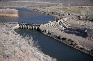
Derby Dam is a diversion dam built from 1903 to 1905 on the Truckee River, located about 20 miles (32 km) east of Reno in Storey and Washoe counties in Nevada, United States. It diverts water into the Truckee Canal that would otherwise enter Pyramid Lake. The canal feeds Lake Lahontan reservoir in the Carson River watershed, where it is used for irrigation.
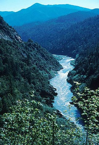
The Klamath River flows 257 miles (414 km) through Oregon and northern California in the United States, emptying into the Pacific Ocean. By average discharge, the Klamath is the second largest river in California after the Sacramento River. It drains an extensive watershed of almost 16,000 square miles (41,000 km2) that stretches from the arid country of south-central Oregon to the temperate rainforest of the Pacific coast. Unlike most rivers, the Klamath begins in the high desert and flows toward the mountains – carving its way through the rugged Cascade Range and Klamath Mountains before reaching the sea. The upper basin, today used for farming and ranching, once contained vast freshwater marshes that provided habitat for abundant wildlife, including millions of migratory birds. Most of the lower basin remains wild, with much of it designated wilderness. The watershed is known for this peculiar geography, and the Klamath has been called "a river upside down" by National Geographic magazine.

Upper Klamath Lake is a large, shallow freshwater lake east of the Cascade Range in south-central Oregon in the United States. The largest body of fresh water by surface area in Oregon, it is approximately 25 miles (40 km) long and 8 miles (13 km) wide and extends northwest from the city of Klamath Falls. It sits at an average elevation of 4,140 feet (1,260 m).

The Trinity River is a major river in northwestern California in the United States and is the principal tributary of the Klamath River. The Trinity flows for 165 miles (266 km) through the Klamath Mountains and Coast Ranges, with a watershed area of nearly 3,000 square miles (7,800 km2) in Trinity and Humboldt Counties. Designated a National Wild and Scenic River, along most of its course the Trinity flows swiftly through tight canyons and mountain meadows.

Lost River begins and ends in a closed basin in northern California and southern Oregon in the United States. The river, 60 miles (97 km) long, flows in an arc from Clear Lake Reservoir in Modoc County, California, through Klamath County, Oregon, to Tule Lake in Siskiyou County, California. About 46 mi (74 km) of Lost River are in Oregon, and 14 miles (23 km) are in California.

The Columbia Basin Project in Central Washington, United States, is the irrigation network that the Grand Coulee Dam makes possible. It is the largest water reclamation project in the United States, supplying irrigation water to over 670,000 acres (2,700 km2) of the 1,100,000 acres (4,500 km2) large project area, all of which was originally intended to be supplied and is still classified irrigable and open for the possible enlargement of the system. Water pumped from the Columbia River is carried over 331 miles (533 km) of main canals, stored in a number of reservoirs, then fed into 1,339 miles (2,155 km) of lateral irrigation canals, and out into 3,500 miles (5,600 km) of drains and wasteways. The Grand Coulee Dam, powerplant, and various other parts of the CBP are operated by the Bureau of Reclamation. There are three irrigation districts in the project area, which operate additional local facilities.

Trinity Dam is an earthfill dam on the Trinity River located about 7 miles (11 km) northeast of Weaverville, California in the United States. The dam was completed in the early 1960s as part of the federal Central Valley Project to provide irrigation water to the arid San Joaquin Valley.
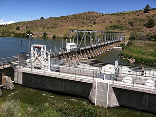
The Link River Dam is a concrete gravity dam on the Link River in the city of Klamath Falls, Oregon, United States. It was built in 1921 by the California Oregon Power Company (COPCO), the predecessor of PacifiCorp, which continues to operate the dam. The dam is owned by the U.S. Bureau of Reclamation.

The Klamath Basin is the region in the U.S. states of Oregon and California drained by the Klamath River. It contains most of Klamath County and parts of Lake and Jackson counties in Oregon, and parts of Del Norte, Humboldt, Modoc, Siskiyou, and Trinity counties in California. The 15,751-square-mile (40,790 km2) drainage basin is 35% in Oregon and 65% in California. In Oregon, the watershed typically lies east of the Cascade Range, while California contains most of the river's segment that passes through the mountains. In the Oregon-far northern California segment of the river, the watershed is semi-desert at lower elevations and dry alpine in the upper elevations. In the western part of the basin, in California, however, the climate is more of temperate rainforest, and the Trinity River watershed consists of a more typical alpine climate.
The Central Utah Project is a US federal water project that was authorized for construction under the Colorado River Storage Project Act of April 11, 1956, as a participating project. In general, the Central Utah Project develops a portion of Utah's share of the yield of the Colorado River, as set out in the Colorado River Compact of 1922.
Savage Rapids Dam was an approximately 39-foot-high (12 m), 500-foot-long (150 m) irrigation diversion dam spanning the mainstem of the Rogue River in Josephine County, Oregon. The dam was demolished and removed in 2009. From 1921 until the spring of 2009, the Savage Rapids Dam almost entirely functioned for irrigation purposes, and it did not provide any flood control, hydro-electric power, inland waterway, or other significant beneficial uses. It only provided very minor recreational or wildlife benefits.

Little Butte Creek is a 17-mile-long (27 km) tributary of the Rogue River in the U.S. state of Oregon. Its drainage basin consists of approximately 354 square miles (917 km2) of Jackson County and another 19 square miles (49 km2) of Klamath County. Its two forks, the North Fork and the South Fork, both begin high in the Cascade Range near Mount McLoughlin and Brown Mountain. They both flow generally west until they meet near Lake Creek. The main stem continues west, flowing through the communities of Brownsboro, Eagle Point, and White City, before finally emptying into the Rogue River about 3 miles (5 km) southwest of Eagle Point.

The Klamath Diversion was a federal water project proposed by the U.S. Bureau of Reclamation in the 1950s. It would have diverted the Klamath River in Northern California to the more arid central and southern parts of that state. It would relieve irrigation water demand and groundwater overdraft in the Central Valley and boost the water supply for Southern California. Through the latter it would allow for other Southwestern states—Arizona, Nevada, New Mexico and Utah—as well as Mexico to receive an increased share of the waters of the Colorado River.
The Klamath River is a river in southern Oregon and northern California in the United States. This article describes its course.
The Cascade Canal is a canal located in Klamath and Jackson counties, in the U.S. State of Oregon. It delivers water from Fourmile Lake in the Klamath River watershed over the Cascade Divide to Fish Lake in the Rogue River watershed. It diverts approximately 5,462 acre-feet (6,737,000 m3) annually into Fish Lake. About 33 percent of the water diverted from Fourmile Lake is lost or spilled on the way to Fish Lake.
The 2002 Klamath River fish kill occurred on the Klamath River in California in September 2002. According to the official estimate of mortality, about 34,000 fish died. Though some counts may estimate over 70,000 adult chinook salmon were killed when returning to the river to spawn, making it the largest salmon kill in the history of the Western United States. Besides the chinook salmon, other fish that perished include: steelhead, coho salmon, sculpins, speckled dace, and Klamath smallscale sucker.
The Klamath Basin Restoration Agreement (KBRA) is an American multi-party legal agreement determining river usage and water rights involving the Klamath River and Klamath Basin in the states of California and Oregon. Discussion of the KBRA began in 2005. Congress failed to pass legislation that would implement the KBRA by the January 1, 2016 deadline.

Red Bluff Diversion Dam is a disused irrigation diversion dam on the Sacramento River in Tehama County, California, United States, southeast of the city of Red Bluff. Until 2013, the dam provided irrigation water for two canals that serve 150,000 acres (61,000 ha) of farmland on the west side of the Sacramento Valley. The dam and canals are part of the Sacramento Canals Unit of the Central Valley Project, operated by the U.S. Bureau of Reclamation. In 2013, the dam was decommissioned and the river allowed to flow freely through the site in order to protect migrating fish. A pumping plant constructed a short distance upstream now supplies water to the canal system.
The Klamath River Hydroelectric Project is a series of hydroelectric dams and other facilities on the mainstem of the Klamath River, in a watershed on both sides of the California/Oregon border.

Un-Dam the Klamath (#UnDamtheKlamath) is a social movement in the United States to remove the dams on the Klamath River primarily because they obstruct salmon, steelhead, and other species from accessing the upper basin which provides hundreds of miles of spawning habitat. The dams have also significantly harmed Hupa, Karuk, Klamath, and Yurok lifeways and communities. Copco #1, Copco #2, Iron Gate and J.C. Boyle are the four hydroelectric dams on the Klamath River that are being advocated for removal.


