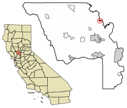
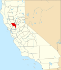
Knights Landing, California

Last updated

Knights Landing
Yolo County California Incorporated and Unincorporated areas Knights Landing Highlighted 0638800.svg
Location of Knights Landing in Yolo County, California
USA California location map.svg
Red pog.svg
Knights Landing
Location in California
Coordinates: 38°47′59″N121°43′06″W / 38.79972°N 121.71833°W / 38.79972; -121.71833
Country Flag of the United States (23px).png  United States
State Flag of California.svg  California
County Yolo County
Area
[1]
  Total1.298 km2 (0.501 sq mi)
  Land1.298 km2 (0.501 sq mi)
  Water0 km2 (0 sq mi)  0%
Elevation
[2]
11 m (36 ft)
Population
 (2010)
  Total995
  Density770/km2 (2,000/sq mi)
FIPS code 06-38800

Knights Landing (formerly, Baltimore and East Grafton) is a census-designated place in Yolo County, California, United States, founded by William Knight. It is located on the Sacramento River around 25 miles northwest of Sacramento in the northeastern portion of the county. Knights Landing's ZIP Code is 95645 and its area code 530. It lies at an elevation of 36 feet (11 m). The 2010 census reported that Knights Landing had a population of 995.

Contents

Geography

According to the United States Census Bureau, the CDP covers an area of 0.5 square miles (1.3 km2), all of it land.

Climate

According to the Köppen Climate Classification system, Knights Landing has a warm-summer Mediterranean climate, abbreviated "Csa" on climate maps. [3]

Demographics

Historical population
CensusPop.Note
U.S. Decennial Census [4]

The 2010 United States Census [5] reported that Knights Landing had a population of 995. The population density was 1,985.7 inhabitants per square mile (766.7/km2). The racial makeup of Knights Landing was 560 (56.3%) White, 4 (0.4%) African American, 10 (1.0%) Native American, 7 (0.7%) Asian, 0 (0.0%) Pacific Islander, 338 (34.0%) from other races, and 76 (7.6%) from two or more races. Hispanic or Latino of any race were 644 persons (64.7%).

The Census reported that 995 people (100% of the population) lived in households, 0 (0%) lived in non-institutionalized group quarters, and 0 (0%) were institutionalized.

There were 317 households, out of which 128 (40.4%) had children under the age of 18 living in them, 171 (53.9%) were opposite-sex married couples living together, 43 (13.6%) had a female householder with no husband present, 17 (5.4%) had a male householder with no wife present. There were 18 (5.7%) unmarried opposite-sex partnerships, and 2 (0.6%) same-sex married couples or partnerships. 76 households (24.0%) were made up of individuals, and 35 (11.0%) had someone living alone who was 65 years of age or older. The average household size was 3.14. There were 231 families (72.9% of all households); the average family size was 3.74.

The population was spread out, with 265 people (26.6%) under the age of 18, 112 people (11.3%) aged 18 to 24, 238 people (23.9%) aged 25 to 44, 268 people (26.9%) aged 45 to 64, and 112 people (11.3%) who were 65 years of age or older. The median age was 34.3 years. For every 100 females, there were 108.6 males. For every 100 females age 18 and over, there were 103.9 males.

There were 343 housing units at an average density of 684.5 per square mile (264.3/km2), of which 213 (67.2%) were owner-occupied, and 104 (32.8%) were occupied by renters. The homeowner vacancy rate was 2.7%; the rental vacancy rate was 9.6%. 655 people (65.8% of the population) lived in owner-occupied housing units and 340 people (34.2%) lived in rental housing units.

History

Knights Landing was founded in 1843, by Dr. William Knight, a practicing physician from Baltimore, Maryland. William Knight built on a mound that marked the ancient meeting place of Native Americans inhabiting the regions about Cache Creek and the Sacramento River. The site early demonstrated its importance as a steamboat landing and point of communication between the people east and west of the big central river. When the town was laid out in 1849, it was originally called Baltimore, but an agreement over the sale of the new town lots could not be amicably arranged and the title Baltimore was lost. Knight established a ferry there, which afterwards passed to the ownership of J. W. Snowball. In those days the ferry tolls were $1 for a man and horse; a team and wagon cost $5. In 1850, S. R. Smith kept a hotel in the settlement and in 1853, Charles F. Reed surveyed and laid out a townsite and was officially given the name of Knight's Landing. That year, J. W. Snowball and J. J. Perkins opened a large general merchandise store on the Native American mound. On January 1, 1854, Capt. J. H. Updegraff opened his hotel with $10 tickets to a grand New Years party. A steamer was run from Sacramento for the accommodation of guests. The establishment was called the "Yolo House." In 1860 D. N. Hershey and George Glascock erected a brick hotel, which took the place of the Yolo House, that inn being retired to the status of a private residence

On March 25, 1890, the Knight's Landing branch of the Southern Pacific Railroad was completed and ready for business, and later the completion of the bridge across the river added immensely to the prosperity of the town. [6] The famous and now merged Southern Pacific Railroad Company once had a line from Davis, California, via Woodland, California, through Knights Landing, and the line continued to Marysville, California, via a junction in Yuba City, California. This 1879 map shows the railroad from Woodland almost to East Grafton (which contains Knights Landing): [7] The line now stops a few miles northeast of Woodland.

Grafton Elementary was the only public school in the community. It closed June 23, 2009.[ citation needed ] The area is served by Woodland Joint Unified School District. In 2010, the Science and Technology Academy of Knights Landing opened on the former Grafton Elementary campus as a charter school.[ citation needed ]

Knights Landing Cemetery (just south of town on County Road 102) is one of several purported final resting places of the stagecoach bandit Charles Bolles, a.k.a. Black Bart. If present, the grave is unmarked.

Related Research Articles

<span class="mw-page-title-main">Davis, California</span> City in California, United States

Davis is the most populous city in Yolo County, California, United States. Located in the Sacramento Valley region of Northern California, the city had a population of 66,850 in 2020, not including the on-campus population of the University of California, Davis, which was over 9,400 in 2016. As of 2019, there were 38,369 students enrolled at the university.

<span class="mw-page-title-main">Winters, California</span> City in California, United States

Winters is a city in rural Yolo County, and the western Sacramento Valley, in northern California, United States.

<span class="mw-page-title-main">Yolo County, California</span> County in California, United States

Yolo County, officially the County of Yolo, is a county located in the northern portion of the U.S. state of California. Yolo County was one of the original counties of California, created in 1850 at the time of statehood. As of the 2020 census, the population was 216,403. Its county seat is Woodland.

<span class="mw-page-title-main">Taylor County, West Virginia</span> County in West Virginia, United States

Taylor County is a county in the U.S. state of West Virginia. As of the 2020 census, the population was 16,705. Its county seat is Grafton. The county was formed in 1844 and named for Senator John Taylor of Caroline.

<span class="mw-page-title-main">Durham, California</span> Census-designated place in California, United States

Durham is a census-designated place (CDP) in Butte County, California, United States. The population was 5,518 at the 2010 census.

<span class="mw-page-title-main">Colusa, California</span> City in California, United States

Colusa is a city and county seat of Colusa County, California, located in the Sacramento Valley region of the Central Valley. The population was 5,971 at the 2010 census, up from 5,402 at the 2000 census. Colusi originates from the local Coru Native American tribe, who in the 1840s lived on the opposite side of the Sacramento River.

<span class="mw-page-title-main">Auberry, California</span> Census-designated place in California, United States

Auberry is a census-designated place (CDP) in Fresno County, California, United States. The population was 2,369 at the 2010 census, up from 2,053 at the 2000 census. Auberry is located on Little Sandy Creek 9.5 miles (15 km) west of Shaver Lake Heights, at an elevation of 2,018 feet (615 m).

<span class="mw-page-title-main">Upper Lake, California</span> Census-designated place in California, United States

Upper Lake is a census-designated place (CDP) in Lake County, California, United States. Upper Lake is located 8 miles (13 km) north of Lakeport, at an elevation of 1,345 feet (410 m). The population was 1,052 at the 2010 census, up from 989 at the 2000 census. The Habematolel Pomo of Upper Lake are headquartered here.

<span class="mw-page-title-main">Lincoln, California</span> City in California, United States

Lincoln is a city in Placer County, California, United States, part of the Sacramento metropolitan area. Located ten miles north of Roseville in an area of rapid suburban development, it grew 282 percent between 2000 and 2010, making it the fastest-growing city over 10,000 people in the U.S. Its 2019 population was estimated to be 48,275.

<span class="mw-page-title-main">Rocklin, California</span> City in California, United States

Rocklin is a city in Placer County, California, about 22 miles (35 km) from Sacramento, and about 6.1 miles (9.8 km) northeast of Roseville in the Sacramento metropolitan area. Besides Roseville, it shares borders with Granite Bay, Loomis and Lincoln. As of the 2020 census, Rocklin's population was 71,601.

<span class="mw-page-title-main">Anderson, California</span> City in California, United States

Anderson is a city in Shasta County, California, approximately 10 miles south of Redding. Its population is 11,323 as of the 2020 census, up from 9,932 from the 2010 census.

<span class="mw-page-title-main">Red Bluff, California</span> City in California, United States

Red Bluff is a city in and the county seat of Tehama County, California, United States. The population was 14,710 at the 2020 census, up from 14,076 at the 2010 census.

<span class="mw-page-title-main">Esparto, California</span> Census-designated place in California, United States

Esparto is a census-designated place (CDP) in Yolo County, California, United States. It is part of the Sacramento–Arden-Arcade–Roseville Metropolitan Statistical Area. The population was 3,108 at the 2010 census.

<span class="mw-page-title-main">West Sacramento, California</span> City in Yolo County, California, United States

West Sacramento is a city in Yolo County, California, United States. The city is separated from Sacramento by the Sacramento River, which also separates Sacramento and Yolo counties. It is a fast-growing community; the population was 53,915 at the 2020 census, up from 48,744 at the 2010 census. The traditional industrial center of the region since the Gold Rush era, West Sacramento is home to a diverse economy and is one of the area's top four employment centers.

<span class="mw-page-title-main">Woodland, California</span> City in California, United States

Woodland is a city in, and the county seat of, Yolo County, California, United States. It is located approximately 15 miles (24 km) northwest of Sacramento, and is a part of the Sacramento metropolitan area. The population continues to grow every year, with a growth rate of 0.33% annually, and a current population of 61,873.

<span class="mw-page-title-main">Dunnigan, California</span> Census-designated place in California, United States

Dunnigan is a census-designated place in Yolo County, California on Interstate 5. The population was 1,416 at the 2010 census. Dunnigan's ZIP code is 95937 and its area code 530. It lies at an elevation of 69 feet.

Clarksburg is a census-designated place in Yolo County, California. It is located on the Sacramento River, in the extreme southeastern corner of the county. It lies at an elevation of 10 feet in ZIP code 95612 and area codes 916 and 279.

Madison is a census-designated place in Yolo County, California. Madison's ZIP Code is 95653 and its area code 530. It is located 10.5 miles (17 km) west of Woodland, at an elevation of 151 feet. The 2020 United States census reported Madison's population was 721.

Yolo is an unincorporated community and census-designated place in Yolo County, California. It is located 4.9 miles northwest of the county seat, Woodland and 24 miles northwest of the state capital of Sacramento. Yolo's ZIP Code is 95697 and its area code 530. It lies at an elevation of 82 feet. The population was 421 at the 2020 census.

Grimes is a census-designated place in Colusa County, California on the Southern Pacific Railroad. It lies at an elevation of 46 feet. The two main roads that run through it are State Route 45 and Grimes-Arbuckle Road. Its ZIP code is 95950, and its area code is 530. Grimes's population was 391 at the 2020 census.

References

  1. "2010 Census U.S. Gazetteer Files – Places – California". United States Census Bureau.
  2. U.S. Geological Survey Geographic Names Information System: Knights Landing, California
  3. Climate Summary for Knights Landing, California
  4. "Census of Population and Housing". Census.gov. Retrieved June 4, 2016.
  5. "2010 Census Interactive Population Search: CA - Knights Landing CDP". U.S. Census Bureau. Archived from the original on July 15, 2014. Retrieved July 12, 2014.
  6. Thomas Jefferson Gregory, The History of Yolo County, California (Historic Record Company, Los Angeles, California 1913), p. 58-59, available online at Google Books
  7. http://www.historicmapworks.com/Map/US/159571/West+Grafton+Township++East+Grafton+Township++Cacheville+Township/Yolo+County+1879/California/