
Burton is a city in Washington County, Texas, United States. The population was 359 at the 2000 census. Prior to the 2010 census, Burton changed its status from a town to a city. The population was 300 at the 2010 census.

Davidson is a suburban town located in northern Mecklenburg and Iredell counties, North Carolina, United States, on the banks of Lake Norman. It is a suburb in the Charlotte metropolitan area. The population was 10,944 at the 2010 census, and in 2019 the estimated population was 13,054. The town was founded in 1837 with the establishment of the Presbyterian Davidson College, named for Brigadier General William Lee Davidson, a local Revolutionary War hero. The land for Davidson College came from Davidson's estate, a large portion of which was donated by his son.

Grand Port is a district of Mauritius, situated in the east of the island. The name means "large port" in French. The district has an area of 260.3 km2 and the population estimate was at 112,997 as of 31 December 2015.

The Southern Highlands, also locally referred to as the Highlands, is a geographical region and district in New South Wales, Australia and is 110 km south-west of Sydney. The entire region is under the local government area of the Wingecarribee Shire. The region is also considered a wine region.
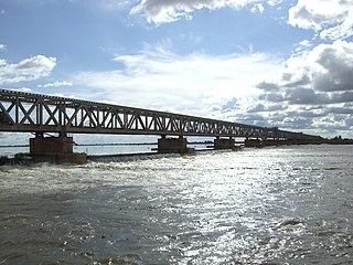
Markala is a commune in Mali's Ségou Region on the Niger River 35 km down stream from the town of Ségou. The commune contains 30 villages in an area of 318 square kilometers and in 2009 had a population of 45,961. Mali's primary irrigation dam, the Markala dam, lies in the commune. The main village of the commune, Diamarabougou, is on the right bank adjacent to the dam which also serves as an important road bridge.

Gorliz is a town and municipality located in the province of Biscay, which lies within the autonomous community of the Basque Country, in northern Spain. The town had 5,664 inhabitants in 2014.

Niono is a town and commune located in the Ségou Region of Mali. The commune has an area of approximately 491 square kilometers and includes the town and 20 of the surrounding villages. In the 2009 census it had a population of 91,554. The town is the capital of the Niono Cercle, one of seven subdivisions (cercles) of the Ségou Region. It lies on the northwest edge of the Inner Niger Delta, near the main channel of the Niger River.
Bukit Kepong is a mukim in Muar District, Johor, Malaysia. It is located near the Muar River.

Arvagh, or Arva, is a village in County Cavan, Ireland, on the shores of Garty Lough and overlooked by Bruse Mountain. It is located on the junction of the R198 and R203 regional roads.
Imuris is the municipal seat of Imuris Municipality in the north of the Mexican state of Sonora.
The municipality of Boñar is located in the province of León, Castile and León, Spain. As per the 2010 census (INE), the municipality has a population of 2,085 inhabitants with almost all of the residents living in the main town of Boñar. In addition to Boñar, the municipality includes the villages of Adrados, Barrio de las Ollas, Las Bodas, Cerecedo, Colle, Llama, Felechas, Grandoso, Orones, Oville, Poblado del Pantano, Remellán, Rucayo, Valdecastillo, Valdehuesa, La Vega de Boñar, Veneros, Vozmediano, and Voznuevo. Most surrounding villages in the municipality of Boñar have between 10 and 30 permanent residents. A few larger villages may have as many as 250 villagers.
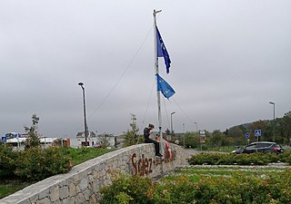
Sciez is a commune in the Haute-Savoie department in the Auvergne-Rhône-Alpes region in south-eastern France. Sciez forms part of a transborder agglomeration known as Grand Genève.

Kolondiéba Cercle is an administrative subdivision of the Sikasso Region of Mali. The administrative center (chef-lieu) is the town of Kolondiéba.

Tominian Cercle is an administrative subdivision of the Ségou Region of Mali. The administrative center of the local government is in the town of Tominian. The Cercle is divided into Communes, and below this, quarters/villages. In the 2009 census the cercle had a population of 219,853 people.
Dogo is a small town and commune in the Cercle of Bougouni in the Sikasso Region of southern Mali. As of 2009 the commune had a population of 33,466.
Bondo is a village and commune and seat of the Cercle of Koro in the Mopti Region of Mali. In 1998 the commune had a population of 15,872 In 2009, population was almost 20,000.
Nosifeno is a town and commune in Madagascar. It belongs to the district of Midongy-Atsimo, which is a part of Atsimo-Atsinanana Region. There are 3881 inscribed voters in this commune. It is located at the Itomampy river. From the coast and Vangaindrano it can be reached by the unpaved, secondary road T18 of 94 km in very bad state of conservation.
Ismailpur (Harauli) is a village in Vaishali district of Bihar state in India.

