
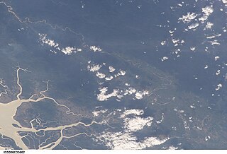
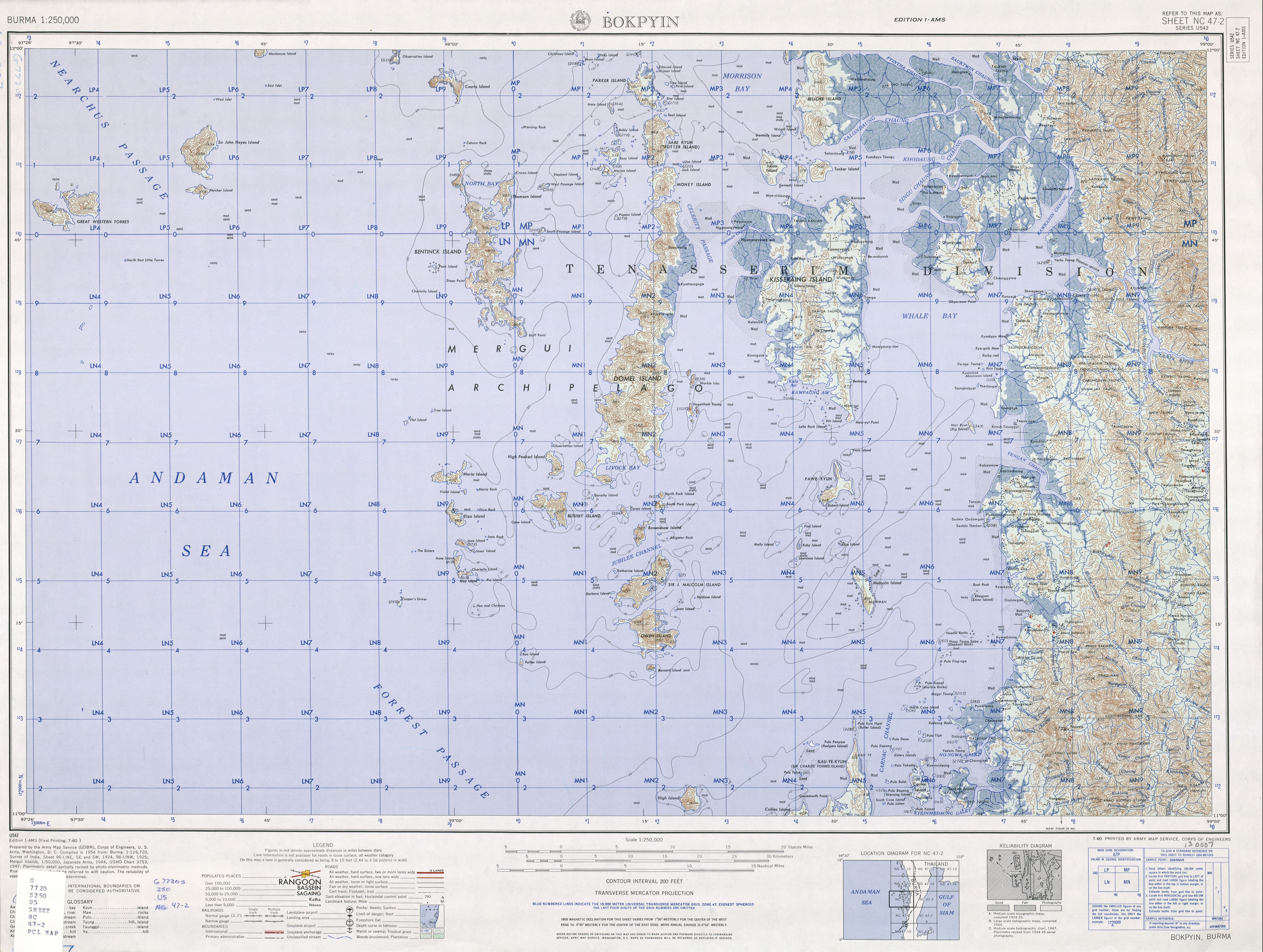
The Mergui Archipelago is located in far southern Myanmar (Burma) and is part of the Tanintharyi Region. It consists of more than 800 islands, varying in size from very small to hundreds of square kilometres, all lying in the Andaman Sea off the western shore of the Malay Peninsula near its landward (northern) end where it joins the rest of Indochina. They are occasionally referred to as the Pashu Islands because the Malay inhabitants are locally called Pashu.

Myeik is a rural city in Tanintharyi Region in Myanmar (Burma), located in the extreme south of the country on the coast off an island on the Andaman Sea. As of 2010, the estimated population was over 209,000. Myeik is the largest city in Tanintharyi Region, and serves as the regional headquarters of Myanmar Navy's Tanintharyi Regional Command. The area inland from the city is a major smuggling corridor into Thailand. The Singkhon Pass, also known as the Maw-daung Pass, has an international cross-border checkpoint.
Tanintharyi or Taninthayi is a small town in Taninthayi Township, Myeik District, in the Tanintharyi Region of south-western Myanmar. It is the administrative seat for the township. The town is located on the Great Tenasserim River which eventually enters the sea at Myeik. The town is located at the confluence of this river and a tributary known as the "Little Tenasserim River" which runs south.

Kawthaung is a border town located in the southernmost part of Myanmar, in the Tanintharyi Region. During British rule in Burma between 1824 and 1948, it was known as Victoria Point. As of 2021, it has a population of 57,949. Facing Ranong in Thailand, Kawthaung is one of 7 officialborder trade posts with Thailand.
Kadan Kyun is the largest island in the Mergui Archipelago, Myanmar. Its area is 450 square kilometres (170 sq mi). The highest point is French Bay Peak, which is the highest point in the archipelago.

Tanintharyi Region is an administrative region of Myanmar, covering the long narrow southern part of the country on the upper Malay peninsula, reaching to the Kra Isthmus. It borders the Andaman Sea to the west and the Tenasserim Hills, beyond which lie Thailand, to the east. To the north is the Mon State. There are many islands off the coast, the large Mergui Archipelago in the southern and central coastal areas and the smaller Moscos Islands off the northern shores. The capital of the division is Dawei (Tavoy). Other important cities include Myeik (Mergui) and Kawthaung. The division covers an area of 43,344.9 square kilometres (16,735.6 sq mi), and had a population of 1,406,434 at the 2014 Census.

Kyunsu or Kanmaw Township is a township of Myeik District in the Taninthayi Division of Myanmar. The principal town is Kyunsu. The township constitutes much of the Mergui Archipelago to the west, northwest and southwest of the city of Mergui (Myeik). The main town is located on the north-east coast of Kanmaw Island to the southwest of Mergui city.

Tourism in Myanmar is a developing sector. As at February 2022, new tourist visa applications continue to be suspended. Although Myanmar possesses tourist potential, much of the industry remains to be developed. The number of visitors to Burma is small compared to its neighbouring countries. This is primarily due to its political situation. However, after the junta transferred power to the civilian government, the tourism sector saw an increase in tourism arrivals, and in 2012, tourist arrivals surpassed the one million mark for the first time. In 2013, the Tourism Master Plan was created, targeting 7.5 million arrivals by 2020.
The Great Tenasserim River or the Tanintharyi River is a major river of southeastern Burma. It flows through the Tanintharyi Region, past the town of Tanintharyi, and enters the sea at Myeik (Mergui). The river rises from the Tenasserim Range at an altitude of 2,074 m (6,804 ft), and flows into the Andaman Sea. The region formed by this river is also known as Tenasserim, or Tanintharyi in Burmese. It is in a constricted coastal region in southeastern Myanmar, which borders Thailand on the east and the Andaman Sea on the west.

Kanmaw Kyun or Kanmaw Island is an island in the Andaman Sea along the coast of southeastern Burma (Myanmar), and is part of the Mergui Archipelago. Administratively, it is located in Kyunsu Township, Myeik District, in the Taninthayi Region. On the northeastern side of the island is the town of Kyunsu, which is the administrative seat for the township. The island covers a total area of 409 km2.

Kat kyi kaik, also specifically called Myeik kat kyi kaik (မြိတ်ကတ်ကြေးကိုက်), is a spicy Burmese fried noodle dish associated with the coastal town of Myeik in Southern Myanmar.
Zadetkyi Island or Zadetkyi Kyun, also known as Saint Matthew's Island, is an island at the southern end of the Mergui Archipelago, Burma. Its northern side forms the southern shore of Hastings Harbor, where there is a base of the Myanmar Navy.
The Myeik dialect, also known as Beik in Burmese, Mergui and Merguese in English, and Marit (มะริด) in Thai, is a divergent dialect of Burmese, spoken in Myeik, the second largest town in Tanintharyi Region, the southernmost region of Myanmar. Myeik shares many commonalities with the Tavoyan dialect, although there are substantial differences especially with regard to phonology.

Singkhon Pass, also referred to as Sing Khon and as Maw Daung after the name of the Burmese town west of the border, is a pass across the Tenasserim Hills on the border between Thailand and Myanmar, at an elevation of 245 metres (804 ft). The pass is close to the narrowest point of Thailand in Khlong Wan (คลองวาฬ) subdistrict, Mueang Prachuap Khiri Khan District, Prachuap Khiri Khan Province.
Union Express is a charter airline based in Myanmar.
Pagodas in Myeik are pagodas on the Myeik Archipelago. Myeik (Mergui) is a city in the Tanintharyi Division in Southeastern Myanmar. A pagoda is a Hindu or Buddhist temple or sacred building, typically a many-tiered tower, in India and East Asia.

Thein Daw Gyi Pagoda is a Buddhist pagoda in Myeik, Tanintharyi Region, Myanmar. The pagoda is the largest pagoda in Myeik and is a popular tourist attraction. Thein Daw Gyi pagoda was situated over (280) years since Myanmar year (1093). We can play the historical Thailand pagoda, Buddha culture museum, Buddha Library and preach abode. And then we can enjoy sunset, natural overview of Myeik and we can play Marhar Atula Yanthi from Thein Daw Gyi Pagoda. The pagoda was built between 1772 and 1778.

Paw Daw Mu Pagoda is a Buddhist pagoda in Myeik, Tanintharyi Region, Myanmar. The largest pagoda in Myeik, it is a popular tourist attraction. The original stupa was said to have been built in the 6th century BC during the time of Buddha and contains his relics.
![k[?][?]n[?]:cum[?]iu' (m[?]itt[?]).jpg](http://upload.wikimedia.org/wikipedia/commons/thumb/3/36/%E1%80%80%E1%80%BB%E1%80%BD%E1%80%94%E1%80%BA%E1%80%B8%E1%80%85%E1%80%AF%E1%80%99%E1%80%BC%E1%80%AD%E1%80%AF%E1%80%B7_%28%E1%80%99%E1%80%BC%E1%80%AD%E1%80%90%E1%80%BA%29.jpg/250px-%E1%80%80%E1%80%BB%E1%80%BD%E1%80%94%E1%80%BA%E1%80%B8%E1%80%85%E1%80%AF%E1%80%99%E1%80%BC%E1%80%AD%E1%80%AF%E1%80%B7_%28%E1%80%99%E1%80%BC%E1%80%AD%E1%80%90%E1%80%BA%29.jpg)


